You’d be forgiven for thinking, reading this blog, that the majority of the walks I do are in the mountains, National Parks, Highlands and Islands. In fact, living in the south east of England, the bulk of my walking involves day trips to the Home Counties. And it has to be said, there’s a great deal of beauty and variety in the scenery to be found within twenty or thirty miles of London, much of it accessible within a couple of hours from where I live.
Over the years, I’ve got to know dozens of different places and developed a number of favourites, but always tried to discover new ones too.
While not every walk is a gem, once you leave that train or bus, every walk gives the opportunity to escape the bustle of London, and often, even on a sunny bank holiday like the one we have just had, to escape the crowds. In fact, many if not most, have some real highlights, and include some beautiful landscapes, sometimes not necessarily associated with the south east of England.
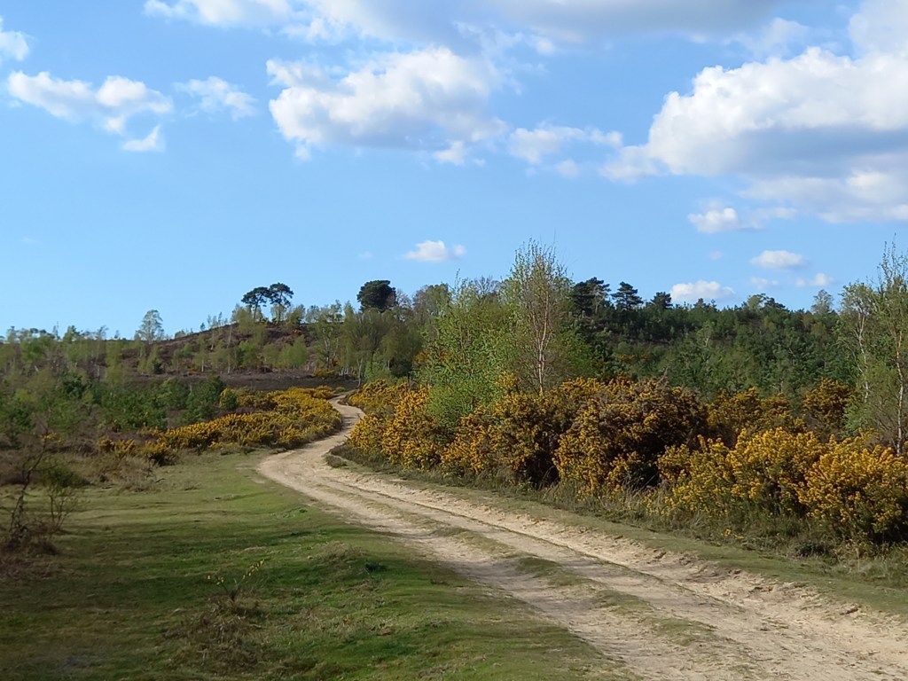
The Ash Ranges in Surrey, on Good Friday. The paths were lined with flowering gorse.
I’m a great fan of woodland, and the last month has seen the annual transformation of the countryside as tree buds turn into leaves, daffodils and bluebells bear flower, and the yellow gorse and pink cherry blossom bring colour to the scene. Birds sing, butterflies flutter, and bees buzz as the temperature rises and the sunlight brings life to all that is around.
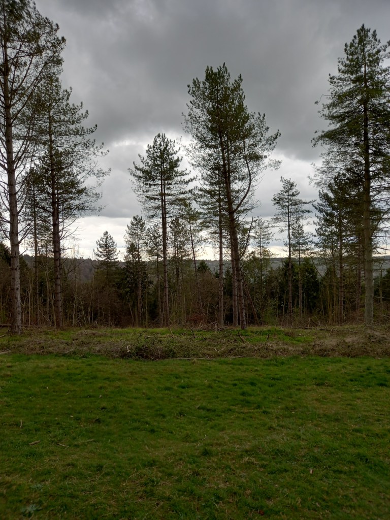
Spring on Black down, near Haslemere, Surrey last yearGrey skies over Wendover Woods, near Aylesbury, Bucks, last week
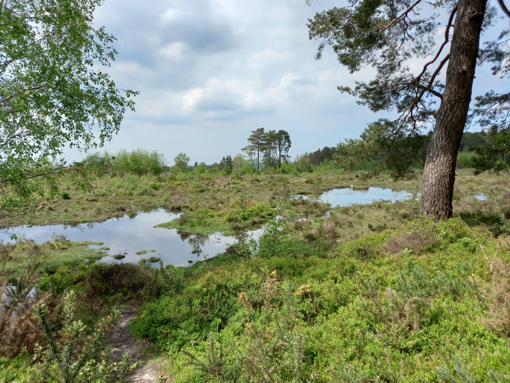
Summer brings long warm days, blackberries, dragonflies, alongside the purple of heather.
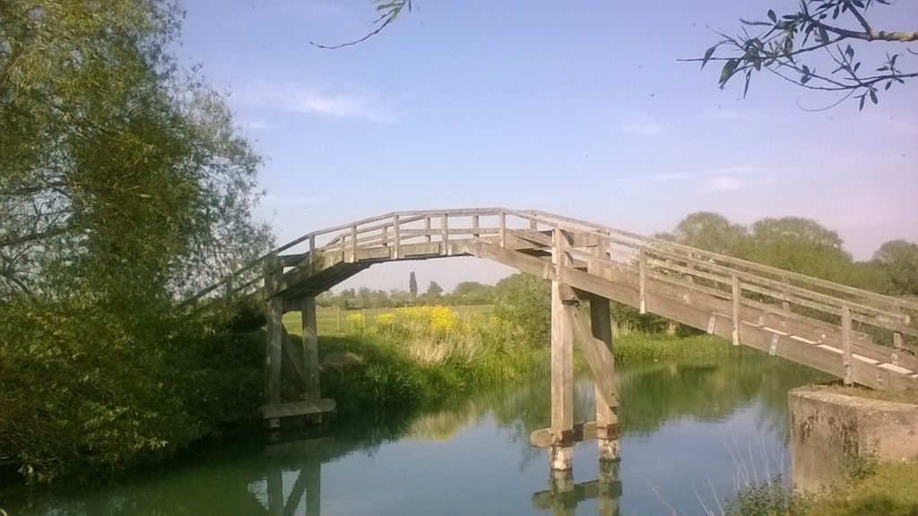
Near Pulborough in The South Downs National Park Bridge over the Thames in rural Oxfordshire
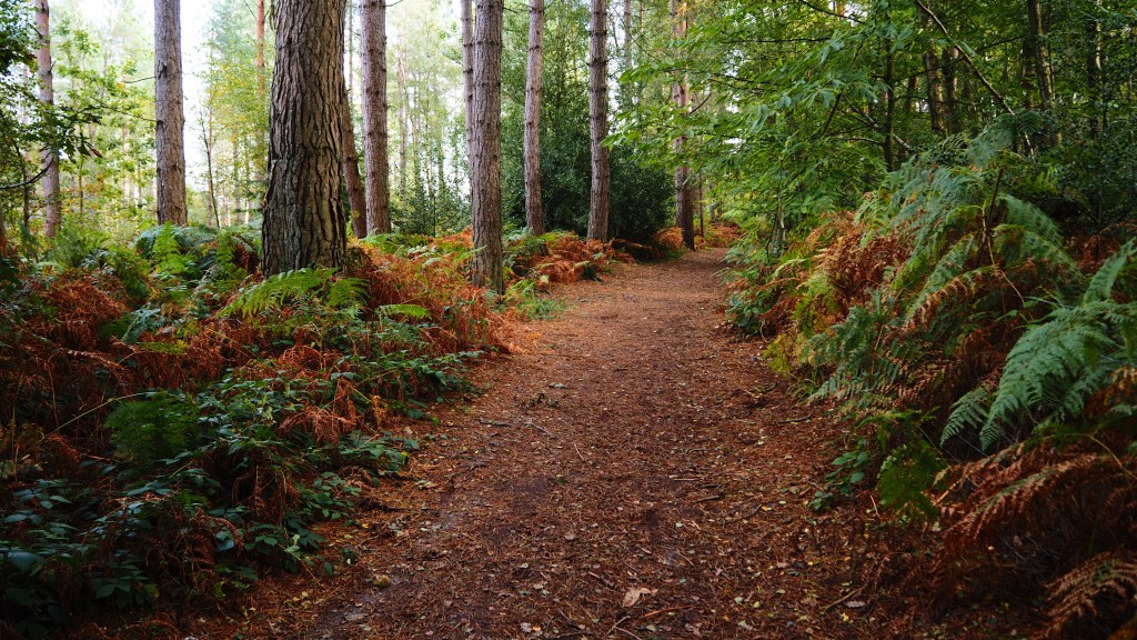
Later in the year, as autumn arrives the leaves turn red and then brown and the ground becomes a carpet of leaves. chestnuts abound.
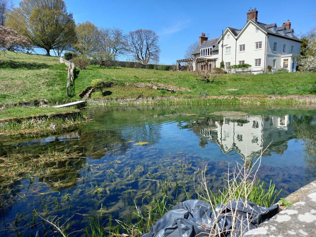
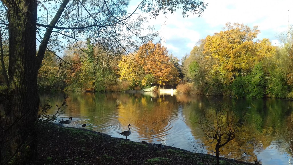
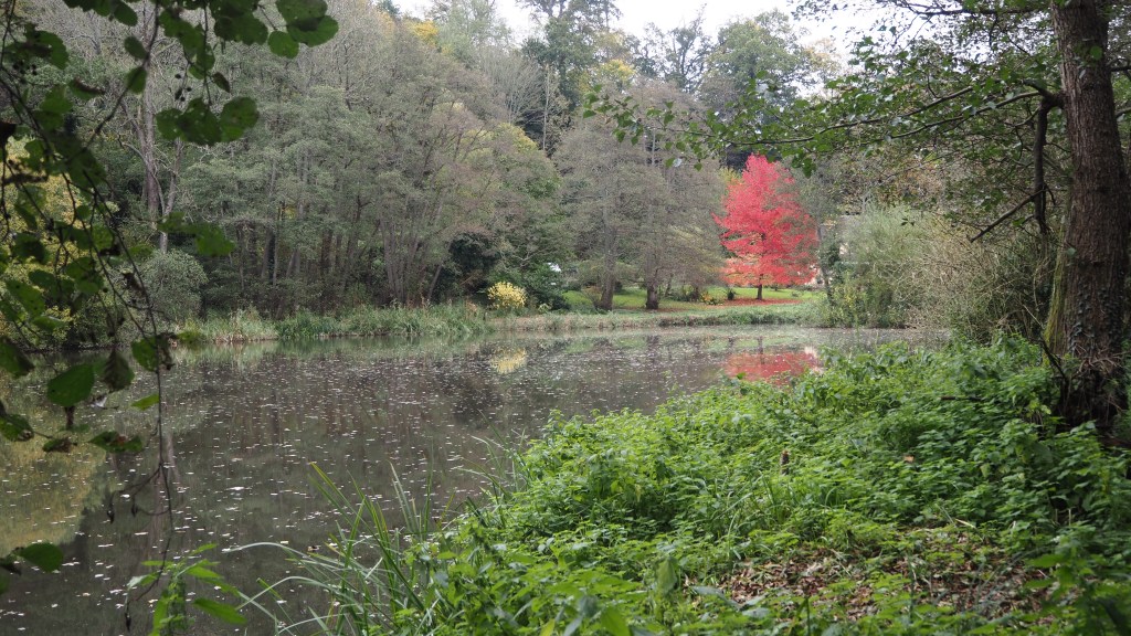
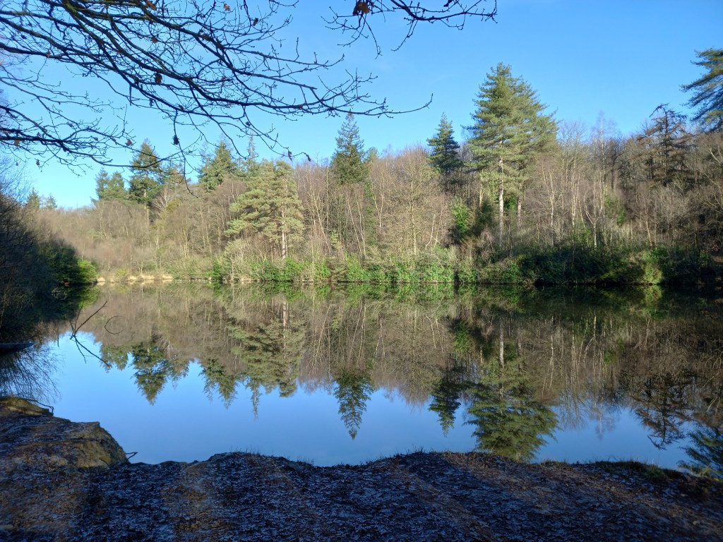
Autumn colour, near Flimwell, Sussex.Crystal Palace park lake in autumnAn splash of colour reflects on a lake, near Abinger in Surrey last autumn
In winter, pine, larch and other conifer brighten a sometimes bleak landscape. An early morning start can bring the beauty of frost covered fields.
Lake Louisa, in Bedgebury Forest, in January
There are many beautiful spots, and it has to be said, a lot of them barely seem to be known other than to locals. We are fortunate to have a number of areas of outstanding natural beauty around London- the High Weald, the Surrey hills, the Kent Downs and the Chilterns. There’s also the South Downs and New Forest national parks. There are some fantastic long distance walks too, capable of being broken down into day walks. The Greensand Way, the North Downs Way, the Serpent Trail, the High Weald Landscape Trail are among my favourites.
Reservoirs, such as Bewl Water, Bough Beech and Ardingly, although manmade , river walks like the Thames path, and lakes and ponds abound with butterflies, birds and flora of many types and can provide ideal places for an afternoon picnic. Forests such as Wendover, Alice Holt, Bedgebury and Mereworth Woods provide a yet different environment and wildlife. Pretty villages with idyllic pubs, churchyards with convenient benches abound.
If you are willing to walk 10 to 15 miles there is barely anywhere in the south east you can’t get to by public transport, offering the advantage that you don’t have to return to you car and can plan a linear walk. But there are lots of lovely circular walks too. Be adventurous, try somewhere different and you begin to realise how much there is out there to see. It’s hard to believe sometimes when you are in these places how close you are to London.
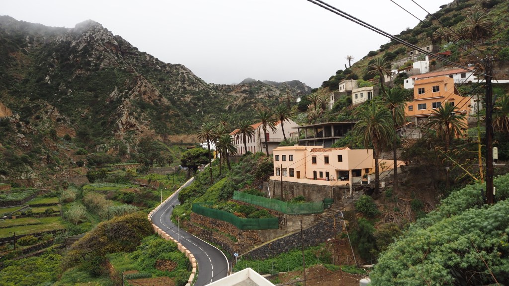
It’s taken around twenty years from when I first heard of the Canary island of La Gomera to actually getting there. One of the relatively few places you can enjoy snow free mountain walking in the northern hemisphere during our winter, the best time to walk there coincided, until now, with my busiest time at work. But recently retired, at long last we managed to visit earlier this month. I even persuaded my wife, Jeni, to join me for a walking holiday there, although I’m well aware by now that walking isn’t really her thing!
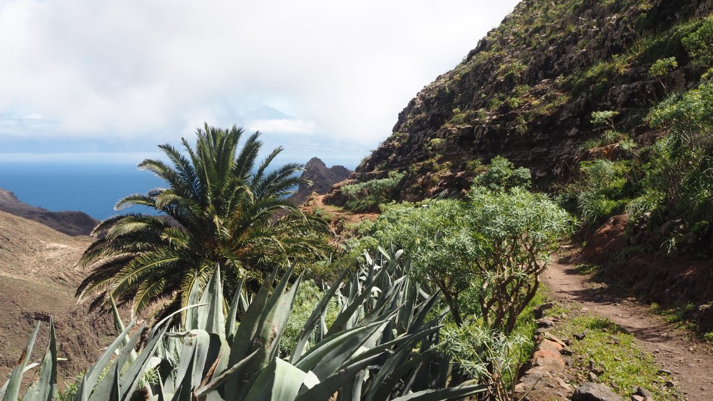
Typical Gomeran vegetation
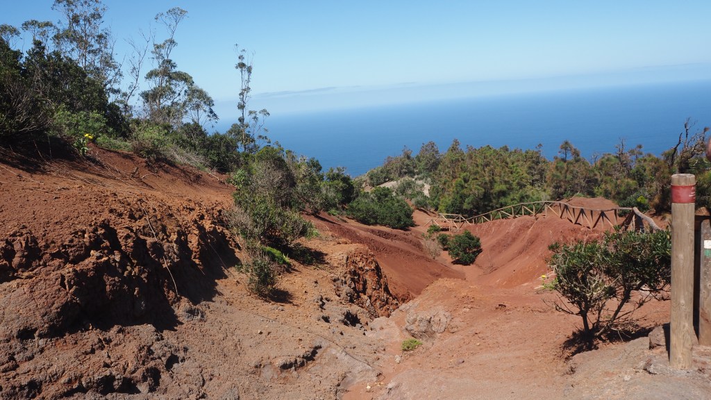
La Gomera is almost entirely covered by mountains and crisscrossed by barrancos (essentially a local name for ravines). Its generally moderately warm climate means that the central part of the island is lush and green, with mossy laurisilva forests (the Garajonay National Park). The north east, where we spent much of our time, is a home of massive palms, papaya, banana and cacti; while the south is dryer and more arid.
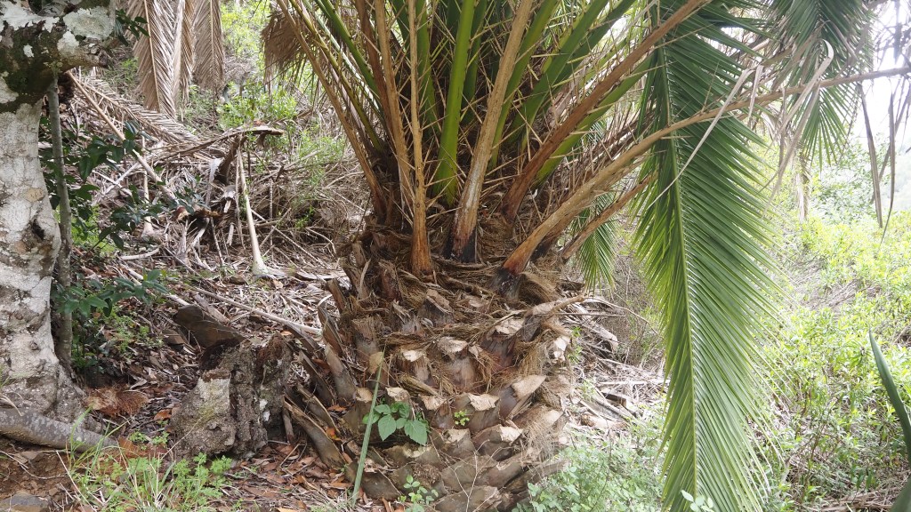
One of the many types of palm tree on the island. This one looked like a giant pineapple.Looking back, on the GR132 between Las Casetas and San Sebastián.
Christopher Columbus restocked at La Gomera on his voyage to the New World, subsequently earning the island the nickname of ‘Isla Columbina’. The island was already inhabited at this time by the Guanche people, who are thought to have originated in North Africa, but was eventually conquered by the Spanish, who have governed it ever since.
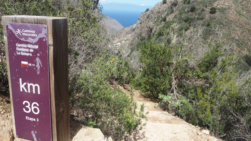
Walking wise, the island has two well marked multi-day routes: the GR131, from Playa de Vallehermoso in the north to San Sebastián in the south (a Gran Recorrido, or Grand Randonnee, part of a route spanning all seven Canary Islands); and the GR 132, a seven day walk around La Gomera. Both are well signed, with regular km wayposts. In addition, there are plenty of day walks, known as PR (pequino recorrido), which are also well marked,
The GR132 has marker posts each km of the route. Sometimes these feel a long way apart!
As first time travellers, we visited using a package offered by the travel company, Inntravel, which gave us a good taster of many of these walks, from bases in Vallehermoso, Agulo and San Sebastián.
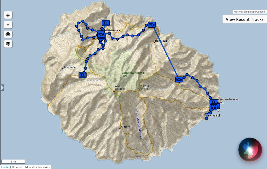
Map showing the walks I did while on La Gomera (the straight line is a car journey linking the walks)
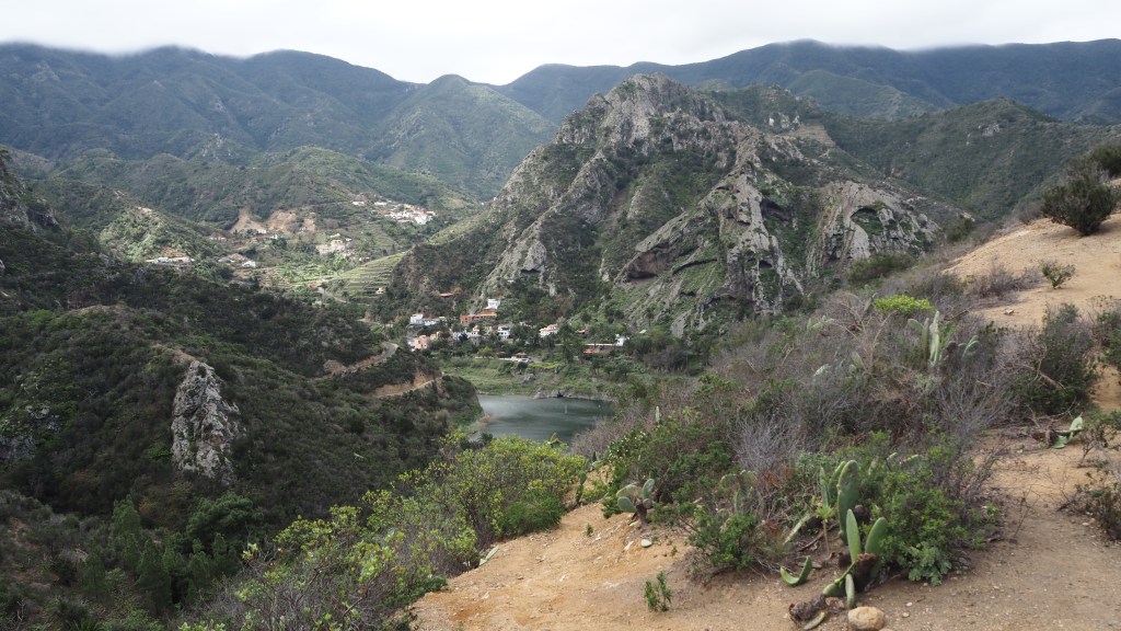
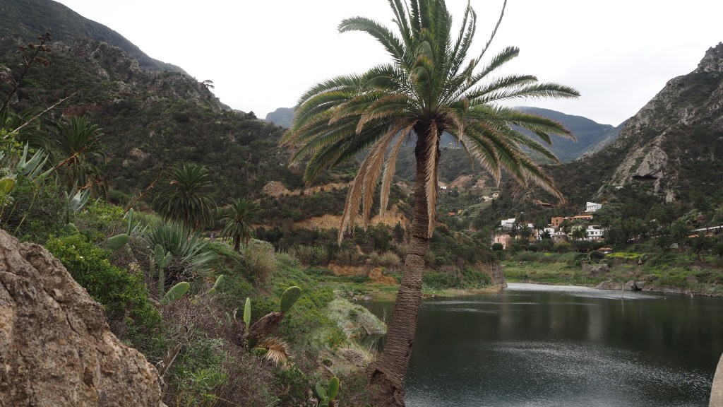
First off, there was a short, sharp climb and then descent to the reservoir of La Encantadora. This gave us a flavour of what was to come, with the rocky terrain and palms typical of the island, but in a short four mile circuit.
Looking down on La Encantadora (the enchanted lake).The ‘enchanted’ lake.
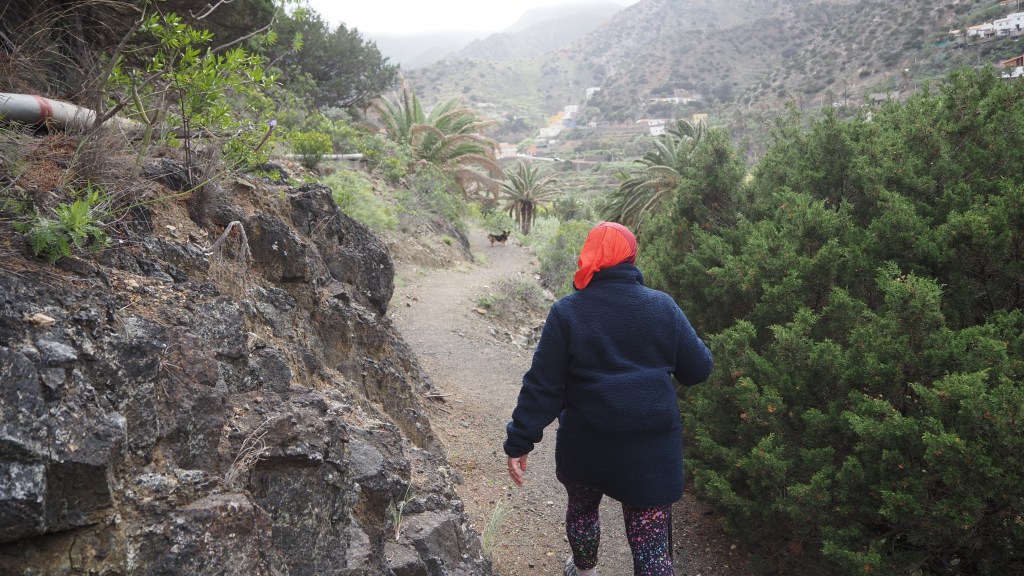
While it was a little blowy this day we weren’t really prepared for the next couple of days, when the Spanish meteorological office gave weather warnings of up to 90 km/h winds. I abandoned a planned walk above the cliffs heading north of Vallehermoso. Instead we did an interesting walk and back to the (small) local beach, initially up a flat farm track through the valley, and back up a more interesting narrow little path, led by a local dog all the way (!) above the valley floor.
Walking towards the beach at Vallehermoso, on the windiest dayA dog leads the way, looking round at intervals to make sure we are following.
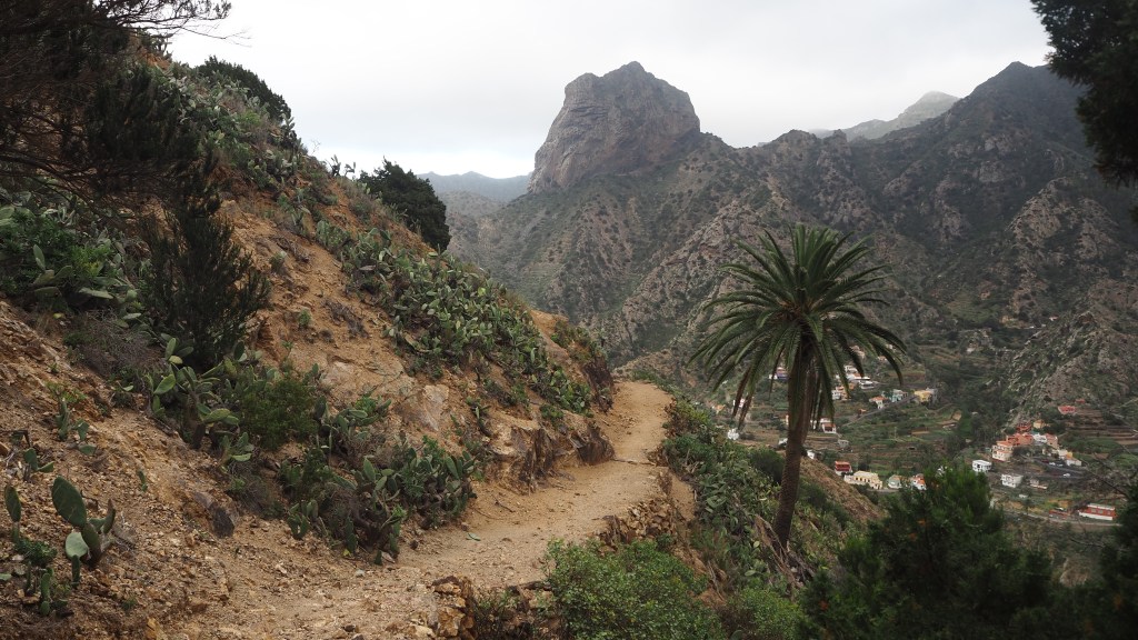
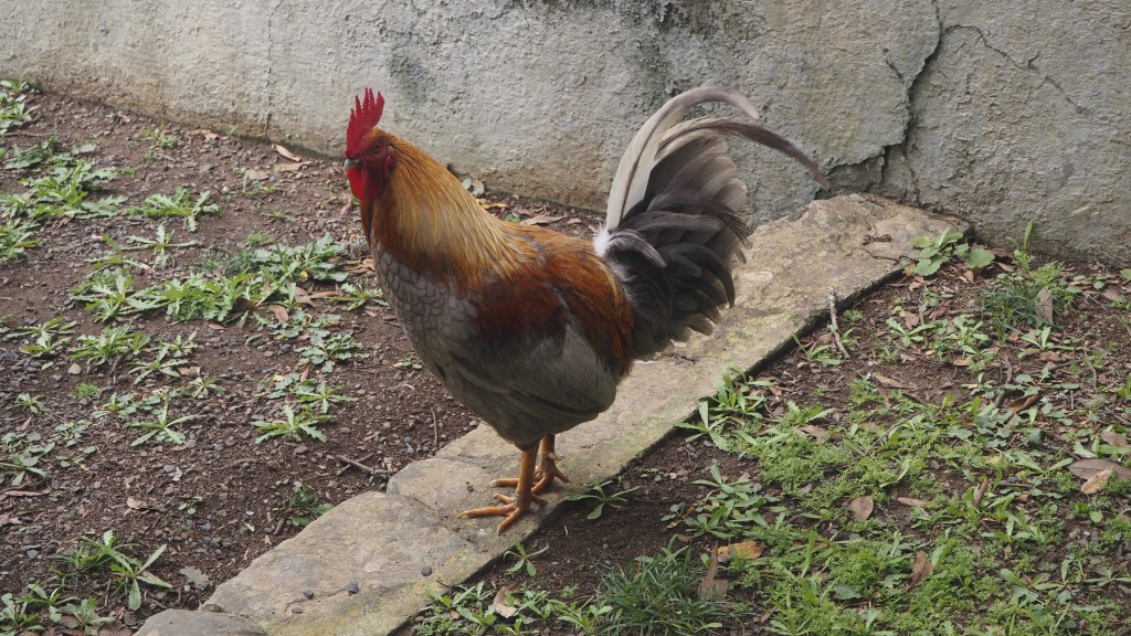
While the forecast was still not great, the next day we managed a suggested circuit north west of Vallehermoso, initially up a long and quite windy path to the hermitage of Santa Clara. Here we had lunch, overlooking the sea, and were joined by some lively cockerels, a chicken and chicks, as well as three cats, who I thought were interested in our tuna.
The Roque Canó dominates most views around VallehermosoClimbing towards Santa ClaraOne of half a dozen cockerels at the Hermitage of Santa Clara
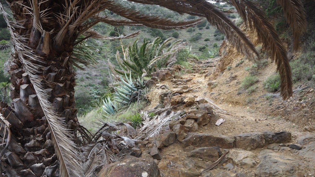
A long gradually climbing track followed, as it became hotter, before we joined the GR132 route back into the village, where we had to watch our steps as the track was rocky and steep. But a beautiful and varied route, surrounded by exotic ( for us) vegetation.
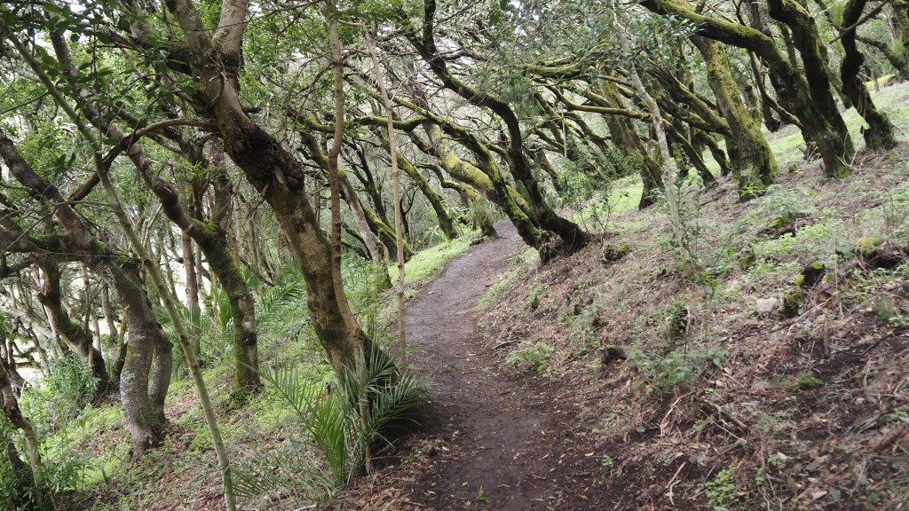
For our final day in Vallehermoso, I took the GR131 north from Las Hayas back to the hotel. This was a walk of two halves. The first part windy, cold , lush and green, but an easy level walk through what reminded me of walks in the woodland of the Surrey hills, albeit a bit greener and mossier. This was the Garajonay National Park, around 20% of which was burnt in the big fire of 2012, but is making a strong recovery. The trees were fascinating to see, lurching firmly to one side, presumably as a result of strong winds.
The slanting trunks of the laurisilva, in the Garajonay National Park
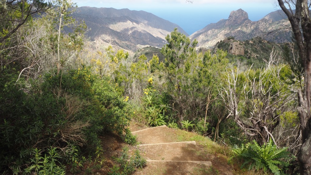
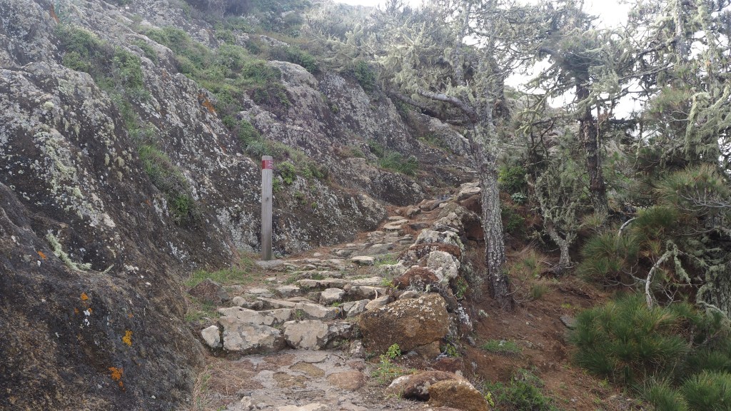
Then suddenly I emerged into the sunlight, and back to the palms, cacti and rocks with a beautiful descent eventually taking me back to the encantadora reservoir. The descent was easier than the day before though, with ready made log steps most of the way. On this day, I encountered more people than on any other walk, perhaps because it was Sunday, but it still wasn’t busy. I spoke to one couple from the south coast of England enjoying their third visit, redoing some walks they had done before.
The long descent from Las Hayas
The next day Jeni was going to join me again for the walk to Agulo, but warnings in the walk notes we had about vertiginous sections of the route led her to take the bus, and instead I was joined by Billy from Prestwick, who was doing the same itinerary as us, and whose planned walking companions hadn’t been able to join him due to illness and injury.
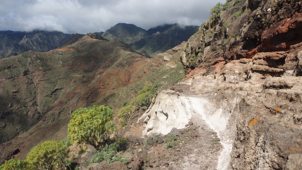
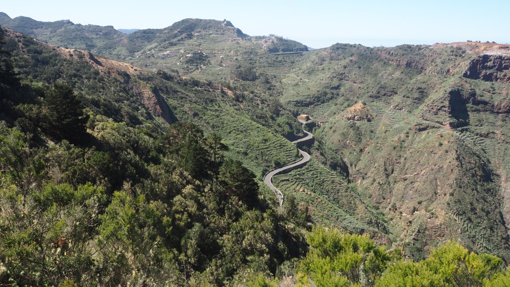
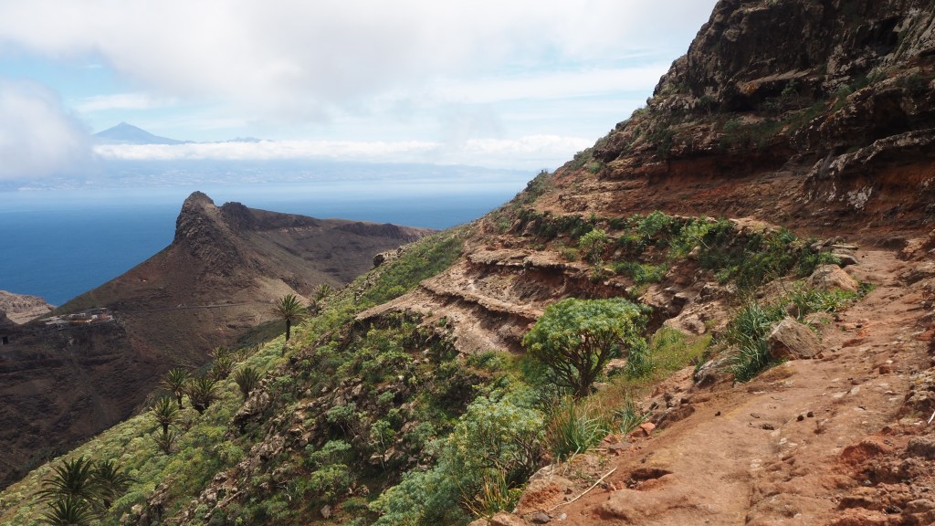
On the GR132 between Vallehermoso and Agulo, looking down on a tropical mountain road
For this day we were back on the GR132 circuit, heading east, initially up beside the impressive and dominant Roque Canó, then descending to another reservoir, before another ascent, with marvellous views of Mount Tiede on Tenerife across the water. Then we passed the Juego de Bolas visitor centre, where I narrowly avoided two coachloads of day trippers in the shop. We then followed the vividly orange soil steeply down to Agulo, in most places alongside wooden fences, the surface latterly becoming a sort of cobbled causeway or mule track. It was quite a lot of up and down, as usual, but we didn’t think anything especially vertigo inducing, any more than the other walks.
The volcanic landscape on the path down to Agulo
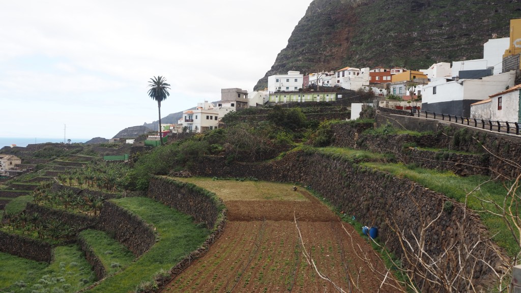
Agulo was a highlight, a real gem of a village, spread out idyllically close to the sea, with a smattering of small shops and cafes. Incredibly quiet and picturesque , we spent a calm day there while Jo, Alan and Billy, who we’d met on the trip, did part of the suggested circuit to nearby towns and coastline, some of it, we later gathered, quite tricky terrain. The hotel, Casa de Helechos, was a delight, and the proprietor who was jolly and helpful, did a wonderful breakfast.
The cultivated setting of Agulo
For the next day we were driven eastwards and upwards, through a series of impressive mountain road tunnels, to a spot known as Las Casetas, on the main GM1 road, where we resumed the GR132 circuit. Or should have done, in fact talking amongst ourselves we took the wrong initial turn, but in fact saved ourselves a rocky climb by instead following a quiet roadway. Billy had joined us once again to the top, but he left us around lunch for a quicker descent- we are always very slow going down.
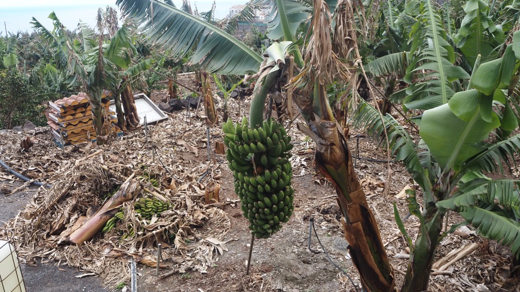
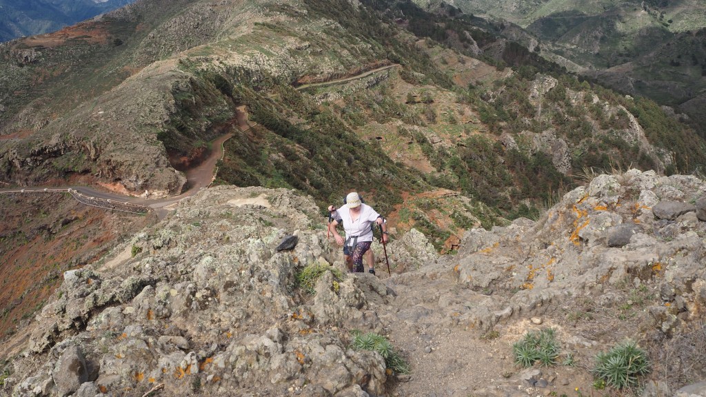
Bananas growing near AguloAscending the GR132My wife, Jeni, ascending the trail on the GR132 near Jaragan.
This was a long walk, gradually becoming more barren, arid and desert like, until we eventually reached the outskirts of San Sebastián and the long walk down to the beautiful Parador where we stayed for the remaining few nights.
The more arid landscape as we approached San Sebastián looked like something out of a Western.
Here we said goodbye first to Jo and Alan from Harrogate, who’d often been a day ahead of us, and with who we’d shared experiences of the walks and convivial evenings ;and then Billy, off to meet friends for a few days in Tenerife.
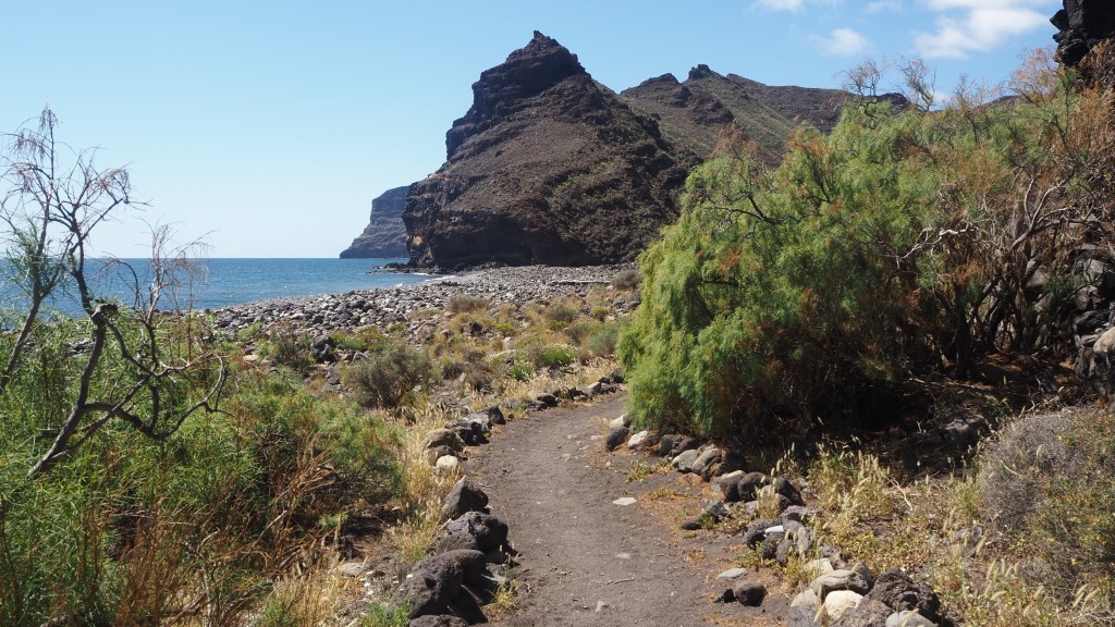
There was a chance for one final walk, a further stretch of the GR132, westward to the Playa de La Guancha. This was a hot day with two climbs and two descents in each direction, and once more the more barren landscape of the south of the island. But the views of Mount Tiede once again were outstanding, and the beach, peaceful and relaxing, making a fitting end to over a weeks’ perfect walking.
Approaching the beach at Playa de La Guancha, after a series of ascents and descents.
So after waiting twenty years to visit what was my conclusion? In my view, La Gomera was well worth waiting for, a perfect destination for mountain walkers yearning for some hiking without snow and rain, and some pleasant weather while Britain is still in the midst of its dank and cold winters. Having said that, be prepared for some high winds in February and March, and take our advice, bring some warm clothes, not just for the evening but for the walks as well. You may be lucky, but we were at times a bit cold, although at other times very warm.
If you get the chance, and you are prepared for a lot of ascent and descent, some rocky terrain, without scrambling or the hazards of ice and snow, a winter trip here is well worth it. The island remains unspoilt while well connected by ferry from Tenerife with its flights to all points of the UK and the rest of Europe. As I hope the pictures show, it really is a remarkable place, with some beautiful walking.
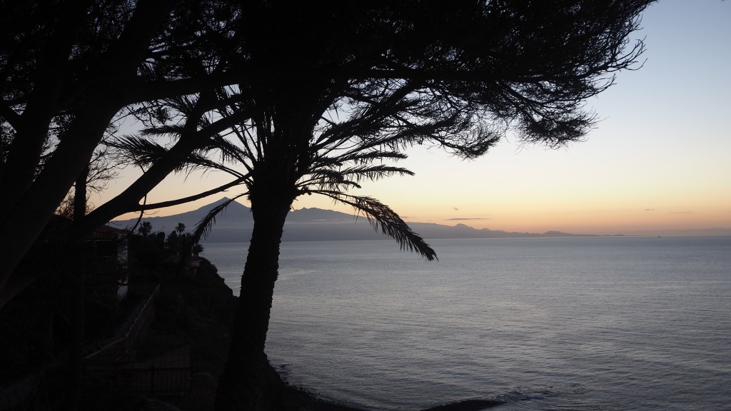
Sunrise from our balcony at the Parador de la Gomera, San Sebastian.
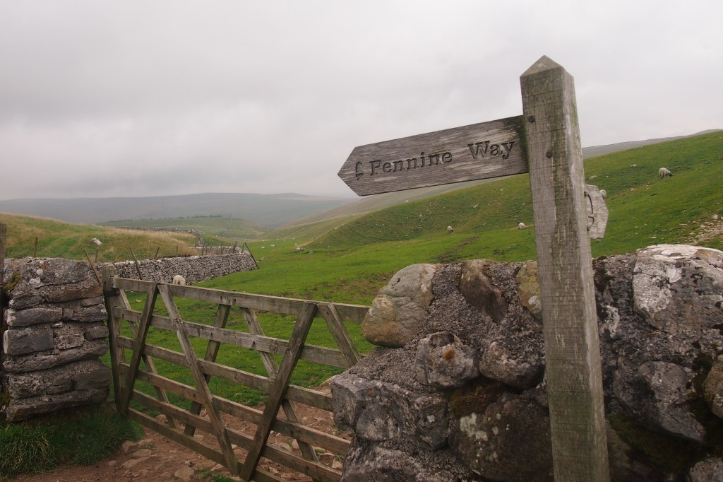
A typical Pennine Way scene, in the Yorkshire Dales
I really enjoyed the Pennine Way. And I’m not sure I fully expected to. Certainly, I knew it passed through the splendour of the Yorkshire Dales, but fundamentally it was more a walk that I felt I should do, rather than one I actively longed to.
I think this goes back a long way. My first recollection of hearing of the Pennine Way, or indeed the Pennines, was back in the early 1970s when a BBC Nationwide reporter, Bob Langley (later of Pebble Mill fame) did a series of reports as he walked the length of Britain’s first official long distance trail, opened only a few years earlier, in 1965. It seemed tough.
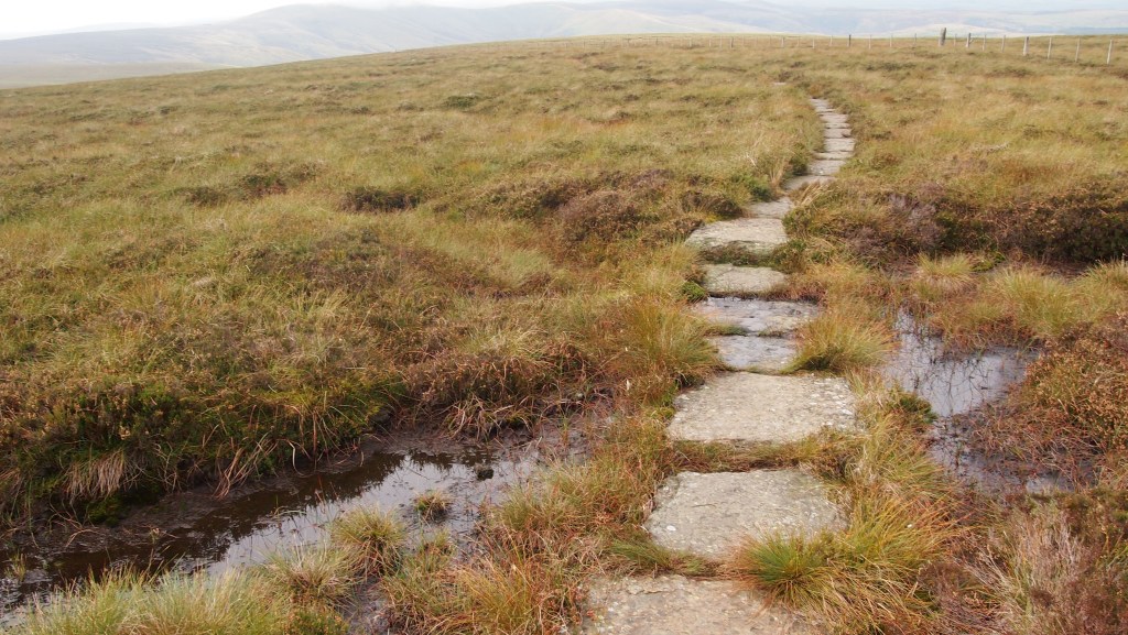
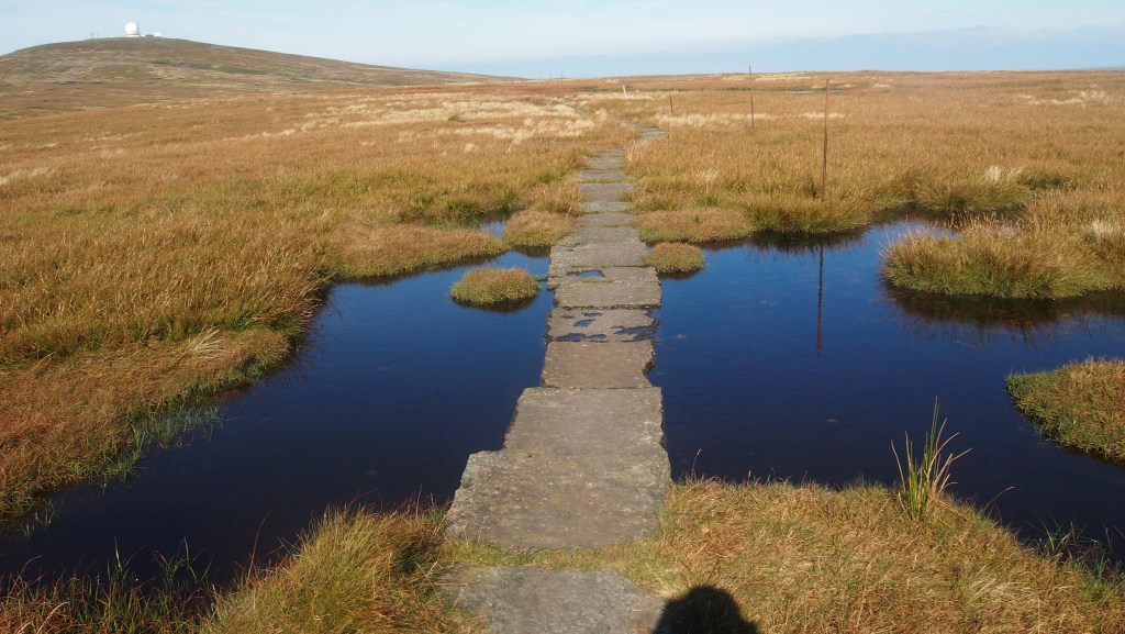
There’s a lot of moor on the Pennine Way, but these days the boggiest parts have been made more manageable by the addition of flagstones, taken from old industrial premises like mills
At this time, the trail became a victim of its own success. Seen as a rite of passage by ‘serious’ walkers, the already treacherous route across boggy peat moor became something of an ordeal as popularity led to the route deteriorating in quality- the peat bog just couldn’t take the volume of use. This in turn led to people turning against the trail and trying a more enjoyable alternative, as more long distance trails were established in Britain. Luckily by the 1990s measures were being taken to address this – largely huge numbers of old industrial flagstones helicoptered in and laid across the worst parts -and by the time we walked the route between 2014 and 2016 it was, while still a challenge, no longer the boggy morass famously described by Alfred Wainwright.
The flagstones as well as keeping feet dry, also make navigation easier.
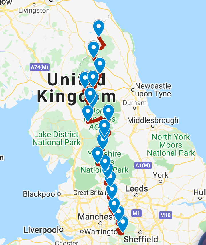
Walking South to North, the route starts in the heart of the Derbyshire Peak District, at Edale close to Kinder Scout, symbolic for its association with the mass ‘trespass’ of the 30s. After that, the first parts of the walk skirt the conurbations of Yorkshire and Lancashire, avoiding the cities through the narrow gap in between, but taking in some of the reservoirs which serve them. After passing close to Haworth, home to the Bronte sisters and the setting for many of their books, you enter the bucolic beauty of the Yorkshire Dales National Park and the grandeur of Malham Cove.
Most people walk the Pennine Way south to north, from Edale in Derbyshire to Kirk Yetholm in Scotland.
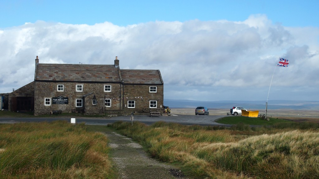
Pen-y-Ghent then follows (an admission- this was the one part of the way we didn’t do due to appalling weather, instead bypassing into nearby Horton). At Keld and its waterfalls the route crosses the now more popular Coast to Coast Walk before reaching the highest pub in England, almost annually snowed in it seems, the Tan Hill Inn.
England’s highest pub, the Tan Hill Inn.
While there is lots more moorland, this is also sheep country too, and you pass through little farmsteads familiar from tv’s All Creatures Great and Small. Grouse shooting was also in evidence during our journeys over successive Septembers (when we were blessed with near perfect weather, most of the time).
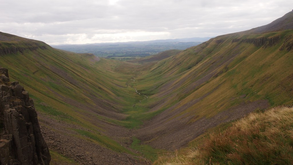
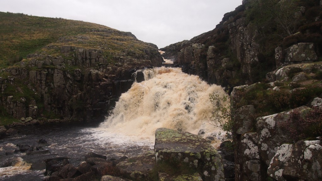
The beautiful Teesdale (a rare touristed section of the trail) with its magnificent waterfalls, leads on past Cautley Spout and then the amazing, and unexpected, High Cup Nick.
The approach to High Cup Nick on the Pennine way gives no indication of what is in store.
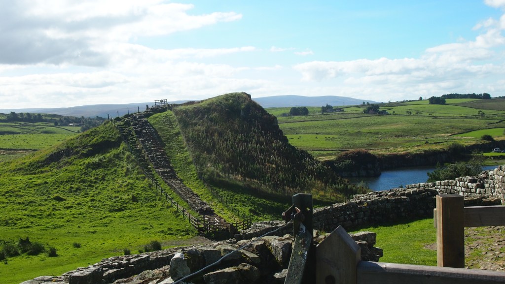
There is then a day of big peaks in eastern Cumbria, beyond the better known Lake District, followed by some lovely little Cumbrian and Durham towns and villages before a further change of scene as you reach Hadrian’s wall.
Hadrian’s Wall
I had never actually been to Hadrian’s wall before, and I was surprised how much the wall seemed to fit the land on which it was built, a fold in the landscape, no doubt chosen for its defensive properties.
After a day following the wall you’re off through the UK’s least visited (but marvellous) National Park, Northumberland, pass through a rare bit of forest, culminating in a final couple of days walking a magnificent high ridge of the Cheviot Hills, on the present English/Scottish border.
Rainbow over the Cheviots
Then there’s a final descent into Kirk Yetholm just over the border in Scotland. Just make sure that, unlike us, you get to the pub in time to have a proper evening meal! After 256 miles or more, you’ll need it.
Having walked the Pennine Way, there’s no doubt I felt a sense of achievement, even though we didn’t walk it one go, nor carry our own luggage or camp. It’s also fascinating to see a less visited part of Britain, yet often so close to civilisation- and as it has sometimes been described , the backbone of England. Now that it’s been carefully looked after it’s well worth a go, and certainly one of the top trails in the UK. But don’t treat it lightly- in bad weather and low mist I can imagine it being a lot tougher than we encountered. And with few if any directional signs on the moorland parts, where paving stones don’t make the route obvious, good map and compass skills, and ideally a GPS (with long battery life) are a must.
As a walker, I am ever conscious of the debt we owe others for the ability to enjoy the great outdoors. While on the one hand humanity has variously despoiled, exploited and damaged the land, habitats and wildlife, and sought to exclude, whether by enclosure, intimidation or the power of wealth; others have to stood up to protect and conserve, open up and share the beauty and freedom that belongs rightly to us all.
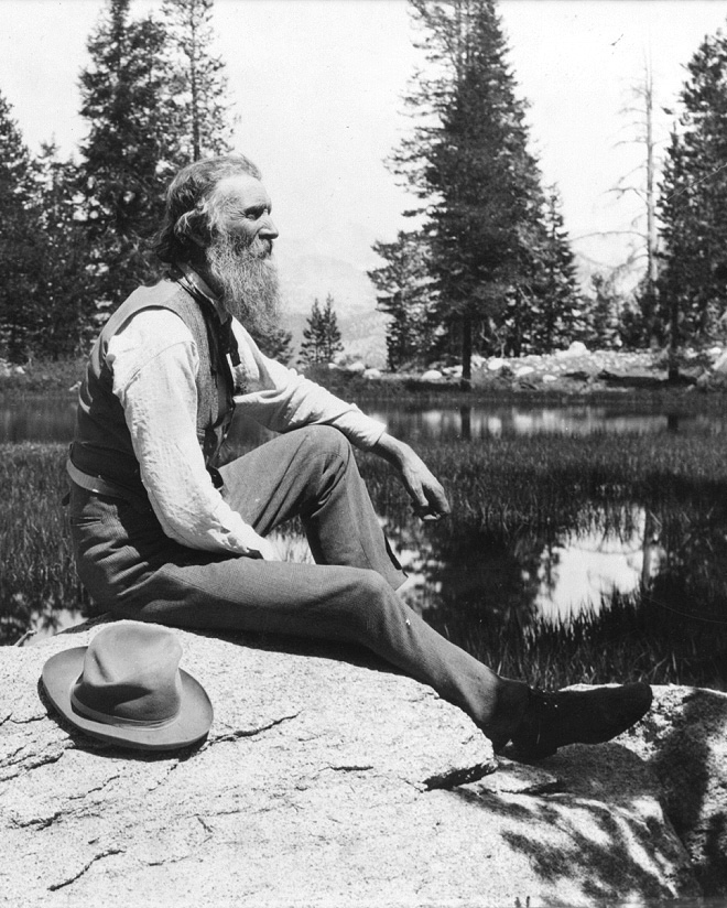
John Muir, a pioneer advocate for wild places and for the idea of National Parks (public domain)
People like John Muir, the founding father of the National Parks movement; Octavia Hill, campaigner who saw the benefits to city dwellers of open air and space and helped found the Open Spaces Society and the National Trust; and Benny Rothman, one of the many who challenged the power of the privileged to exclude others from places they loved, in the now legendary mass trespass on Kinder Scout of 1932.
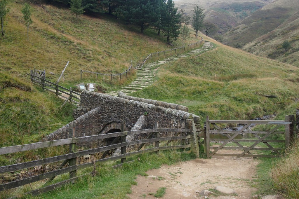
Jacob’s Ladder, on the approach to Kinder Scout, site of the 1932 mass trespass and now owned by the National Trust
In many ways we are fortunate in England and Wales to have, since 1949, enshrined in law, a network of legally recognised rights of way for walkers, as well as the more recent addition of a right to roam over moorland and mountain. Scotland has longer standing informal traditions, more recently legally recognised, to roam and camp, a right also enjoyed across a number of other Northern European countries.
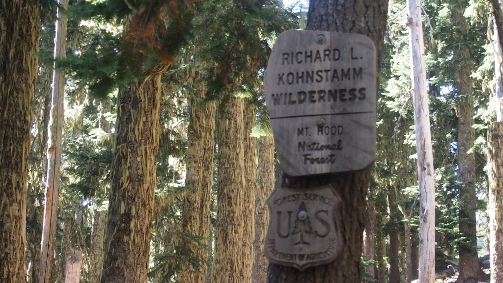
Other countries such as the US, while more resistant to granting public access to private land, have set aside large areas, owned by central and local governments, as National and State parks, and National Forests.
A sign in the federally owned Mount Hood National Forest, Oregon, USA
We don’t have to look very far to see the effect of where such access rights are much more limited. Take Ireland, north and south, for instance, where there are few National Parks (none in Northern Ireland at all) and few public rights of way other than roads. As a result, walkers there are largely restricted to a few permissive paths and designated long distance walks. The threat of litigation has stymied attempts to widen public access.
But I don’t think the battle is won, so to speak, even here. The right to roam in England and Wales was watered down in its passage to legislation, excluding for instance, many river banks and woodlands; and in recent years there have been moves to criminalise trespass, ease restrictions on building on green belt and sell off state forestry land to give a few examples. A deadline of 1 January 2026 has been set by the government preventing further additions of rights of way to the definitive map. These are all retrograde steps.
I hope these and new threats fail, and we can instead look more positively to the idea of granting greater access, alongside responsibility and better land stewardship. We need to protect and enhance Areas of Outstanding Natural Beauty, National Scenic Areas and Sites of Special Scientific Interest, designate further National Parks (eg mid Wales, the Mournes, Glen Affric and Galloway), and ideally move to a situation where everywhere is open, unless there are good reasons (eg nature protection, safety) and not misuse the need for personal privacy or security as a catch-all to exclude most from vast swathes of land.
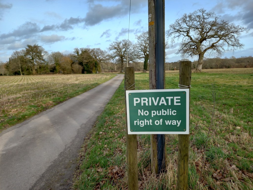
After all it would be nice to see fewer of those threatening ‘Private’ and ‘Trespassers will be prosecuted’ type signs and more ‘Responsible walkers welcome’ ones.
An all too typical sign in the English countryside.
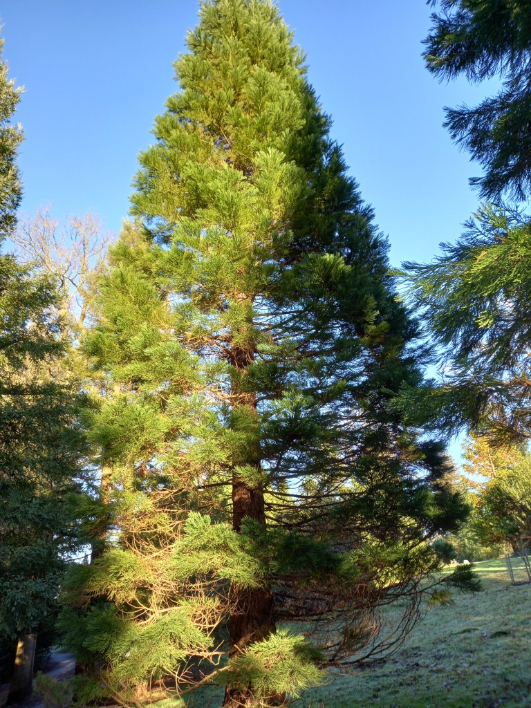
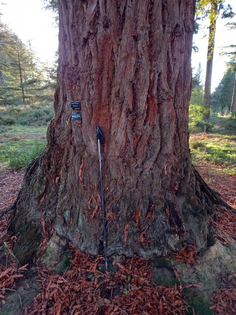
A sequoia in Bedgebury national pinetum, which has the largest number of different conifer species growing anywhere in the world on a single site.
This Christmas I was given a fascinating book: King Sequoia, about the most magnificent and largest of trees, the giant sequoia, part of the redwood family. Written by a former US National Park ranger,William Tweed, it relates the fascinating, but predictably disturbing, story of how the mightiest of trees was first encountered by European Americans in isolated groves in California and has subsequently been at various times, marvelled at, exploited, destroyed and now protected.
It’s a story which has parallels with that of many species of flora and fauna, and of habitats, across the world, showing how short term financial gain (which ironically in this case rarely actually materialised) almost brought this most magnificent of trees to the brink of extinction.
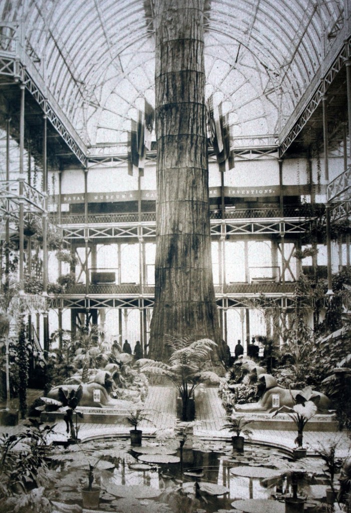
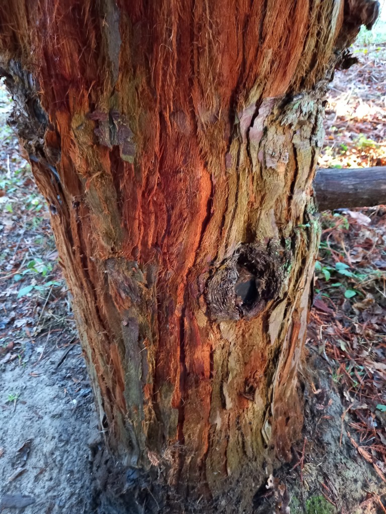
Part of a giant sequoia, displayed in the exhibition hall of the Crystal Palace, south London, in the late nineteenth century.
What really brought it home to me was a picture in the book of how the Victorians thought it was a good idea to remove the bark of one of the world’s oldest trees and put it on display at the Crystal Palace exhibition, barely a mile from where I live. But many other tales related in the book are equally shocking.
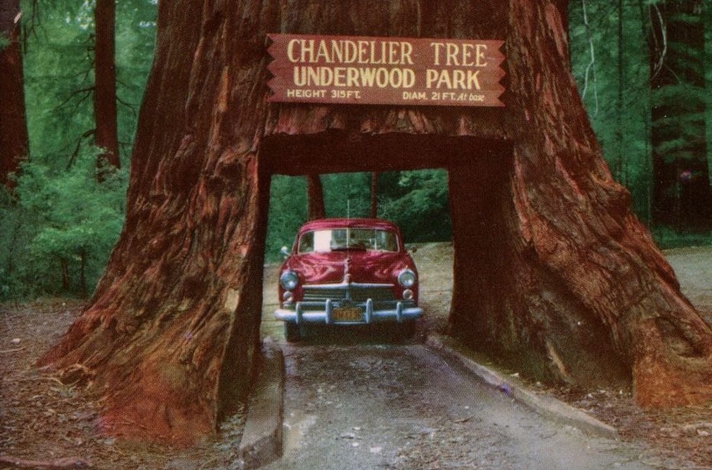
One of several sequoias which have been ruinously cut for the amusement of tourists.
We’ve all seen the pictures like that above of people driving through a cut out cavity in the trunk of a sequoia, which somehow, someone thought was a good idea! For the tree to reach this size took thousands of years, but inevitably the trees have eventually died as a result. Such a shame, and so unnecessary.
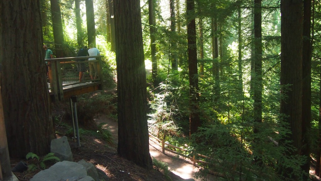
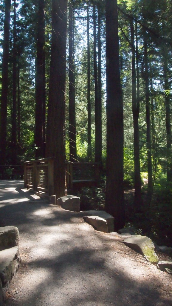
The Hoyt arboretum in Portland, Oregon
I guess I first became aware of the just how amazing these trees are on a visit to Oregon in 2015. That they provided welcome shade during searing heat during our visit was a bonus, although recent record breaking wildfires in California have highlighted the new dangers which climate change brings.
In fact naturally occurring forest fires, every 25 to 30 years, are actually beneficial to redwood trees. They enable other species to be cleared while the thick redwood bark protects sequoias against short term fire damage and enables redwood seedlings to flourish before other species can grab the light needed to grow. But the sheer ferocity, frequency and extent of recent forest fires in California threaten even the redwoods. Recently park rangers have taken to covering the base of particularly vulnerable old sequoias with aluminium foil in the hope that this can protect them further.
While, outside California’s sequoia groves, there aren’t any of the massive, thousands of year old specimens of sequoias that make these trees so special, nonetheless since the three species were first identified by Europeans in the mid nineteenth century, seeds have been exported around the world.
Coast redwoods at Bedgebury,
Bedgebury, our national pinetum, has some of the UK’s best examples, and with the help of the dedicated compilers of the Redwood World website it is easy to find a redwood tree near you. In fact, I’ve already found two not listed but labelled in a nearby wood, and what I’m fairly sure is a coastal redwood in a nearby park, also not listed. So there are more than you think. While nothing like their American counterparts they are still beautiful trees and it’s amazing to think that in three thousand years they may still be there, if human behaviour allows.
When I started this blog, the original aim was to cover my planned journey along the Alpe Adria trail in summer of 2020. In my initial posts I deliberately wrote in definitive terms: I would be walking the trail, not that I merely planned or hoped to do so.
Times have changed and all you can do is plan and hope these days. An Austrian travel ban for Uk citizens last summer put paid to my hopes of walking the trail in 2021, but I’m optimistic now about 2022: despite omicron.
But an alternative goal I set myself early in 2020 has proved possible. The ‘walk 1000 miles’ in a year idea. In fact I’ve done it twice now and am aiming for a third year.
The walk 1000 miles medals, available for the official website, are a nice memento.
Like the idea of walking 5000 or 10000 steps a day, a target like this incentivises you to get out every day, and to push yourself a bit harder. In fact, if you have the time, and are of reasonable fitness, a 1000 miles in a year is really very feasible. At 2.73 miles on average a day, to be honest you could do it just walking the dog.
Now I’m retired, my regime is to do at least a 2.5 mile walk round a local park every day, a weekly day walk of 10 miles or more, and at least one weeklong walking holiday. Even with lockdowns and enforced self isolation, that enabled me to reach the 1000 miles quite comfortably- by 24 November in 2020, and by 7 October in 2021. ( I got to 1086 in 2020 and 1309 in 2021). The key really is not to think of the quickest way from A to B as your default, but to think ‘can I walk it?’, and ‘where can I walk today?’
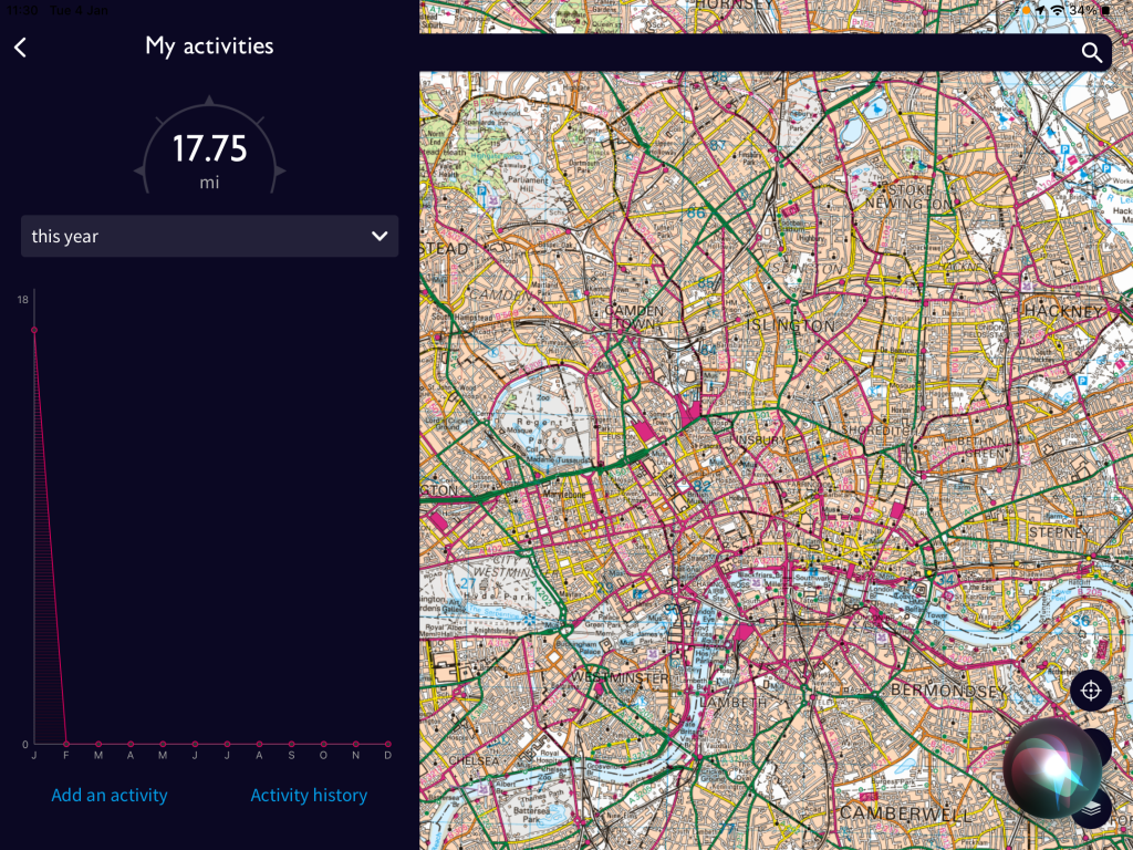
What and how you measure distance is another question. Up until now I have only measured whole miles walked outside and measured on a gps device, or drawn on the OS map app. If you’re just doing it a fitness target you might want to include distance indoors, but some of the pedometer apps are not necessarily that accurate and can overstate what you walk I’ve found. My purpose has been to spend time outside for mental well-being, enjoyment as well as physical health hence limiting to what I can map outside.
The Ordnance Survey app has a useful ‘my activity’ function to record miles walked this year.
For 2022, with hopes of walking the Alpe Adria Trail at last, I am now setting my sights higher aiming to reach 1500 or even 2000 miles this year. I’ll also be using the OS app to measure distance using its useful ‘record a route’ function as you walk, measuring distance by gps not hypothetical steps. This makes it even easier to record distance walked (as well as measuring fractions of miles, which I have missed before and hence understated).
Anyway, if you are interested there is a website called walk 1000 miles, and this week’s Country walking magazine , which sponsors the idea, will include a fill in chart to record your progress in 2022. Happy walking!
To many fans of the great outdoors, the recent news of the death of Kev Reynolds, mountain writer par excellence, is sad news indeed. I only met Kev once, more than twenty years ago now, but his photographs and writings have encouraged me -and many others, I am sure – to get out , explore and head for the mountains.
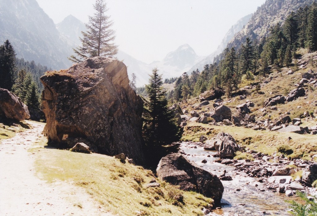
The Vallee de Letour in the French Pyrenees
He will forever be remembered for his definitive guide ‘Walks and Climbs in the Pyrenees’ , first published in 1978- certainly the volume that first inspired me to visit this mountain range back in 2001.
I first noticed Kev’s name on Cicerone guidebooks to walks in the Home Counties back in the 1990s, and having tried some of these, it wasn’t long before I saw that as well as guides to walking in Kent and Sussex, he had written guides to many Alpine areas as well as the Himalayas. Sometimes these were the first English language guidebooks to these areas, or certainly the first to be more than travelogues.
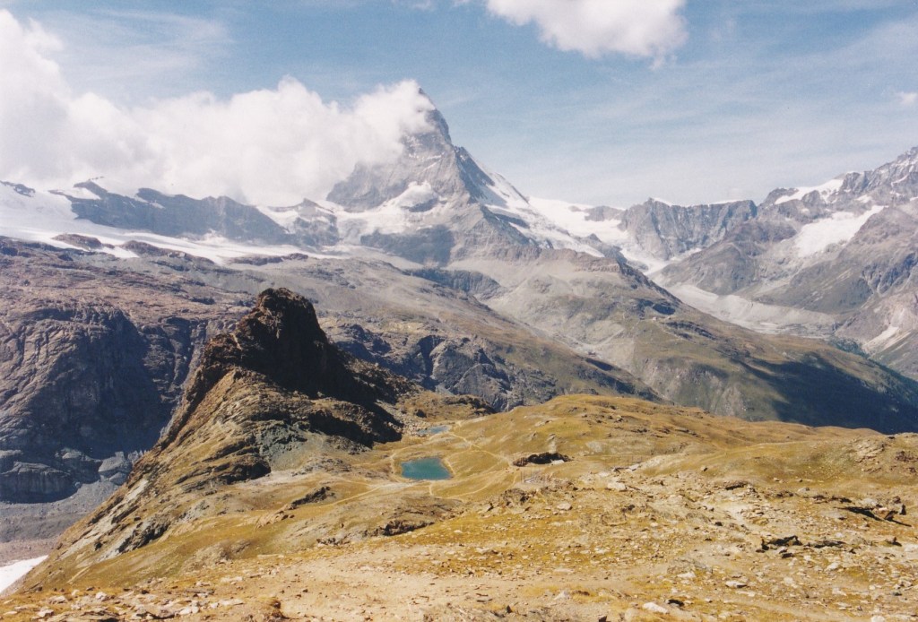
The Matterhorn, from near Gornergrat, above Zermatt, Switzerland, which I visited soon after hearing Kev wax lyrical about the joy of the high Alps
He once described himself as ‘the man with the world’s best job’ , having managed a youth hostel in Kent before embarking on a career in journalism, guidebook writing, guiding, photography and lecturing- all based around his love of the outdoors.
Before my first visit to the Alps, I noticed that he was giving an afternoon talk on the Alps at the nearby High Elms nature centre, and sparking my interest, I took the afternoon off to go and hear him talk . I’m glad I did. He captivated his audience (mainly pensioners) with slides and stories of his many visits to the Alps, its different countries and regions. Afterwards I remember speaking to him about a forthcoming holiday in Zermatt and he couldn’t hide his enthusiasm, giving confidence to a then novice like me that there were walks there for every ability.
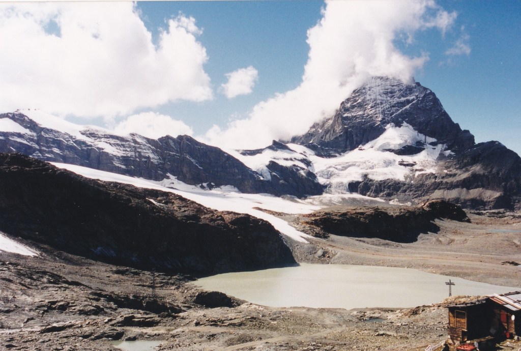
Another view of the Matterhorn
After that I’d frequently see his name pop up in outdoor magazines, and visits to the Pyrenees and the Ecrins National Park followed, making heavy use of his guidebooks.
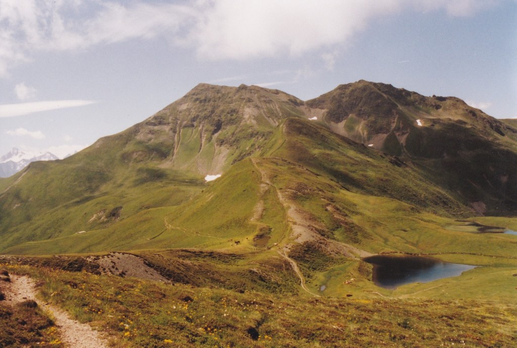
One of the most memorable days he led me to was a walk he described (in a now out of print Inghams guide) known as the Pinzgauer Spaziergang, Kev called it one of the great walks of the region, and if he said that you knew it was good. In fact I’ve seen it described as ‘Austria’s best day hike’. It is certainly an amazing walk, with expansive views of the mountains from a grand height, but which you can reach by means of cable cars at each end.
On the Pinzgauer Spaziergang, near Zell am see, Austria
I had beautiful weather walking this route in summer 2001, and took my time, including stopping near the end at an idyllic mountain inn. That in fact was my downfall, as the clouds soon came in, I missed the last cable car down ( at something like 4.45 in the afternoon) and had to walk all the way down. Which would have been ok had it not bucketed down, and the downward path been a building site for works associated with a new ski lift!
In 2004, I embarked on the Alpine Pass route, for which he wrote the definitive guide. That book was my bible for four weeks that summer, although I do remember on occasion his text somewhat underplayed what’s involved. For instance ‘an old mule path that makes a gently sloping traverse of the hillside’ I remember as three hours of never ending, if beautiful, descent!
But it’s a small criticism when you have contributed so much to so many peoples lives, witnessed by the many warm and heartfelt wishes on his book of condolence. All I can say is thank you Kev, for inspiring me and many others to experience places we would never otherwise have seen. Your guidebooks and legacy will live on.
Snow on the Richtelipass, on the Alpine Pass route, in July 2004.
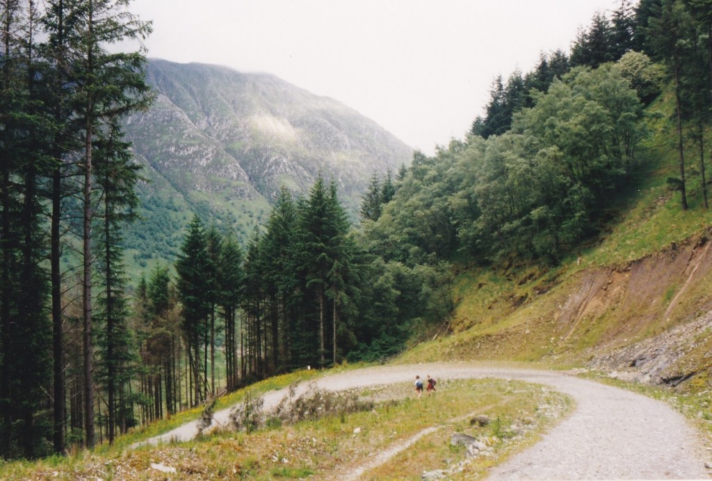
Twenty three years ago, my wife Jeni and I completed our first long distance walk, the West Highland Way. In Jeni’s case it was also her last, but I got the bug. As the weather turns autumnal, I thought it would be an opportunity to launch an occasional series of posts of some of my favourite long distance walks. And Scotland’s West Highland Way is certainly one of the best.
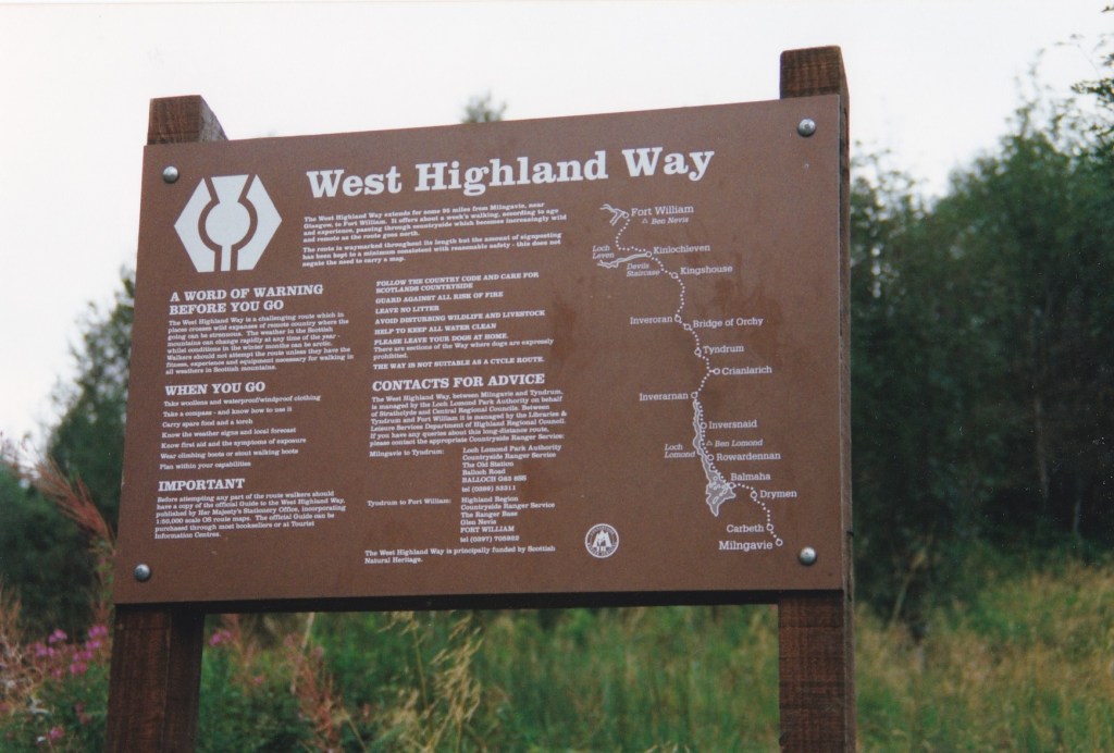
Information board on the West Highland Way
The West Highland Way is deservedly popular, and has, so I have heard, grown ever more so since we walked it in 1997/98. Starting gently on the outskirts of Glasgow at Milngavie (pronounced ‘Mullguy’) it builds quickly to a series of highlights: Conic Hill, Loch Lomond, Rannoch Moor, the Devil’s Staircase, and Glen Nevis. Around 95 miles long, and with a lot of up and down, and some potentially boggy and slippery sections, it could take anything from 5 to 10 days to walk, depending on your stamina, abilities, the weather, and your inclination.
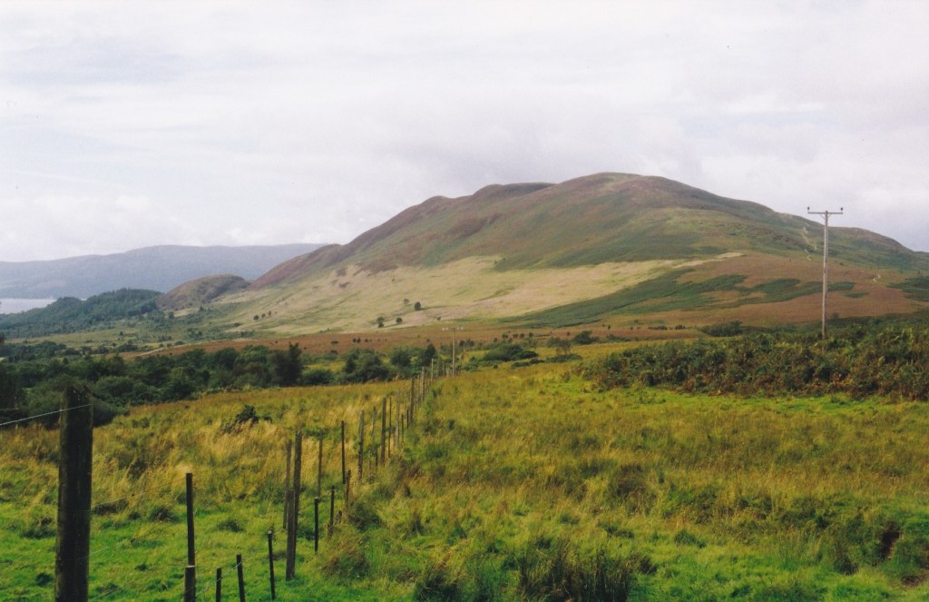
Conic Hill
The first real test is Conic Hill, on most people’s day two. Not a huge hill, but one that builds to some fantastic views down the other side- of the magnificent Loch Lomond. When we were there we had our first real experience of ‘all in a couple of hours’ Scottish weather: sun, sleet, hail, wind, and to this day Jeni and I call this Conic Hill weather. I’ve been back since, and can say that it’s much more enjoyable on a sunny, clear day.
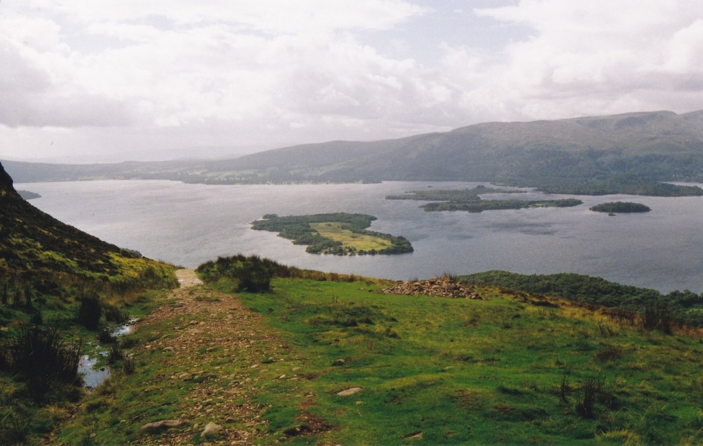
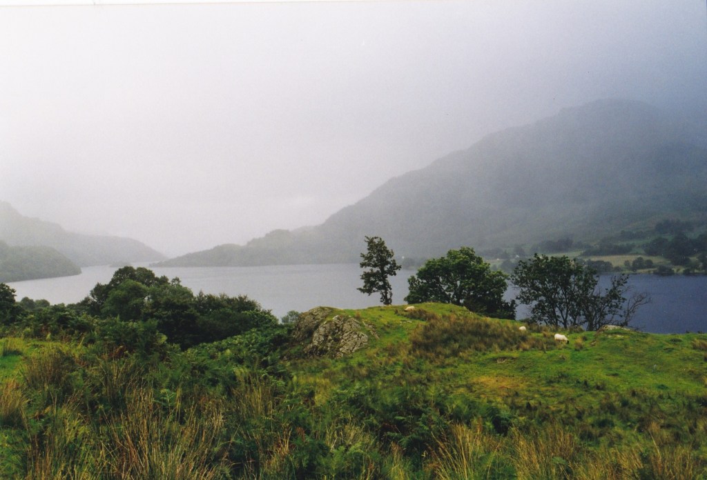
Coming off Conic Hill, you reach Loch Lomond at Balmaha, and spend the next day or two walking the entire length of the east side (car free) of the Loch. We had a day of rain, and a day of (mostly) sunshine.
Looking from Conic Hill down to Loch Lomond
The first part was straightforward, with the trail following the banks of the loch, and then turning inland into forest climbing up and back down several times before rejoining the loch at intervals, although you never stray far from it. Our second day was a long one (not helped by my injuring my ankle the day before after jumping from a rocky step too heavily) and took us from Rowardennan, where there is a youth hostel, to Inverarnan. An amazing walk with the loch always to your left, and several stretches where you are slowed down as you clamber rocks or negotiate a path through. It’s also long… so Inverarnan’s Drovers’ inn is a welcome stop at the end as you arrive at the north end of Loch Lomond.
Loch Lomond
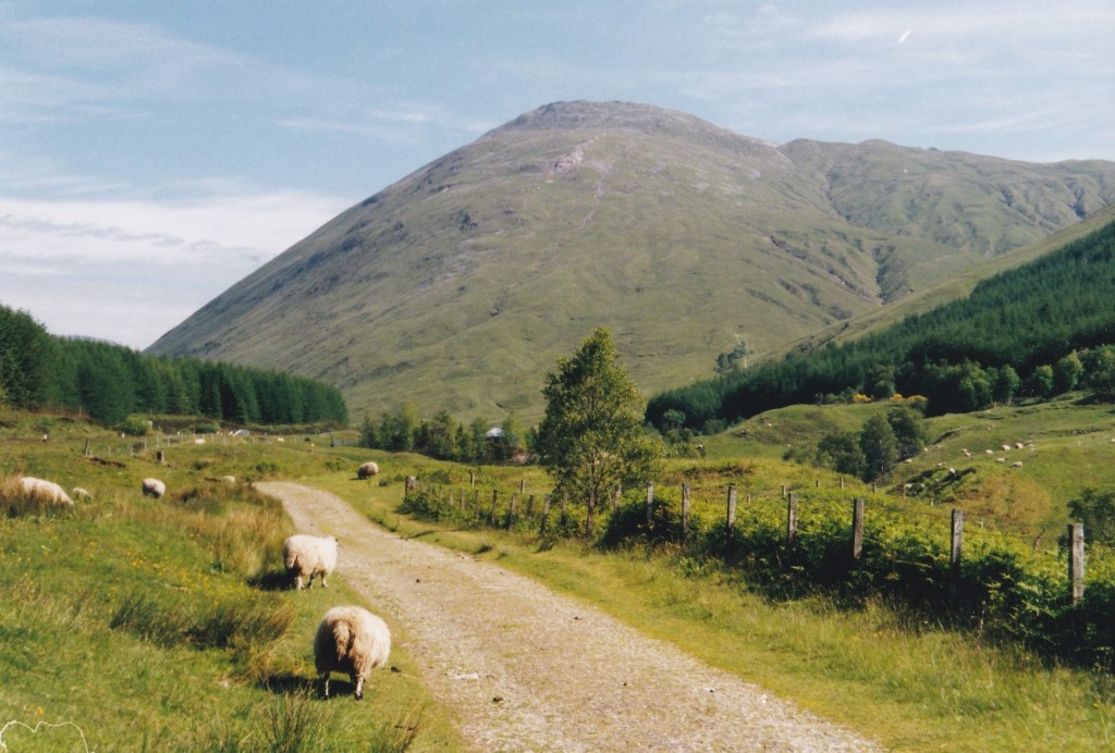
The next day or two takes you along General Wade’s old military road (one of several built by the English for their troops fighting the Scots in the eighteenth century) and quite painful to walk on in places; and then alongside the road and railway (including its remarkable horseshoe bend) of Strathfillan.
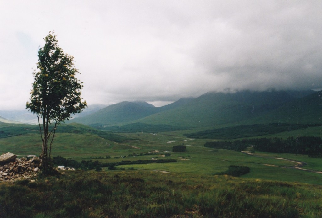
The weather behaved for us in Strathfillan, near Bridge of Orchy
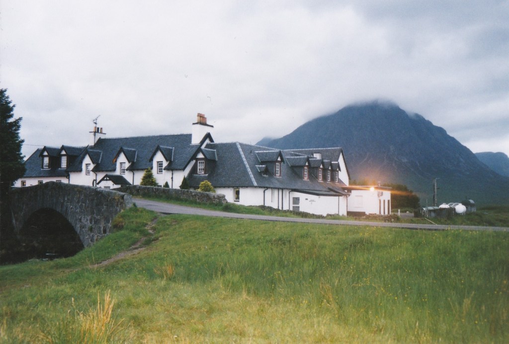
The longest day for us followed, across Rannoch moor, starting with a climb above Loch Tulla, before becoming wilder, leaving plantations behind, when you experience first the bleakness, and then the grandeur, of the moor itself. I’ve already written on one of my previous posts that this remains one of my favourite places, but even so, at the end of the day, the isolated Kingshouse hotel, is a welcome sight.
Kingshouse hotel, before its recent redevelopment
The hotel has been there since the eighteenth century, and its setting is second to none. When we were there it was a quirky mix of the original and a variety of additions and fittings from what looked like the sixties and seventies, and retained the smell of drains reported by Wordsworth two hundred years before! I still remember the deer coming up to the picture windows in the lounge for food scraps as the sky darkened (around 11 pm in June, when we were there)- a truly magical sight. The recent redevelopment has been controversial- not for the demolition of the ugly twentieth century additions, but because of the size and design of the new extensions, but undoubtably it will enable more people to experience a night there, and unless you are camping, the only other option is to catch a bus to Glencoe.
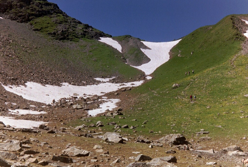
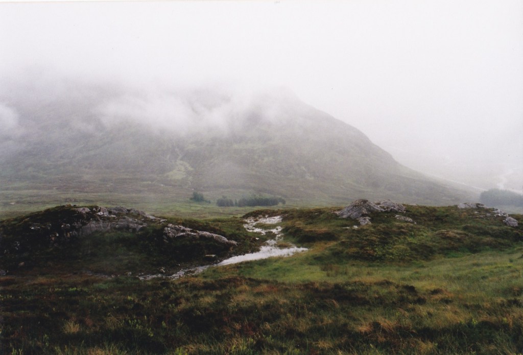
Our next day was a washout, so we didn’t really see the Devil’s staircase, which I’m told is one of the highlights of the walk. Hopefully, one day I’ll get back and do that on a clear day.
Near the Devil’s staircase
The final stretch , an unavoidably long day from Kinlochleven to Fort William, is a real highlight. It starts with a climb, then a long walk past abandoned farmhouses, before a varied series of climbs and descents through forest, past trickling streams and open areas with expansive views as you approach Glen Nevis and the mighty Ben Nevis itself.
The final descent towards Fort William
Some people round off their trip with a climb of Ben Nevis. We were very happy instead to follow the walk with one of the most scenic bus rides in Britain, surely, from Fort William to Portree on Skye, reached by the bridge from the mainland, and a relaxing few days on Skye, before travelling home.
Overall, I would say the West Highland Way is a moderately difficult walk, which requires some preparation, to be reasonably fit, and the right sort of kit to contend with the changeable Scottish weather. We actually did it in two parts, in September and June, and managed as a result to avoid the worst of the midges. While it’s not to be underestimated, it should be within most walkers’ capabilities, certainly if you, like us, take advantage of one of the bag carrying services offered.
Book ahead though as it’s popular and accommodation thin on the ground. It’s well worth it and makes a memorable and enjoyable introduction to the highlands. I can still remember it vividly all these years later, which says a lot.
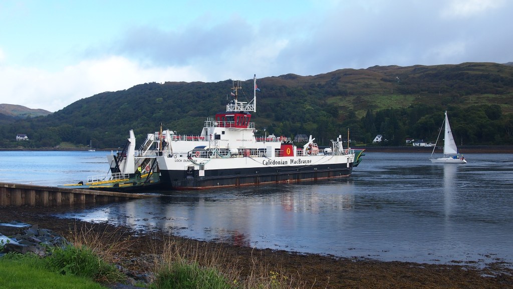
I’ve come to the conclusion that Bute, which lies just off the Firth of Clyde, just a couple of hours from Glasgow, is a much underrated place. Having just come back from a week in Rothesay, Bute’s biggest town, courtesy of a kind offer by a friend of ours to stay at his flat, I can thoroughly recommend it.
The ferry from the mainland
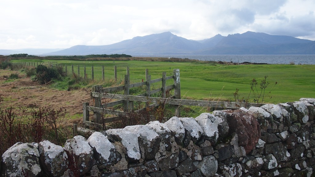
As you might expect, Bute has many similarities to neighbouring areas and islands, such as Arran and Kintyre, but on a smaller scale, without the high peaks, but with a similar variety of quiet rolling moors, beautiful coastline, forestry and a few small settlements. It’s not in any sense remote, but despite its proximity to civilisation, it feels like it is, and for much of the walking we did we saw no one else.
Before we arrived, I discovered that the island has its own mini ‘long’ distance walk, the West Island Way (clearly a pun on the hugely popular West Highland Way) but which can be walked quite comfortably in three of four days, unlike the WHW, which generally takes at least a week.
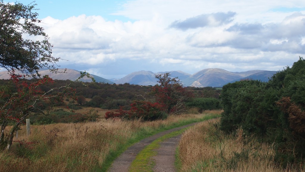
Walking from Kilchattan bay, it doesn’t take long to cross from the east coast to the west, with views across to Arran
Our first day on Bute took us from the south of the island at Kilchattan Bay, through a wood, past an old airfield to a short stretch of rocky beach, before cutting inland uphill with views across the island and beyond.
Rowan berries in fruit, with the hills in the distance
The tracks are easy going and well signed, and after a short climb, you descend gradually down to Loch Fad, where there are anglers and a bird hide. Rothesay is only a couple of miles further on. The whole walk was around ten miles and took us about six hours.
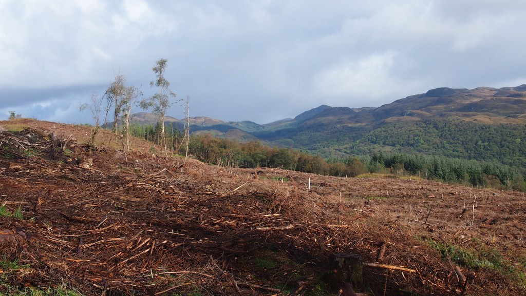
For the second day, I was a bit more ambitious, and my wife opted out of this one. Taking the bus this time to the north of the island and the small secondary ferry from Rhubodach, I risked taking the forest route despite some warnings about some felling was possibly taking place there. I reckoned that if the path were closed there would be signs (there were, but not at the junction with the alternative), and more importantly, there would be less walking across vague moorland, and potentially boggy, paths.
Tree felling at least had the advantage of opening up some views
True I did encounter some forestry work, but there was, as it turned out, only about ten minutes where I had to be very careful to avoid large logging trucks and getting swallowed up in the rutted, red mud they left behind. But if you do choose this option at present do keep your wits about you, be careful, and give a wide berth to those enormous trucks and trailers!
My day was one of fast changing Scottish weather , with at least five brief but heavy spells of rain, including one just after I’d decided I was getting burned and needed sun cream. Just after I’d put that on, the temperature dropped rapidly from about 20 to 6 or 7 degrees in a matter of minutes, with icy rain coming down, before warming up again a quarter of an hour later.
But anyone who has walked in Scotland is used to this and you just have to be prepared for Scottish weather and for taking waterproofs on and off frequently. Overall , though, I couldn’t complain about that day as 90% of the time it was fine, unlike the weather the day after.
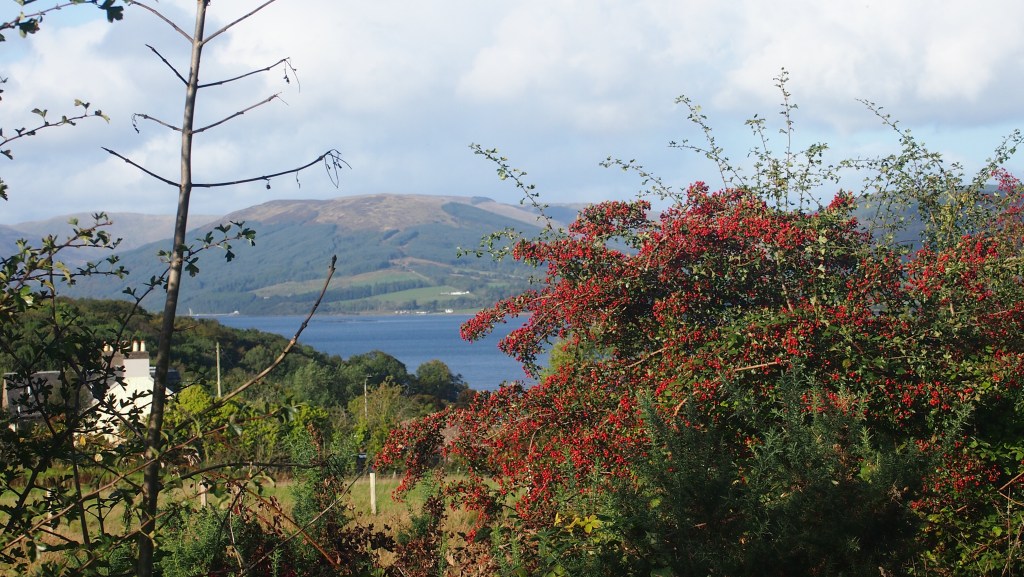
Looking back towards the mainland, above Port Bannatyne
After leaving the forest, there was a short boggy patch, so I was glad I’d opted for this rather than the alternative, which probably would have involved much more bog as well as route finding. Following the moorland there was an easy and very pleasant long walk through Glen More, before a sharp turn took me along the route of an old industrial tramway, shielded by hedges from the road which runs parallel.
The route then approached Port Bannatyne before turning off across good tracks across open land and finally the descent to Rothesay. This time I’d walked about 13 miles and taken together with the previous walk, had walked most of the length of the island. None of it was hard, and for a few short climbs you gained the benefit of some lovely views of the island and beyond.
There are still another two sections of the West Island Way left for another visit maybe: a loop at the southern end of the island from Kilchattan bay, and the alternative route north of Rothesay to Rhubodach. if you are interested there is a dedicated website, and the signage throughout is pretty good, better for instance than that for the nearby Kintyre Way.
Apart from the walking, the stately home and grounds of Mount Stuart on Bute are also well worth a visit. We went there the following day. The house is opulent and extravagant, though in a tasteful sort of way. I honestly don’t think I have never seen so much marble in my life.
Inside Mount Stuart, hereditary home of the Earls of Bute
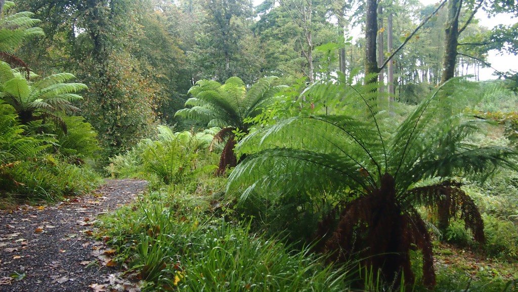
The grounds are huge and include a beach, woodland, pinetum and kitchen garden. A past Earl of Bute was a keen botanist- and it shows.
New Zealand ferns add a touch of the exotic to the woodland walk
We managed to pack quite a lot into five days on Bute. There’s no need to bring a car, as there are all year round bus routes to the north and south of the island, and the hourly ferry to Rothesay leaves from the grand Wemyss bay train station, reached in under an hour from Glasgow.
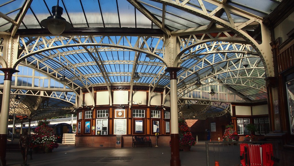
Wemyss Bay station, from where you catch the ferry to Rothesay
And in the summer there’s an open top bus route too, which, unfortunately we managed to just miss on its last day of the summer season.
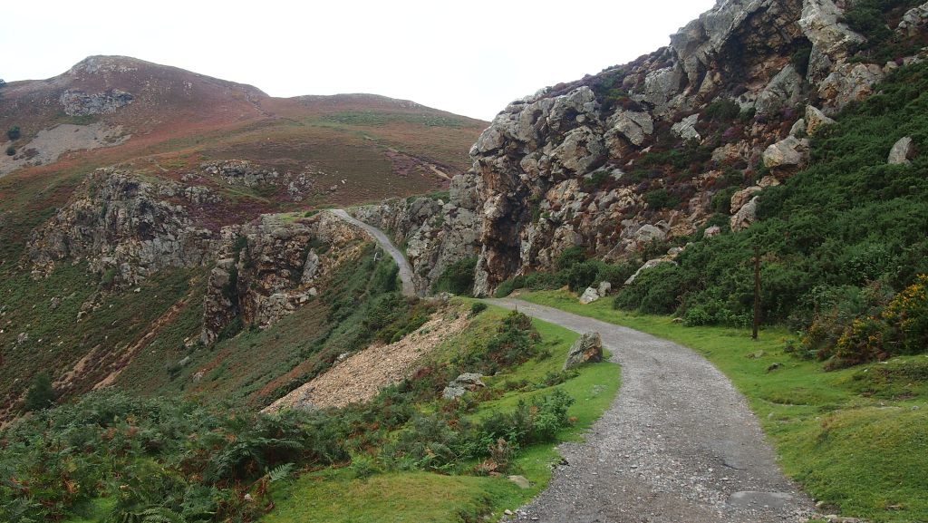
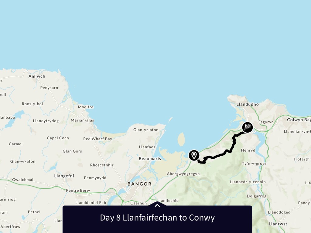
And so we came to the final day of the route. As it turned out, the shortest day of the walk, from Llanfairfechan to Conwy, totalling just over 11 miles.
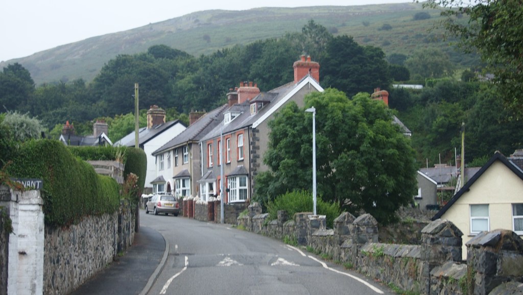
Leaving Llanfairfechan
It was a similar start to yesterday, climbing up via lanes, through a farm and then onto the moor, this time above Llanfairfechan. The route zigzagged up the hillside and then settled on its route north-east towards Conwy.
The terrain of hilly moorland too was similar to yesterday, although there seemed fewer difficulties with the path, remaining almost all relatively easy going. To our right we could see the final hills and mountains of Snowdonia, to the left the hills descended to the sea, but the shapes of the hills were varied. As we continued, the route often climbed briefly before descending again, but for much of the way was broadly level.
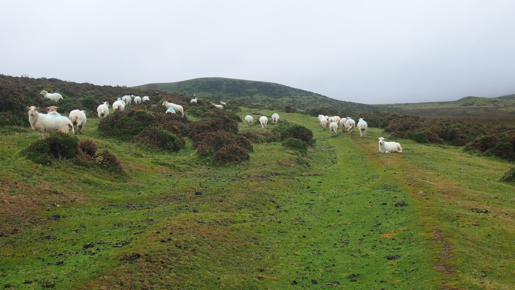
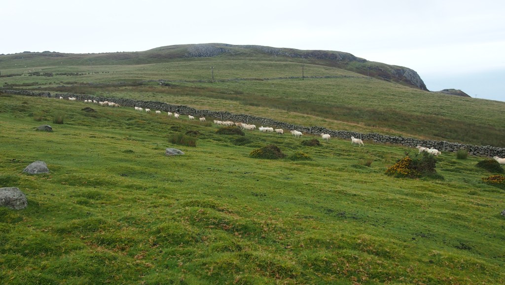
Sheep grazing on the moor
At one point we watched a shepherd and his dog round up his sheep. I’ve seen it a few times before, but it’s something I never tire seeing.
Sheep scurry away as they are herded up
After lunch we entered an area signed as Pensychnant nature reserve, then left through a gateway to arrive at an unexpected alpine-like road climbing between two steep hills, and crossing our path. This spot, Synchnant Pass, made an interesting change to the moorland walk, and Climbing up the other side of the road, there were more people than we had seen all day, although it was still far from busy.
Synchnant Pass
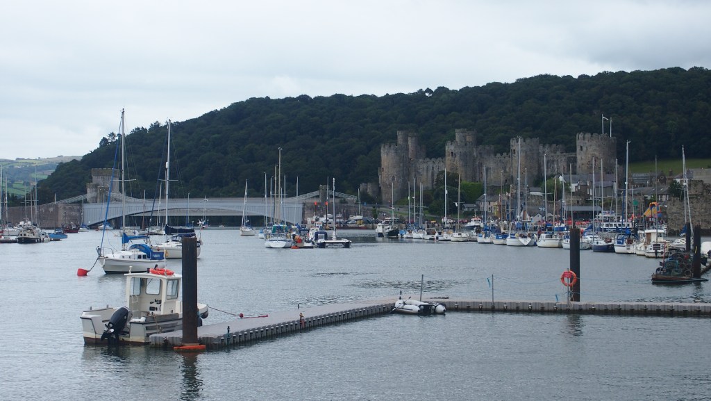
Finally the route led us on a long gradual descent to Conwy, with views across in the distance to Llandudno. We crossed an inauspicious road, passed a school, and then turned the corner to arrive at the river Conwy estuary with views across to Conwy Castle, which dates back to the 13th century, and the Conwy railway bridge, designed by Robert Stephenson.
Conwy Castle as we approached the end of the eight day walk
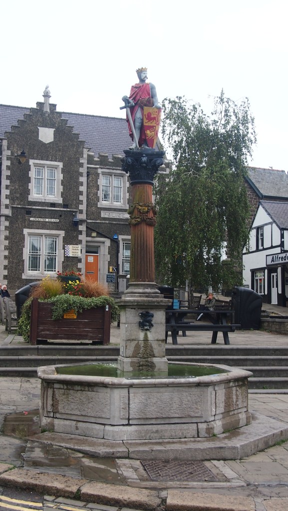
A further turn of the corner led us through the town walls, past the smallest house in Britain (apparently) to the high street and the end of the Snowdonia Way at the statue of Llywelyn the Great.
The end of the Snowdonia Way
So what do I think of the Snowdonia Way now that I’ve walked it?
I would say it scores highly on a number of measures, and compares very favourably with many of the more popular, well known, and well established routes. It gives the walker a good flavour of the Snowdonia national park, its variety and the quality of its landscape and walking. While not a ‘walk in the park’ nor a fully blown mountain route (unless you choose that, very different, option) it is probably on par in terms of difficulty with the Pennine way or Wainwright’s coast to coast walk. Certainly it’s less remote than some other routes, but during the day, it is easy to forget you are only a few miles away from a main road or popular town or village.
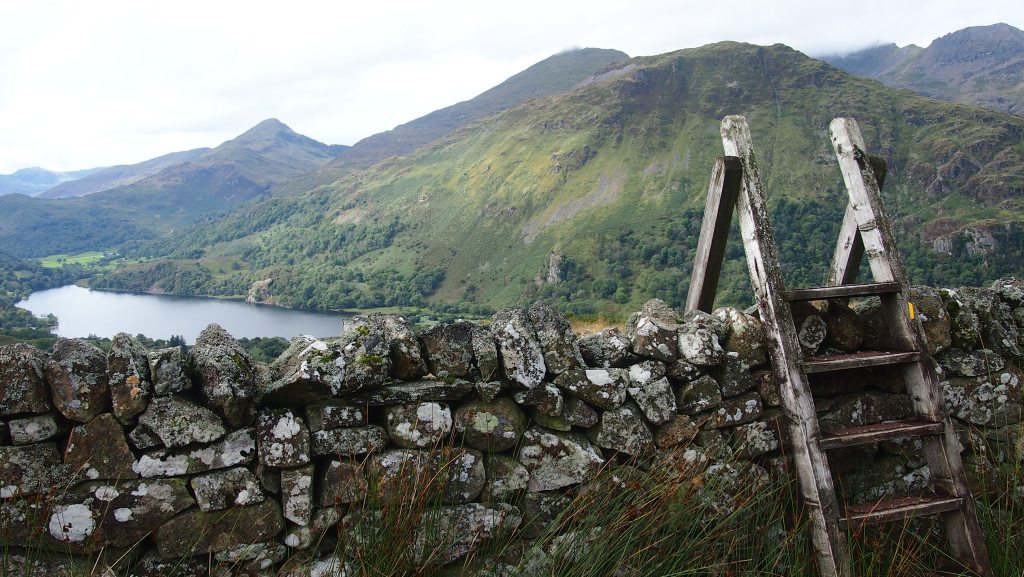
looking back on Llyn Gwynant
The walk has a huge amount to offer- wood and forest walking, moorland, coastal views, valleys carved out by glaciers, waterfalls, rocky paths, lakes and grand vistas. Despite all the hype attracted by Snowdon itself this year, the way (and I suspect much of Snowdonia) remained largely quiet and peaceful during our visit in early September 2021, where we were lucky enough to enjoy overwhelmingly dry weather. None of the individual climbs enroute are more than 400 metres and there are rarely more than two of these a day.
For anyone interested I would strongly urge you to pick up a copy of Alex Kendall’s book, the Snowdonia way, published by Cicerone Press. If you look on the ‘extra’ section on Cicerone’s website you will also find a podcast interview with Alex. There is also a website for the route. At the moment the only holiday company I have found offering self guided holidays with luggage transfer for the Snowdonia Way is Alpine Exploratory, but having experienced their arrangements on this trip, they come highly recommended too.
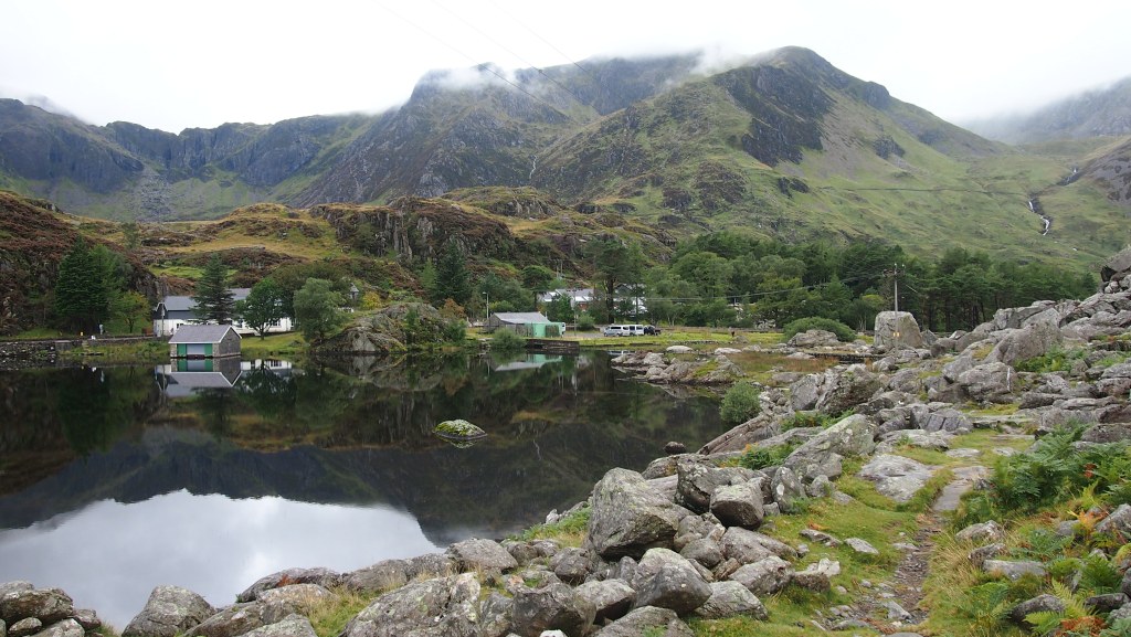
Llyn Ogwen
I would not be put off either by the fact that the route has yet to be signed on the ground or specifically marked on Ordnance survey maps. Route finding is not difficult, Cicerone have provided GPX files for your gps which we made use of, and Alpine Exploratory provided very detailed and very handy route cards detailing every step of the way.
So if you fancy Snowdonia, and want to avoid the crowds on Snowdon, why don’t you get out there and walk it? The route is recorded as 97 miles, we clocked up over a hundred. Eight days, the time we took, seemed about right, and I now feel I know Snowdonia a lot better. Lots of great memories, and I’m sure I’ll return here before long.