Hiking the Alpe Adria Trail: Day 37

Jeni and I, just after we met up again after five weeks, on Monday night

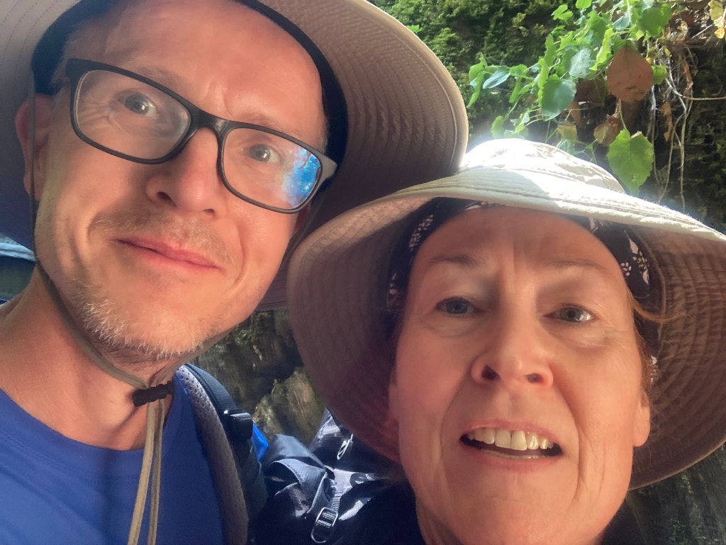
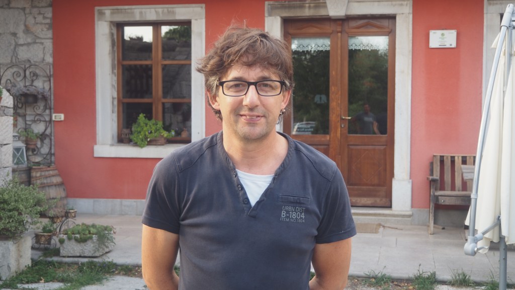
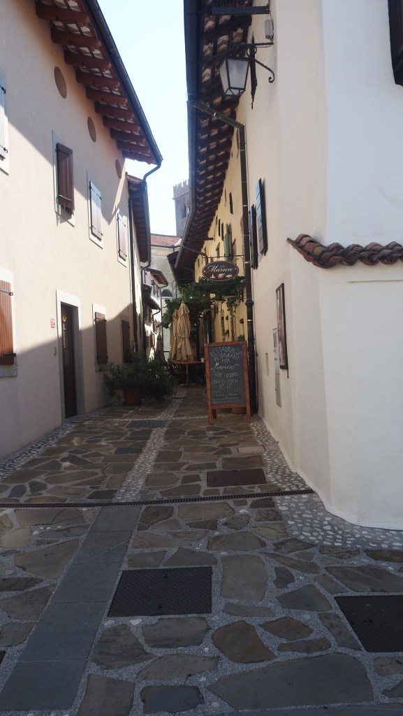
Jeni and I were finally reunited last night in the little village of Bagnoli in Italy. It’s been over five weeks since we were last together in Dollach in Austria, back on Day 3 of my trek. At one point it looked touch and go whether her flight would be cancelled but luckily it was just a bit late. By about 7 pm she had arrived, and we had a quiet evening catching up, and a modest meal round the corner at the local refugio.

Overnight we were woken by flashes of lightning and rumbles of thunder, but by morning there was barely any evidence it had rained at all. It was our 25th wedding anniversary but celebration would have to wait for later, until I had finally finished the trek.

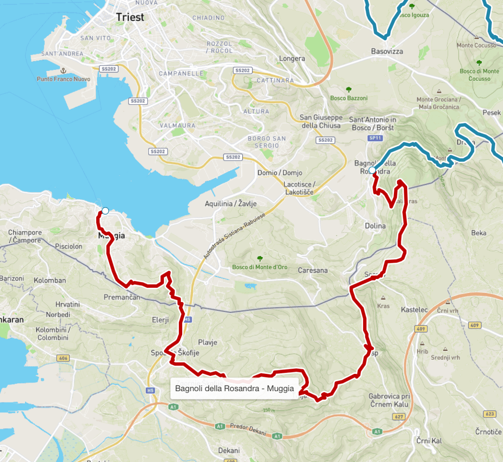
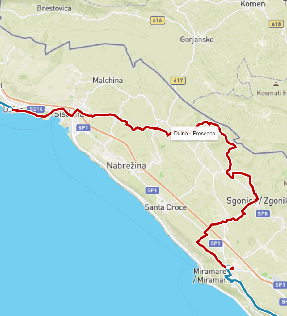
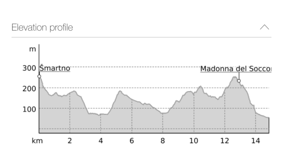
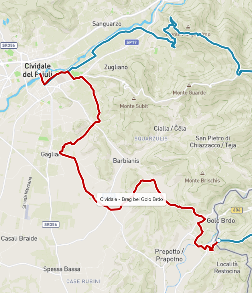
So I set out after breakfast, with Jeni travelling ahead with the taxi driver and the luggage to Muggia. I had another six hours or so of walking ahead of me.

I’d had a bit of a panic a couple of days ago when I’d noticed that the Alpe Adria app stated that stage 37 of the trail was closed. Apparently there had been another wildfire, as with stage 33. But both fellow hiker Edwin, and Simona, who booked my trail arrangements, assured me that the ‘old’ version of the trail was open, so it was simply a case of following a slightly easier route.

Leaving Bagnoli

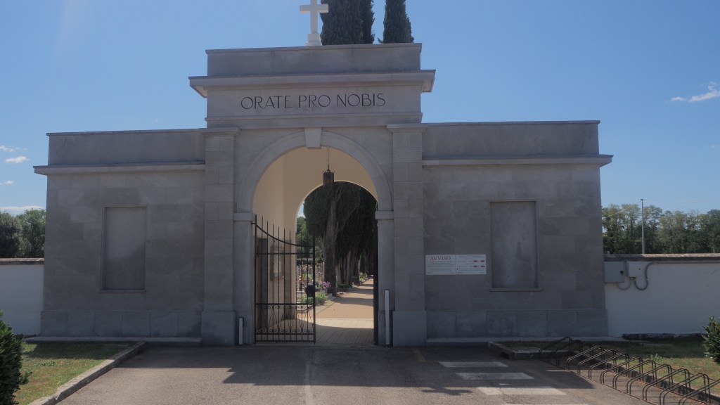
Walter the cab driver, who it turned out was also a member of the Italian Alpine club, explained to me very helpfully that the ‘old’ path left the current official route by a cemetery and was marked as route number one and with red and white markers throughout. And with his advice, a map and my gps track (which showed the old route anyway) I was fine.

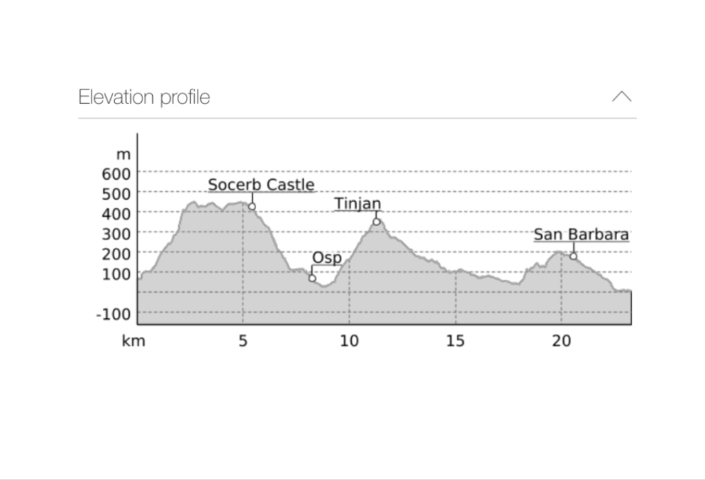
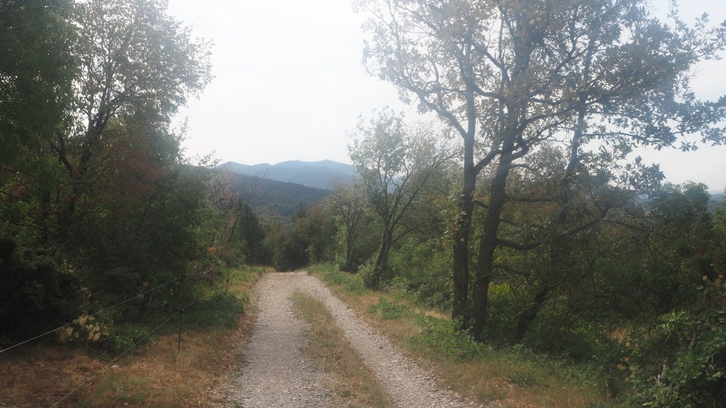
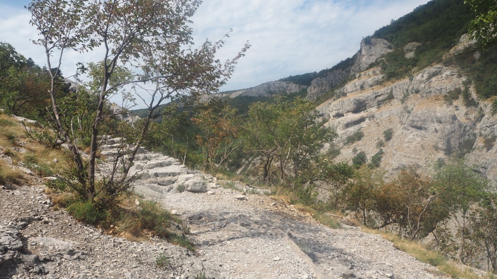
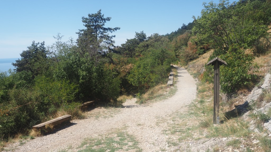
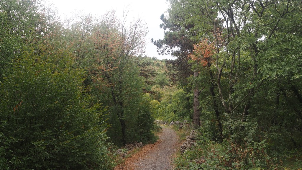
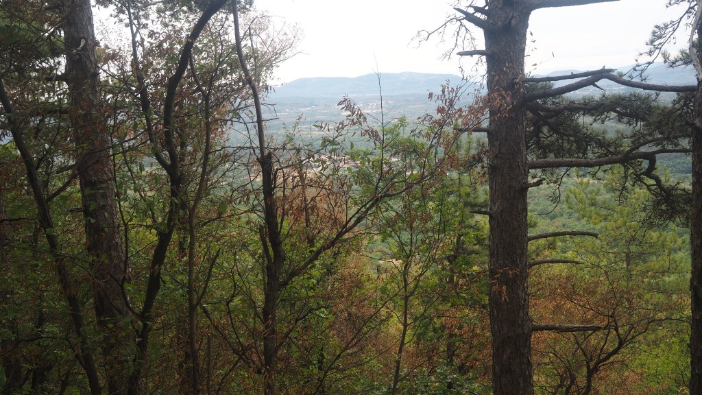
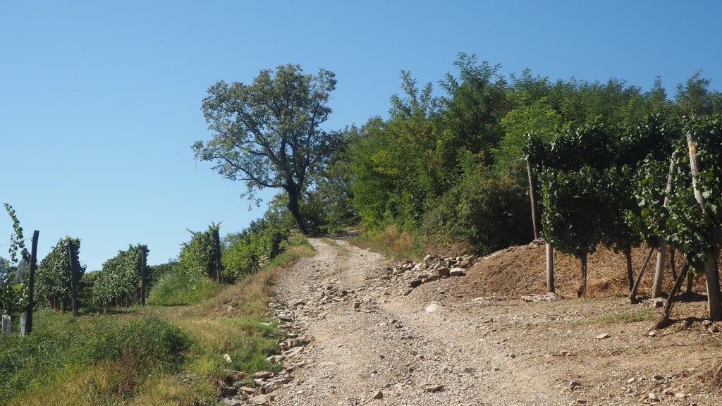
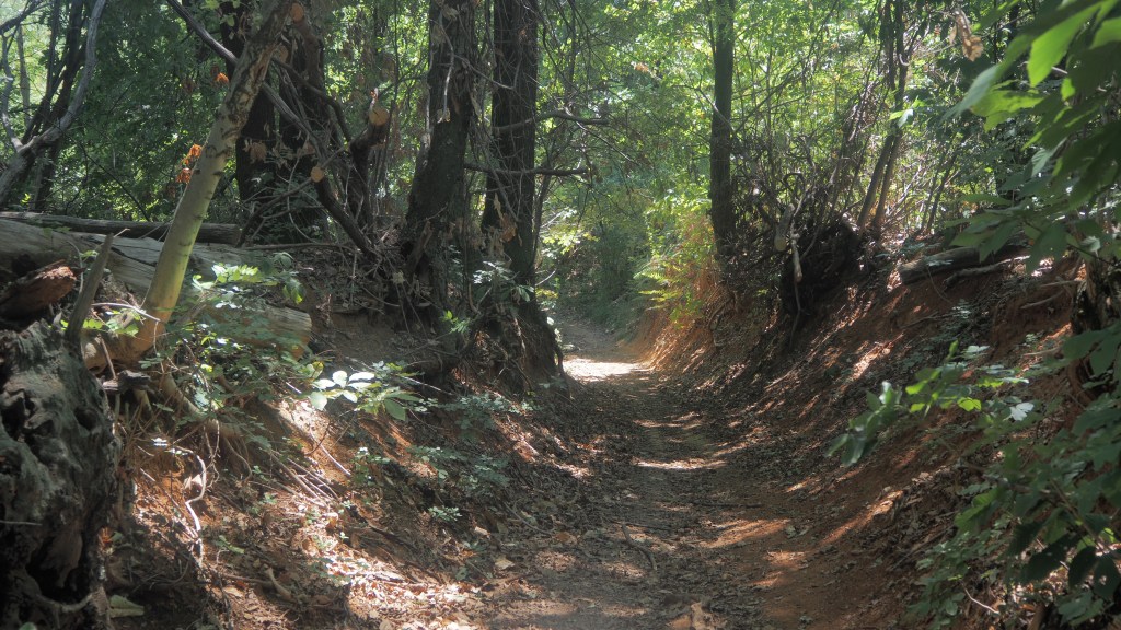
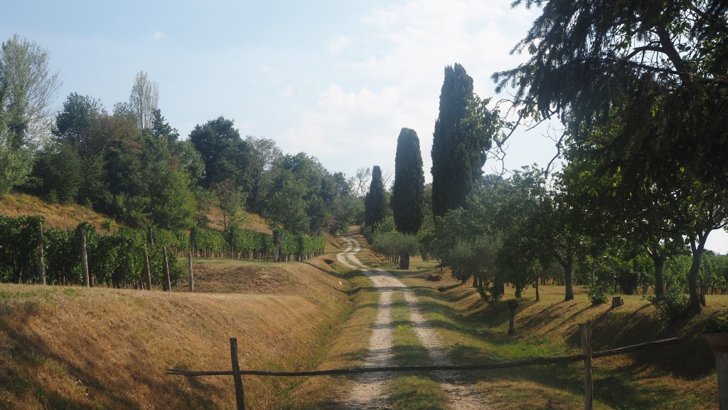
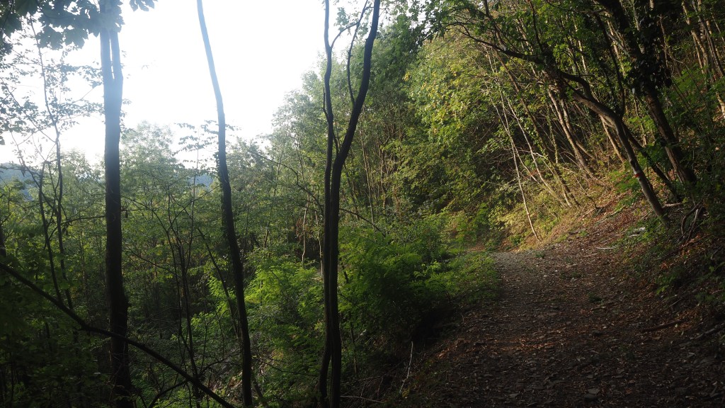
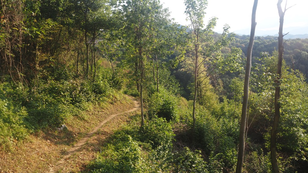
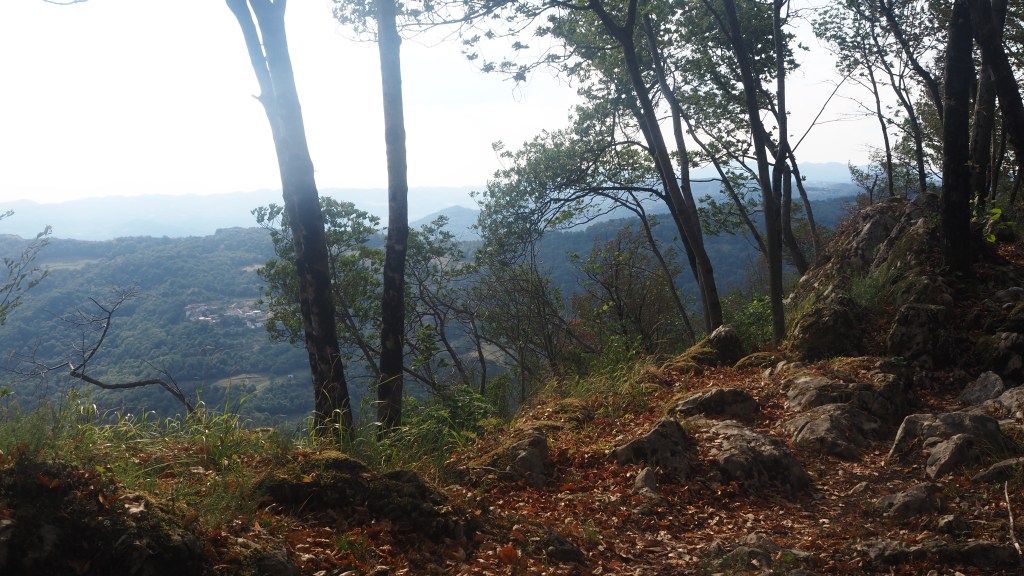
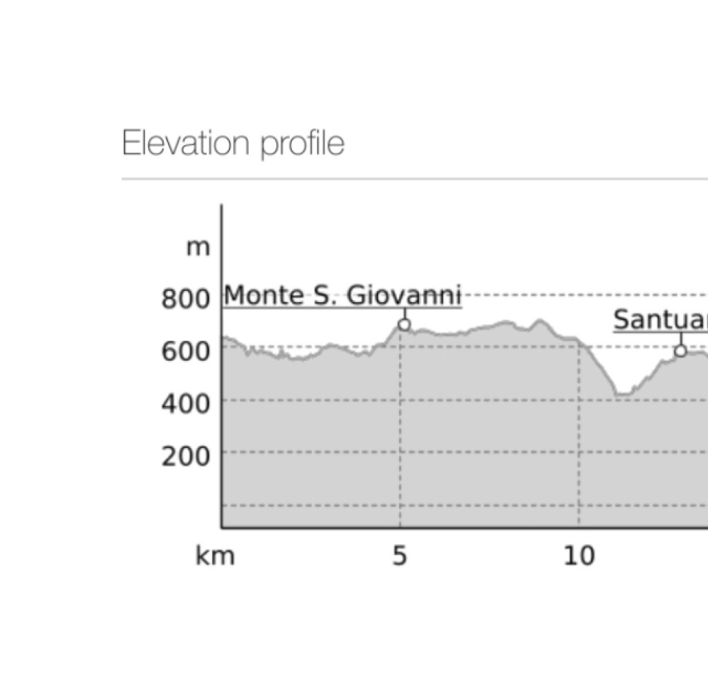
First off, was some more woodland walking, going up hill, round the hillside and then back down. Along the way this time in the wood was something I hadn’t seem much of on this trip. Discarded rubbish, but also clothes and rucksacks. Why had they been left? Perhaps they had been stolen? It was a bit of mystery why there would be so many in this particular wood. I hoped it wasn’t anything sinister.

Walking through the woods

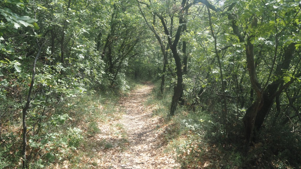
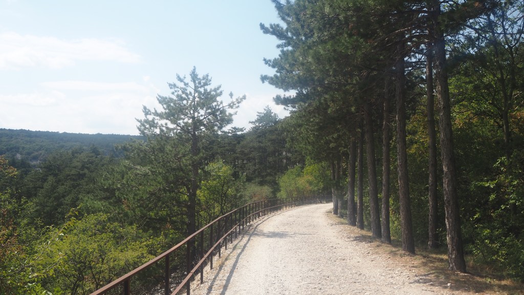
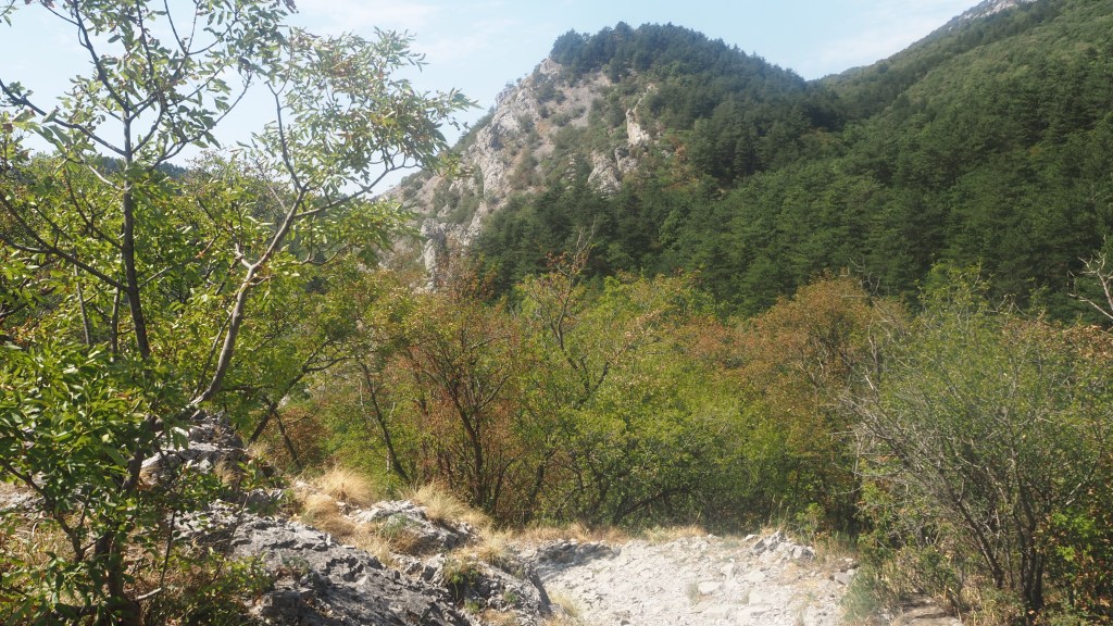
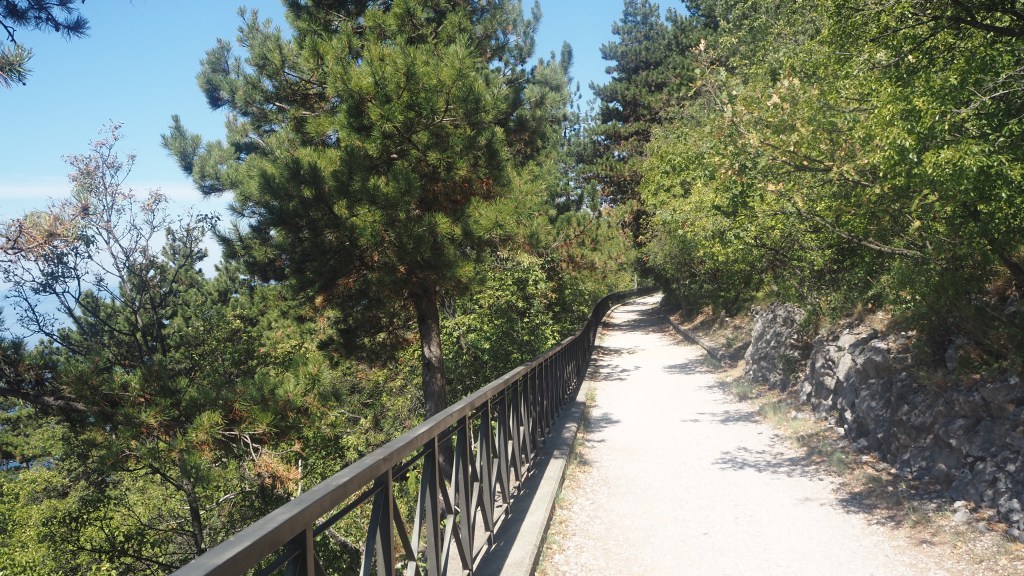
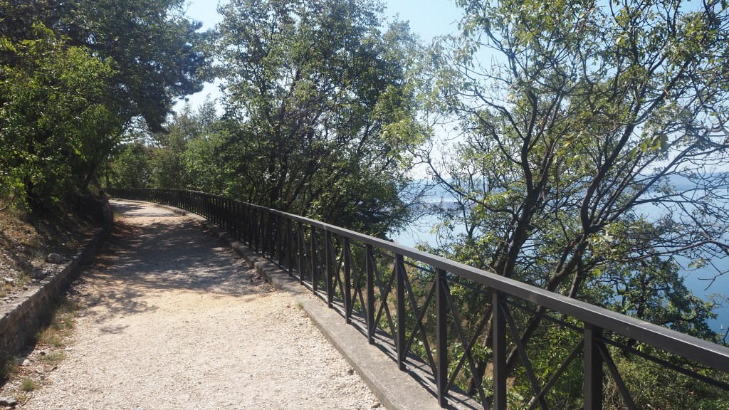
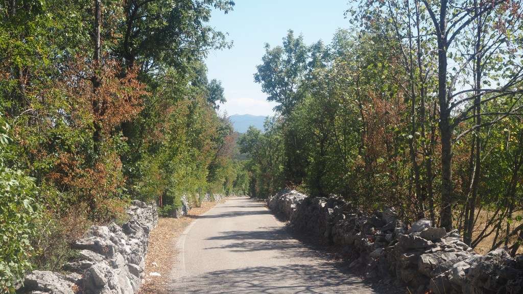
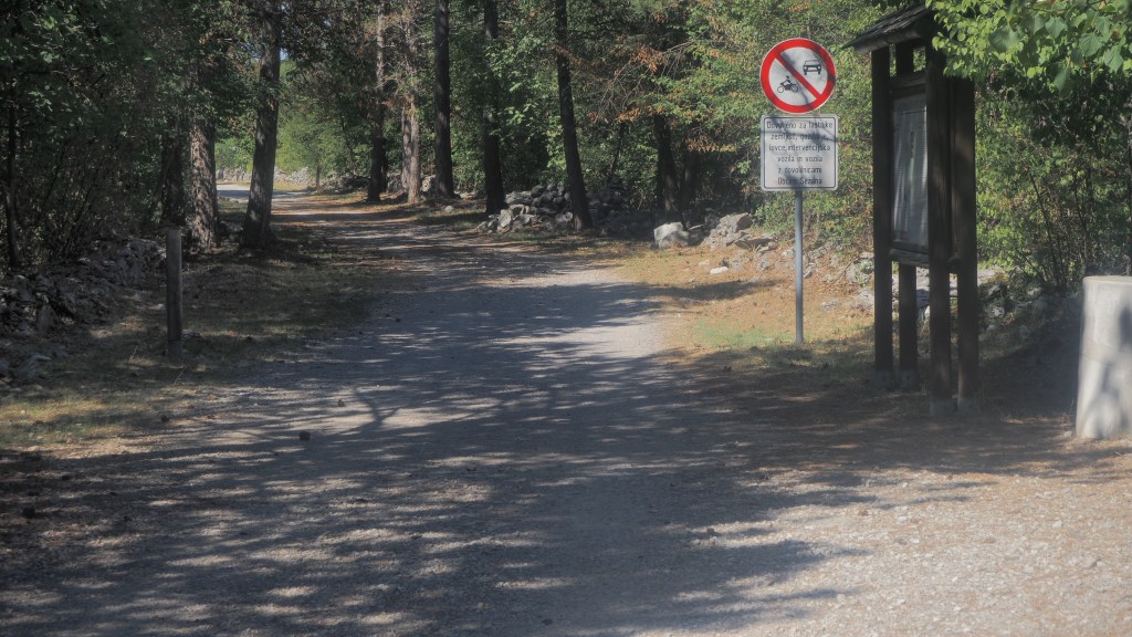
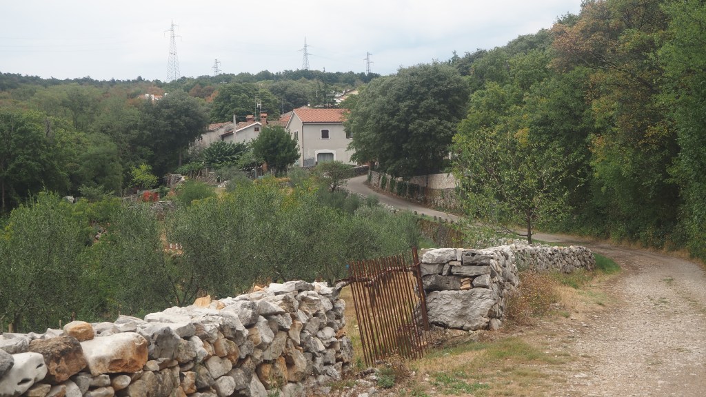
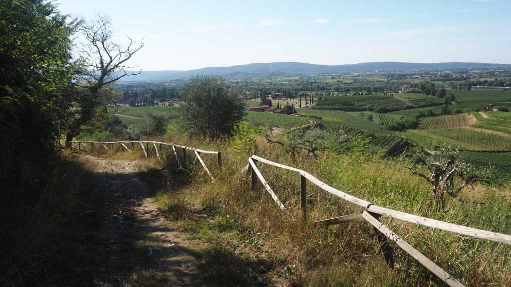
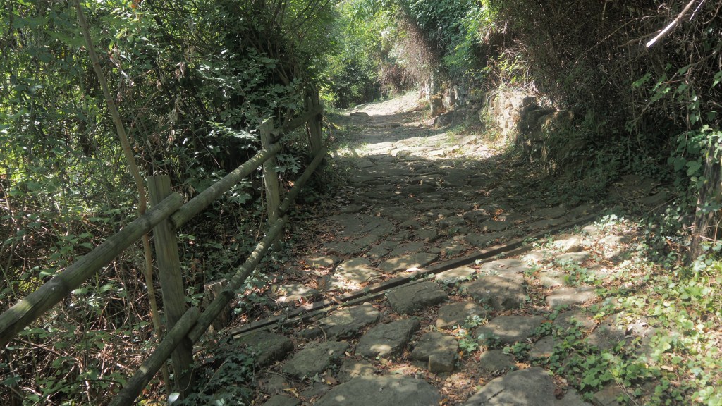
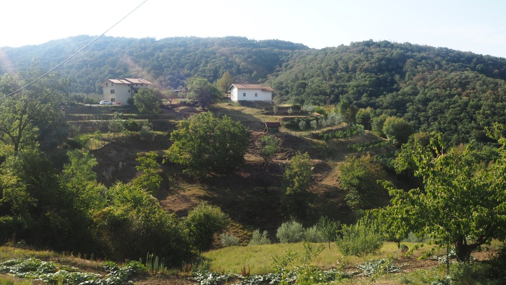
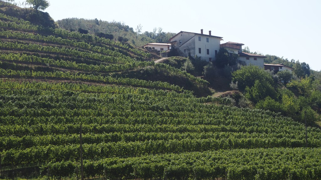
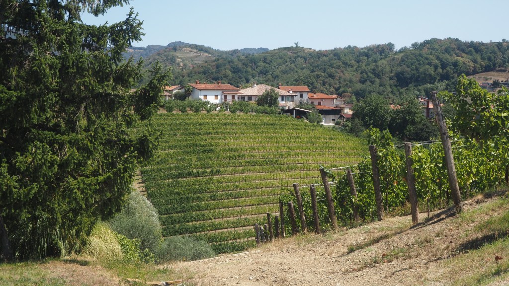
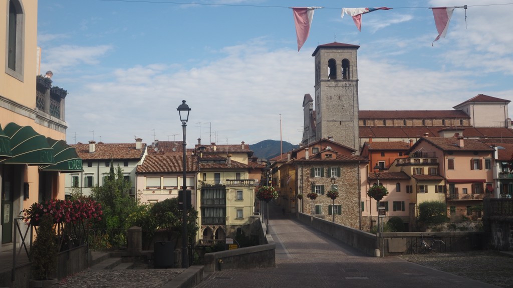
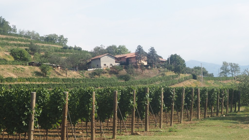
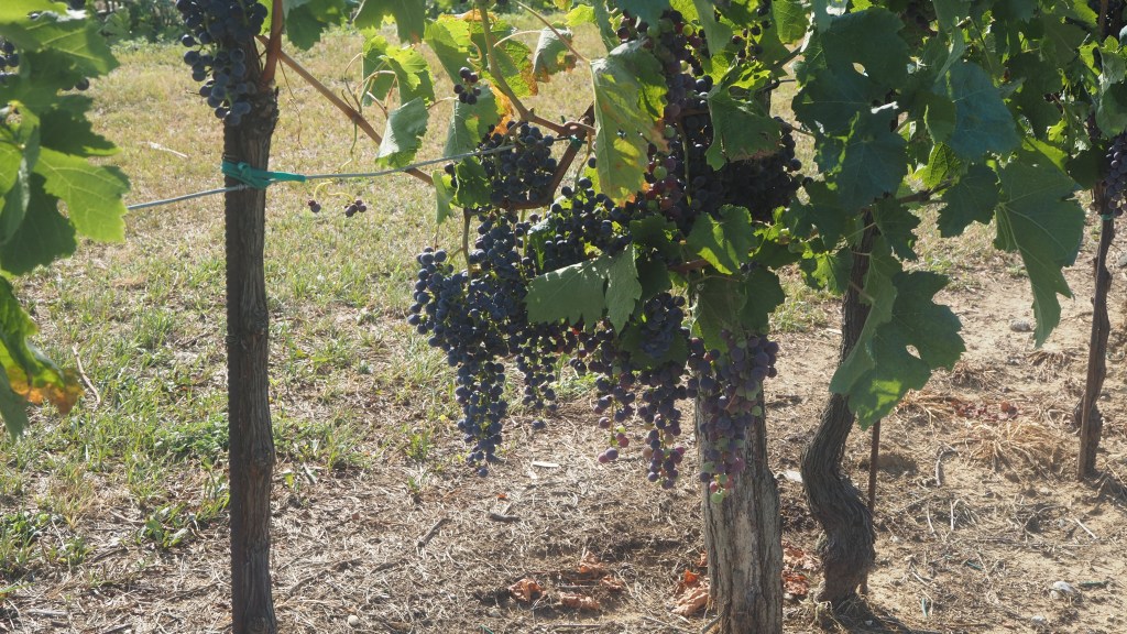
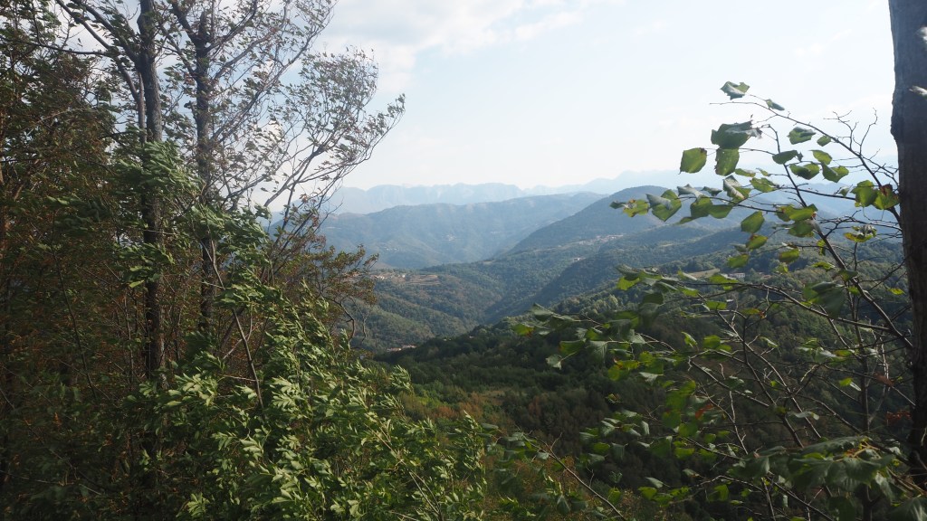
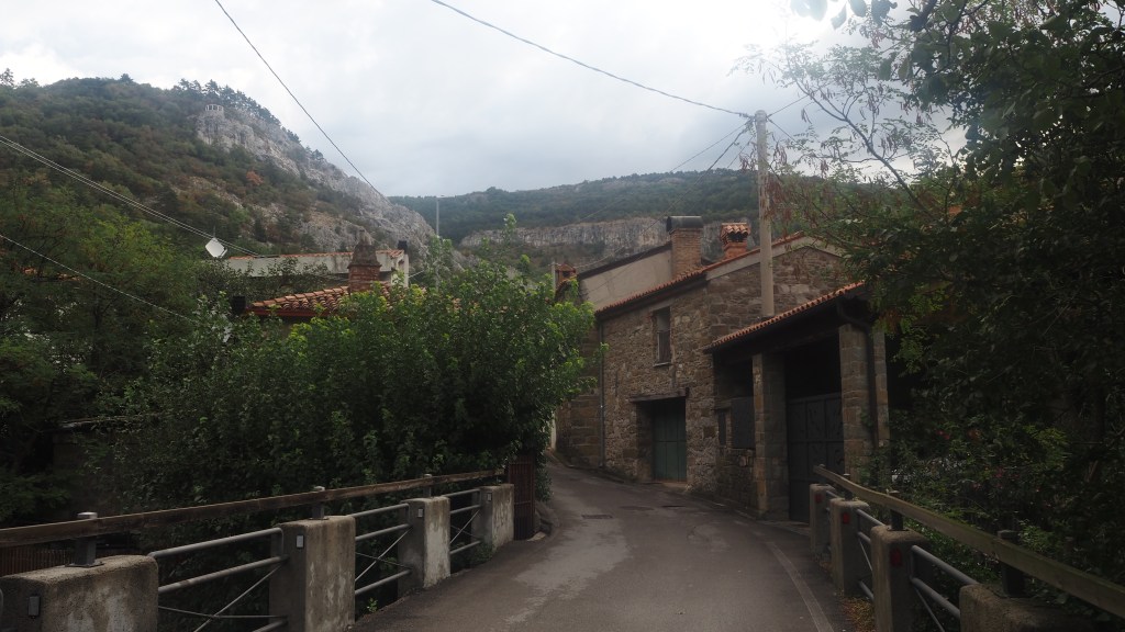
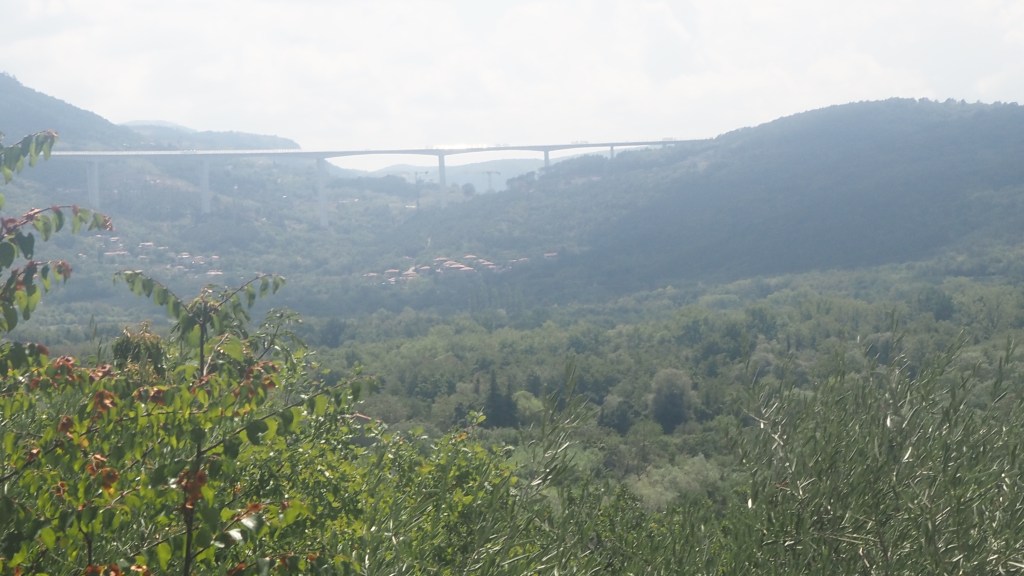
After rejoining the road, I found the diversion to the old route, and carried on through more woods. Eventually the trees started to thin out and the sunlight and the heat of the day burst through. It was back to 30 degree temperatures now and I could see across the hillside to wooded hills and a massive motorway viaduct. I descended down to a road, followed this for a little while, and then along a shady path alongside the edge of another forest on one side and fenced in plots or gardens on the other.

View of the hills and a motorway viaduct

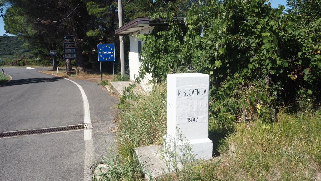
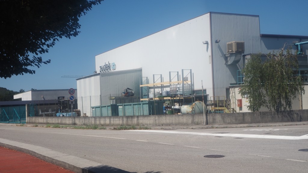
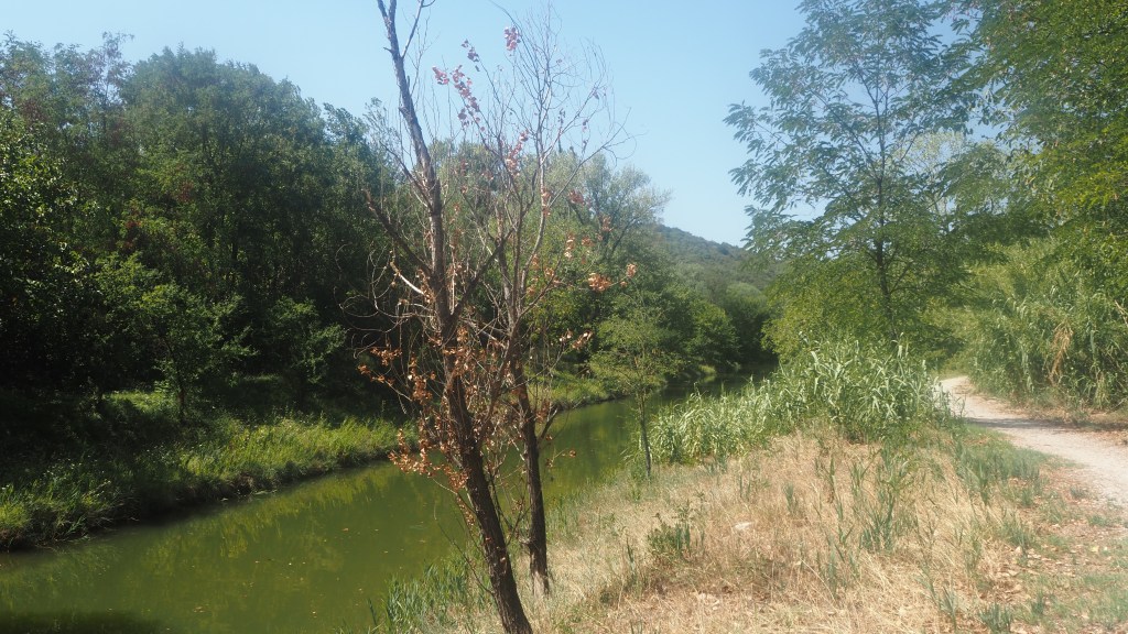
The next part was less appealing. First, I had to walk alongside an industrial estate, then there was a brief interlude by a river before I passed under a motorway and had to cross a couple of fast moving slip roads. All of this took about forty five minutes, until I finally escaped the traffic for a little country road which led right up to the Slovenian border. My phone kept pinging with messages from British Telecom saying ‘welcome to Slovenia’ and ‘welcome to Italy’ – they obviously didn’t know which country I was actually in. By the time I turned away from the border my gps told me I had only 5 km to go- Italy was literally only 5 km wide behind Muggia before it became Slovenia.

A lovely industrial estate

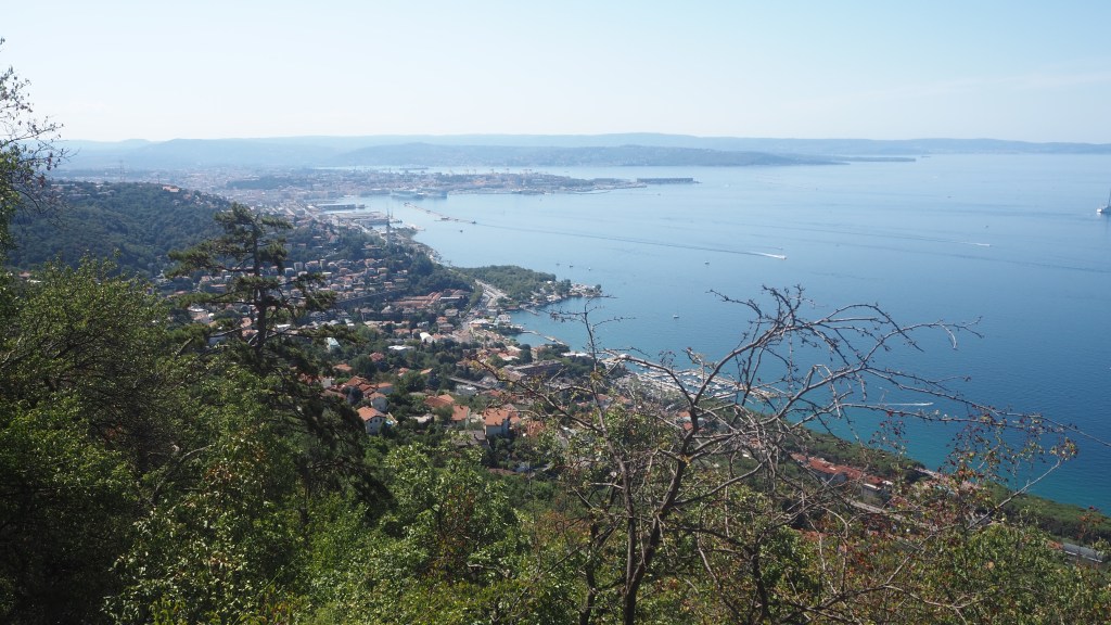
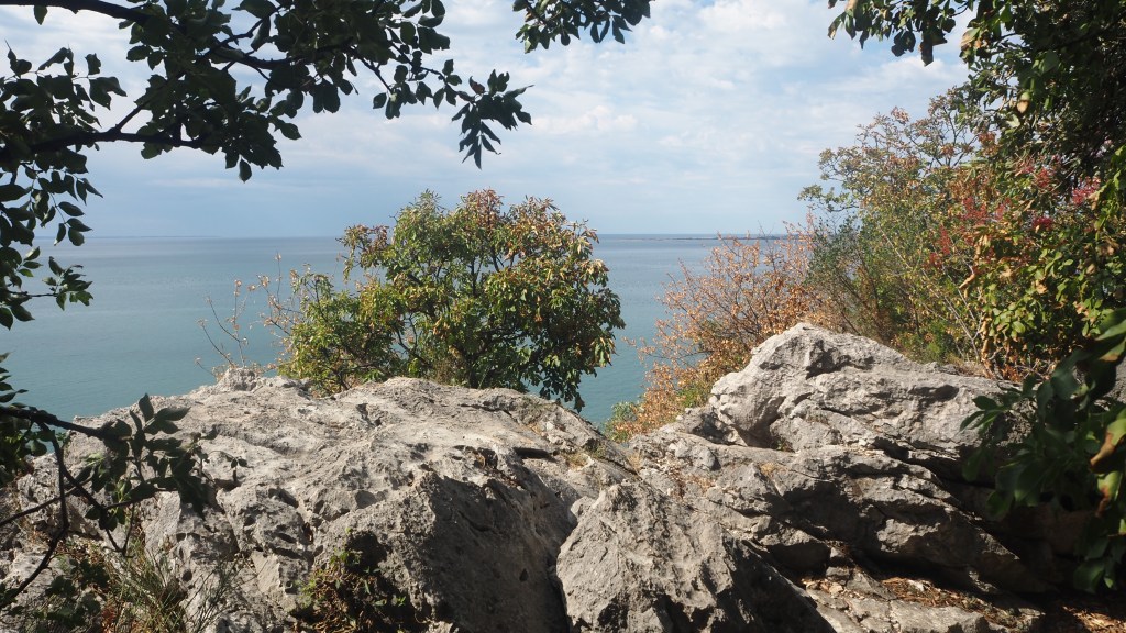
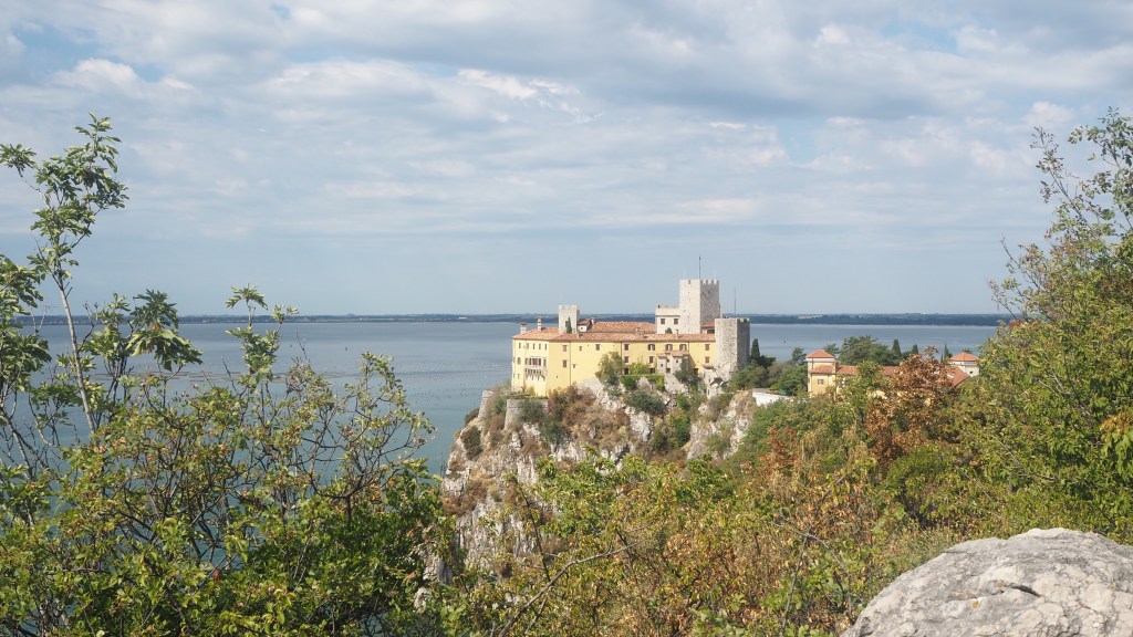
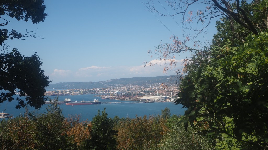
Then there was one final slog up one final hill. The first part was in the full glare of the sun. Thankfully the route then came under the cover of the trees for a bit, before flattening out. Annoyingly though, this climb to Santa Barbara, as it was called, barely gave any decent views, just little snatches of Trieste though the trees, and then as soon as it had climbed up, it was back following the road down again.

A brief interlude between the industrial estate and motorway

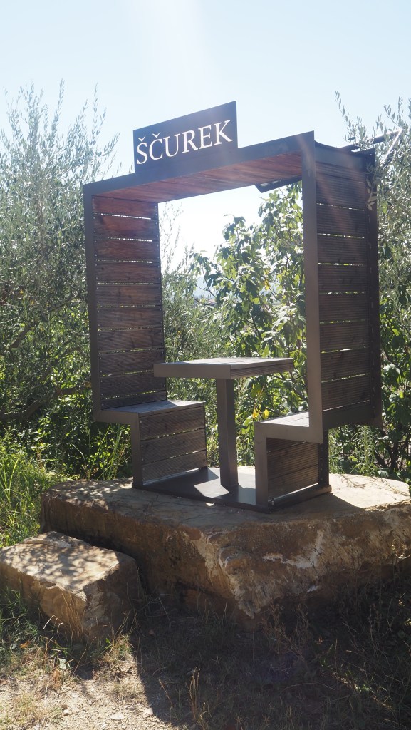
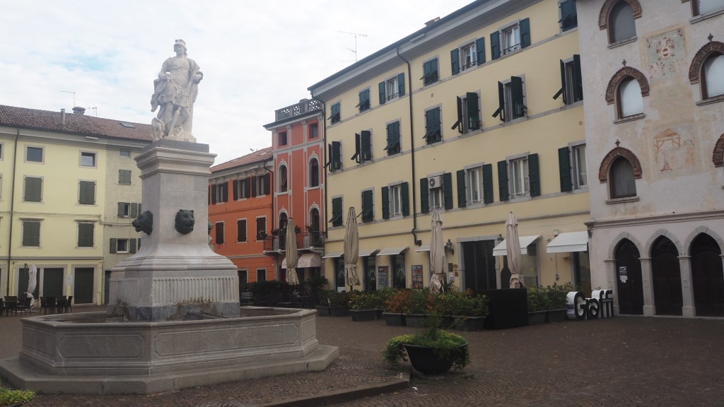
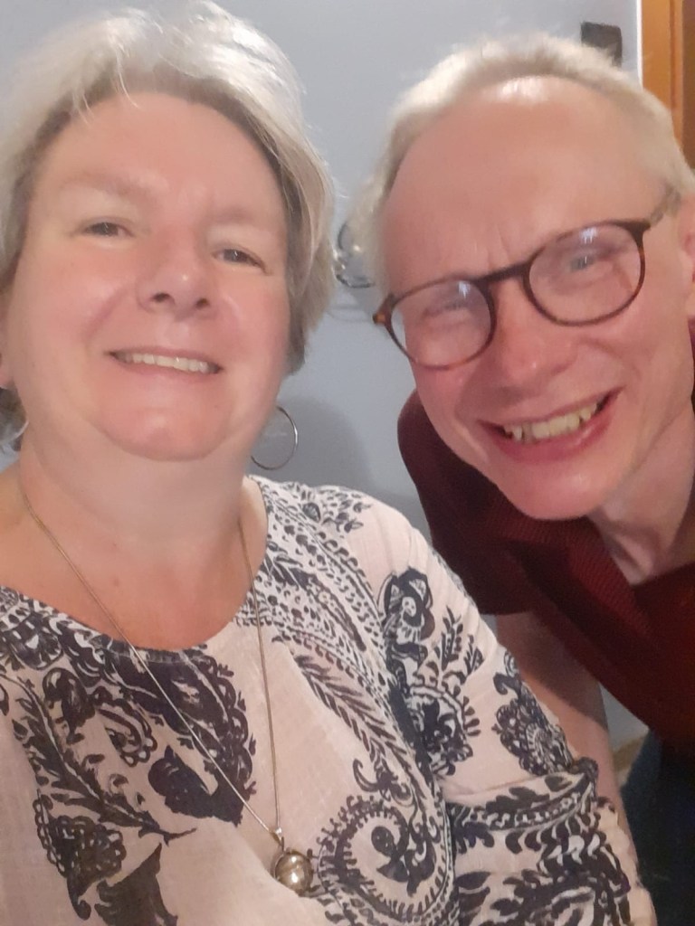
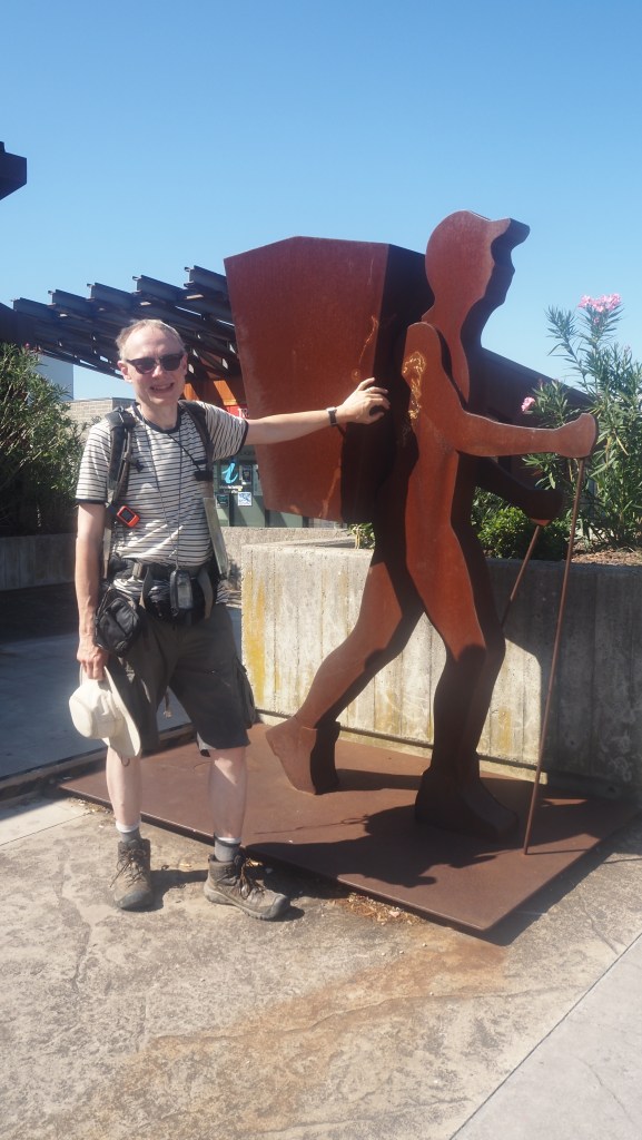
The end was a bit ignominious and disappointing. But I knew I wasn’t far away from the seafront where the route finally ended. Looking down a side street I could now see Jeni waiting for me as I approached the finishing post so to speak, where an Alpe Adria walking figure (a sort of sculpture) signified the formal end to the route. As I approached, I found tears welling up – I’d finally done it and to top it all Jeni was there to see me arrive. And it was our 25th wedding anniversary too.

A rare glimpse of Trieste through the trees, at the last hill, Santa Barbara

I’ve surprised myself really. How I’ve managed, how I’ve kept going. I’m not after all known for being particularly fit or sporty, and have never walked anything like this long before in one go, the nearest being the coast to coast Southern Upland way back in 2008. That was about half the length (212 miles) and half the time (15 days). Or there was my half completed cross Switzerland trip back in 2004, where I flew back with the family after they came to meet me, being put off by the difficulty of carrying my own gear up mountain passes and a nasty incident with a bull chasing me that really sapped my confidence. It was not completing that hike that had made me all the more determined to finish this time.

Thinking about it, I am on the whole someone who, more often than not, perseveres with things, once they decide to do them. I hadn’t done every stage of the trail, due to storms and wildfires, but I had walked over 705 km- some 438 miles- and climbed and descended over 22,000 metres. Not 100% of what I’d planned to do, but 90% of it or thereabouts. In the process I’d managed to raise over £1000 for charity to help save pangolins, which made it particularly worthwhile.

I knew other people, like me, were doing the trail, because I had met them. Almost universally I think they were more sure -footed than me, probably fitter, able to carry more, faster. It’s still not a minor achievement for anyone though. Not that many people can or do walk such a distance and climb such heights. Most people wouldn’t want to. The majority would probably walk the route in stages of a week or two (and to be honest that’s the more sensible thing to do). I had wanted to do it this way and had done so, and that’s what matters. And I feel the better for it.

But if you ever hear me suggesting that I might do another walk of this scale, length or difficulty again, please remind me what I have written here on the day I finished this one- ‘never again!’

Over time I’ll probably remember just the best parts and the worst parts. Maybe I’ll look back on the photos and the blog to remind myself. Will I remember how it felt? I’m not so sure. It’s has really been a trip of a lifetime though I have to say. And thank you for helping me to do it, with all your messages of support.

Thank you to Jeni and Rachel above all. Thanks to all those who sent me lovely messages and kept my spirits up and donated so generously. Thanks to all those marvellous people I met. And thanks especially to those supremely helpful people at the Alpe Adria Trail booking centres, Bettina and Simona, who arranged every hotel, every taxi transfer, and offered assistance all the way through. You have all been great.

The final stage of the route. I actually followed a slightly shorter ‘old’ route. I walked a final 20.94 km today, or 13 miles. The final tally was 705.91 km or 438 miles.
Ascent today was 528 metres. Total ascent over the whole trail was 22,866 metres, total descent was 24,616 metres.

Hiking the Alpe Adria Trail: Day 36

After five weeks, I’d finally reached my penultimate day’s hiking. But some have overtaken me! Edwin and Gerjanne, who I met on the trail near Ossiach, and who started after me, arrived in Muggia last night – congratulations to them. And thanks to you both for all your useful advice on the way.

Edwin and Gerjanne ‘the Dutch couple’ who I met several times on the hike, have been a source of good advice, and completed the trail yesterday. Congratulations!

I meanwhile woke in the night with a migraine, and in the morning had my usual post migraine nausea and light sensitivity. Not ideal for walking, but it mostly cleared up after a couple of hours, thankfully.

The hike started with a long walk on the road round the Lipica stud farm. Maybe because it was still early, but I never did manage to see a single horse there.

Leaving Lipica

Leaving the grounds there was a glut of advertising hoardings for casinos, slightly bizarre, as it wasn’t exactly Las Vegas. Once I crossed the road I was back in the countryside. It started with a climb to near the peak of Kokos.

This was nothing like the climbs of past days and weeks and was in the shade, but because I was still feeling a bit sick from the migraine, I had to take it slowly. I knew though that this was the only major climb of the day, and I prefer, when it’s hot, as it was beginning to be again, that the bits of uphill were earlier when it was cooler and I was less tired. All the climbing was done by about 10:30 which was ideal.

Views opened out at the top

Once at the top there were some views of the wooded hillsides and the path started to descend again. I went through a couple of villages, before joining a wide cycle track. This was the trackbed of the former Trieste to Hrpelje railway, which closed in 1958. I followed this for quite a while, eventually crossing back into Italy yet again, for the final time, I think. I found a picnic bench to eat my surreptitiously hidden ham rolls that I’d made up at breakfast.

Following the former railway line

One thing about tracks along former railway lines, and why they make such good cycle tracks, is that they are almost entirely level. Often though they’re not the most interesting walks, but this one became more interesting as it progressed. First it started to tower over the landscape below, which dropped away to my left. Then there were some little tunnels that the path passed through, and the views opened out around.

Entering a short tunnel

The Alpe Adria trail then took a turn off to the left down a sharp zigzag path to what was now a deep valley. And as it did so I started to be able appreciate the Val Rosandra, which I had now entered. This was a real treat, and though I’d been aware that the trail had something special like this at the end To look forward to I didn’t know quite how nice it would be. And so close to Trieste too.

The wooded hills of Val Rosandra
The walk along Val Rosandra

At the bottom I took a path parallel to the valley with marvellous views backward and forward. It was, though modest in scale, the first bit of mountain scenery I’d encountered in the trail for over a week, yet different to other mountainous stretches and a lovely end to the day’s walk.

Another view of the valley

As I arrived at our bed and breakfast for the night the host explained to me it was Ferragosto, a public holiday, sort of equivalent to our August bank holiday Monday. Which explained why there had been so many people and families out today and why I could hear people having a barbecue outside.

As I write my wife, Jeni, is in the hands of Ryanair, hopefully finally winging her way towards Trieste after some delays. We should be reunited later today after our longest time apart in over 27 years. I’m really looking forward to seeing her again, after all this time on my own. While I haven’t felt as lonely as might- with the people I’ve met and folks back home staying in touch – it’s a very different thing to see you partner again after such a long gap. Tomorrow should be a double celebration with our 25th wedding anniversary and my final day on the Alpe Adria Trail. And I’ve told Jeni not to bring any walking boots. She is getting the taxi with the bags to meet me at the end.

I really have to thank everyone so much for your amazing support for the blog and my charity page over the last few weeks. It means a lot to me. As I write, after a flurry of very generous donations in the last week, including in the last hour, and including one anonymous donor who I will thank here, whoever you are, you have got me to have my revised £1000 fundraising target. That’s absolutely fantastic, so thoughtful and kind, and should really help Fauna and Flora international in their work to protect pangolins.

I hope it has also raised some awareness of their plight and helped a little bit to spread the word that more needs to be done to protect these and other endangered species. It’s given some meaning to my personal challenge but it’s you I have to thank for being the ones who have contributed. I’ve just been putting one foot in front of another.

Today I walked 18.85 km or 11.7 miles. Cumulatively I’ve now walked 685 km or 428 miles
Todays gross ascent was 339 metres, and descent 654 metres. Cumulatively I have claimed 22338 metres and descended 24000.

Hiking the Alpe Adria Trail: Day 35

The day didn’t start well. Just as I was leaving the hotel I found a cockroach in the washbasin. Then I just missed a bus. After waiting half an hour for another, I missed the stop for Prosecco and ended up in Trieste, and had to wait for the bus to come back again. So I didn’t start walking until gone 10:00, which I think is my latest start so far.

The beginning in Prosecco wasn’t auspicious either. I spent about twenty minutes trying to find which direction I should be going and which was the right street before I really got the walk under way.

But once out of Prosecco and going in the right direction, I soon found myself at the start of the Strada Vicentina, a grand promenade built high above Trieste in the 1820s. It’s sometimes called the Strada Napoleonica, but to me it makes more sense to call it after the engineer who designed it rather than a certain Corsican who I suspect had little to do with its actual construction.

The Strada Vicentina

It must have cost a fortune to build at the time as it’s relatively gentle in its gradient, and apparently involved blasting solid rock to construct. The route is several km long and takes at least an hour to walk. Thankfully it’s reserved for pedestrians and cyclists only. There were quite a few people having a Sunday morning stroll along it today.

View of Trieste from the Strada Vicentina

The views of Trieste and the Adriatic are amazing from here, and the city gets closer as you walk towards the Strada’s eastern end. Here there used to be a tram going up to Opicina (it only closed about three or four years ago) and if that had been working I could have walked the Strada Vicentina yesterday at the end of the day, and simply got the tram up and down the hill to my hotel (without my unwanted detour to Trieste this morning). Hopefully at some point they will get the tram going again- they were somewhat antique, a bit like the ones in Lisbon, (there’s a stationary one on display in Opicina). In the end it probably all comes down to money, or lack of it.

The mothballed Opicina tram

At the end of the Strada I arrived at a busy road, by an large Obelisk. Helpfully here there was a subway to the other side of the road, where a quiet road uphill led to a camp site before a less grand, but almost as beautiful, continuation of the promenade took me further along the coast, again with views high above the bay. Here there was a perfect spot for my lunch.

Another perfect lunch spot today

The track then descended quite steeply, still in the same direction, before climbing again and eventually turning inland. I crossed back over the motorway and through a couple of villages, Trebiciano and Gropada, before a long stretch of quite pleasant road walking back towards the coast again.

Further up the coast
A long but pleasant road walk

It was a bit of a zigzag route this part, because once I reached Basovizza, I promptly headed north again crossing the Italian/Slovenian border once more (I think this is the fourth time now) on a track, named after another engineer, Josef Ressel.

The reason for all of these border crossings is quite evident. Trieste is on a little strip of Italy only a few miles wide, with the hinterland beyond in present day Slovenia. Now I can’t claim to know the full history, but suffice it to say that Trieste has a various times been a ‘free’ city (as recently as the early 1950s), part of the (Austrian) Habsburg empire and now in modern day Italy. Geographically the borders look a bit peculiar, but there are always good reasons why things end up as they are.

Luckily, with open Schengen borders, it doesn’t matter too much. But probably only 35 years ago, a route such as the Alpe Adria Trail, with all of its border crossings, would have been if not impossible, administratively difficult, I would imagine. I’m sure border officials would have wanted to know why I wanted to keep crisscrossing from one side to another. As it was, today, I saw a guy happily crossing the border, marked by an innocuous road sign, just to walk his dog.

Another inauspicious border

The last few km was a pleasant shaded woodland walk, with frequent signs in various languages, including English, along the way. Then emerging from the wood I arrived at the Lipica Stud farm complex.

Not being knowledgeable about horses, I hadn’t appreciated until recently that Lipica is famous worldwide, and as my hotel, casino and golf complex illustrates, a big moneyspinner. Evidently Queen Elizabeth II has visited at least once as photographs of her are prominently displayed around the hotel. The rooms have doors designed to look a bit like stable doors and there’s a horse theme everywhere. However, as yet, I have not seen one horse. Maybe tomorrow I will.

Today I walked 21.64 km or 13.5 miles. I have now cumulatively walked 666km or 416 miles
Todays gross ascent was 463 metres. Cumulative ascent is now 22199 metres.

Hiking the Alpe Adria Trail: Day 34

It was distinctly cooler when I left today at about 8:30: ideal hiking weather in fact, in the low 20s. The sun was behind the clouds almost all day, and for a short time I was even treated to some light drizzle. It really was a pleasure to walk in and so much easier than some of the conditions I’ve struggled in recently.

Approaching one of the villages en route

The route left Sistiana passing by road through a series of little villages- Slivia (near the cave I visited yesterday), San Pelagio and Prepotto – before taking a stony wide track through the woods. Woodland walking was going to be the theme of the day- in fact walking on tracks through forests and woods has been the one real constant throughout my five weeks on the trail.

After the tantalising view of the Adriatic on the Rilke path yesterday, the trail went inland again today, and I could only occasionally see the sea in the distance to my right. Tomorrow I will return to the coast for a while before the route heads inland one final time to take a big clockwise loop around Trieste, from north west to south west, ending in Muggia.

The woodland walk with the milder weather and the leaf falls felt distinctly autumnal

Once leaving the road today the only people I saw all day on the hike were some mountain bikers, probably following a similar route to me. But whenever I left the woods for a little spell walking through the villages, I was barked at by dog after dog. Almost every house and garden appeared to have an ‘Attenti Al cane’ (Beware of the dog? ) sign, and as soon as one stopped barking another started. Thankfully, the gardens here almost always have big fences and gates and I didn’t encounter any animals running loose. Also often the big barks turned out to be quite little dogs.

One of many signs like this I saw, usually after hearing the animal in question

To be honest it was largely an uneventful day, but none the worse for that. My biggest difficulty was I didn’t really have much in the way of lunch as I’d had little success finding supermarkets open to buy anything the last few mornings. So after finishing my last couple of muesli bars, I was keen not to dawdle too long.

One of the villages I passed through today

After a final long stretch of walking in the woods, I finally emerged in the town of Prosecco- the Prosecco of sparkling wine fame. Here I had to wait half hour or so for a bus, in the company of a lively group of young Pakistani men, who helped me confirm I was at the right bus stop. By the time I got off at Opicina I was beginning to feel really hungry, so I asked at reception where the nearest supermarket was. The receptionist seemed surprised at me asking and told me it was twenty minutes out of town, before saying, but there is ‘Gigi’s’, almost as if it was secret known only to locals.

A rare view through the trees

I asked where that was and was told head for the church and it’s tucked away in an alley behind. The sign doesn’t say ‘Gigi’s’, it’s just everyone knows it as that after the original owner, who died many years ago. So I headed off, and luckily bumped into someone who spoke English and pointed me to it, because I would never have found it otherwise.

Imagine the joy I had when I opened the door to see rows of fruit and veg (try shopping when you’re hungry). So I started loading up my basket, and then I thought I had better get some bread. This was when I found out that no-one was in any sort of hurry. The bakery, butchers and deli were all at one counter, and there was nowhere you could just pick up some bread without going there. You had to pick a ticket up as if you were in an NHS waiting room queuing for a blood test. And I thought, I’m going to be here that long just trying to get two rolls. People were asking for two slices of this meat, and a slice of that cheese as if they had all day. Someone appeared to be having a massive cheese party.

A pumpkin patch

The checkout was no quicker. I don’t know how they bear it here: it makes a five minute trip to the supermarket like a day out. But patience is a virtue, as they say. Needless to say the shop is shut on Sundays so I made sure I have enough for the next couple of days as who knows when I may see my next bread roll otherwise. Maybe I should just sneak one or two out from the breakfast table in my pocket in the future.

I walked the rest of stage 34 today, from Sistiana, where I left off yesterday, to Prosecco. It was a walk of 21.5 km or 13.4 miles. Cumulatively I have now walked 644 km or 402 miles
Gross ascent today was 488 metres, making a cumulative total of 21736 metres

Hiking the Alpe Adria Trail: Day 33

Well I’ve seen plenty of the Alps, and, since leaving them behind, the hills and vineyards on the borders of Slovenia and Italy. Today I finally had my first glimpse of the Adriatic Sea.

My first view of the Adriatic

Originally today was to see me hiking from Gradisca d’Isonzo to Sistiania, a long hike comprising the whole of stage 33 and the first couple of miles of stage 34 of the AAT. A couple of weeks ago, though, wildfires (or arson) closed the whole of stage 33, and although the fires were put out, they had started up again more recently. I was advised not to attempt this stage of the route even if was technically ‘open’ – it was unlikely to be an attractive sight after all of that damage in any case.

So instead I aimed to walk just the first little part of stage 34, from Duino to Sistiana, along the so called Rilke path, and take it easy the rest of the day . But even that was in doubt, as I had reports that yesterday the Rilke path had itself been shut because of fires. Luckily, today that turned out not to be the case.

Having caught the bus from Gradisca to nearby Trieste airport, and then on to Duino, I got out at a stop on an inauspicious busy road, by an out-of-town shopping centre. Walking back a couple of hundred metres I spotted the Alpe Adria sign on a lamppost, and the entrance to the Rilke path.

Duino castle

There was a big sign with symbols warning you what you weren’t allowed to do here, including, it appeared, playing a trumpet. The path itself was marked by a neat and tidy border of stones and there were constant warnings not to divert from the path or climb on the rocks, (something which apparently has led to a number of deaths). Within a couple of minutes the path emerged from the wood to my first view of the Adriatic. Here I finally was, at the sea that marks the end of the trail, albeit with still a further four days walking before my end destination of Muggia.

The next hour and half was perfection itself. A lovely easy level walk on top of the cliffs with periodic views out to sea, with Duino castle behind me and the marina of Sistiana ahead, framed by a rocky coastline.

Along the Rilke path

What a change from vineyards. I felt like I was on finally on holiday as people strolled past in flip -flops and beachwear. It was a lovely route, gradually becoming less shaded by the trees and more open to the coastline as it progressed. A little rocky underfoot ( I wouldn’t like to tackle it in flip -flops) it was mainly level and as it approached Sistiana there was cliff top café where I stopped for an Italian coffee and ice cream.

To be honest it just reveals that sometimes you really don’t need the pain for the gain. No hot tiring climbs, or descents where you have to watch every step. Not hours and hours of walking, just a lovely coastal stroll.

Sistiana harbour

Beyond I came to a tourist office, which I popped into, to see what I’d could do with rest of the day. A chance glance at an advertisement for cave tours, and a helpful adviser, led me to taking a visit to the nearby Grotta Le Torri di Slivia caves later that afternoon. I love show caves, and where better to go when it’s hot out knowing that underground it’s a constant 10 degrees or so.

According to my map, the caves were 2 or 3 km down the road, at a turn off, so I left myself plenty of time to walk there, and when I arrived the tractor- hauled people trailer sitting in the farm yard featured in the advertising reassured me I was in the right place. It was small scale tourism based around the farm. The tour was at 5:30 and I was half an hour early, and about ten minutes before it was due to start the tour guide, Carrado, arrived.

No one else had booked or showed up, but the tour still went ahead. Carrado drove me down a stony track, under a motorway to what looked like a scrubby bit of land between fields. He got out, went to turn on a generator to power the cave’s lighting, and unlocked the door to the cave, hidden behind some hoarding and a bush.

When you enter a cave within seconds you become aware of the change in temperature, the same all the year round, whatever it’s like outside.And inside, needless to say, like mountains, every cave and cave system is unique. The first thing I saw this time was a small flurry of bats flying around inside, but while they were visible from time to time during our visit, mostly they kept out of our way.

Looking down at the original entrance to the cave
A mass of stalactites
Strange shapes formed over thousands if not millions of years

Often when you visit a show cave, whilst they almost always wow you with their displays of weird shapes, mineral deposits, stalactites and stalagmites, it can be difficult, when you’re in big tour party, maybe with lots of children, to imagine the awe engendered, the silence and darkness encountered when someone first set foot inside. Here though all I could hear was the occasional drip, or flutter of bats’ wings; and the lighting was targeted and subtle with my guide pointing his torch at features of interest referred to in the commentary.

The stairs down to the cave

So for the first time ever, I had my own ‘private’ tour of a cave, with a guide and his thoughtfully provided English narration on a device he was carrying. We descended into a number of caverns, saw where the cave extended narrowly beyond the part you could visit, and learned about the different shapes and how they were formed.

More unusual shapes

There were stalactites and stalagmites of all sizes, columns where they had joined together and rounded rocks, coloured in red and white, from iron and calcium. Shapes that had taken thousands, perhaps millions of years to form.

I had been expecting quite a small cave or series of caves, so I was very impressed with the enormity of the caverns I was shown around, and that all this was hidden underneath a nondescript field next to a motorway. Apparently, the Karst region, which straddles Italy and Slovenia is full of such caves- thousands in fact-the majority obviously not open to the public.

Pictures never really capture the majesty of the formations or their scale, but if you’re ever anywhere near a Trieste or Sistiana I’d urge you to think about paying the Torri di Slivia caves a visit.

Carrado, my tour guide for the Torri di Slivia caves

And not only wouldn’t Carrado take a tip, but his English speaking colleague promptly drove me back the couple of miles down the road to my hotel when he saw I didn’t have a car. What nice people.

I only did the very first part of this stage, in the top left, the Rilke path, today, between Duino and Sistiana. It was 4.26 km or 2.6 miles. Cumulative distance now 623 km or 389 miles. There was very little ascent or descent.

Hiking the Alpe Adria Trail: Day 32

Some of the comments about this stage of the trail on the Alpe Adria trail app are a bit disparaging. So I wasn’t holding out particularly high hopes for it.

With low expectations, it turned out actually to be a decent day’s walking for the most part, despite ending up being quite a lot longer than the distance I was expecting. Like yesterday, there was still quite a lot of road walking, but it didn’t feel so tedious somehow, maybe because the stretches along road arose in shorter bursts, separated by time walking on paths and tracks. Also, even by the end of the day, the trouble I’d had later on yesterday with my knees didn’t recur, for which I was grateful.

I got off to a nice early start this morning, but even at 8:00 it was still incredibly hot. I’m not sure what it’s normally like in this part of the world at this time of the year, but I wouldn’t be surprised if, as in much of Europe, the intensity of the heat is greater than usual here. I’ve certainly never encountered temperatures like this in Europe so early in the day.

Shady streets of Cormons, as I walked through early in the morning

The hotel I’d been staying in had been a little out of town, before I reached Cormons, so it was only today that I actually saw what the place looked like, although the church tower, as in most places, had been prominent. Of course, what shortened yesterday’s walk added to today’s one and partly accounted for the greater distance I actually walked compared to the published distance for this stage of the hike.

Soon after leaving Cormons a short steep path led up and into some woodland. The next hour or so was mainly on shaded woodland tracks, although I knew from what I’d read this wouldn’t last. Before long I was back amongst the vineyards again. This time, though, there were some little breaks, and even the weather briefly eased when the sun popped behind a cloud and a bit of breeze arrived.

A woodland walk- very familiar by now, but very welcome in the heat

It wasn’t to last though and soon the sun was beating down again. When I think that last week I was doing some long ascents and descents in this sort of heat, 33 or 34 C, it’s a relief to know that the rest of the hike, and especially today’s stage, were going to be really quite flat by comparison. Even a little ascent, when temperatures are in the 30s, brings up a sweat and it isn’t long before you become really dehydrated. Today it was manageable.

Emerging from the wood back into the vineyards

For the first time in a while, I passed a lake. Unlike many of the dry rivers I had seen lately, it looked reasonably full. Unfortunately the lake was largely sealed off behind fences, bushes and ‘private’ notices and it looked like it was reserved for club fishing. I had only occasional glimpses of it through gaps in the trees – a bit of a shame I felt.

A glimpse of the lake that was reserved for fishing

Then It was back on the road and I passed through a sprawling town, San Lorenzo Isontino, which, on its outskirts, had another big cemetery.

A bar in the town of San Lorenzo Isontino

I’ll be honest – I rather like cemeteries and churchyards. I find them peaceful places. I know our local one, even during the height of covid lockdowns, when local parks were heaving with people, was a bit of a sanctuary of peace and quiet. It was the same here.

Cemeteries and churchyards are also ideal for finding a shady seat for lunch on a hot day when seats in the shade are in short supply. So that’s where I sat today, with the occasional relative or friend of the departed coming to pay their respects, and to water the flowers on the graves.

The entrance to the cemetery where I stopped for my lunch

Beyond the cemetery, I passed a museum of rural life, which only apparently opens once or twice a week for a couple of hours, before passing under a motorway via an underpass. On the other side I met the Isonzo river – none other than the Soca in the guise of an Italian name. It was only a week since I’d last walked alongside it, before first crossing the border into Italy, but it felt more tamed here, less rugged, and was surrounded by scrubland rather than the backdrop of the Karavanke mountains.

Despite the river’s proximity to the motorway, people were still enjoying the waters here, although in nothing like the numbers I saw when it was the Soca, not the Isonzo, back near Bovec last week. It was still recognisably the same river though, with its distinctive blue -green colour (clear water and the nature of the river bed? I’m not sure) and white rocky beaches and paths alongside. Indeed, the path I was following was another white stony path like last week’s near Dreznica and, as before, the instant you started walking on it, you could detect the intensity of the heat reflecting off the ground.

The Isonzo – aka the Soca- on today’s walk

Then, strangely, the path took me back under the motorway and on a fairly pointless detour to a place called Farra d’Isonzo, only to come back and cross the motorway a third time. Here, somehow, I lost the track and ended up taking a bit of a short cut, along a busy road, luckily with space to walk alongside the carriageway. Finally I arrived in Gradisca d’Isonzo and my hotel.

For an English traveller you cannot imagine the joy in finding not only did this hotel room have air conditioning, but it was the first in five weeks to have a kettle and a selection of teabags. The things you miss about home!

Todays walk totalled 23.5 km or 14.7 miles. Cumulatively I have now walked 618 km or 386 miles
Todays walk was one of the most level so far (note scale above). I climbed 245 metres and descended 295 metres. Cumulative ascent now 21173 metres.

Tomorrow as I write, is still a bit uncertain. There are areas affected by recent, but currently extinguished, wildfires ahead and it looks like stage 33 is entirely closed. I am taking advice from Simona, the very helpful lady at the Tarvisiano tourism agency, who has made all of the arrangements for me on the second half of this trip, before I decide exactly what to do. I know I won’t be hiking the whole of what I’d originally planned to do tomorrow, but I’m hoping I can walk a short way along a pretty route known as the Rilke path, if only for a couple of hours. We’ll have to wait and see.

Hiking the Alpe Adria Trail: Day 31

The wind rattled through the window during the night, but by morning the air was still and the sun was beaming strongly, heralding another hot, dry day. It was forecast to be at least as hot as yesterday, in the low to mid 30s, and was already baking hot when I left Smartno around 9:00 am.

Vineyards all around

After first following a misleading sign down a rocky path, I made my way back up to the road to take me though a succession of Slovenian villages, including Travnik, Kozana and Medana. The road had a steady flow of traffic, and there wasn’t a pavement, so it was a relief when the route finally led off the road for a little while- down to a dry river bed and through vineyards. Again vineyards were all around, dominating the landscape.

A break from the road

It wasn’t flat, but the inclines weren’t too sustained and generally after climbing a bit, I’d drop down again. Soon I was back on the road though, and all along it were a succession of hotels and restaurants promoting the local wine. As I’d seen before at intervals there were a number of unusual seats designed also to promote a particular variety or vineyard and encourage you to stop for a glass or two.

These seats appeared at intervals along the road. Securely is a wine variety of the region.

The road crossed back into Italy, this time marked by border signs, and what looked like a former customs post, with smashed-in windows. Unsurprisingly, once the border was crossed, the landscape didn’t look much different though, and I soon passed the village of Plessiva, with another restaurant promoting local wine.

The border between Italy and Slovenia appears to be marked by a drain.

After about three hours’ walking I was beginning to think that I was in for a third consecutive day of nothing but vineyards, vineyards and yet more vineyards. Now I know I welcomed the change on Monday, but to be honest, walking though agricultural land of any sort is not really what I enjoy. At home, I don’t mind a little walking across fields or field edges, as part of a walk, but I’ve always preferred woodland, riverside, forest, heathland, mountain and moor.

Soon after crossing into Italy, and passing Plessiva village the route took a turn to the right, signed as Bosco Plessiva- Plessiva wood. I spotted a shady picnic bench by an empty childrens’ playground where I could have my lunch. I can tell you the first bit of sustained shade for about three hours was hugely welcome, and when I came to resume my walk afterwards, I was delighted to find that the next hour and a half carried on within the woods, making a welcome change from the endless vineyards and direct heat of the sun.

The welcome shade and variety of the woods

The woodland path was interesting too. It wound around, up and down, performing a u shape in the route before finally emerging at yet another vineyard. As this trail frequently does thought it reserved a little ‘treat’ for the end – the biggest climb of the day, and then as my destination, Cormons, opened out before me, the biggest descent. The route followed a steep cobbled path that eventually came out at another road near my hotel.

The steep path down to Cormons

What I’d noticed today is for the first time during my trip that my knees were starting to ache, and as the day progressed this became more evident. It’s not surprising really after all that my body has been through over the last five weeks, and knees were always bound to be one of the parts of the body taking the brunt of these unusual levels of activity. At least they are no longer bruised like they were initially after a few days. I think all of the hiking, ascents and descents have begun to take their toll, and walking on a lot of asphalt roads today probably hasn’t helped either. I just hope they don’t get more painful over the next few days. Today I was using the walking poles more than ever to try and relieve some of the pressure on them.

But at least today brought back a bit more variety to the walk, at last, and I hope that continues. It shouldn’t be long either before I get my first sight of the Adriatic, where my end destination lies.

Today I walked 16.81 km or 10.5 miles. Cumulatively I have now walked 595 km or 372 miles
Todays gross ascent was 423 metres, and the descent was 602 metres. Cumulative ascent now 20988 metres and descent 22375 metres.

Hiking the Alpe Adria Trail: Day 30

Thump, thump, thump.

I wake up with a start. Was that noise real, or was I dreaming?

It’s pitch dark

Silence.

Thump, thump, thump

I put the light on. It definitely is real and I’m staying on a remote farm in Slovenia. It feels like the middle of the night. I’m a bit freaked out by it.

Cautiously I edge to where I think the noise is coming from and see a face at the little window in the lobby outside my room. Quickly putting my shorts on, I hear him saying something in English. He looks friendly. He has children with him.

I open the door, and realise what I’ve done. A family are staying in another room in the house and have just returned home. It isn’t the middle of the night, it’s 10:50 pm and I’ve been fast asleep for two hours. I left the key in the lock inside in the house door, like I do at home, in case of fire, but that’s meant they couldn’t open the front door with their key.

It’s all a misunderstanding. I had asked one of the sisters running the farm whether anyone else was staying in the house. I thought she had said no, but maybe she misunderstood what I was asking in English?

View, at daybreak, from my farm lodgings at Breg

Earlier there had been another misunderstanding about where dinner was going to be. To be honest it’s hardly surprising. Here am I with zero second language skills travelling through three countries in Europe for six weeks and I expect everyone to speak English and understand everything I say. And largely they do. But it’s not surprising that sometimes there are misunderstandings.

Anyway in the morning I have breakfast at the farm. Renate, an Austrian lady staying in the next door house who I met at dinner last night is there too. She too claims poor English, but manages pretty well I think.

It’s another hot day’s hiking in prospect today, with predictions of mid 30s temperatures and a long 25 km hike, from Breg to Smartno. Not too hard, just long and hot. And so it proves.

A Slovenian church, surrounded by vineyards

Like yesterday it’s largely a walk through vineyards. A big wide open landscape of vines in all directions, rolling hills, and on the horizon the mountains that I’ve already hiked through, the Karavanke. The area is known as the Brda, Slovenia’s top wine growing region. Unlike yesterday (which was just across the border in Italy) there’s very little woodland, and almost no shade. It’s already hot at 9:00 am in the morning.

Hillsides covered in rows and rows of vines

In the morning the walk takes me along roads, along a few rocky tracks, and by a church. Walking along by one vineyard I see a tractor on the road being driven very slowly by a boy who looks about 13, while a man (his dad?) takes fence stakes off the back of the tractor one by one. I have to say I have seen this sort of thing in Britain too, in a farmyard though, not on a public road.

The walk climbs and then descends, then climbs again all day. Lizards dart across in front of me frequently. I have lunch in a shady seat by another one of those immaculate graveyards they have here, with shiny new looking gravestones, flowers all looking well looked after. Then the path descends to a main road in a valley, alongside a river, before climbing the other side.

I pass through the village of Fojana, and down again the other side. There’s a long stony track section and I read in the guidebook that the next village, Dobrovo, has a castle, but in my parched condition, more importantly, a supermarket where I can get some more water and an ice cream. Because despite carrying three litres of water today, I’ve nearly run out again and still have about eight km to go.

Dobrovo’s castle

Passing the castle I come to a strangely empty supermarket known as Market Brda, clearly there primarily to sell and promote local wine. The local wine section is enormous and there are people outside drinking the local produce. I get what I need, cool down with more water and ice cream, and then walk past a little bar next door where I spot Johann and Marianne, with Renate, who I met last night.

They are enjoying wine spritzers, and I have a little chat, before I say I’m keen to get on and get finished. So I follow the road, flat for a bit and then there is a last punishing climb in the heat to the village of Imenje, when I realise that the distance left registering on my gps includes a little side trip that I don’t need to do, and before I know it I’m in Smartno, my end destination, itself.

Smartno is built on a hill, has ancient walls and little narrow alleys with a few bars and restaurants, and I wander round but I’m looking for Hotel San Martin, and it’s not where my gps says it should be. After a bit I ask a barman, and establish the hotel is back where I first arrived, so I’ve walked round in a circle. But that apart, today, I’ve not done too badly, taking about seven hours to walk 26 km, including over 800 metres of ascent in mid 30s heat.

Alley in Smartno

With one future stage (33) out of action due to wildfire, all of my remaining days are shorter and have less ascent than today. Most are graded easy. So even in this heat, if I’ve managed today, I should manage the rest without any problem.

Today I walked 26.2 km (16 miles) entirely in Slovenia. Cumulatively I’ve now walked 578 km (361 miles)
Todays gross ascent was 810 metres. Cumulatively I have now climbed 20,505 metres.

Hiking the Alpe Adria Trail: Day 29

Cividale del Friuli is a beautiful little town, and dates back over 2,000 years, being founded by Julian Caesar in the year 53 BC. It’s full of winding little streets, a bustling central square and little nooks and crannies. There’s an attractive little bridge, museums and buildings of interest.

The closed restaurants of Cividale.

Which makes it all the more annoying that when I came to looking round for somewhere to eat there early on Saturday night, thinking I’d get in before tables were booked and restaurants filled, there didn’t seem to be anywhere open to sell food of any sort (unless you count ice cream). Restaurants were shut and cafes and bars sold only drinks. So I asked at the hotel and the receptionist said I would have to wait until 8pm before places started opening. I was tired and instead just ate a few snacks I already had before just crashing out to sleep by 9pm.

Bridge at Cividale

But next morning it wasn’t any better. The receptionist told me that I might be able to get something to eat between 12 and 2 on a Sunday. But by 1230 there were still no restaurants open and only one bar which proudly advertised baguettes and panini. I ordered a baguette and it arrived: dry, hard and tasteless, all of 12 euros too. And this was Italy, land of food. Luckily I had managed to find an out of town supermarket that was open earlier and grabbed a few more snacks. I must just have picked the wrong times to eat. It reminded me a bit of Britain in the 1970s.

Square in Cividale

Anyway, the main thing was I had had a rest and sleep in a nice cool room, and awoke refreshed to resume the walk. Today’s walk I knew was short and easy, which was just what I wanted at this stage.

Starting in the morning is never as quick and straightforward as I would like. You would think you could just walk out of the hotel door and start the walk. But before you get going there always seems to be so much to do. Apart from the usual morning activities- breakfast, teeth cleaning, ablutions, there are extra ones for walking: filling your water bottles, checking you have everything from hat to gps, covering yourself in sunscreen, finding the relevant walk instructions from the book, making sure you haven’t left anything charging still plugged in, sealing up you luggage and taking it downstairs to reception, paying for any drinks you’ve had, finding a supermarket that’s open to buy your lunch, switching on your gps, getting a signal, putting on the tracking device, sending messages to the family, extending your walking poles, checking you have enough money, making sure the hotel has returned your passport, checking where you are staying that evening and know where it is. It just seems such a lot of faff, and you’re always thinking you’ve forgotten something. I have now moved hotels 27 times in the last month as I walk from place to place and I’m feeling like a travelling salesman.

Finally, I left and soon after I bumped into Johann and Marianne again. We walked together for a little while, as we left the town and headed for the nearby vineyards. The landscape was totally different from any day before: cultivated, flat, with rows and rows of vines, some very gentle hills, and a few little bits of woodland in between.

Vineyards, on the walk today
Black grapes on the vine

It felt a bit like walking in Kent, if you mentally replaced the vines with hops (although Kent has some if its own vines these days) and was pleasant and enjoyable even though much of the day was spent on minor roads. The temperature had dropped back a bit, to the mid 20s or so, but what really helped was there was a quite strong breeze.

The farmhouses were attractive, rustic affairs- slightly dusty and often a bit delapidated, but attractive to look at. It was peaceful apart from the odd cock crowing or dog barking. I passed through a few villages – Gagliano, San Floriano and Mernico, and then climbed a steep set of steps up to a church, before crossing the invisible border back into Breg in Slovenia (just) and my room for the night .

The vineyards spread out in every direction

It was a slow, uneventful day, but has eased me back into the walking for the final week or so. Tonight I’m staying at Tourist Farm Breg. Here my room is 400 metres down the road from the farm itself in my own house. Dinner and breakfast is in the main farm and there’s a nice view of the hillside.

Where I’m staying tonight

Tomorrow is a much more substantial hike- nearly double the length, at 26 km instead of 14 km today. It also has the most significant ascent of any day left on the trail, a total of over 900 metres of climbing, still less than a lot of days I’ve done already. My book rates it easy to moderate, so I’m reassured by that and will just see how I get on.

Today I walked only 14.4 km or 9 miles. Cumulatively I’ve now walked 552 km or 345 miles.
The scale here is larger than usual . The total gross ascent was only 246 metres. Total cumulative gross ascent now is 19695 metres.

Hiking the Alpe Adria Trail: Day 28

A month ago today I started this hike. In the last week I’ve enjoyed some of the best days of hiking on the trail so far. At the same time though the temperature has really shot up as the week has progressed, and by this morning I was really beginning to flag, and looking forward to my rest day in Cividale on Sunday.

But first I had one more day’s walking and it looked like a long one – 23 km, 616 metres up and 1121 metres down. Not classed as difficult, but long, and expected to take at least eight hours.

So when I read last night on my blog comments that Edwin and Gerjanne (the Dutch couple that I’d met last week who are also hiking the AAT) had found that there was a once daily bus leaving from Castelmonte to Cividale, I was immediately tempted to make use of it. I’d still be walking the majority of today’s stage, but I’d be able to shorten it by 9 km and a bit of descent. The only catch was the bus left at 12:10. And my guidebook said it was a five hour walk there from Trebil, and often the book’s timings were a little ambitious.

Nevertheless I decided to go for it, helped by a self service breakfast that I ate soon after 6:00. Despite this I didn’t get going til just after 7:00, so my timings were tight.

The start of the walk, early in the morning

Broadly speaking the route today ran close to the road, although that wasn’t always obvious. The paths ran through woodland, along the edge of farms, and through a few bits of open pasture. The majority was in the woods, and the condition, difficult and gradient of the route varied hugely.

The trail as it reaches more open hillside

Some parts were broad wide tracks, but others were narrow little woodland crevices. The descents were often quite steep, where you had to watch every step, and many involved loose rocks and tree roots. So just when you got a pace on, you had to slow down and watch your step. There were also quite a few short steep sections, and although nothing lasted anything like as long as yesterday morning, they were still quite tiring. Added to which, because of the carpet of leaves on the floor, sometimes it was a little difficult to distinguish where the path actually went. Luckily, usually when it wasn’t otherwise obvious there were red and white paint markings on trees to help you along, although a couple of times I still managed to go the wrong way and had to retrace my steps when I found the apparent ‘path’ had vanished.

The villages immediately looked different this side of the border – more Italian in design if you like. Interestingly, some villages appeared from the signs to have dual names – in Italian and Slovenian- proving that borders are never absolute and even where natural features like mountains form obvious barriers there is almost always a blurred borderland in language, if not culture, both sides of any boundary.

The first notable feature on the walk today was a small church perched on the hillside -at Monte San Giovanni. I reached here more or less on schedule, at around 9:00. From here were some lovely views of the wooded hillsides, often hidden in the walks through the woodland.

View from Monte San Giovanni

The area is known for its chestnuts, and although much less common than at one time, the ground was carpeted with dry leaves, which always found their way into my boots somehow, requiring frequent stops to pick them out.

Descending from Monte San Giovanni

The weather was a bit cooler than yesterday- if the upper 20s can ever be described as cool. Also as I’d started early this made a big difference, particularly in the first hour of walking. Occasionally the sun would go behind clouds too which helped.

A less common sight these days, an old hay waggon

There was another church (San Nicolo) and then the steep descent started. I tried to hurry this as much as I could but it was hard with uneven and loose rocks. Finally I could see my destination, of Castelmonte, up on a hill, if only I could get there in time for my bus. After the descent suddenly the route took me up again, and I thought I should make it in time. Which I’m glad to say I did.

First view of Castelmonte , before I climbed the hill

Castelmonte is a religious sanctuary, and possibly dates back as far as 1,800 years. Before that it was a Roman military base. It’s quite an impressive sight, helped by its prominent location. But I didn’t really have time to explore.

Castelmonte

I caught the bus, suddenly being told that I should wear a face mask- not realising that this is still the case on Italian buses- and began the journey down the hill. As we descended via a series of hairpin bends, the clouds darkened, and by the time I alighted twenty minutes or so later at Cividale railway station, it was literally bucketing down. I was so lucky to have learnt from Edwin about this bus, shortened the hike, and avoided the rain.

Today’s my wife’s annual ‘cat’s away’ party, where she has a chance to have a house party without me being there to moan that I don’t like parties! I hope everyone has a great time.

As for me, I’m struggling to find somewhere to eat here in Cividale but more than anything I just need to sleep and rest and to recharge myself for the final nine days of the hike starting on Monday. As I write another heavy thunderstorm has arrived, but I expect it’ll be back to the really hot weather next week . Luckily, many of the days are shorter and graded easy, so I think I should now be on the home straight. I hope so.

The shortened version of my hike today took me from Tribil di Sopra to Castelmonte, from where I took the bus to Cividale. The walk was 14.8 km (9.25 miles) instead of the expected 23 km (14 miles). Cumulatively I have now walked 537 km or 336 miles.
The shortened version of the hike still involved 677 metres of ascent, but much less descent ( 701 metres) than the full version. Cumulative gross ascent is now 19449 metres, well over two ascents of Mount Everest (but a lot easier!)
Design a site like this with WordPress.com
Get started