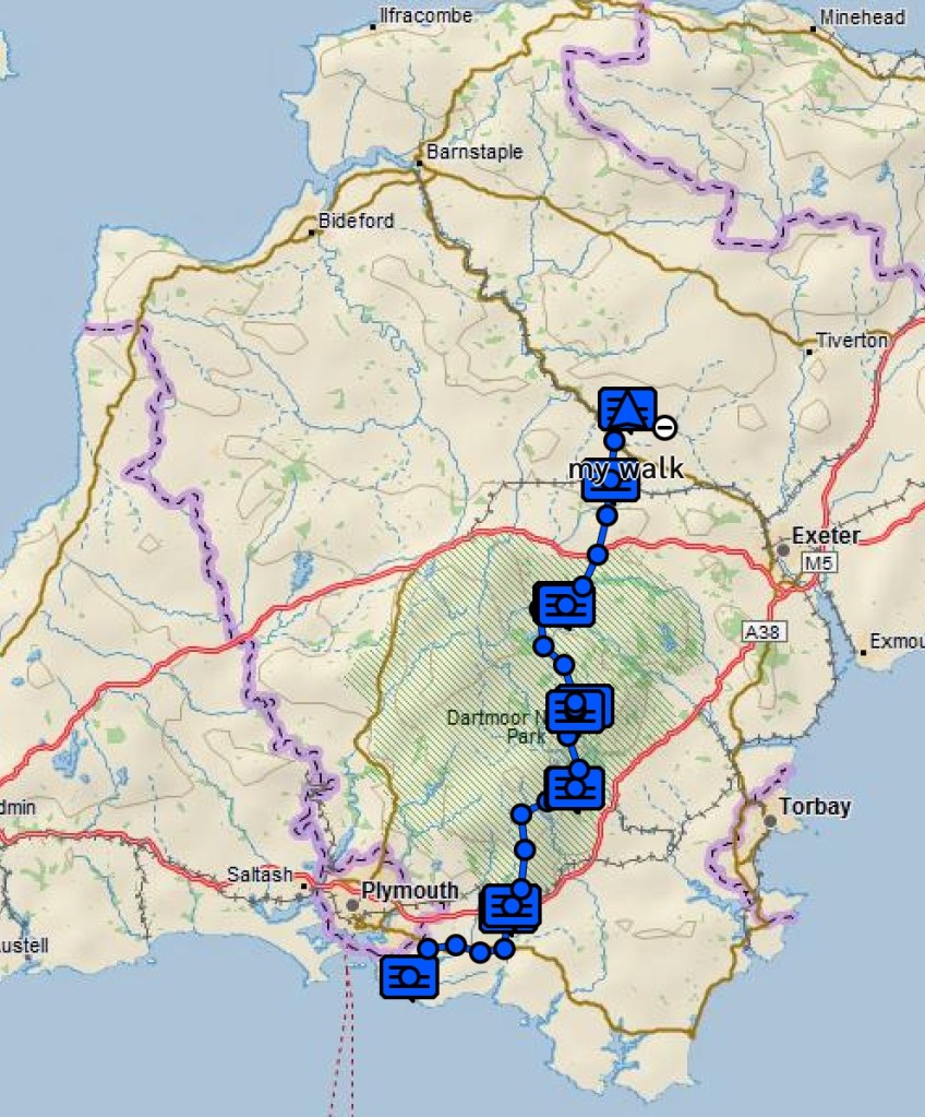
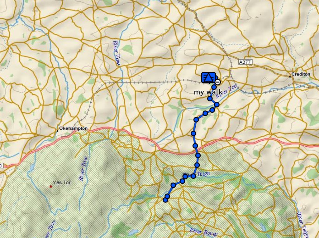
Today’s walk divided into two halves. In the morning, we had more Devon hamlets and churches, and a lot of hills, in ever increasing heat. In the afternoon we entered Exmoor, and followed the pretty river Barle. It was another 14 mile, seven hour walk.
In the first few hours, we passed through the villages of Knowstone, Yeo Mill, West Anstey and later Hollowcombe and Hawkridge. Between them were fields, hedged paths and lanes with steady climbs all the way. We climbed nearly 600 metres overall, but it felt more than this, with many descents in between.
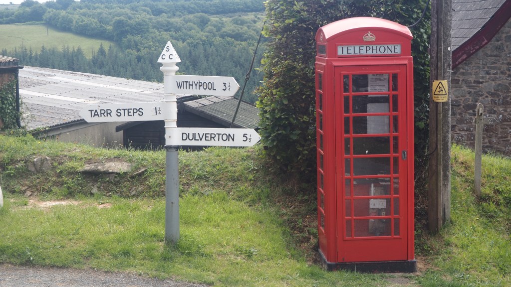
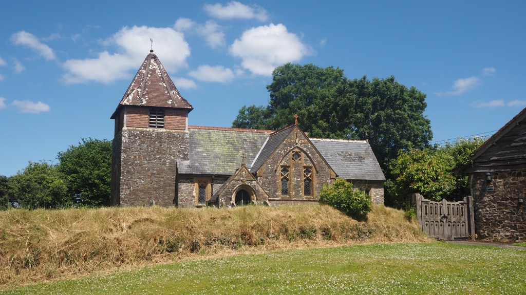
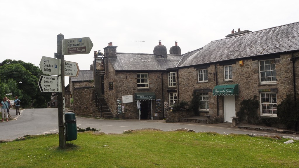
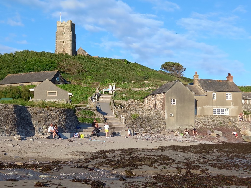
Hawkridge village, as we crossed into Somerset
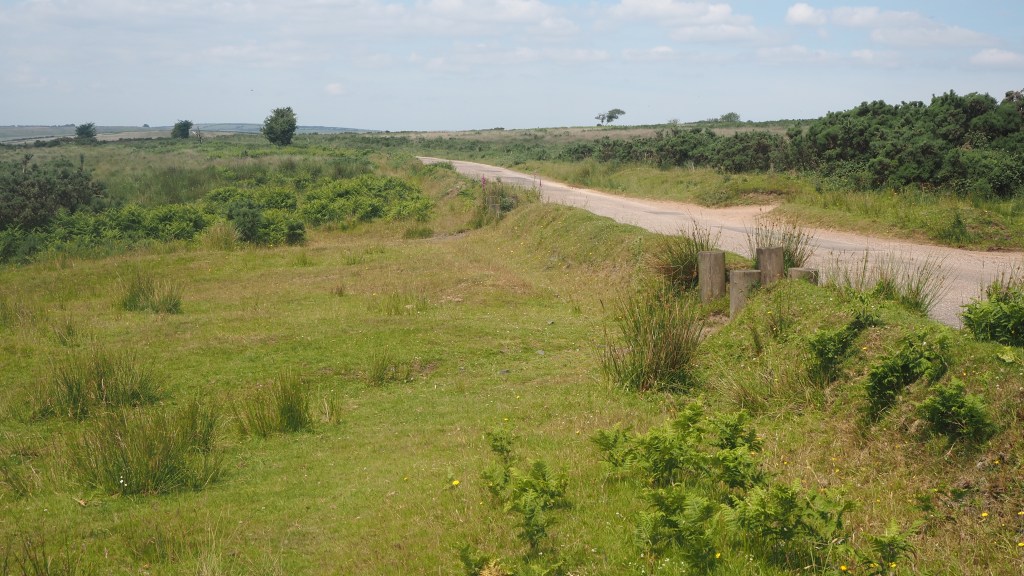
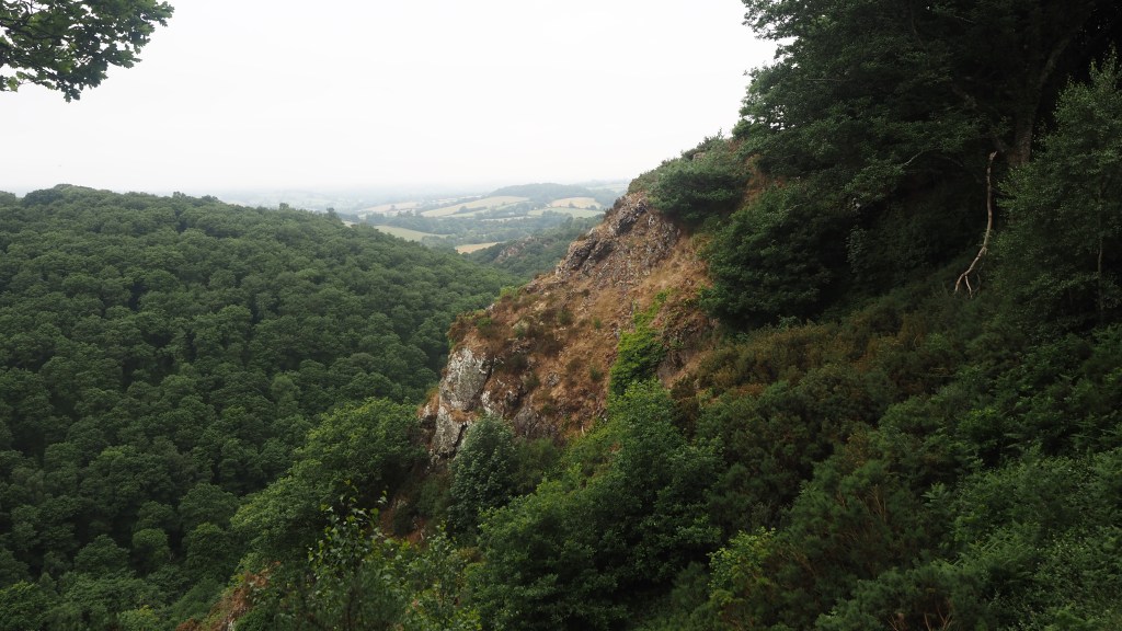
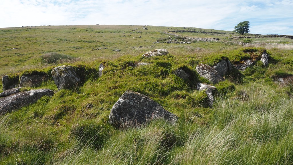
Crossing into Exmoor, the landscape changed quite suddenly as gorse and scrub, heathland and moor took over from hedges and farmland.
Exmoor
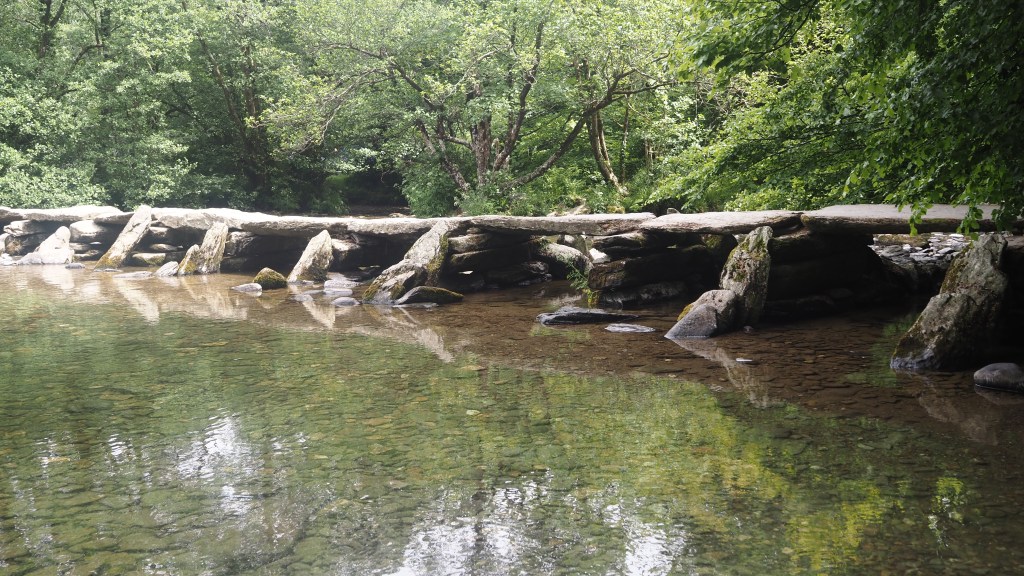
A steep descent led us to Tarr steps bridge, thought to date back to the Middle Ages, and the longest example of a clapper bridge anywhere in the country. This is a well-known beauty spot, with kids paddling in the river, an ice cream stand and a nearby pub. On the Tuesday we visited it was relatively quiet, although we still saw more people here than for the rest of the day put together. But it’s popular here and I can see why.
Tarr steps bridge
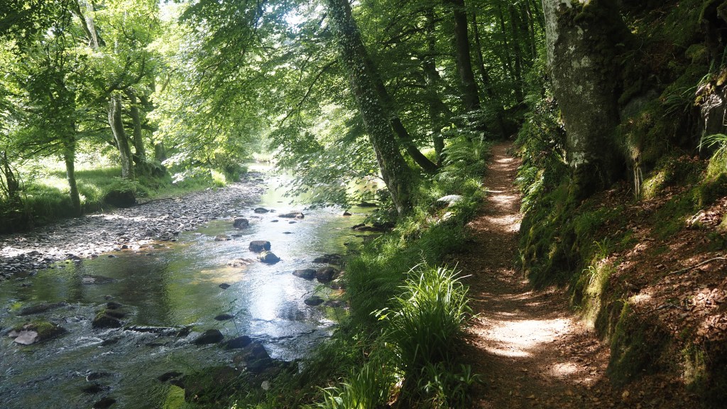
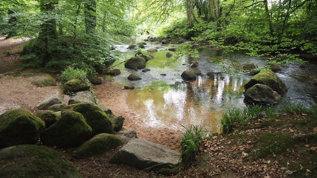
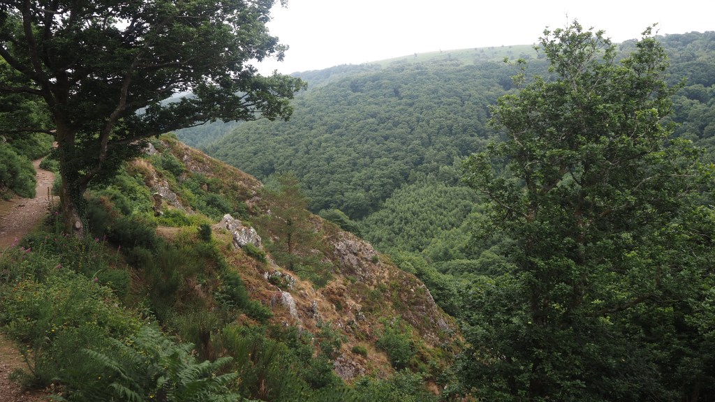
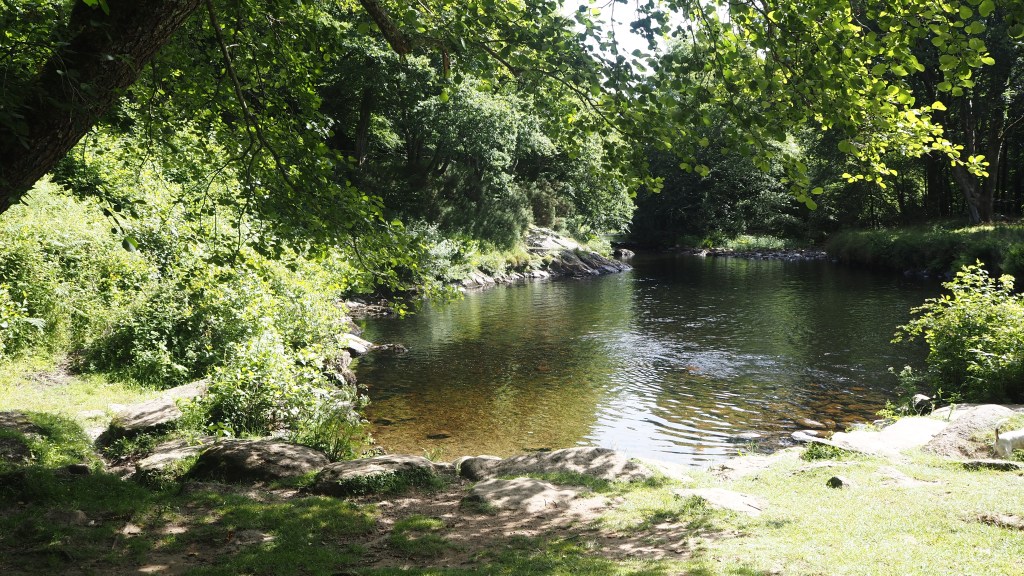
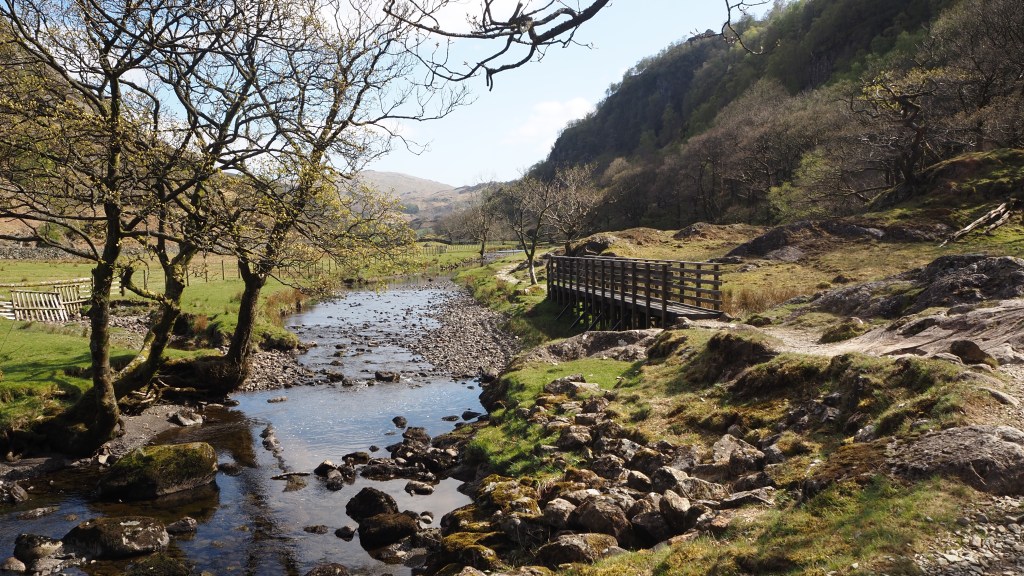
The next four miles for me was the highlight of the day- a lovely riverside walk that we followed into Withypool. Most of this was shady and easy walking, apart from a stretch where horse riders were directed to ford the river, while walkers like us had to negotiate a trickier section involving tree roots and rocks.
Walking along the river Barle
Scourge of today was the horse fly. You don’t feel them, but suddenly notice one of these nasty critters on your arm and leg. When you brush it away, you are probably already bitten and bleeding. I’m covered in their bites after today’s walk.
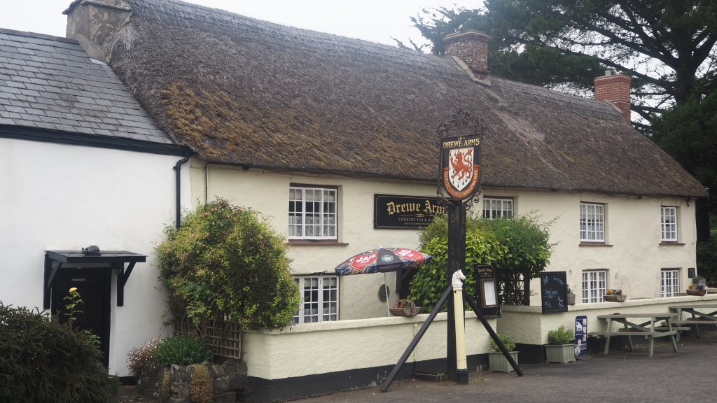
But horse flies apart, it was a lovely day, if a little tiring because of the heat (in the upper 20s I think) and the many uphill stretches. At the end of day, we arrived at our accommodation for the night in the little village of Withypool, actually in Somerset, which we crossed into during the afternoon. Nearby, in Winsford, so we heard, is the family estate (or one of them) of Stanley Johnson, father of our current occupant of number 10. Or at least at the time I am writing this. Luckily, we won’t be crossing his land.
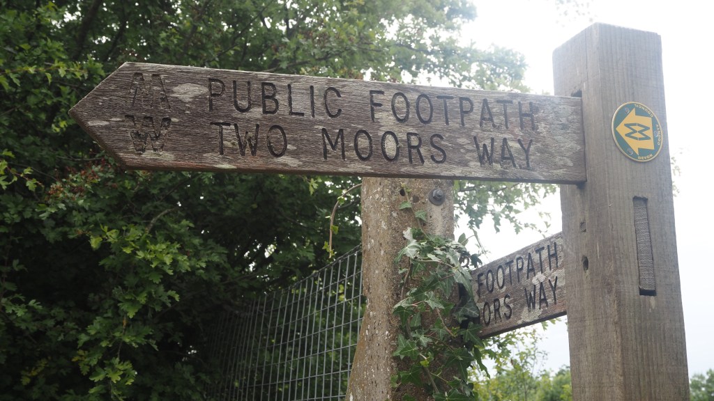
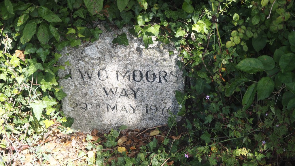
Two Moors Way sign as we entered ExmoorToday’s walk took us into Exmoor, and out of Devon into Somerset
The sun re-emerged today after two days of hiding and lit up the Devon countryside as we began our walk this morning. I think that’s why I enjoyed the walk today much more than yesterday, despite the fact it was around twice as long, at some 14 miles.
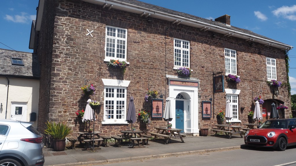
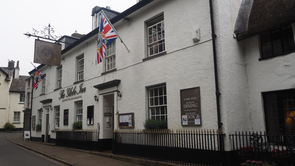
Our walk took us 14 miles from Morchard Bishop to KnowstoneThe Mitre inn, Witheridge
After a lovely stay at the Mitre Inn in Witheridge we were driven back to Morchard Bishop to resume the walk from where we had finished the previous afternoon. From there it took us until about 1.30 pm to walk the seven or eight miles back to Witheridge, across fields, through little copses, along tree lined tracks and lanes.
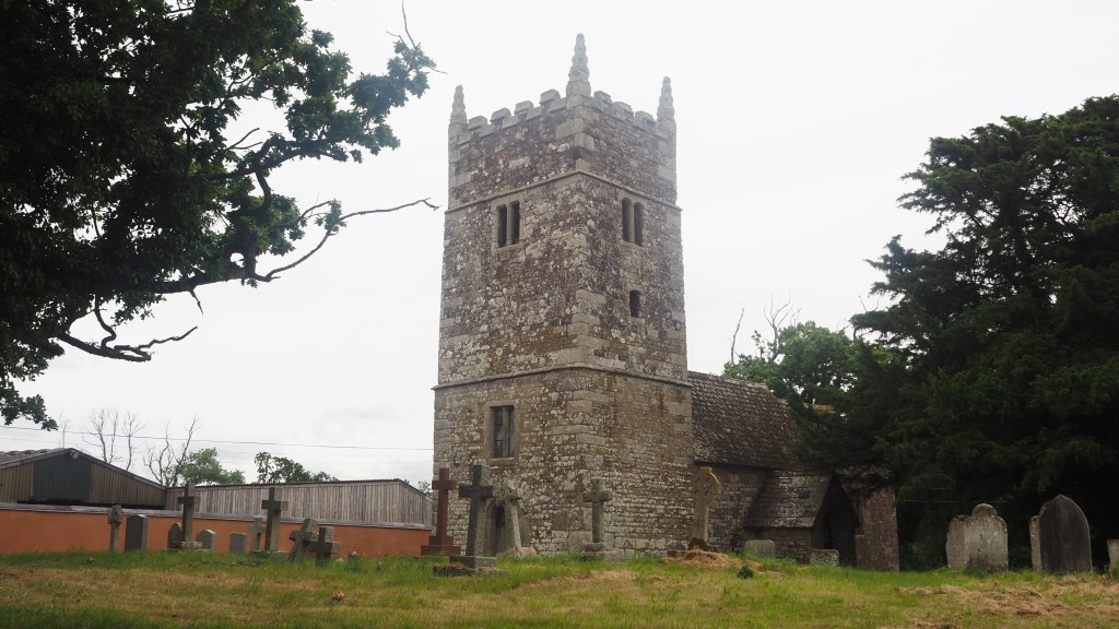
The church of St Peter at Washford Pyne
After a few miles, we passed another of the fascinating little churches that line the route. This one, the church of St. Peter at Washford Pyne, was on the site of a church dating back to the 13th century, although the current version is a reconstruction following a fire in 1880.
Just before we reached Witheridge, we had a threatening encounter with a herd of large bullocks. They charged towards us, but my friend Keith’s stern shouts stopped them long enough for us to get out through the gate before they changed their minds. Though has happened to me a few times now- it’s an almost inevitable occasional hazard as a walker- it’s still unnerving even if the chances are that the animals will stop at the last minute rather than stampede.
Threatening bullocks, after we safely crossed a gate out of their field, just before entering Witheridge
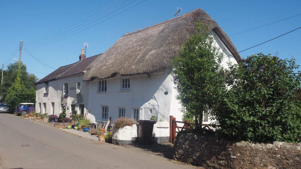
Witheridge itself is full of thatched cottages. In fact every little village of hamlet in this part of Devon seems to have at least a few, and I don’t think I’ve seen so many before (admittedly I’ve never visited the Cotswolds). Each is different, and they really are the epitome of what you expect of a perfect English country village.
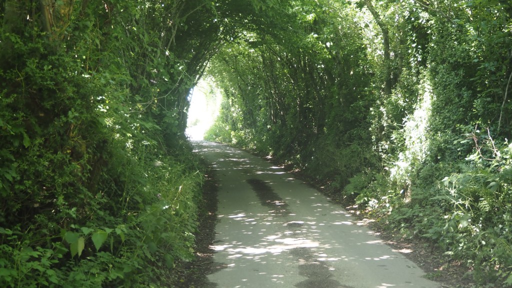
A typical thatched cottage at WitheridgeShady tree lined lane on today’s walk
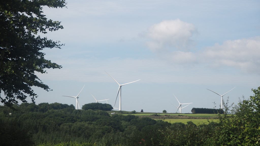
In the afternoon a long stretch along country lanes towards a wind farm was followed by a wide shady track underneath arching trees. We ended with a lengthy section of boardwalks saving us from the worst of the mud to reach open common and our final destination, a remote farm.
Wind farm near Knowstone
We knew that we weren’t getting any food tonight as it seems to be a local thing round here that pubs shut on Mondays, and the farmer had warned us to bring our own food, which we did. Not was I really surprised at the lack of Wi-Fi, as it is a bit remote here and the couple running the place were clearly a little old to worry about such things. I was a little put out, though, that my bath plug had a gaping hole in it though particularly as there was no shower. Luckily, my friend Keith let me make use of his ‘private’ bathroom down the hall.
But nevertheless it was a chance to rest and read ( at least once one of our noisier neighbouring boarders had quietened down!) After all, why stay in a lovely quaint thatched farmhouse if you expect all mod cons .
Mentally, passing the half way point of a walk is the point at which you appreciate what you have taken on – you know that you have ahead of you no more than you’ve done already. Unless of course all the tough terrain is saved to the end! Last night we passed the half way point on our coast to coast walk, having clocked up over 60 miles out of 117 and completed five days out of ten. Neither of us feel especially tired either, so that bodes well for the rest of the walk.
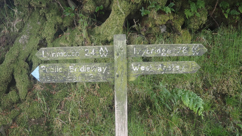
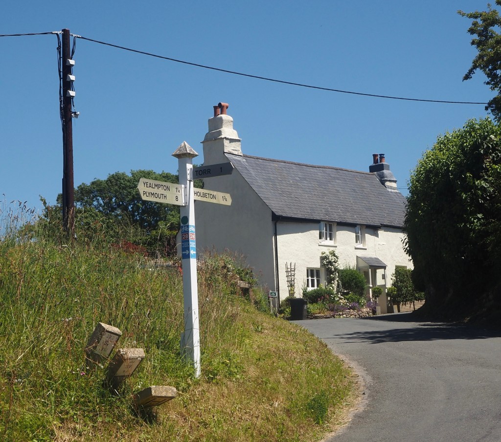
The directional signage today was mostly good today, with a few exceptions
As we have crossed through rural Devon the villages have been far apart, small, and accommodation few and far between. So for the last couple of days we have been met and dropped off by a friendly and knowledgeable driver from the local taxi firm and have stayed overnight in neighbouring towns. Our driver has been a mine of information on where we should and shouldn’t go, where’s nice and where’s not . How he managed to know his way around and cope with the winding narrow roads of this part of Devon in a large taxi I don’t know, but I guess it becomes second nature after a while.
The church at Clannaborough
The walk itself today was a short seven miles, which took us only til 2pm, giving us the remainder of the day to rest for the first time since we started. It wasn’t my favourite sort of walk I have to admit, being predominantly a mix of crop field edges, fields of sheep, narrow hedged lanes and occasional farmyards.
Generally the route was signed reasonably well. Unfortunately, at one point when we did go a little wrong, I managed to tear my trousers on barbed wire, crossing a stile. Luckily I didn’t cut myself.
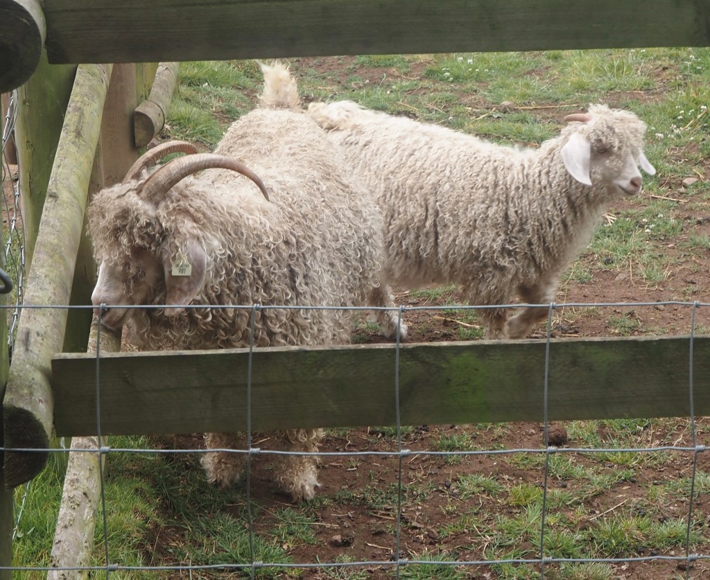
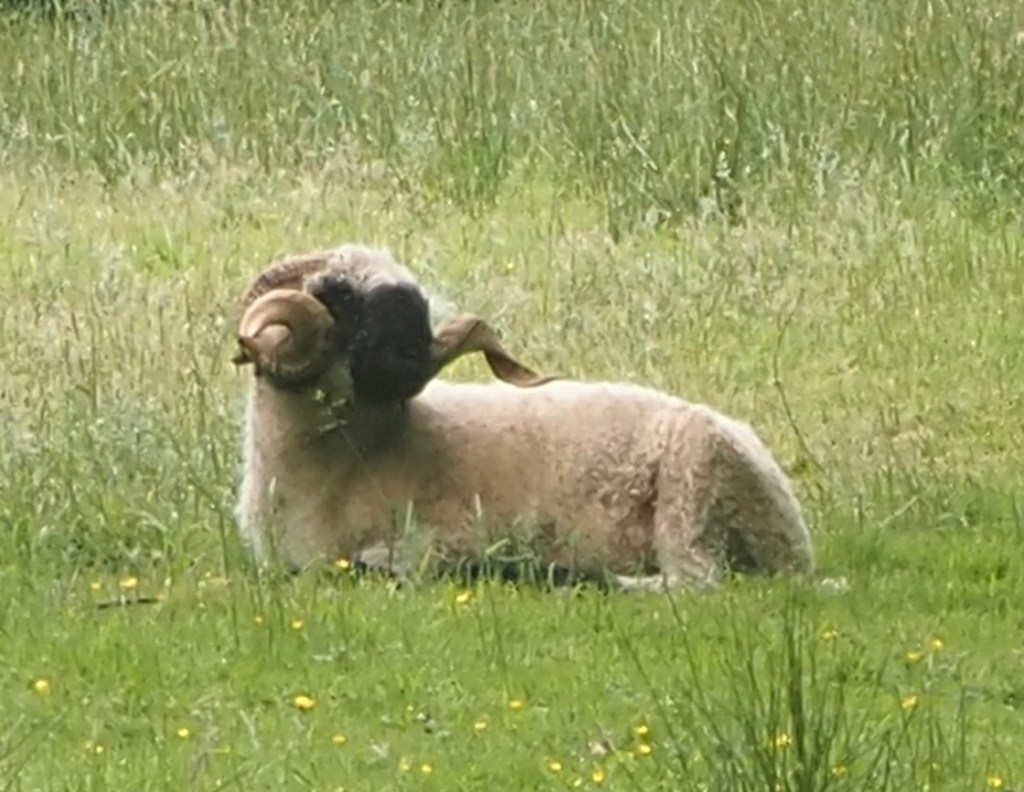
We also passed an unusual, and nonplussed, ram, followed by strange looking sheep that looked more like dogs with horns. Dogs barked as we passed isolated farms. We traipsed through yards of manure and stubbly fields, until finally we could hear the traditional peal of church bells letting us know we’d nearly reached the village of Morchard Bishop, where today’s walk finished.
Some unusual sheepAnd a ram
Tomorrow looks like a bigger challenge, and the longest remaining day, taking us to the southern edge of Exmoor.
Our starting point today, the Globe Inn at Chagford, where we had stayed overnight
Overnight the weather had changed completely and we awoke to an eerie, misty morning with just a touch of drizzle. Very different from the days up until now. We set off from Chagford, heading back down to join the Two Moors Way at the River Teign below.
Initially we followed the River Teign
The next part of the walk was, for me, the highlight of the day, and all the better for being totally unexpected. Entering the Castle Drogo estate, managed by the National Trust, we climbed up to some magnificent views from a balcony path high above the wooded gorge of the Teign. I really did not know or expect this sort of scenery in Devon, and it reminded me more of the French Pyrenees or the Belgian Ardennes. Although the path didn’t take us to the castle itself, the views from the gorge alone were well worth the climb and were the most mountainous I think I’ve ever seen in the south of England.
The gorge at Castle DrogoAnother view from the path above the gorge
Descending from the height above the gorge, we arrived next in the picture postcard village of Drewsteignton, with village pub, red phone box, thatched cottages and general stores making it look like somewhere out of Miss Marple or Midsomer Murders.
Pub in the village of Drewsteignton
The afternoon was more gentle countryside – field edges, woodland paths and then a long stretch along a narrow country lane lined by tall hedges, which became, after a while, a little oppressive. For a couple of miles we really saw nothing apart from these hedges, so it was a relief when finally a gap by a gate revealed again the rolling Devon countryside.
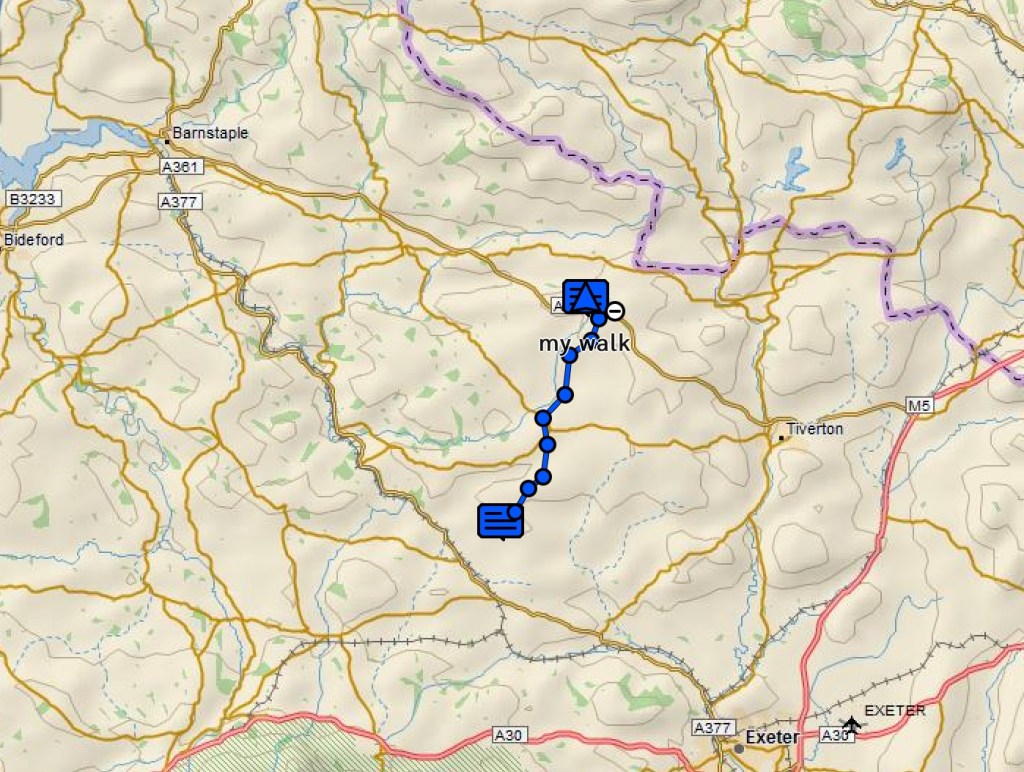
One of several holloways we followed todayOur walk today, from Chagford to Whelmstone Cross, from where we were transferred to stay in Crediton overnight.
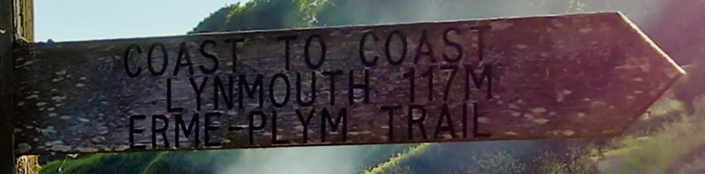
As we were approaching the end, and our rendezvous with a taxi to take us to the overnight stop at Crediton, annoyingly we found the path closed due to rail works. With the closed path ahead shown as crossing the newly re-opened passenger railway to Okehampton, we can only assume that the railway authorities needed to upgrade the crossing point or something similar. So we had, instead, to make an extra mile detour near the village of Colebrooke to cross the railway by a road bridge. Just as we arrived at the end point of our walk, fifteen minutes before our taxi was due, there was a peal of thunder, prefacing a much needed heavy downpour. Which made the sign below we’d seen earlier in the day seem like some portent of the future.
At the end of today, the heavens opened. Maybe this sign passed earlier in the day was a sign of what was to come.
Forecasters had warned that today could be the hottest ever June day in Britain. So we were quite relieved to find that when we were dropped off back at the top of the hill above Widecombe to resume our walk, there was a fresh breeze. In fact, for about the first seven or eight miles of today’s walk it was warm but cooled by winds. So windy in fact that sometimes it was at times difficult to hear each other speak.
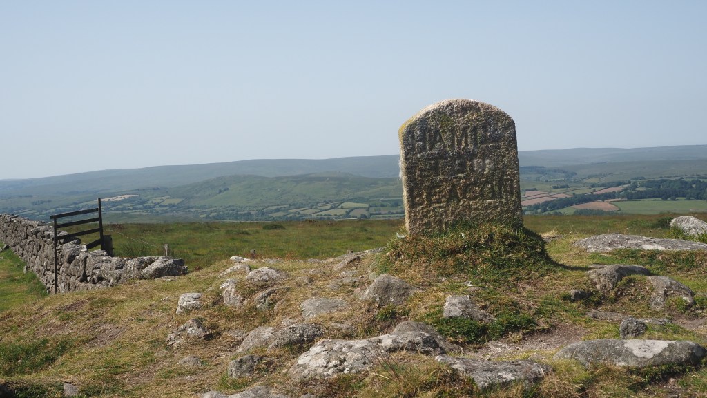
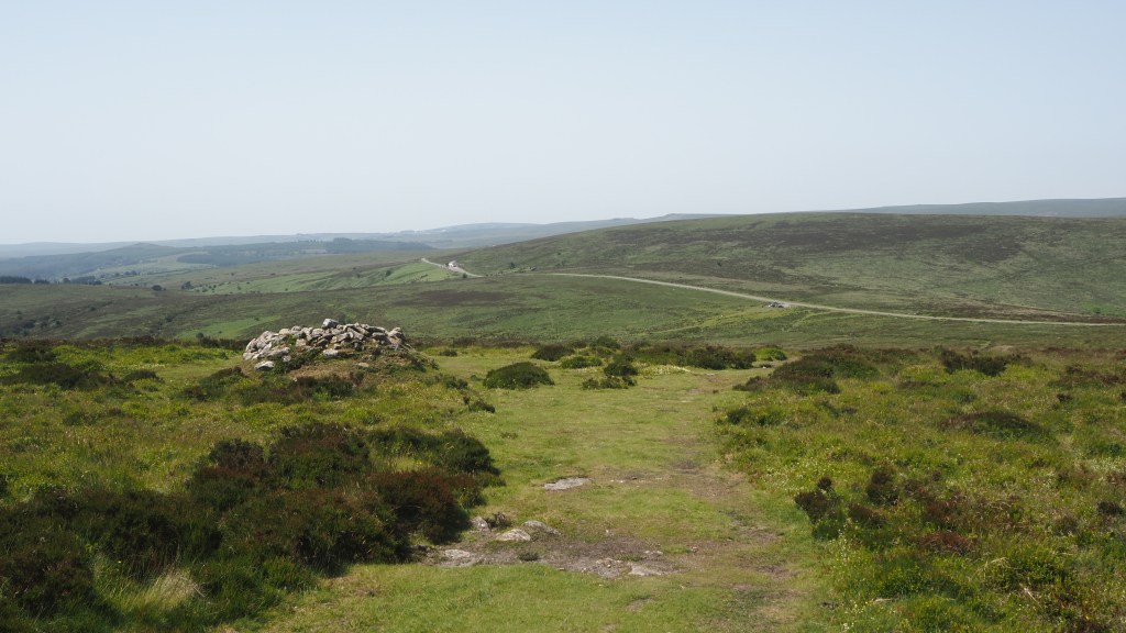
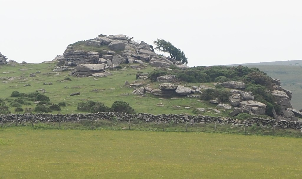
We were following an undulating path high up on Dartmoor from the start today, with a succession of tors, burial mounds and cairns. There were modest climbs to each, with names like Two Barrows, Single Barrow and Broad Barrow, before we reached Hameldown Tor, about 500 metres above sea level.
Hameldown beaconOne of the many tors we passed today
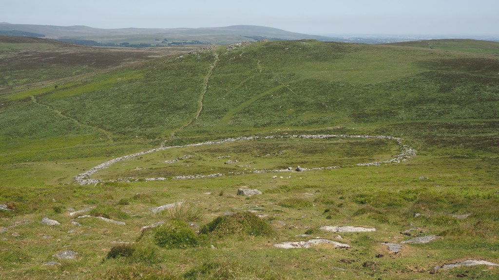
From here as we passed the brow of the hill, we looked down upon the best preserved archaeological site on Dartmoor, Grimspound. It’s a remarkable stone circle with a gateway, and is thought to date back to the Bronze Age, around 1300 BC. From what I can gather, some of it is a bit of reconstruction from the late Victorian era, but nonetheless it is an interesting sight.
Looking down on Grimspound
Following Hockney Tor we descended with a magnificent view down to the road, where we were meant, according to our guide book, to ‘pick up’ (a bit of a vague expression) a broad grassy path.
View down from Hockney Tor
In fact we spent the next 45 minutes trying to find this path, following false leads and ditches that lead nowhere in particular. The trouble was, it was difficult to see at a distance the difference between a dry ditch, sheep track or simply a change in vegetation. We walked across boggy moss, through sharp gorse, getting our legs cut to pieces in the process, and having to watch every stop to avoid twisting an ankle on holes and grassy tussocks. We followed our gps track pretty accurately, so maybe the map was wrong, or , more likely, we were walking a matter of metres away from a nice pleasant grassy track that we never found.
Reaching the edge of the moor
Eventually we reached the ridge path cutting across at right angles that we were aiming for, had our lunch, and thereafter managed to stick to the route. The end of the moor was reached and we were back onto farmland, shady wooded paths (thankfully, as it was much hotter once down from the height of the moor). The last few miles took us alongside and across the river Teign, and past Holystree Manor, and then a final slog uphill to Chagford, our base for the night.
The river Teign
So another enjoyable day, with only one instance of getting lost this time, and our last day on Dartmoor itself. The next few days are going to take us through quiet mid Devon, before we reach the second of the moors, Exmoor, on Tuesday.
Our route today, from near Widecombe in the Moor to Chagford
Today’s walk was the most varied of the trip yet. We had ‘chocolate box’ villages- Scoriton, Horne, Jordan, Widecombe in the moor. There was the wooded Dart Valley around New Bridge. There were climbs and descents, wooded paths, and open moorland vistas.
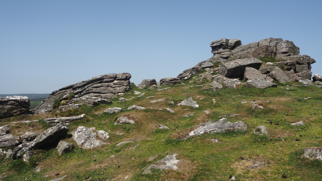
A typical Dartmoor tor
It’s been another hot day with temperatures in the mid 20s, so we were quite glad it was a shorter this time, around eight and a half miles and a fair bit in the shade.
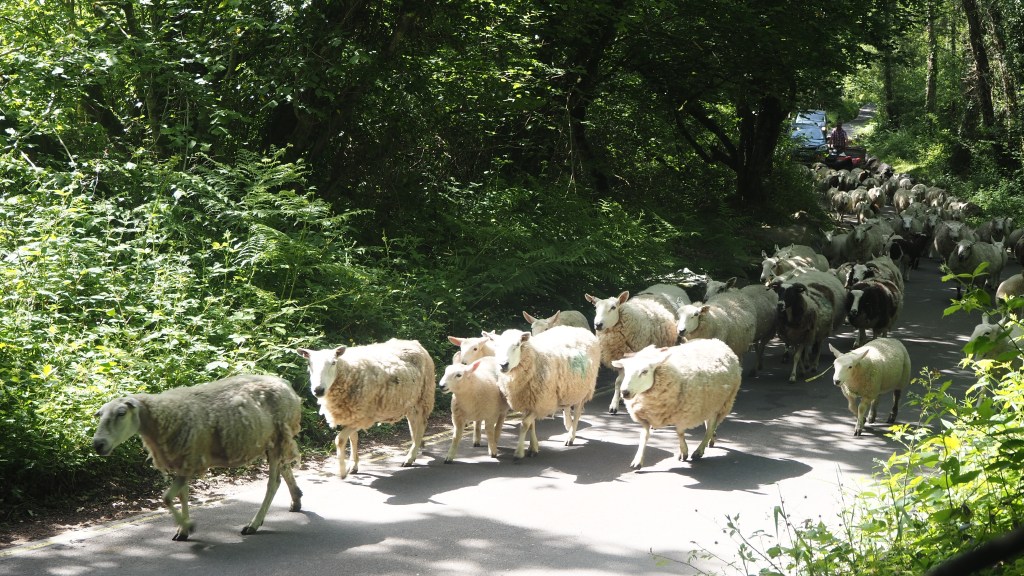
For me the highlight of the day was seeing a shepherd and his dog driving a herd of sheep along the road. Everyday rural life round here I’m sure, but still fascinating to see.
Sheep being driven along the roadToday’s walk, from Scoriton to Widecombe in the Moor
Up on the top, near Aish Tor, after briefly losing the trail, we found ourselves on ‘Dr Blackall’s drive’, a wide level track looking out over the hillside, apparently created by a local resident for his wife in the 1870s when she was too infirm to walk. Presumably they managed to get a horse and carriage up here so they could continue to enjoy the views over the moor together.
Dr Blackall’s drive
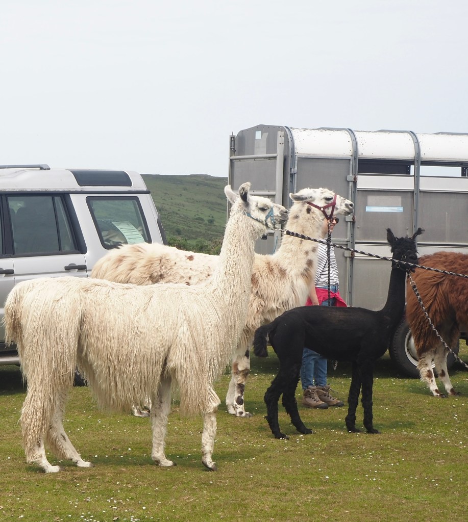
Later, there was the incongruous sight of some llamas, brought up to the car park in horse box. Apparently you can do walking tours with llamas if you are so inclined, although I’m not sure that I would have fancied doing today’s walk alongside a llama, even if it carried my bags.
Llamas at Bel Tor
Anyway, the day ended with a steep 1 in 5 hill down, losing almost all of the height we had gained during the day in one short stretch. There was time for a Devon cream tea at Widecombe, before we were due to be picked up to be taken back to Scoriton by the landlord of the pub at which we are staying. It turned out he originally hailed from Ilford but had given up a career in IT for a life in a Devon village. Sounds like a wise move to me. Although writing this blog and posting these photos I’m not sure what an IT expert makes of the shortcomings of English rural ‘broad’ band.
An almost hidden stone marker indicating the start of the Two Moors Way, just outside Ivybridge
Today we started on the Two Moors Way proper, after yesterday’s introductory day on the Erme-Plym trail. Within ten minutes of leaving Ivybridge, we passed an inauspicious stone marking in the bushes indicating the start of the Two Moors route, and shortly after entered Dartmoor national park.
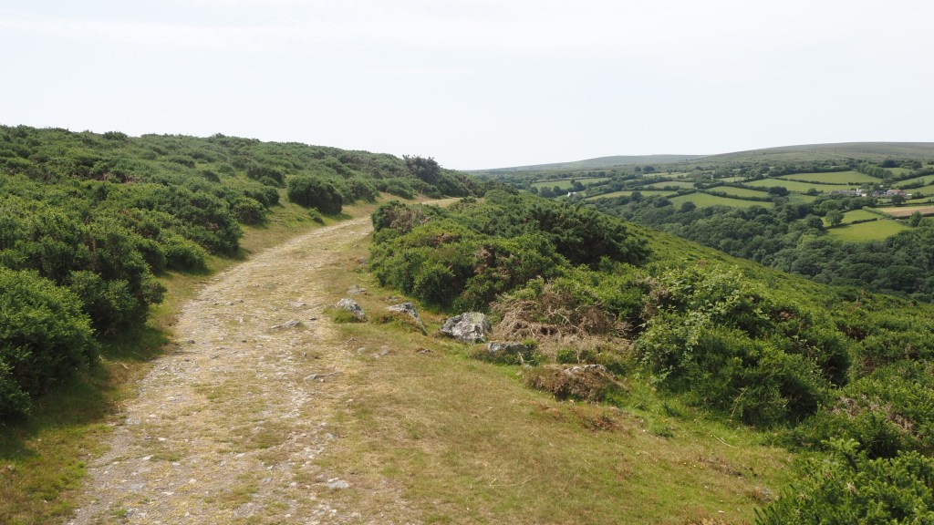
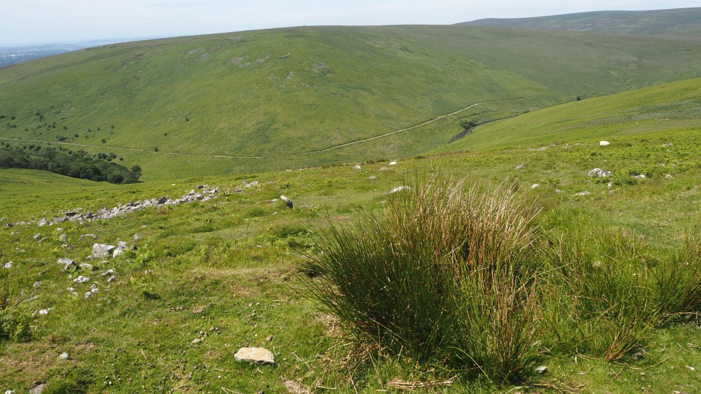
The open moor
We climbed up onto the moor, and immediately encountered a very different landscape to the managed farmland of the previous day. And, as we have experienced before in Britain, bizarrely, the minute you enter a moor, the signage becomes non existent. There is, I’ve been told, a school of thought in this country that moorland should be free of any form of signage, in order to preserve the wilderness character of moorland. I’m not sure myself that this ‘purist’ approach really makes sense. Once again, armed with a Garmin gps, a detailed guide to the route and more than twenty years’ experience of long distance walking, we today still managed to stray from the route on at least three occasions. And this was in perfect weather with dry ground, and a long June day. I would think that a few marker posts, arrows on rocks or even paint markings like those in mountain Europe wouldn’t go amiss, and would help prevent unnecessary emergency call-outs.
A moorland ‘path’
Our route today took us into the heart of Dartmoor along clear tracks, not-so-clear tracks, and non-existent tracks.
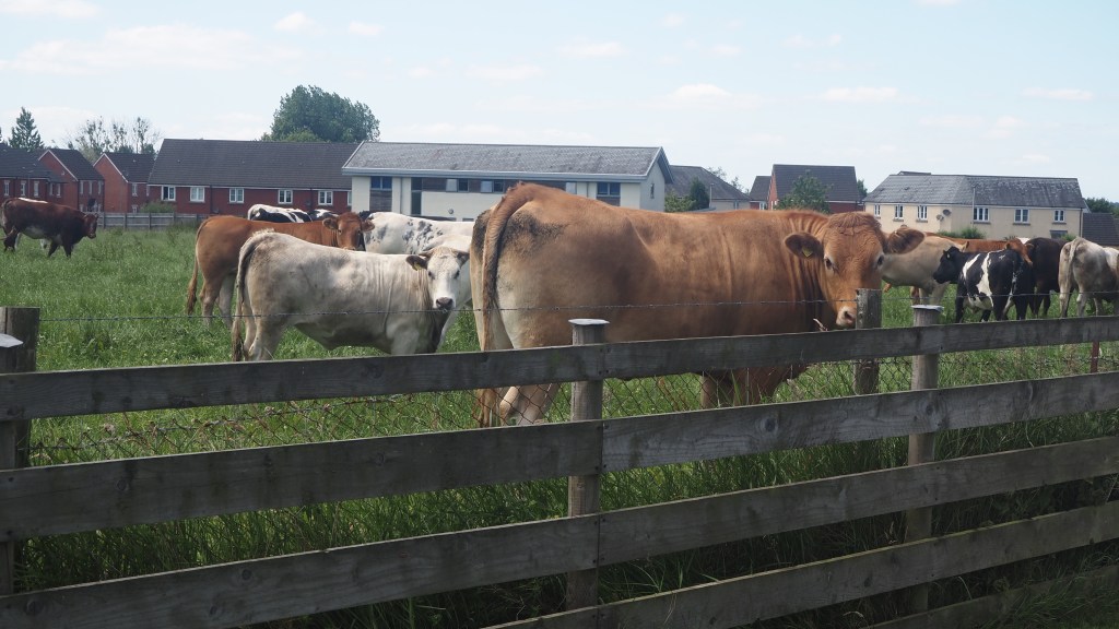
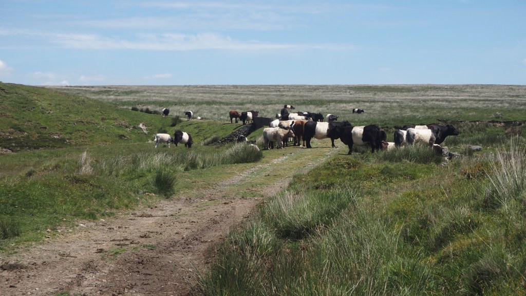
A couple of times the path was completely blocked by cattle, and detours around were a little tricky. We had to wait for the cattle to provide gaps for us to pass, and to avoid unnerving mother cows with their calves, as well as passing some bullocks. But in the end none of the animals were really threatening. It just meant we had be careful, patient and alert.
A path blocked by cattleDartmoor ponies
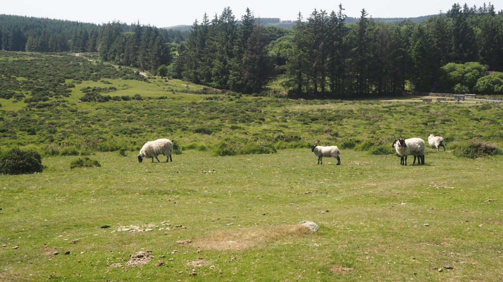
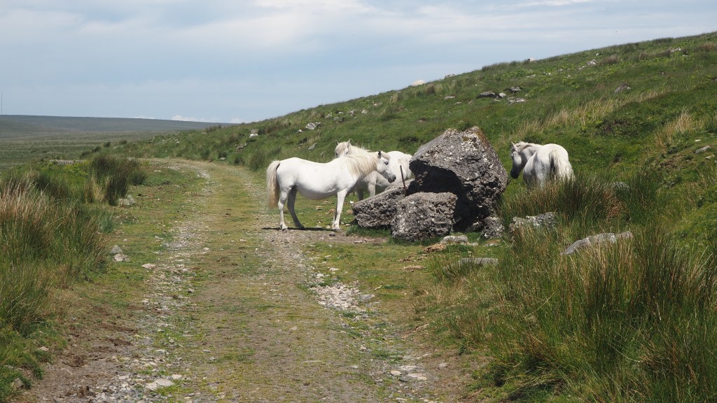
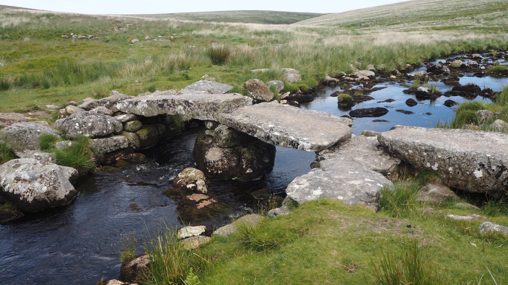
We also encountered sleek, Dartmoor ponies for the first time. Apparently they are not wild, all belonging to someone, but they have been a feature of the moor for time immemorial, giving a special character to the moor . In fact they are so associated with Dartmoor they were chosen as the symbol of the national park. Along the way we also crossed a couple of ‘clapper’ bridges- stone slabs placed carefully across ditches and streams, but which seem perfectly to complement the landscape. They were also some old cairns, puzzling ruins, and stone tors (rocky outcrops familiar to readers of the Hound of the Baskervilles)
A typical ‘clapper’ bridge
What I noticed also is that the landscape of Dartmoor is lusher and greener than the Pennine moors. No doubt this helps explain the ponies and cattle not seen in the northern grouse moorlands. But nonetheless, both types of moor share some common features: sphagnum moss, bog (luckily much drier than usual due to the recent weather) and tussocks of reedy grass, as well as the inevitable hardy sheep. As well as ease of getting lost!
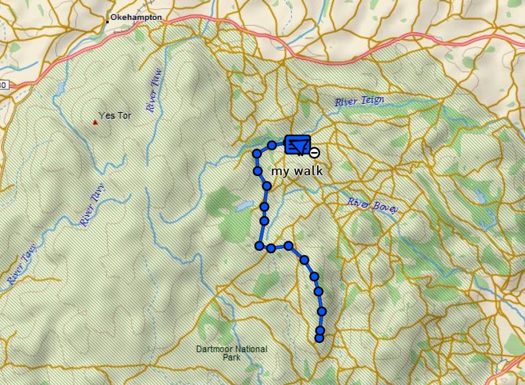
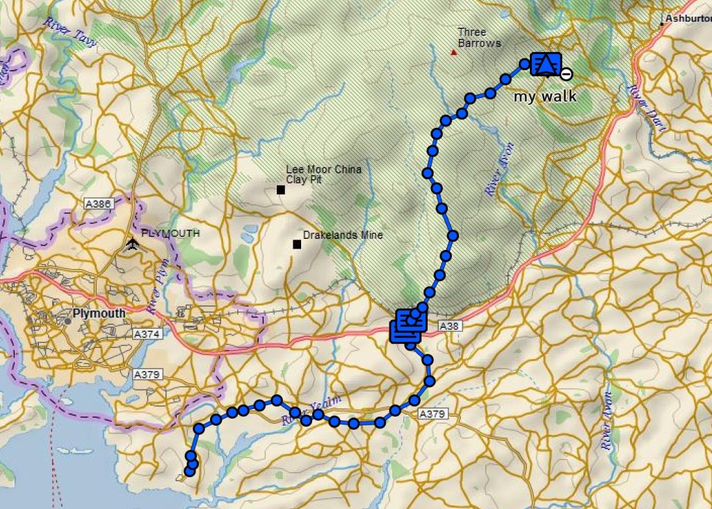
Out route across Dartmoor today took us north east toward the village of Scoriton on a route of 14 miles , rising gradually and descending more steeply. It didn’t take us long to go a bit wrong.
Track of our first two days’ walking.
If our first misrouting didn’t take us long to recover from (regaining the ‘correct’ route in ten minutes or so, on open moorland), the second mistake took a little longer, and involved jumping a couple of small ditches before rejoining the path. But the third was a different story.
Only a couple of miles from the end, we unintentionally veered a little too far right, and trying to follow an alternative route back left to the official route, a promising path turned into a little sheep track before disappearing altogether. Convinced (rightly) that we weren’t far from the route but (wrongly) than an alternative marked on the map would lead us there, we ended up in steep corner of woods having to climb over a broken gate. We carried on through brambles, holly and tree roots on an increasingly precarious ‘non’ route before we realised that we would have to cross a small river to get to where we needed to be. Without a long detour back up the hill, and so close to a bridge I could see marked on the map, we persevered, slowly, getting scratched and watching every step. Eventually we could see the wooden bridge we needed to reach and managed to get near to it, but annoyingly without being able to reach it to cross, our path blocked by a steep river bank and trees. So we still had, in the end, to cross the river by means of nearby mossy stones, before finally breathing a sigh of relief as we to managed to regain the trail .
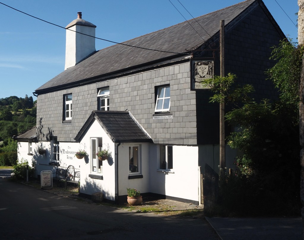
From there it was only a couple of easier miles walking down hill to the village of Scoriton, and the pub, the Tradesman’s Arms, where we are to be staying the next two nights.
The Tradesman’s Arms, our home for the next two nights
So all in all, today was a very different day to yesterday, crossing a much wilder landscape, managing to get lost a few times, and not seeing a road virtually all day. I think it has reminded us how careful, even in beautiful dry sunny weather like today, you need to be, and how you have to respect the moor. Certainly I would not recommend relying solely on Google maps to navigate, as someone we met today, a little lost, appeared to be doing. And you need to be prepared to have to recover your way if do get lost, or even to retrace your steps.
Tomorrow is more moorland, but a much shorter eight miles, and hopefully we have learned a lesson and will keep our eyes more keenly on the ground and our gps to make sure we don’t go wrong. We shall see!
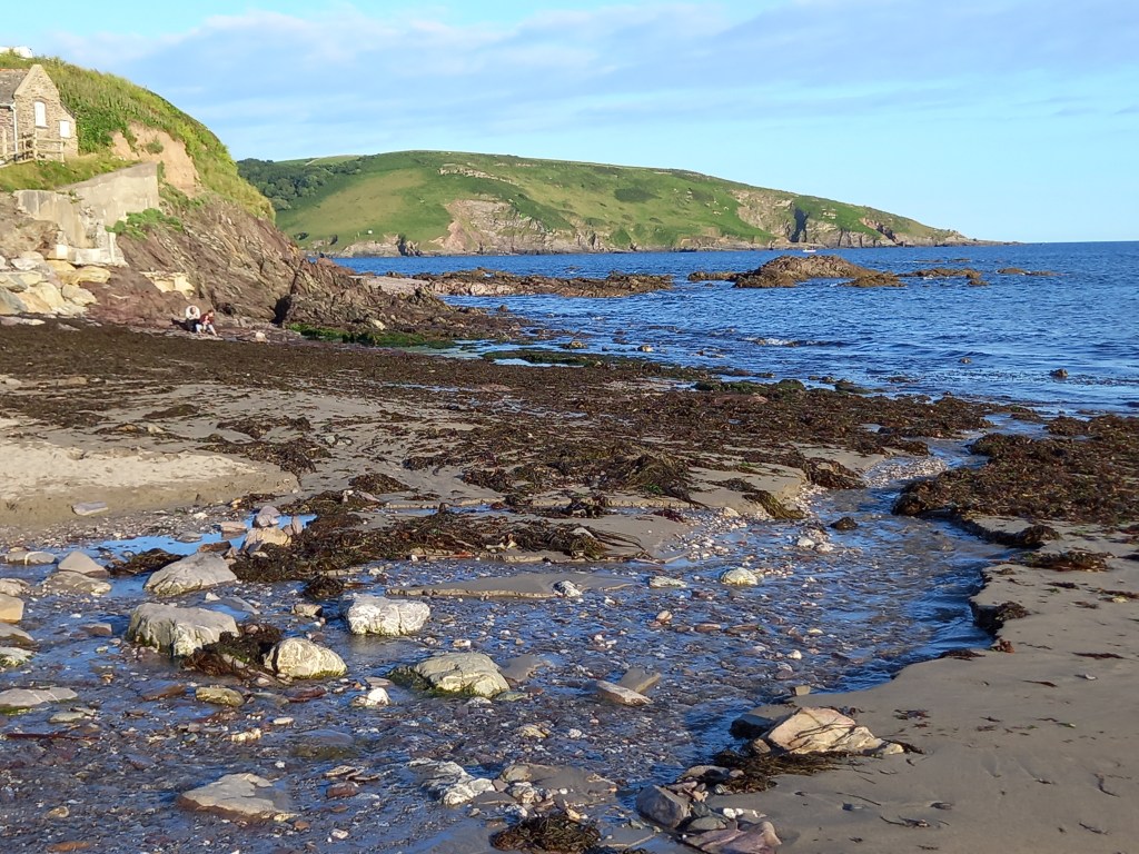
The start of the route, at Wembury on the south coast of Devon
There’s more to Devon than cream teas, pasties, fish and donkeys on the beach. I’ve always been conscious of that, but up until now, I haven’t spent a huge amount of time there, to get a true flavour of the county. With two national parks, Dartmoor and Exmoor, and miles of glorious coast line, not having done much walking there, for a keen walker like me, is a notable omission. But over the next fortnight, I aim to put that right.
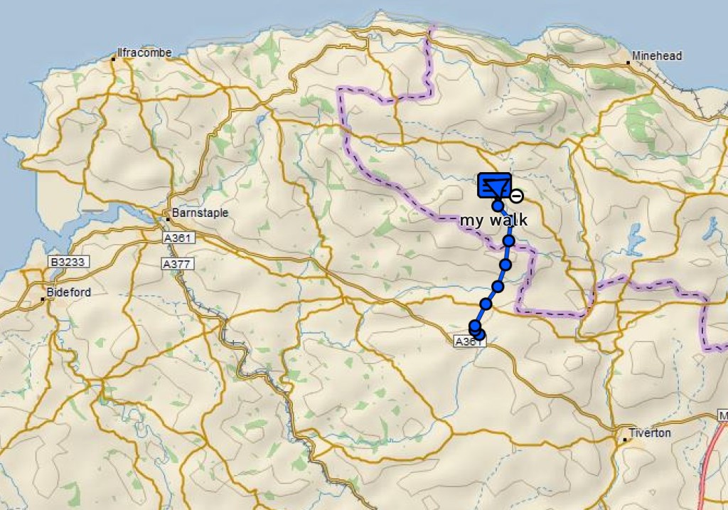
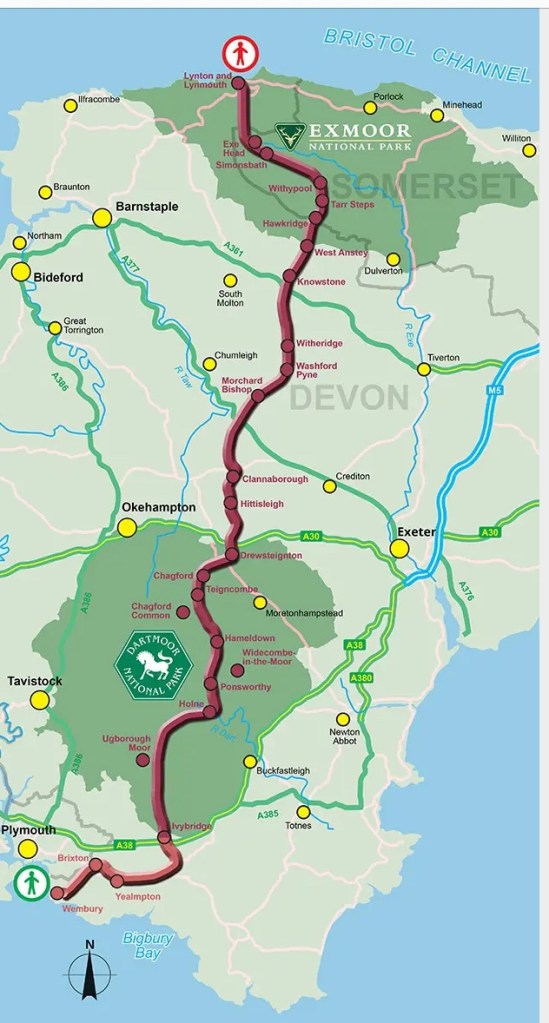
Devon’s coast to coast- crossing two national parks from Wembury in the south to Lynmouth in the north.
We’re walking the Two Moors way, across Devon from Ivybridge in the south to Lynmouth in the north. But to make it a complete ‘coast to coast’ walk we have added a further 16 miles along the Erme Plym trail from Wembury. The total route amounts to around 117 miles and will take us 10 days. The whole route is promoted these days as ‘Devon’s coast to coast’.
The beach at Wembury
We started the route last night by visiting the beach at Wembury and walking the first couple of miles from there to the pub and back to our B and B. Today we did a further 15 miles, across a pastoral, peaceful landscape of wooded combes, field edges, holloways and riverbanks to the town of Ivybridge.
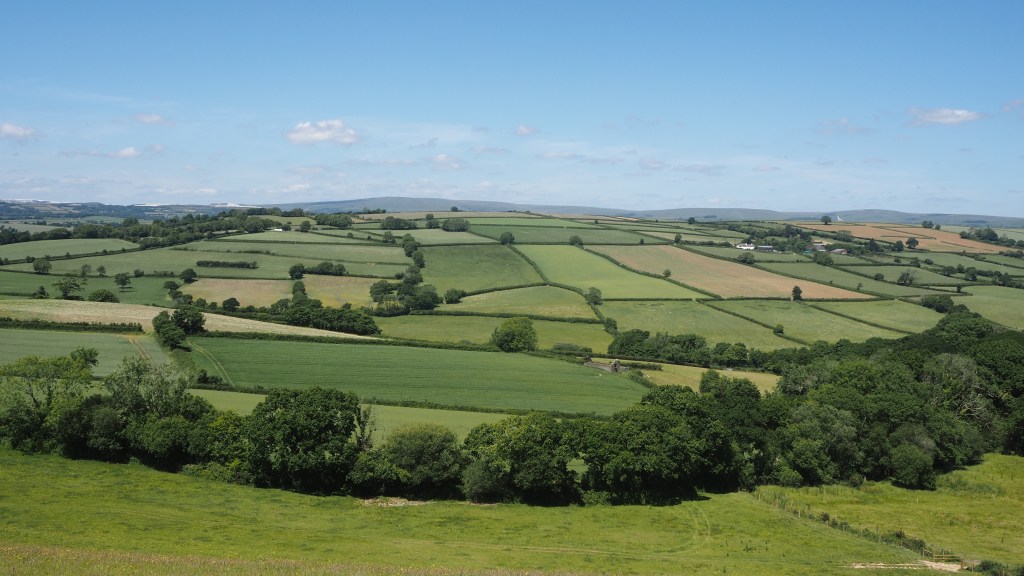
The views when they opened up were the patchwork quilt of fields and hedgerows you see in many parts of the country, particularly the south of England. Thankfully, this part of Devon seemed to have escaped the worst of the reduction in hedgerows that has happened elsewhere. On the horizon you could make out the vague shape of Dartmoor tors, where will be walking in the next few days.
A typical view across the agricultural landscape of south Devon .
Today we saw hardly anyone, apart from a lost cyclist who asked his way. At one point our path was blocked by mother cows and their calves; we diverted briefly to a lane to avoid them. Otherwise it was an uneventful, perhaps unremarkable walk, pretty but not especially memorable, and a good warm up for the tougher moorland stretches of the walk, which start tomorrow.
When you are about to embark on an undertaking like a big trek, it seems an ideal opportunity to raise some money for a good cause that has particular meaning to you.
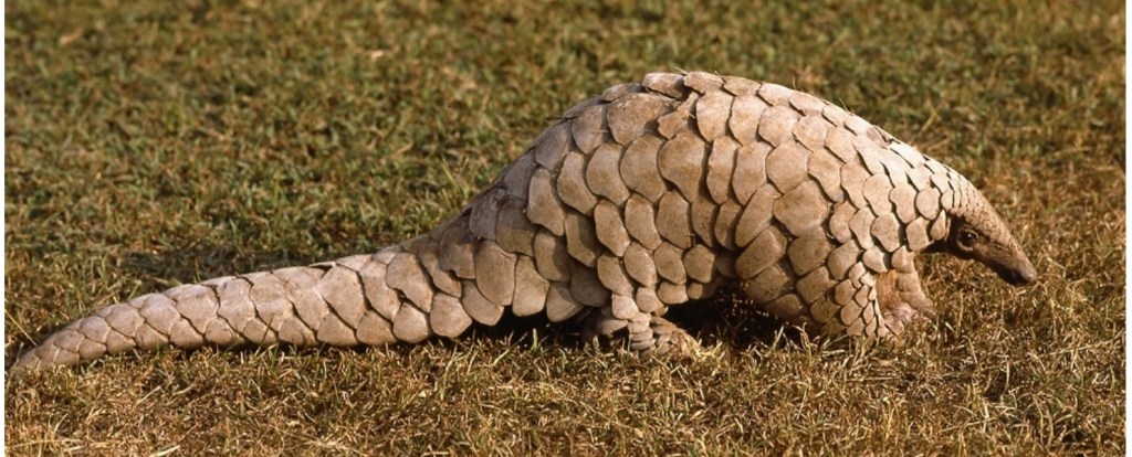
Now there are many different charities I could have chosen, but I wanted to pick something urgent, less high profile, and perhaps hence less likely to otherwise benefit from fund- raising than better known good causes. This is what led me to want to raise money to help protect the endangered pangolin.
The human race has a remarkable ability not only to wage war on itself, but to harm or destroy other species too. Whether it’s overhunting or fishing, destruction of habitat, trophy hunting, deliberate destruction, introduction of invasive species, or causing climate change, humanity all too often has disregarded, exploited, or cold-bloodedly killed animals in numbers beyond their ability to replenish or sustain their populations.
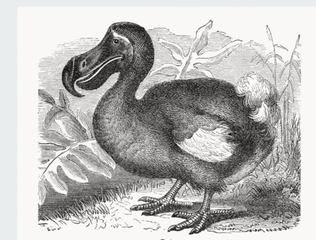
The dodo, the buffalo, the red squirrel, the mountain gorilla, the orang-utan, white rhino, giant panda and passenger pigeon are some of the more famous examples of animals pushed to the brink or beyond. But for everyone of these well known examples there are many other species for which near extinction is not well known or goes practically unnoticed by much of the population.
The dodo, probably the most famous of species driven to extinction by humanity.
Sometimes captive breeding programmes in zoos provide part of the answer, but breeding in captivity is not always that easy, nor is even keeping some animals in zoos practical in all cases.
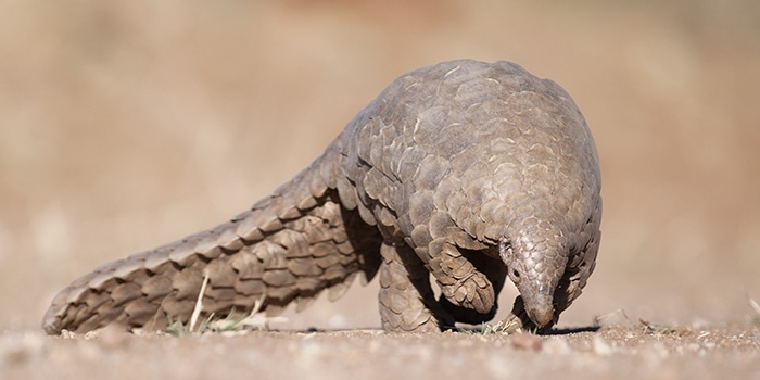
Unfortunately , pangolins, scaly ant-eating mammals which live in parts of Asia and Africa, face more problems than most.
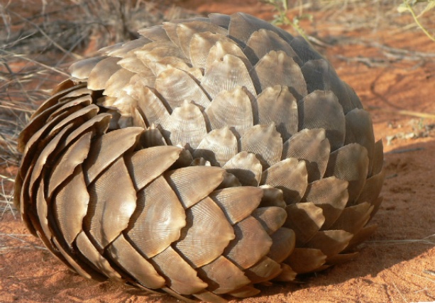
They are the most trafficked animals in the world. Their scales are huge business, as they are believed by some to have medicinal properties. The trade, though illegal, is lucrative, and relatively easy due to pangolins’ small size. Their natural defence is to roll into a ball. Hundreds of thousands are killed a year.
Pangolins roll into a ball to defend themselves
Pangolins are also killed for bushmeat in some countries.
Pangolins rely almost exclusively on eating ants, which means they are difficult to keep in captivity, as they need to roam relatively large areas
The plight of pangolins is not well known or publicised.
Two of the eight species are crucially endangered, or on the verge of extinction, and the others are increasingly vulnerable and likely to become critically endangered soon. Action is needed now, before it’s too late, and while internationally and in many national laws pangolins are protected, this doesn’t mean the trade has ended.
Once pangolins disappear, that’s it. They are gone forever. And this is not natural evolution. It’s not even, in this case, accidental. To use an emotive and perhaps overused term, it’s effectively genocide. And every species which disappears has a knock -on effect on others too, upsetting the delicate balance of nature.
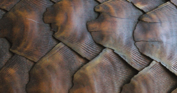
Pangolin scales are believed by some, without any scientific evidence whatsoever, to have medicinal properties
Let’s help turn the tide, and do something positive. If you feel like I do, and think that these things matter, and these beautiful animals do not deserve to disappear, please do support me by making a donation to my just giving page for Fauna and Flora International in support of its work in protecting pangolins.
The end of April, I have heard from several people this week, is one of the best times of year to visit the Lake district. It certainly seemed so this year, when I encountered four days of dry, sunny weather, pleasant but not too hot temperatures, and modest but not overwhelming numbers of visitors.
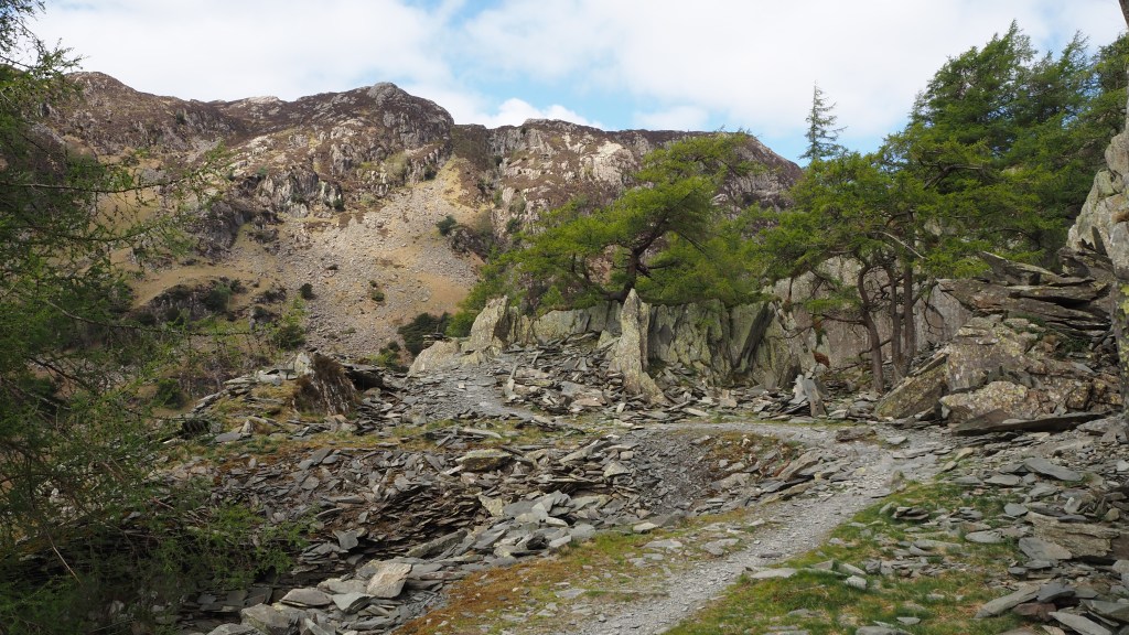
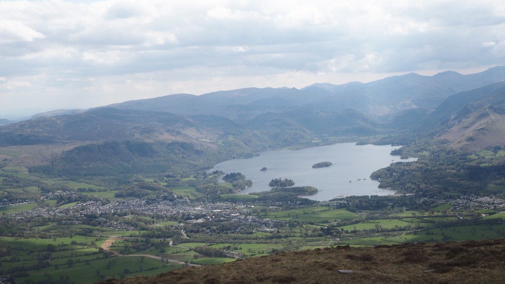
Four days, four wonderful, varied walks, all within a few miles of Keswick. My favourite was probably what turned out to be a twelve circuit around Rosthwaite in Borrowdale, renowned as the wettest place in England, but also one of the most beautiful- and not a drop of rain last Wednesday anyway.
Climbing Castle CragThe view from the top
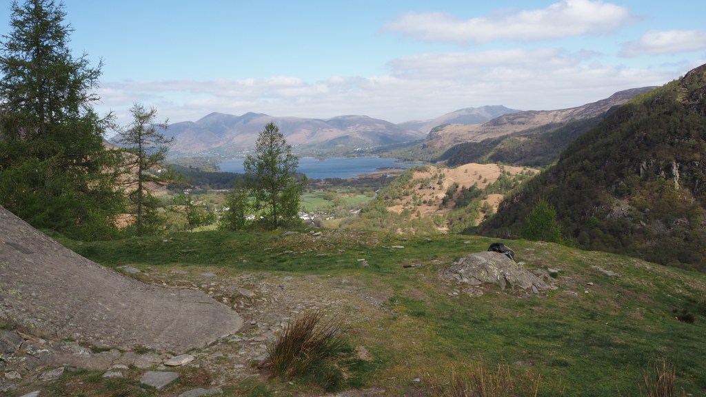
The walk included a short, sharp climb up Castle Crag, which, while a mere 290 metres up and the most diminutive of the ‘Wainwrights’, offers views as good if not better then many a higher peak.
The two mile or so walk along Watendlath beck, 250 metres or above the Borrowdale valley
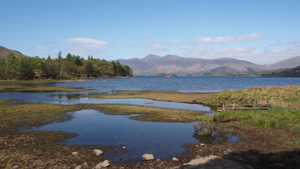
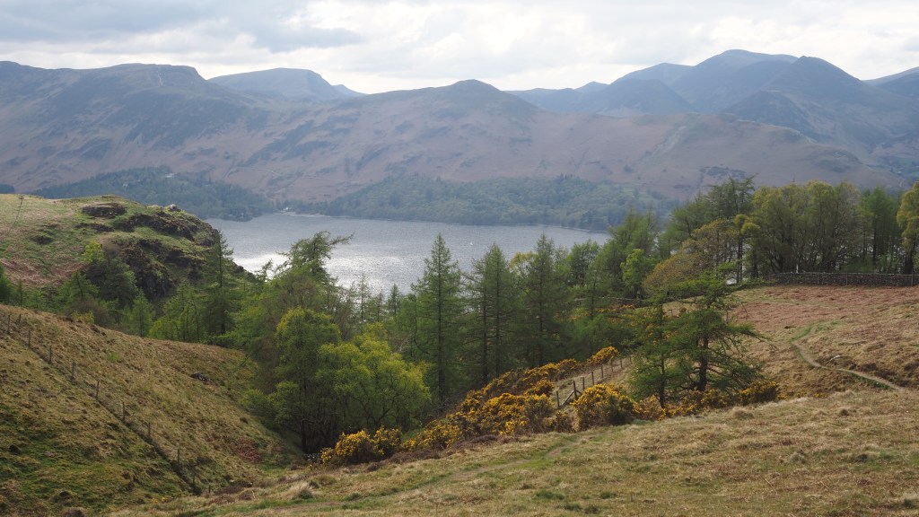
Similarly, a walk up Walla Crag, also a smaller fell, gives more magnificent views, this time from the east of Derwent water.
Derwent water visible from near Walla Crag
But what will stay in my memory as long if not longer than any of these experiences, is an unexpected incident which occurred on my climb up Skiddaw, a 930 metre behemoth which dominates the landscape north of Keswick. Above all, what happened brought home to me the affinity and supportiveness of fellow walkers and how random acts of kindness by complete strangers can help give confidence in the overwhelming goodness of human nature.
After a long enjoyable walk towards Skiddaw’s summit via Ullock Pike, Longside Edge and Carl Side- to many the most beautiful approach to Skiddaw, largely in the company of Rose, a fellow walker I met on the way up, I faced the stiff, steep, bleak scree slope to Skiddaw’s summit. Back on my own again, suddenly, 830 metres up, a mere 100 metres in height from the top, I just lost it.
The climb up towards Skiddaw from Carl Side just got steeper and steeper. I stopped in my tracks towards the top of the path in this photo, where the angle of the path probably wasn’t, but felt like it was, 45 degrees.
Feeling I was going to topple, I started scrambling, and then just stopped. A little precariously perched on the path , I turned around to face away from the mountain, and I began to realise just how difficult it was going to be for me to regain my confidence and stability to walk safely down the five or ten minute walk back to the little plateau of Carl Side.
I saw a couple ascending and they asked if I needed help. Of course that was exactly what I did need, and Julie and Neil, who turned out both to have been trained in mountain rescue, couldn’t have been kinder and more helpful if they tried. They calmed me down, stayed with me, gave me a sugar boost from Lucozade, and contacted their colleagues by phone to get someone to help me back down the relatively short stretch back to where I would feel safe again,
A couple of phone calls later, and more people arrived, both ascending and descending. These included Phil and his partner going down, and an athletic anaesthetist going up. (I only wish I could remember all their names). All, without a moment’s hesitation, offered to help. Between them they lifted me back on my feet and supported me back down to Carl Side, carrying my rucksack for good measure. Apart from their overwhelming act of kindness, they couldn’t seem to accept that what they were doing was anything other than something anyone would do, and didn’t seem to the least bit daunted by helping support a 58 year old man down what I had considered to be quite a dangerous looking undertaking just carrying myself.
After being helped down to Carl Side, I walked down a little further with my samaritan walkers, before finally sitting down to have lunch at this spot.
What those people did and said I will never forget. They not only got me out of a tricky situation, they helped give me confidence that what I’d had was little more than a moment of panic, and that it shouldn’t put me off heading for the hills again. Which is exactly what I did for the next couple of days, albeit at lower height!
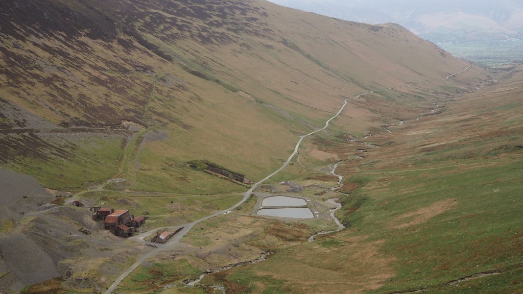
Coledale Beck and old mine workings on walk a couple of days later climbing towards the the fells of Outerside and Barrow