Hiking the Alpe Adria Trail: Day 27

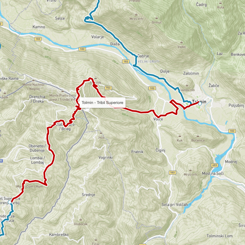
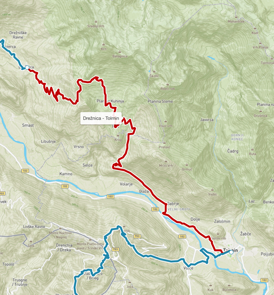
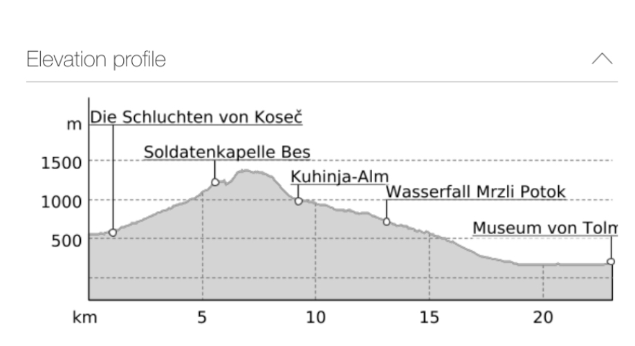
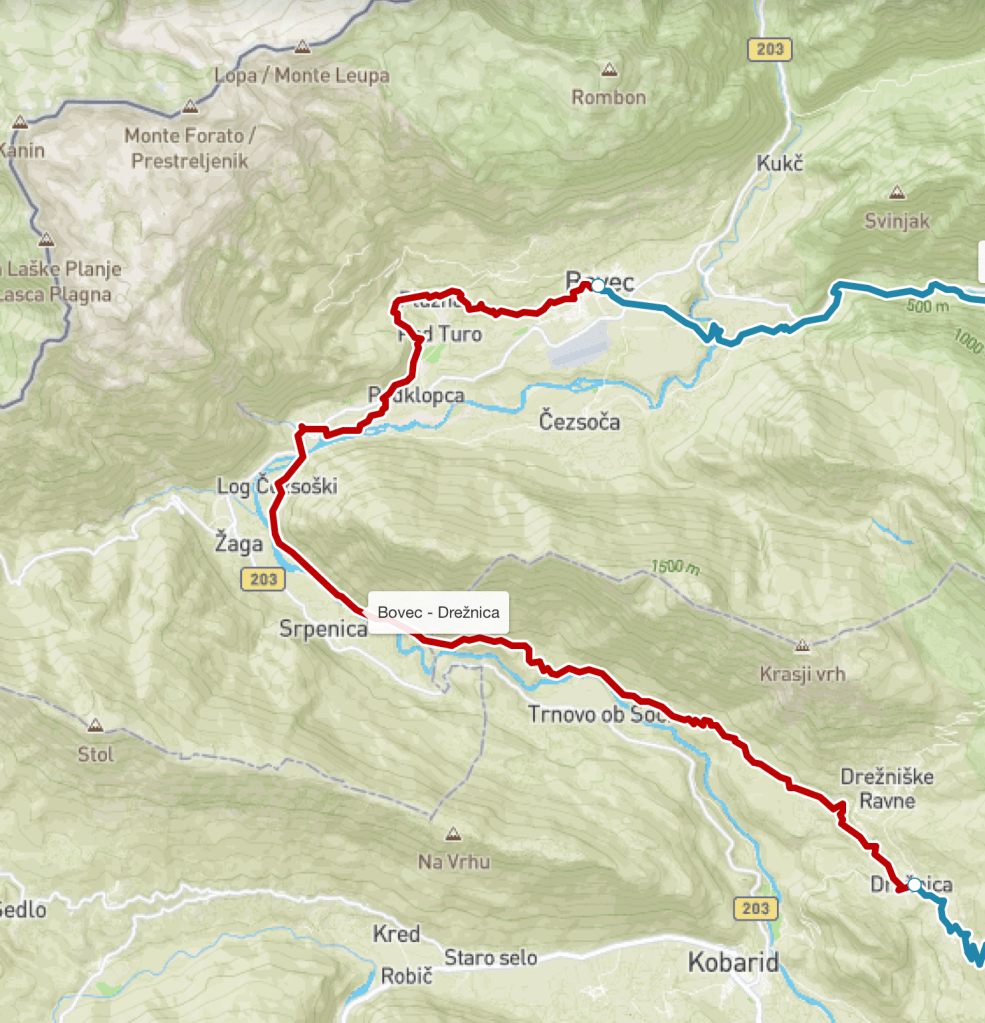
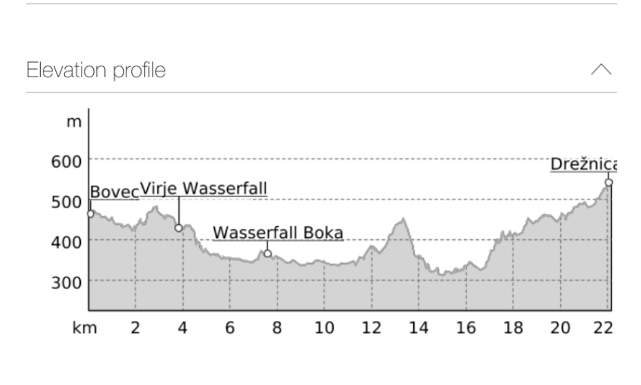
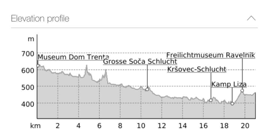
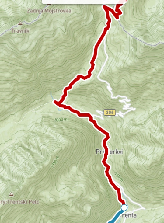
This morning was the hardest few hours’ walking I can ever remember. And I’ve done hundreds of walks over the last twenty five years in all sorts of terrain. It wasn’t that it was technically difficult, but simply that it was so hot, and so steep. And the really difficult part went on for at least two and half hours.

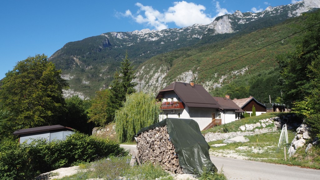
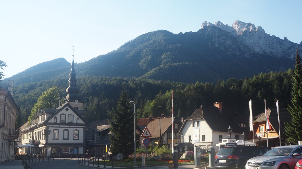
Leaving Tolmin I wanted to get started early, but thought I’d better stop off in the supermarket first. I had planned to go to Mercator, but saw one a bit closer called ‘Euro spin’ so I though I’d give it a go. Unfortunately, while it was cheap, a sort of Aldi/Lidl place, there was only one checkout operator and everyone seemed to be bulk buying ( cabbages and onions for some reason). So I wasted about half an hour just to a get a roll and an apple.

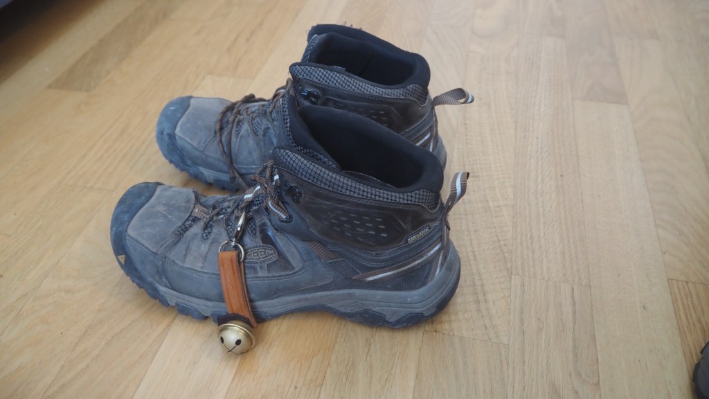
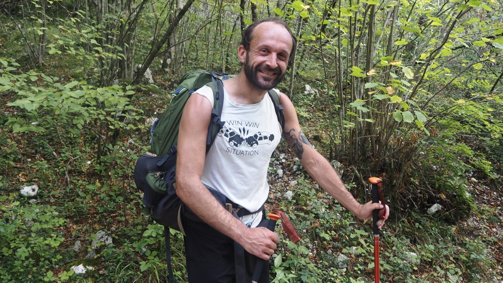
The curious thing was that while I was in this shop, for the only time in the day, my bear bells began to work. By the time I left , they had returned to form and gone silent and didn’t make much of a noise the rest of the day. I’d given up on tying them to my boots and they were back on the rucksack.

Farewell to the Soca

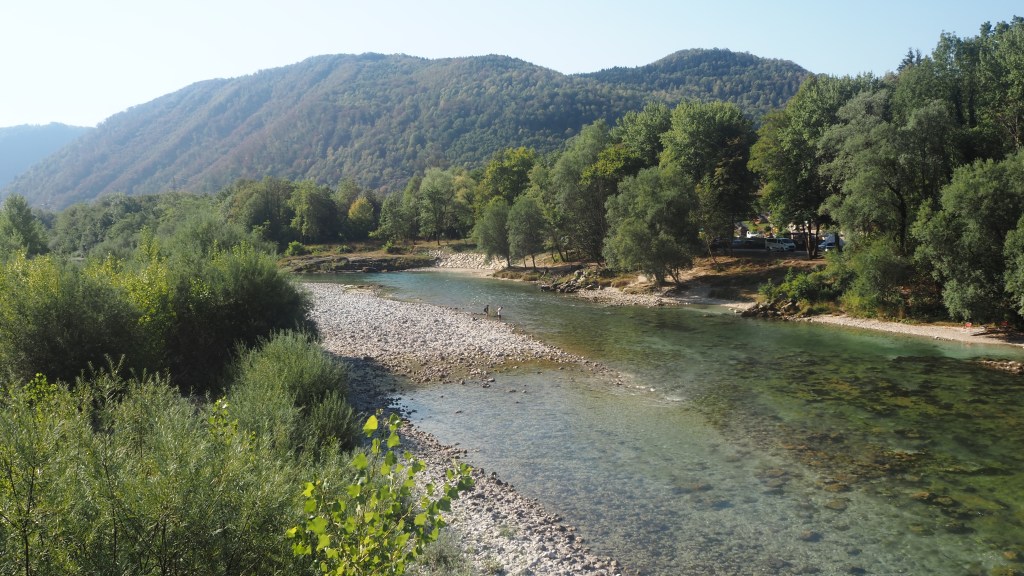
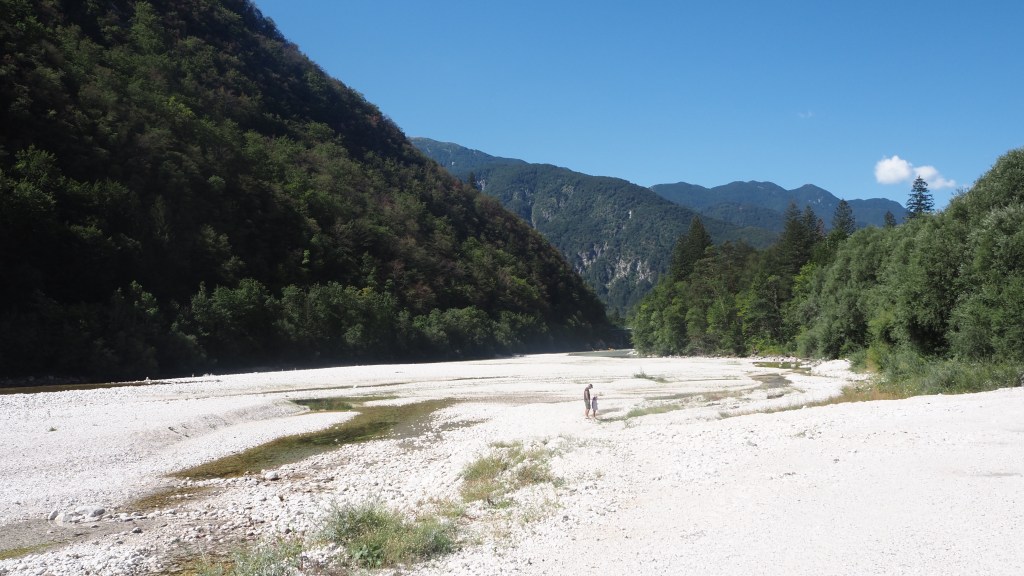
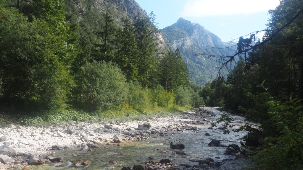
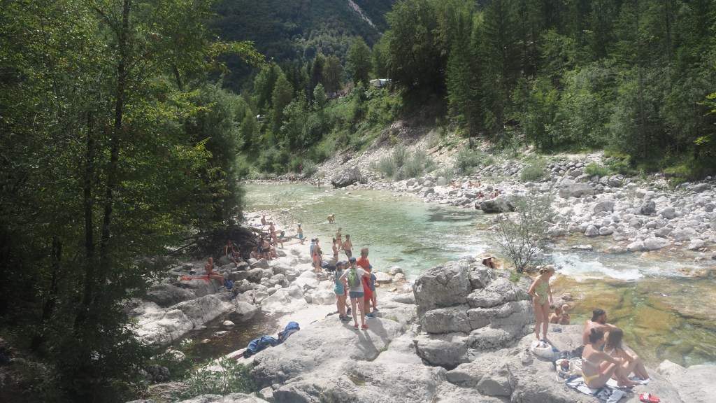
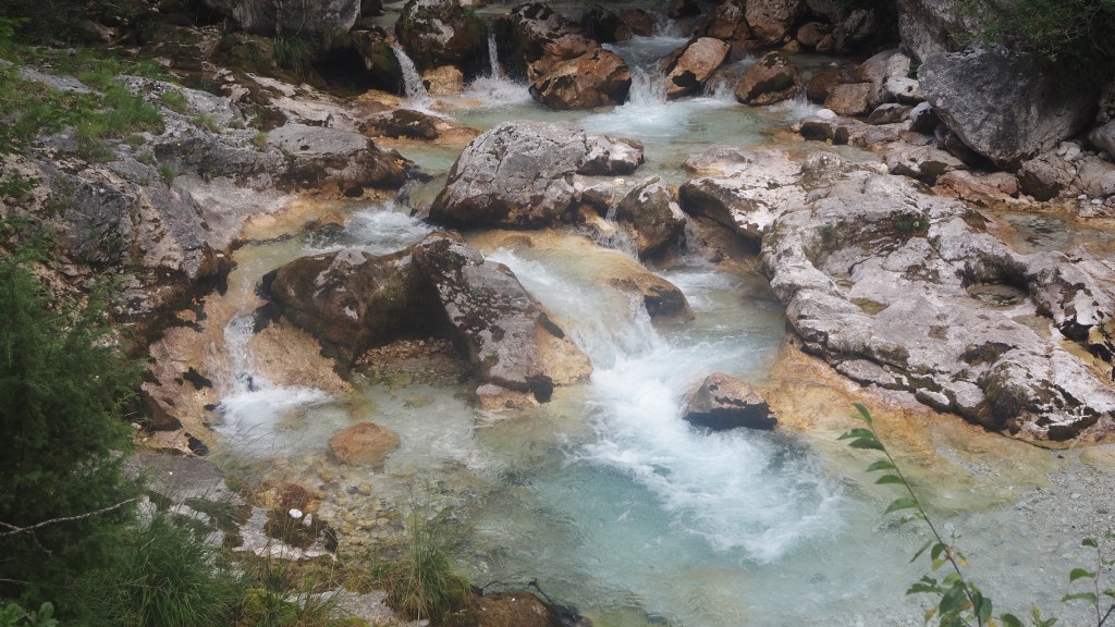
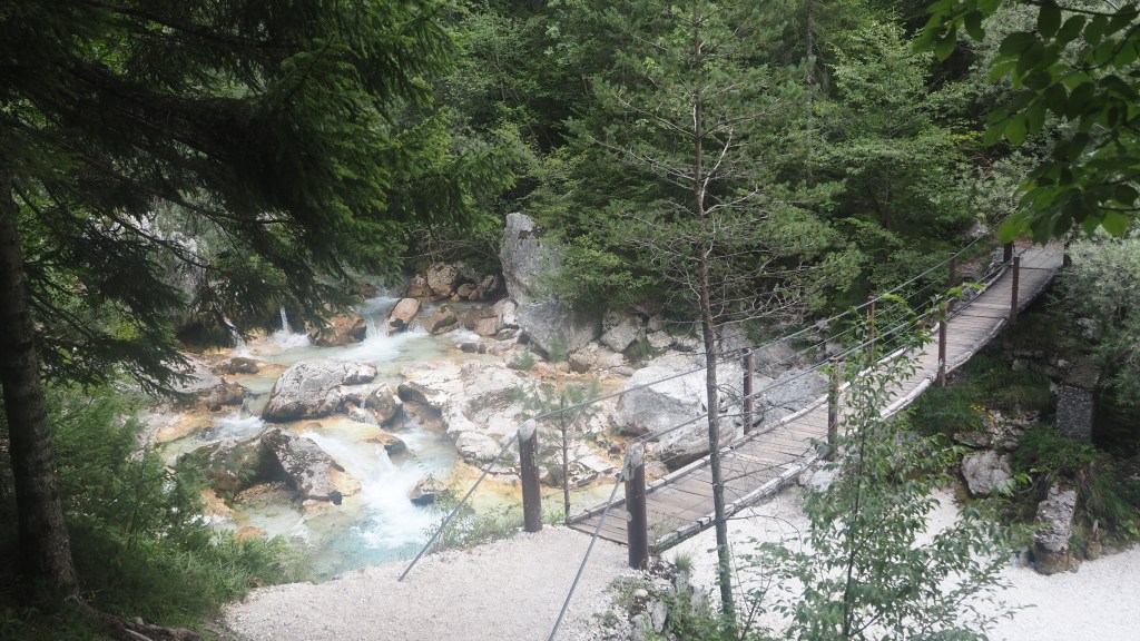
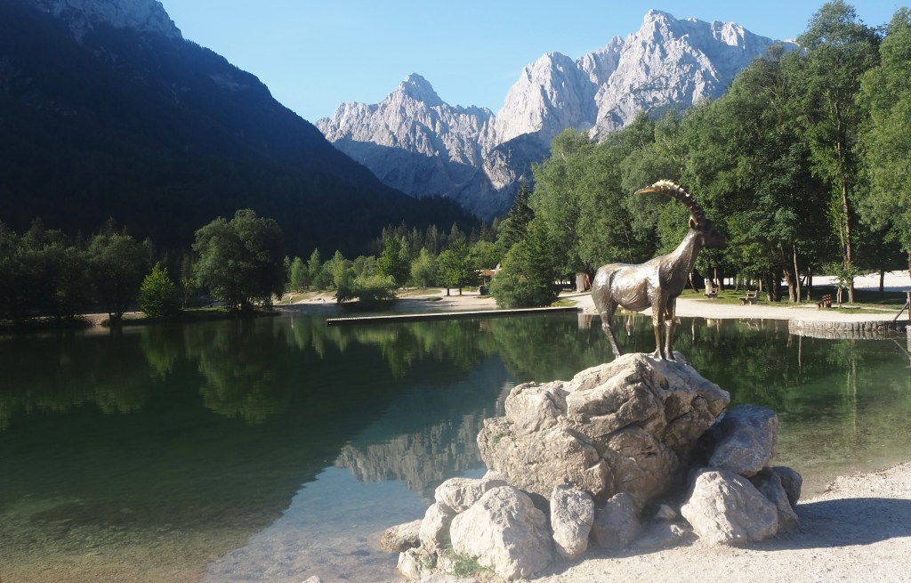
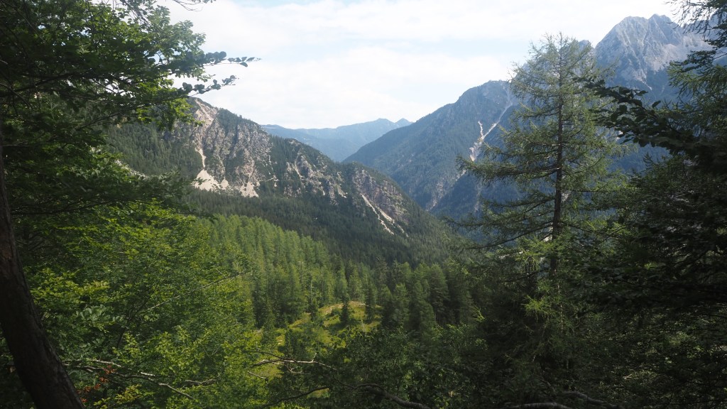
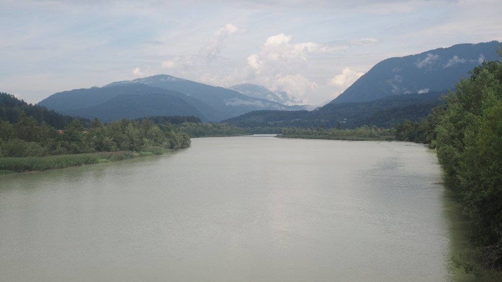
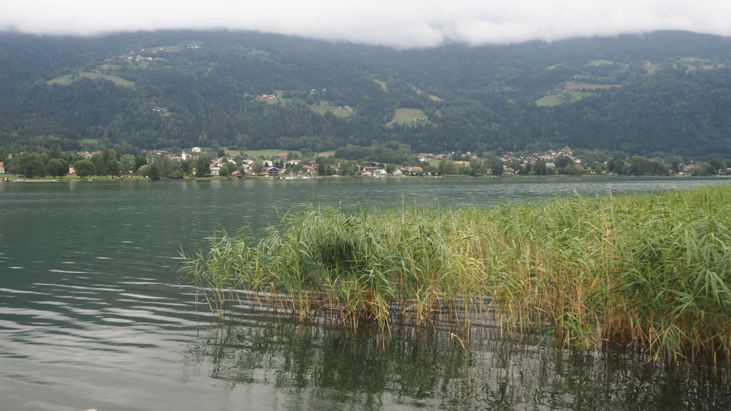
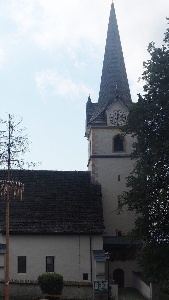
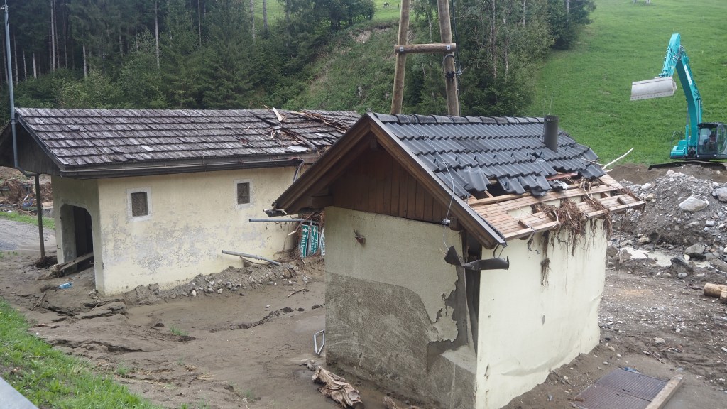
It was still not nine o’clock but it was already blazing hot outside. After an initial brief visit to the Soca, I crossed a bridge over the river, and passed through the village of Volce. Here there was a dead cat lying in the road, alway an upsetting sight and it looked recent. The owner may not have even realised the fate of their pet as yet.

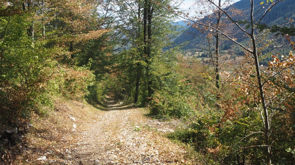
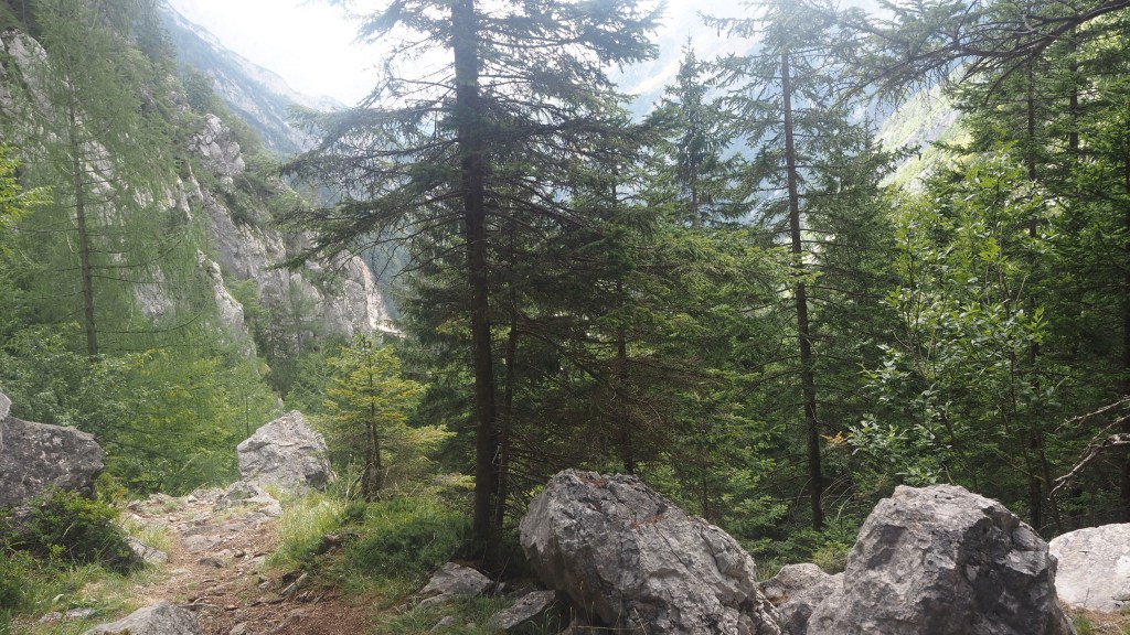
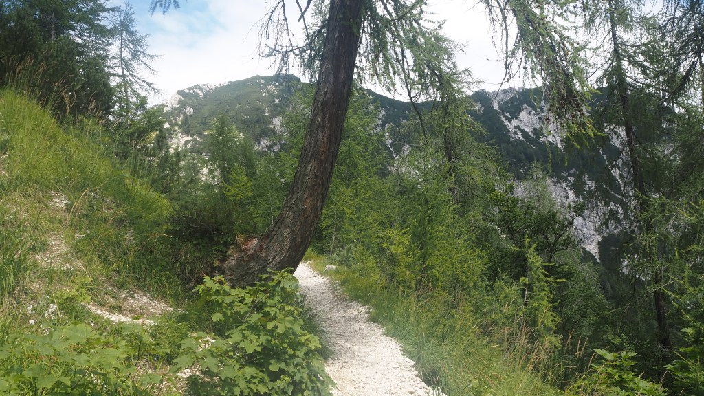
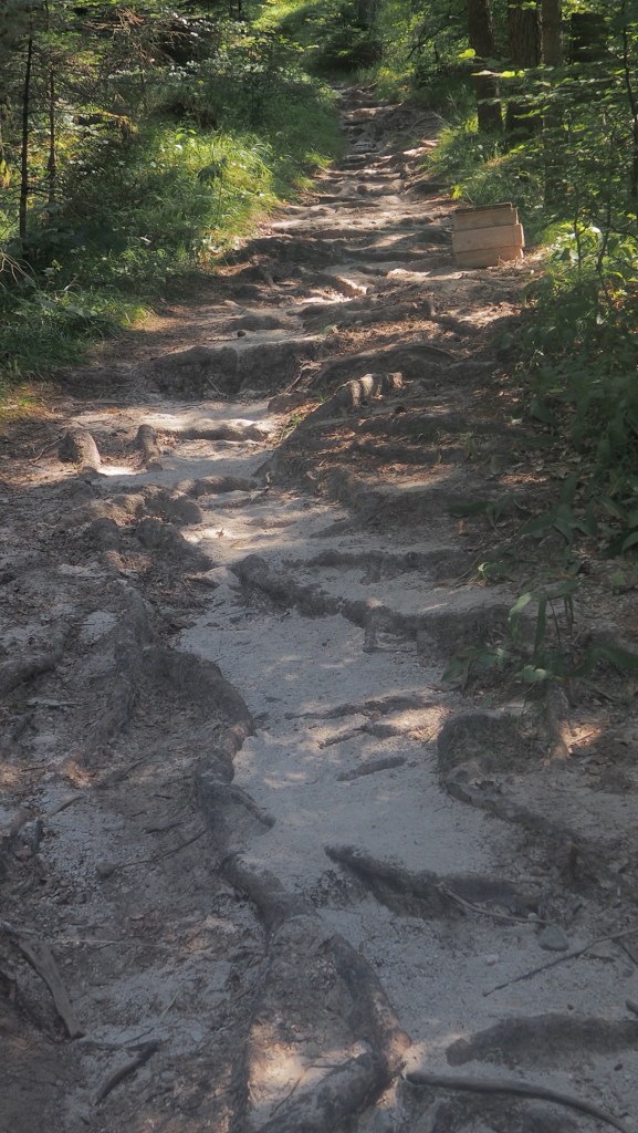
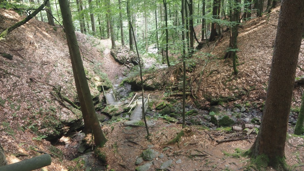
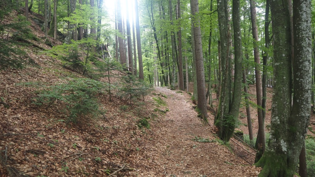
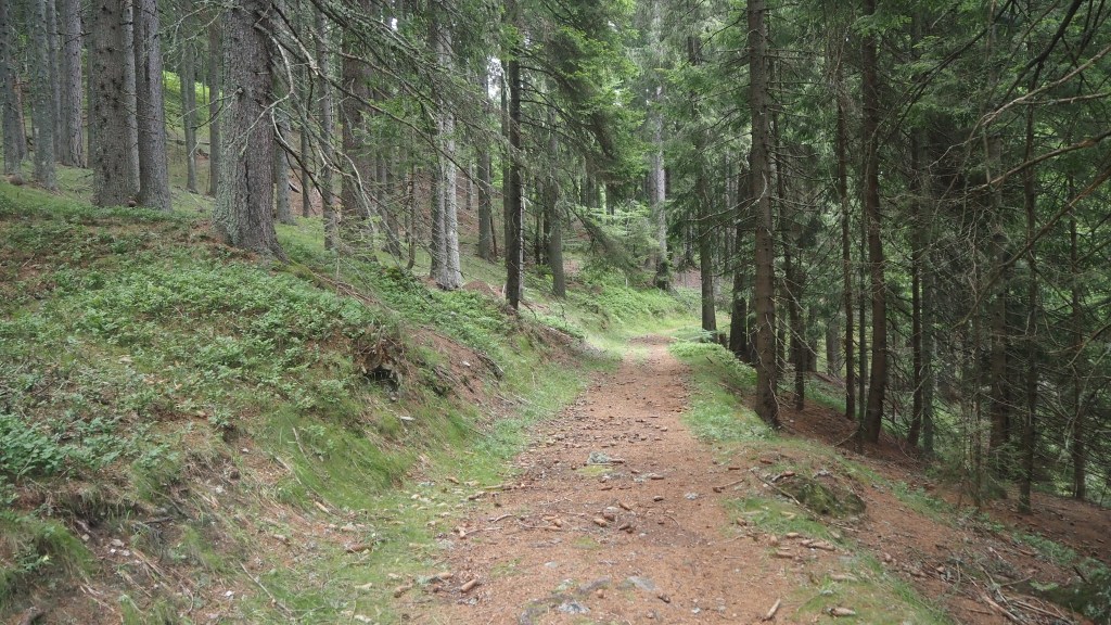
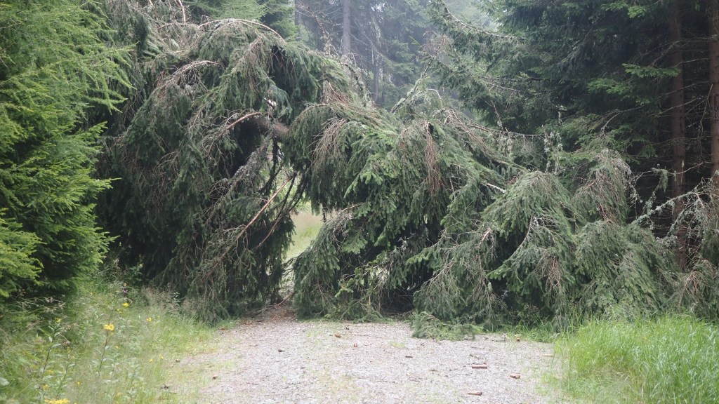
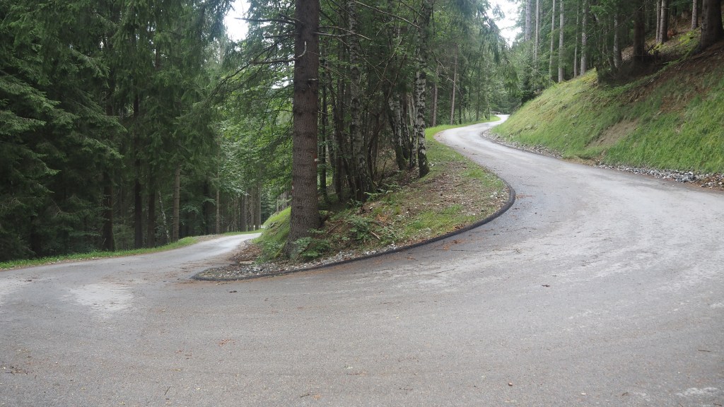
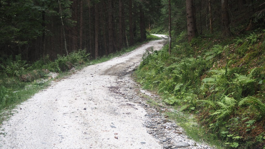
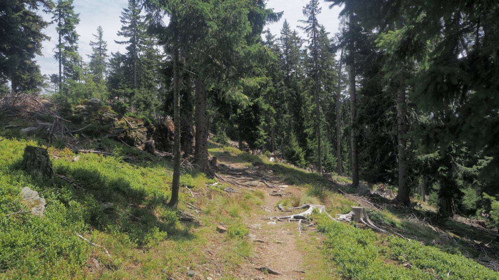
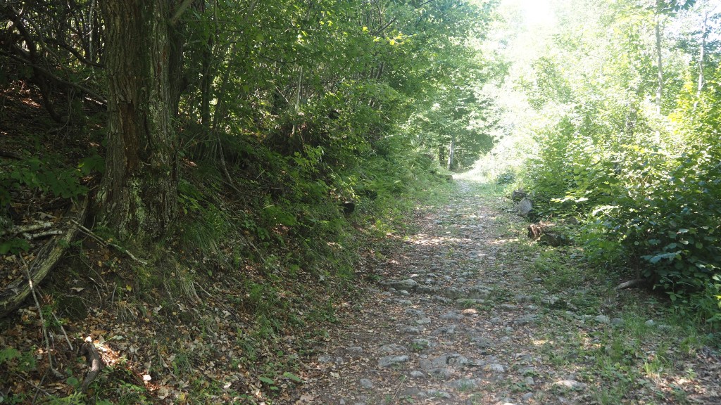
Then I followed the road beyond the village as it started climbing. The road was pretty steep, but the main problem that it was in the full light of the sun. So when eventually the route turned off up a woodland path, I breathed a sigh of relief that it was finally shaded. However, past experience should have told me by now that it was bound to get steeper now, and sure enough it did.

Part of that seemingly unending slog uphill

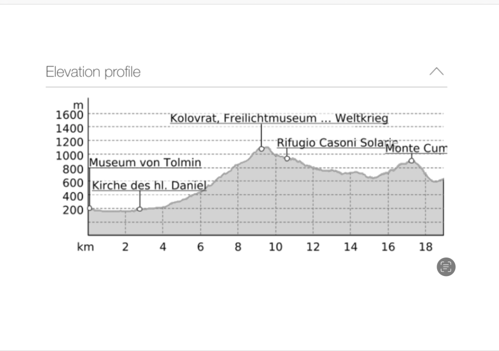
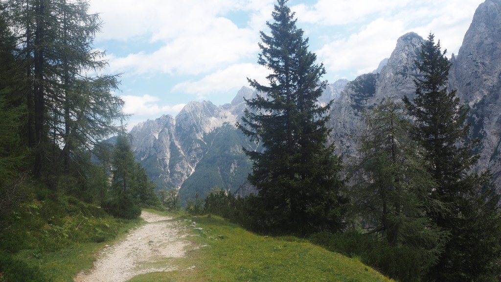
As the path climbed I got hotter, more exhausted, and dehydrated as I went on. I paused at intervals to drink some water, glad that once again I decide to take three litres with me. By about 11:15 there was a brief interval when the path met a road, but the relief was short lived as the path simply crossed it and started climbing once more. I was hot, dry, tired, and starting even to worry if I could carry on. Would I get heat exhaustion or heatstroke? I could see on the map that I would join another road before long and just held out for that. Thankfully when I reached it, it turned out to be almost at the top by the open air museum. There was a little cabin selling drinks and a shady seat to rest. So I bought another litre of water, drank it and had my lunch.

After a big effort like that morning’s walk, you feel you deserve some recognition for your efforts, but as ever there were families, older people and kids who’d just driven up and had no idea what I’d put myself through ( and if they had would probably just have thought ‘mad dogs and Englishmen’). I had definitely made a decision though, that I wouldn’t be climbing the next little peak, Monte Cum, which was ahead on the course of this stage of the route. Especially as the lady selling drinks in the cabin had said that I could just walk down the road.

View across the Slovenian side from the open air museum at Kolovrat, showing the Soca winding across the landscape

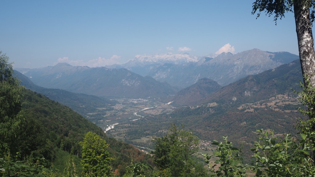
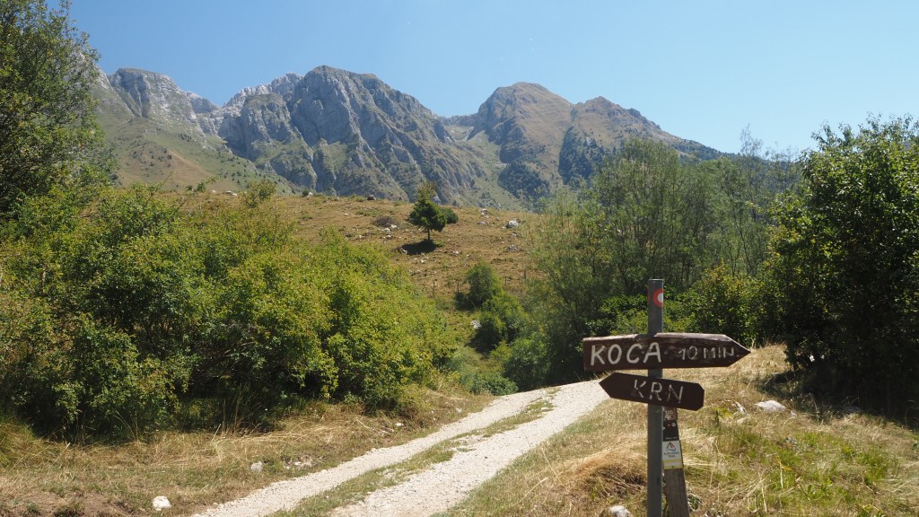
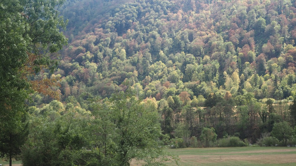
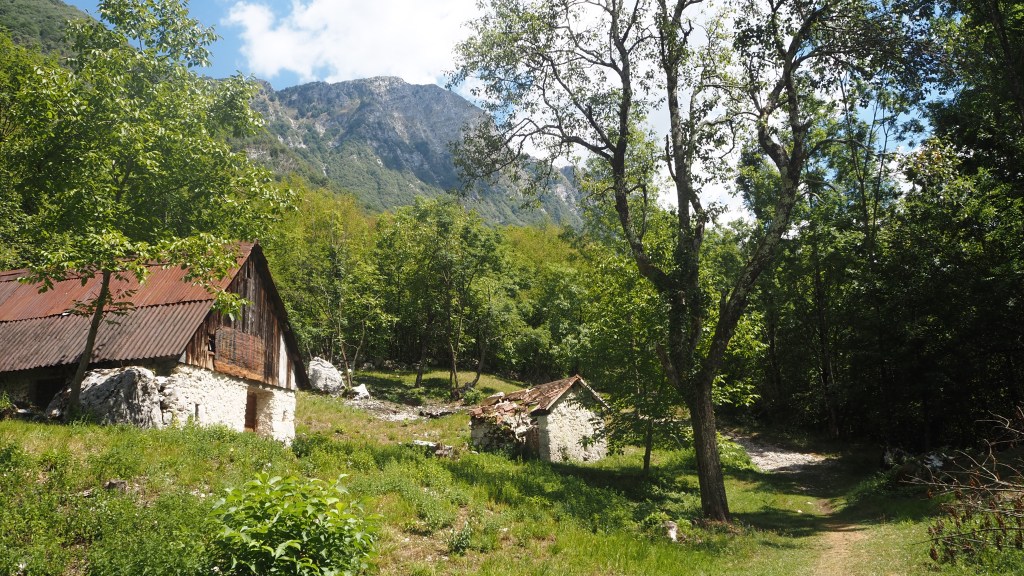
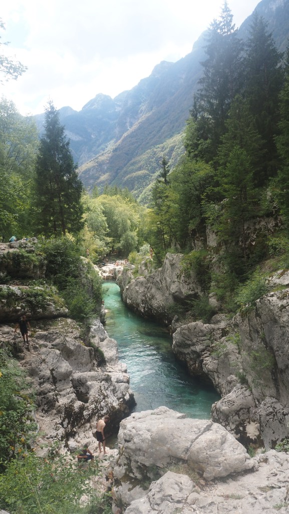
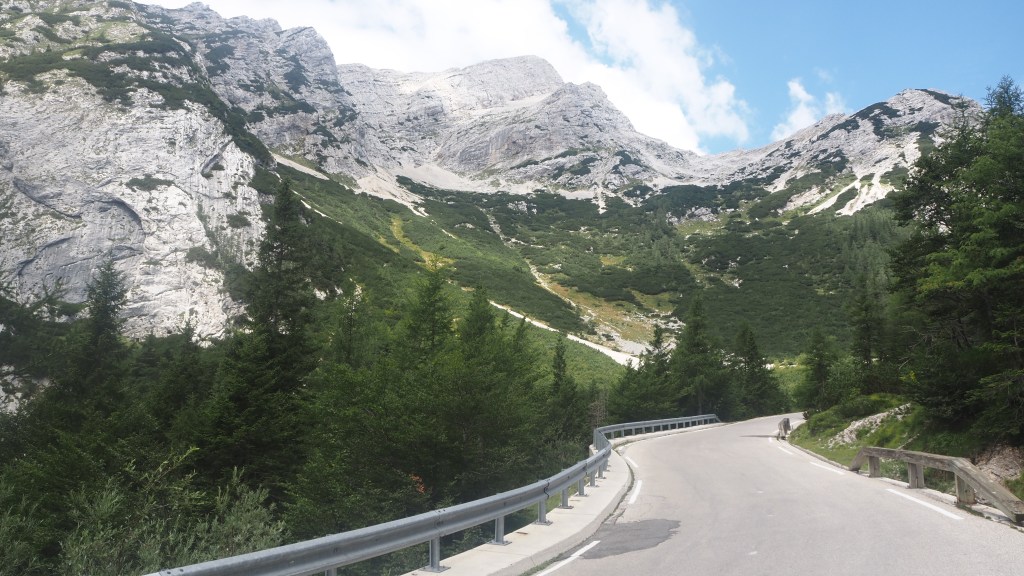
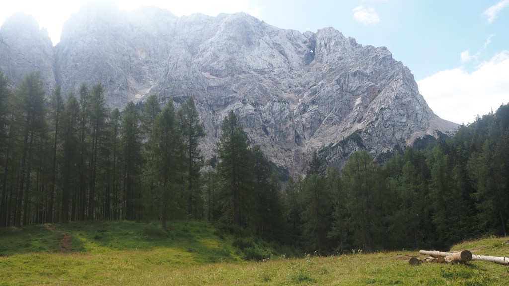
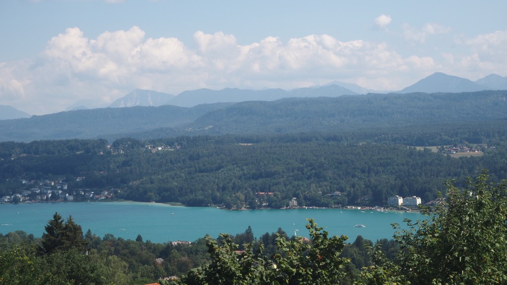
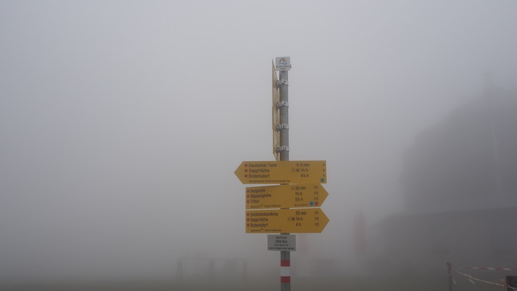
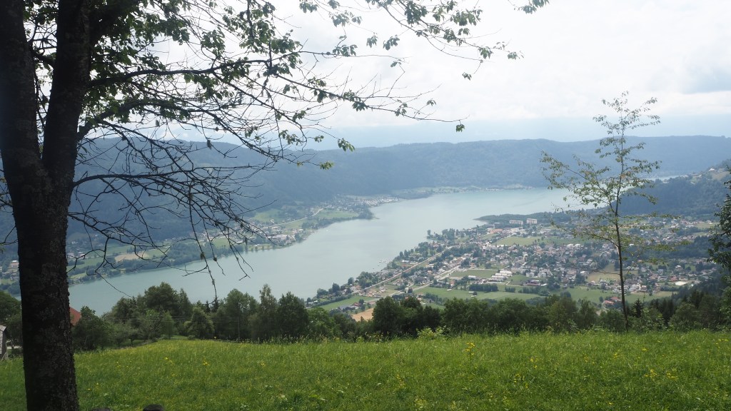
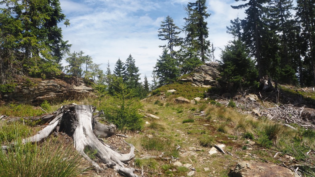
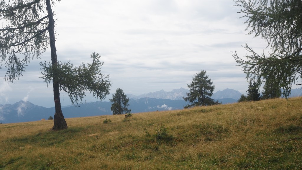
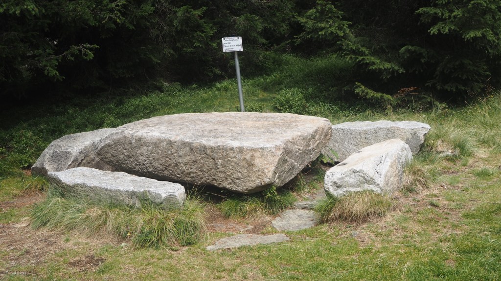
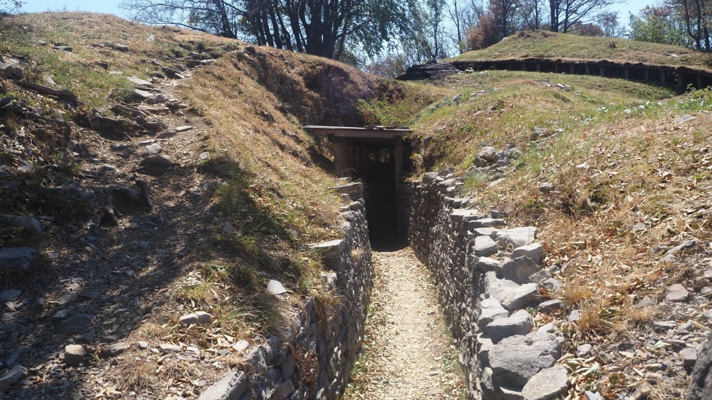
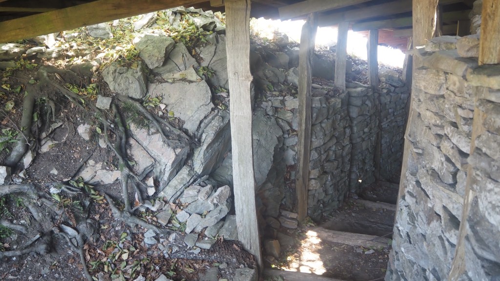
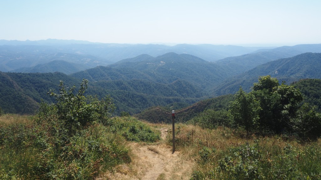
Anyway, suitably recuperated I had a chance to take in my surroundings. Apart from the stunning final views back to the Soca and Slovenia, I was at the site of the Kolovrat open air museum, where Italian troops had dug trenches and battled against the forces of the Habsburg empire during the First World War. A number of the trenches had been restored, and in fact the continuation of the Alpe Adria Trail actually took you through them.

I find these sorts of places fascinating, but also strangely sanitised and unreal. We all know that when inhabited they would have been filthy and flooded, running with vermin, and those serving would be battling not just for their country but for their own lives, having no idea whether they would survive. Now where these battles had been fought were just pieces of wood, sandbags, and channels in the ground, and you had to use your imagination to envisage how they had once been.

A trench at the Kolovrat open air museum just inside the current borders of Slovenia
Inside a trench

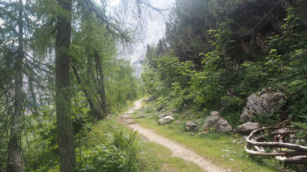
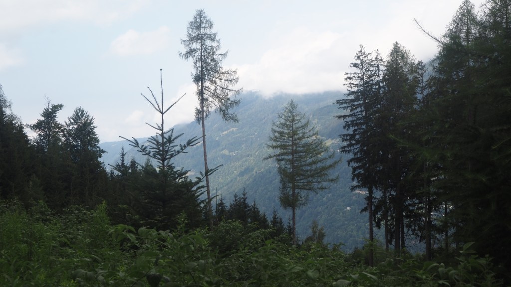
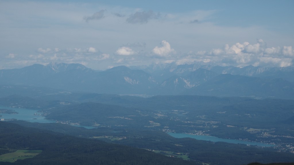
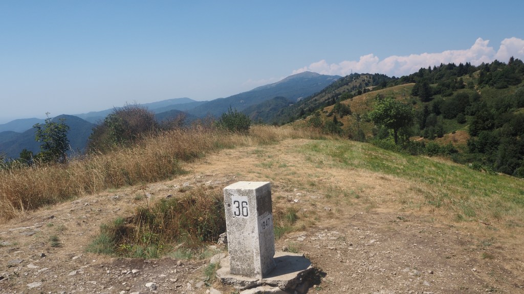
After walking though some of the trenches, the path took an upward turn to reach the actual current border between Italy and Slovenia, on the crest of the hill at Na Gradu/Monte Poclabuz. You could see here the Italian side for the first time, and what immediately struck me was how wooded it was. Apart from a sign and a telescope, there was barely recognition that this was an international border, fought over in the past, and even forming the boundary of Churchill’s ‘Iron curtain’ later on.

The inauspicious border, with Italy on the left and Slovenia to the right.

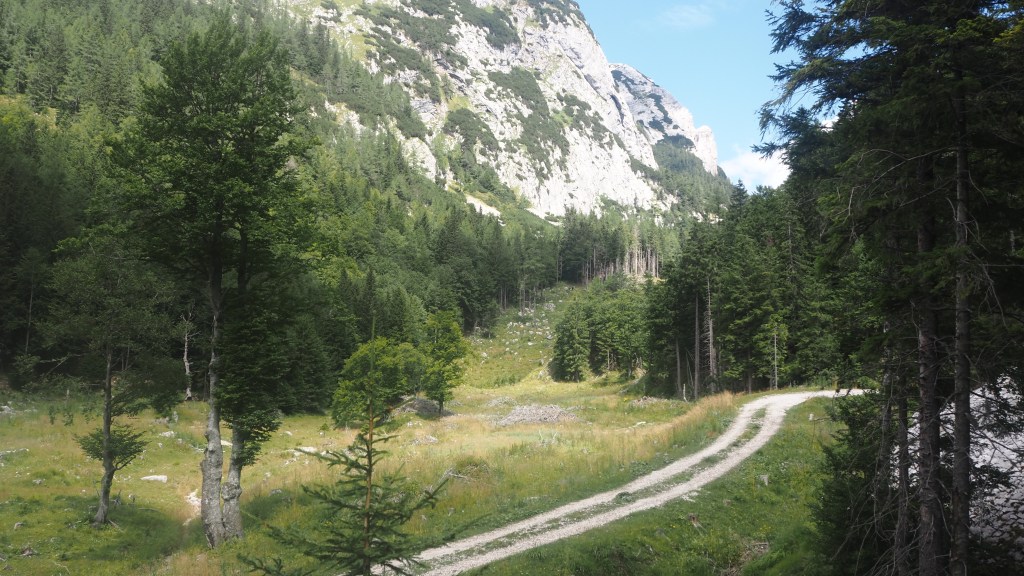
The route downhill was steep, and I was soon wishing it was over. Luckily I could see where it joined the road and it wasn’t far, but I took my time to descend not wanting to have an accident after getting so far on the trail already. On reaching the road, that decided it for me, I was sticking to the road, apart from the occasional short cut.

First look down into northern Italy

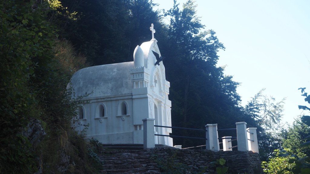
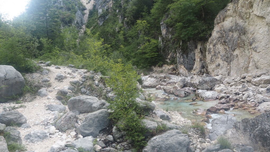
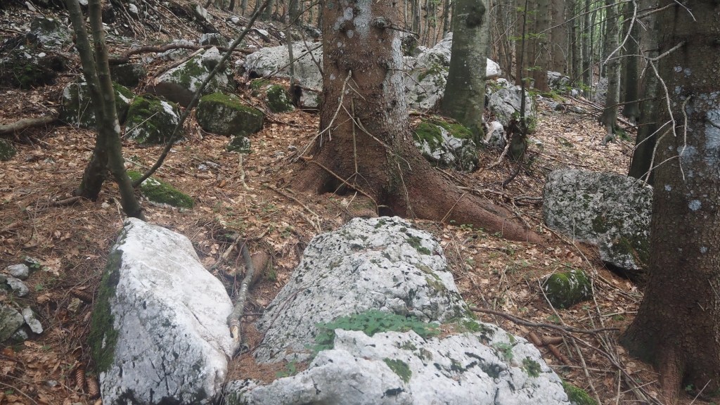
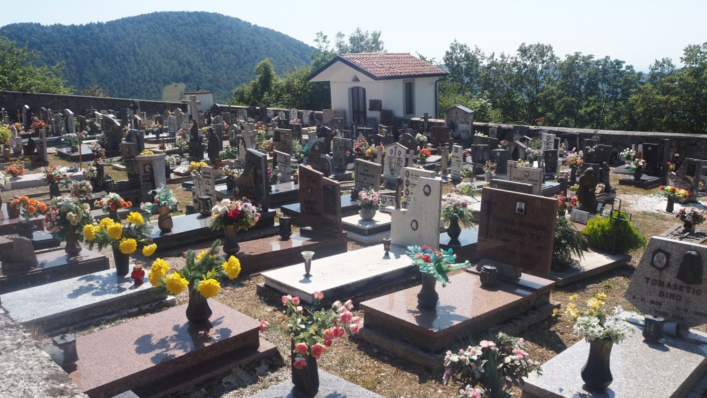
I passed through my first Italian village, Ciabuzzaro, and thought I’d take the AAT bypassing the village of Prapotnizza. But this led up and then just seemed to peter out, so I returned to the road. The second short cut was more successful, again on the AAT proper and led past a beautiful cemetery and chapel. I took the track downhill from here and then started noticing deposits on the ground, which didn’t look like they came from horses. Bear scat maybe? I hurried back to the road and stayed with it after that, particularly avoiding the climb to Monte Cum.

The colourful and well maintained WW1 cemetery near San Volfango

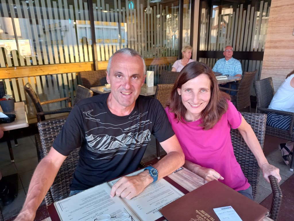
In fact the road was incredibly quiet, with only one vehicle every ten or fifteen minutes, and it was mainly level too, with plenty of shady stretches. So I was very glad that I’d taken it, especially when I later heard from fellow AAT hikers, Johann and Marianne, that it was hard work for little or no benefit.

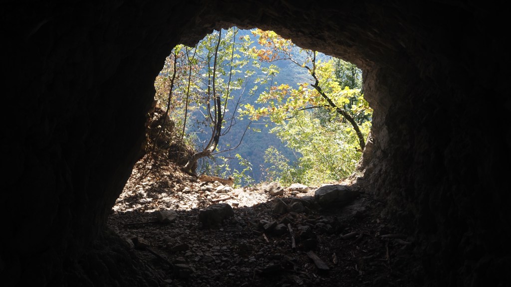
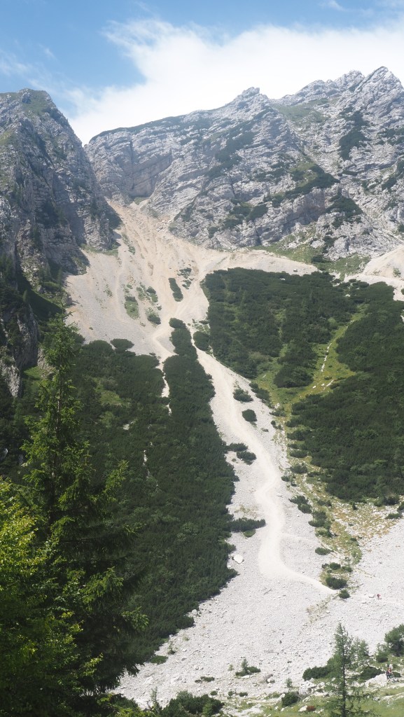
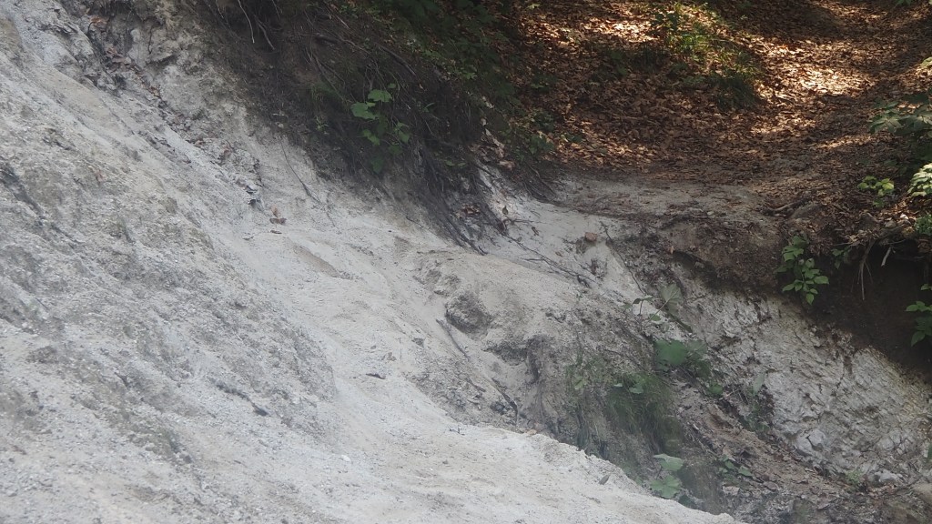
The road had obviously suffered from rockfalls, as sections of it had metal netting to prevent small bits of rock crumbling away and falling onto the road. There was also two or three caves in the rock alongside the road, where the rock for whatever reason had been eaten away.

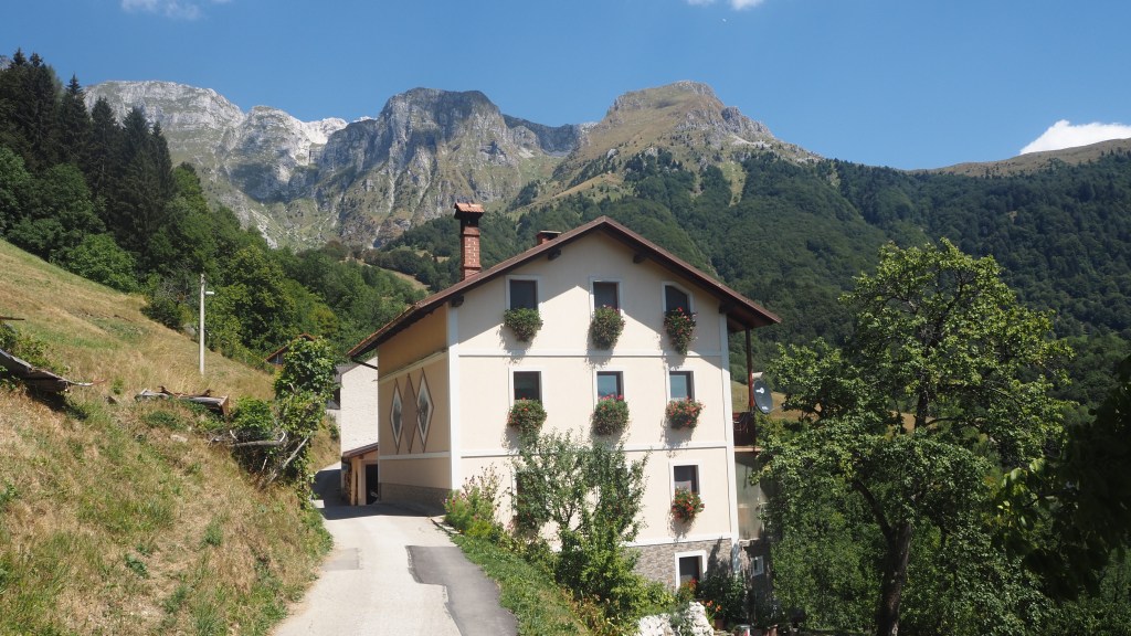
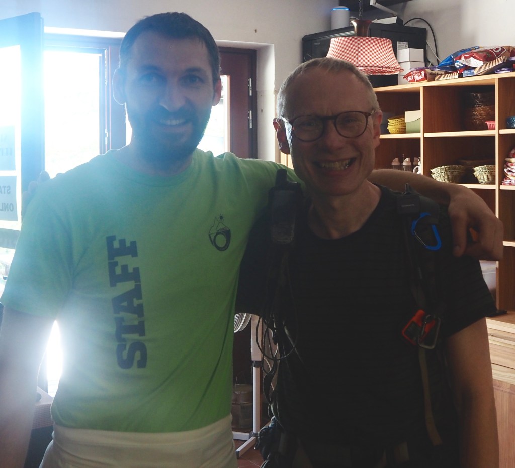
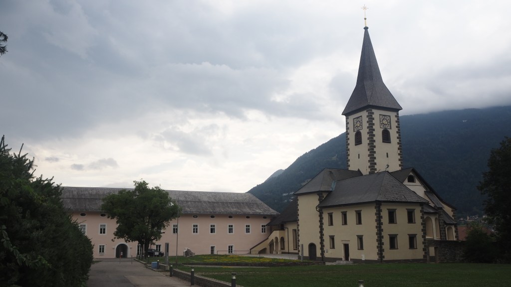
Finally I arrived in my first Italian stay of this trip, at Tribil do Sopra, a little village. I hadn’t actually appreciated from the booking that I’d made that I was staying in a hostel. My room actually had four beds, but I had the room all to myself and the showers were down the hall. But the dinner was nice and the staff friendly so I have nothing to complain about.

Tomorrow is my seventh day of walking in a row, but my guidebook promises although it’s long that the height gain is less and it’s easier. I hope that proves right. I’m really beginning to need that day off.

Today I walked a little longer than expected taking the road part of the way. Distance walked was 24.13 km or 15 miles. Cumulative distance walked now 522 km or 327 miles
Today I ascended 1116 metres, less than the 1300 or so if I had climbed the second peak. Cumulative ascent now 18772 metres. Descent was 701 metres, making 20073 cumulatively

Hiking the Alpe Adria Trail: Day 26

If you’ve been reading the blog of this trip from the start you may remember I said there were five days on the trail classed as difficult by my guide book. The first, Day 5, was certainly difficult for me, as I can’t forget arriving at the hotel throughly exhausted at 7 pm in the evening after about ten hours walking. Fate, in the form of the weather, intervened to mean I missed two more of the ‘difficult’ days, and I chose not to walk across from Austria to Slovenia on day 22, a fourth of the five. So that left only one ‘difficult’ day left, today’s walk. With temperatures forecast to hit 34 C and a lot of climbing and descending involved, naturally I was a little apprehensive about what was in store.

The Italian chapel at Planica

I needn’t have been. The climb up, although reasonably tiring, was in the shade, and more or less all over by 11:30, when I reached the little white Planica chapel, built in World War I in memory of Italians who died on the Isonzo front. There then followed a walk through woodland, and it was at this point, not having seen anyone at all, that my mind turned to the potential danger of bears.

Apparently Slovenia has one of the most thriving brown bear populations in Europe, thought variously to number anywhere between 500 to 1000 individuals. Now I’m not sure where they all live, but in my mind it’s bits of woodland or mountainside where there aren’t many people. And you’re always told don’t surprise a bear. Of course, if you walk on you own you can often be pretty quiet, so best to try and make a noise. After worrying about this on a trip three years ago to Slovakia, also home to many bears, I’d invested a couple of euros in a set of bear bells that I could hang from my rucksack.

On Monday I’d tried using them for the first time. Without much success I have to say, and today I thought I’d have another go. Now it’s probably because I bought some cheap tourist trinket, but these bells don’t seem to want to make a noise. In fact you had to violently shake them to get them to make a sound at all. So I tried tying them to my rucksack, but realised that didn’t move enough, or touched something to dull the noise, so it was going to have to be legs or feet. I didn’t really have anything I could attach them to on my shorts so I tried my boots instead. But then I had to make sure they weren’t too loose that I tripped over them. And even with them tied to my laces, I found that they only really made a noise if I flicked my foot as I walked. Which was a bit of a pain to be honest. I felt a bit like a failed Morris dancer.

The particularly useless bear bells, tied to one of my boots

So it was back to plan B. Which involved singing, humming or making a noise. For some reason when I’d done this before I’d found myself singing ‘Colonel Bogey’ (must be a peculiarly British thing I guess). So that’s what I did. Until I emerged into a cattle field and didn’t think it was necessary any more. Luckily later in the day, when again in the forest, I seemed to be making so much noise crunching dry leaves, rocks and clicking my walking poles, that I thought I could dispense with the singing and the bells altogether.

When I emerged from the woods, it was to a wide ranging open mountainside with farmland around. All around the views were big and impressive, and once again were different from those on previous days. It really was beautiful. You could see paragliders launching themselves off the top of a nearby peak (last night’s hotel in Dreznica had advertised itself as a paragliding centre) and later in the day, I saw them landing near Tolmin. They seemed to be able to take their time to glide gradually downward on the air currents.

Finding myself into the sunlight I’d expected it to be incredibly hot but luckily there was a bit of mountain breeze up this high ( I was now at about 1200 metres). There were some non plussed cattle that were grazing on the trail, but they don’t seem to worry about me thankfully.

I passed a nice looking mountain cafe, Koca Kohinja, and might have been tempted to stop, but I’d brought my own lunch and knew that these places often were quite slow. But it was certainly a lovely spot, and reasonably busy.

Shortly after I bumped into the couple I’d met on Sunday walking up to Vrsic. Johann and Marianne were from Austria, and it turned out we’d been staying in the same hotel the night before and hadn’t known. They’d taken a day off earlier for a swim, and were now back on the trail. We had a quick chat and then they forged ahead, but I bumped into them again later at a restaurant, when I barely recognised them without sunglasses and headgear and they told me they’d had another swim. I expect we’ll meet again from time to time.

Johann and Marianne, who I met again today on the walk, and at the restaurant in the evening

Next, the trail led through the village of Krn, before turning off into woodland again. And the descent began. I think it must have gone on for two and half hours at least. Essentially plodding along this one path that gradually descended. It was semi shade most of the time so wasn’t too bad, and I’d did as I planned and taken three litres of water today, which turned out to be needed.

House at Krn

There weren’t that many notable features on the way down and you couldn’t always see much of the view around. At one point I passed a waterfall, and then an unusual little viewpoint, just off the trail, down to the Soca valley, where you had to look through a hole in the rock to see it below.

An unusual viewpoint
The long walk down

I also couldn’t help noticing the dry, crispy leaves underfoot, and looking across at the tree covered hillsides, that the leaves of some were already turning red and brown even though it was only early August. It can only be yet another effect of manmade climate change, I would think, as I’m sure that’s not usual even here.

Foliage showing trees turning red and brown and it’s still only early August

After a quick stop for an ice cream at camp site, there was a further three or four km into Tolmin. Although this was on flat easy roads and paths, down on the valley floor the temperature was much hotter and there was hardly any breeze compare to up higher. So I arrived in Tolmin, tired and hot, for my final overnight stop in Slovenia, by about 5 pm, and the bliss of an air conditioned hotel room.

Today I walked 24.83 km or 15.5 miles. Cumulatively I have now walked 498.8 km or 311 miles

Tomorrow I’ll cross into Italy, and it should be an interesting day of history and borders, as well as the usual fine scenery I’m sure. Plus the last big, 1000 metre plus climb of the trip.

Todays gross ascent was 744 metres, making cumulative ascent of 17656 metres. Gross descent was 1089 metres, making a cumulative total of 19372 metres

Hiking the Alpe Adria Trail: Day 25

Undoubtably this was the hottest day of my trek so far, with temperatures climbing into the upper 20s and lower 30s rapidly. After the exceptional scenery of the last two or three days, it was a bit less dramatic, and in some ways a little disappointing, as I had hoped for another day alongside the Soca as nice as yesterday’s. That was probably expecting too much. While today the route did follow the river for much of the day, a lot of the time the Soca was tantalisingly hidden behind shrubbery even when it was close.

Village outside Bovec

From the start in Bovec the trail led me through farmland and then woodland, providing welcome shade, but some slippery footings where the sun hadn’t yet had the opportunity to dry out the ground under the trees. There were options slightly off route to visit a couple of waterfalls, Slap Virje and a little later, Slap Boka, and had it not been so hot already, and the detours not involved additional hills, I probably would have visited at least one of them. But I was keen not to have another really long day, especially in this heat, so instead stuck to the basic route.

The mountains reflected in a reservoir

A reservoir provided perfect reflections of the mountains, and then I followed the route down to the Soca, for the first time today, also following part of the Narnjia trail, which takes in some locations used in the shooting of the Narnia movie ‘Prince Caspian’, back in 2008.

‘Narnia’

Alongside the river was a vast spread of white rocky ground, some of it no doubt, normally underwater. This white rock, as I found out throughout the day, reflected the heat and, away from any shade, made it particularly hot and dry to walk amongst.

I should take back what I said in a previous post about trail signage in Slovenia, because on this stage of the route there were clear yellow signs at almost every path junction. The only real confusion came around the turn off for the Boka waterfall, where the signage, which I followed, seemed not to have been updated to reflect the route on the app. I followed the signs and stayed on the north side of the river, following the Juliana Trail, whereas the revised version, on the app, would have taken me across to the other bank. Whether it would have been any better I’m not sure.

A rare view, through the trees, of the Soca on today’s walk

The route I took led me through the little village of Log Cezsoski, and along a farm track with views of the mountains around. It was pleasant at first, but then as it approached the Soca, it started followed a long stretch of unshaded white rocky trail, which because it was shielded by undergrowth didn’t actually allow you to see hardly any of the river itself. For the next couple of kilometres all you could see were the bushes either side of the path, and they didn’t even seem to provide any of the much needed shade.

Luckily a bit later along, the path did go back into woodland, which gave some welcome relief from the unrelenting sun, although the surface underfoot then became so rocky and uneven it was like walking on railway ballast.

Just as I emerged from the woodland, a familiar figure approached. It turned out to be Thomas, the guy from Hamburg I had met a couple of days before shortly after the Vrsic Pass. He’d managed to find a spot at a camp site last night even though they’d told him initially they were full. He was still planning to go the Tolmin punk rock festival, but had decided to spend a couple of days in Ljubljana beforehand meeting friends.

Thomas, from Hamburg, who I’d met twice on the trail

To be honest, I’m a bit envious of people like Thomas’ ability to be so spontaneous. I sometimes wish I was able to do that sort of thing rather than all the pre planning months ahead that I always feel is necessary. Unfortunately I think you just need to be a different sort of person and a bit more relaxed about the risk of things going wrong than I am for it to work for me.

Thomas was continuing on the Juliana trail, along the Soca, and we parted ways when the AAT sign to Dreznica pointed uphill. My route then started to climb modestly for the rest of the afternoon.

Farm buildings alongside the path

By this point, the heat was really starting to get to me and I was conscious that the two litres of water I had brought today wouldn’t last much longer. So I tried to walk a bit faster as the route turned to road and became easier underfoot.

And then, just at the point I was almost out of water, in the village of Magozd, when I had probably at least another half an hour before the end of the days’ walking, I saw this enticing sign pointing down the hill saying, in English, ‘Fresh drinks, 100 metres’. This I couldn’t resist, so I followed it, thinking it would lead to a bar or cafe.

Fresh drinks- who can resist?

But there was no evidence of any such place, only another wooden arrow with ‘Fresh drinks ‘ which appeared to point to a house. I rang the doorbell, and a young woman answered and pointed me to a tree and a bench in the garden, by the second sign. She said ‘help yourself’.

Drinks in a tank. Believe me, there were a lot of wasps here.

By the tree, in an open tank of cold water were dozens of coke cans and a few bottles of water. Unfortunately, though, swarming around the drinks were also twenty or thirty wasps. Having made the effort so far and being so thirsty, I didn’t want to give up now. So, improvising, I delicately used my walking poles like chopsticks to pick a bottle of water out of the tank without getting stung. After two or three attempts I amazed myself by actually managing it and whisked the bottle quickly away from the wasps, before pouring the contents into my own water bottle. I could have easily drunk another, but I didn’t want to push my luck a second time. There was an honesty box in which to put some money, so that was the least I could do.

Dreznica church

Actually after that I wasn’t far away from my destination, the village of Dreznica. But that extra half litre of water really did help. Tomorrow I think if the temperature stays this high I may have to carry three litres with me, just in case. It’s probably not likely that I will find another kindly local leaving out drinks for passing hikers like I did today.

Todays walk was 24.08 km or 15 miles. Cumulatively I have now walked 474 km or 296 miles
Today’s gross ascent was 623 metres, bringing the cumulative total to 16912 metres.

Hiking the Alpe Adria Trail: Day 24

It’s difficult to write a daily blog without drifting into clichés and repetition. But today’s walk really was superlative. I was following the Soca valley all day long, which lies within Slovenia’s Triglav National Park.

Unlike the majority of the days hikes so far, this wasn’t a big climb or descent. Nor was it a gentle flat walk along a river bank, although I did follow a river almost all day. I started back in Trenta, after being driven back there from Bovec.

Morning in Trenta

At first the views of the river Soca were fleeting, and when you saw the river its water level was clearly very low. The path wandered behind trees and sometimes a little bit away from the river, and over the course of the day to and fro, up and down, along stony paths, through little bits of woodland, sometimes a few metres from the river, sometimes a bit further away, occasionally along the roadside.

A view of the Soca in the early part of todays walk

Last night I’d been woken by thunder and lightning, and while it stayed dry almost all day, during the morning in particular, the rocks and tree roots I walked over were incredibly slippery from last night’s heavy rain. This slowed me down, and I have to say as the day progressed and I became a little more tired, it was evident I was slower than almost everyone else, as I kept stepping aside to allow others to overtake me.

The trail, on the left, close to the Soca, which at this point seemed be almost dry

This was actually the first time on the route, apart from little interludes like the Austrian lake towns or the very top of the Vrsic pass, where there was a flow of people all day. Most seemed to be young couples or families. There were people with dogs, people out for a swim, and judging by what they were wearing, this was the top attraction. There were a few hikers, with all their camping gear on their backs, and a group of scouts, but most were probably just walking a little way to find a spot to swim or sunbathe, if their lack of apparel was anything to go by.

The river at first seemed incredibly dry, at times only a couple of metres wide and not very deep. Maybe it was the tributaries that fed into it that built up the flow, or perhaps the river split at points into more than one channel, but it did seem to gather more water after the first few miles until it at least looked like a river, although you could see it was low.

One of several suspension bridges over the Soca I crossed today. They were a prone to wobbling in the middle

Along the route today there were probably half a dozen river crossings, including a few suspension bridges, as the path crisscrossed from one bank to the other. These were always a bit of fun, and a great spot to take pictures up or downstream. Most were a bit on the wobbly side, so if you stood in the middle to take a photograph you needed to hang on, particularly if someone else was crossing.

By lunchtime I’d arrived at the first really popular spot, by the Jelincic cafe. Here lots of people were gathered on rocks, swimming and generally lounging about. The guidebook mentioned a shady seat under a tree, and I was lucky enough to grab it for my lunch spot.

Shortly after, continuing the walk, the river suddenly narrowed into a fast moving gorge, hemmed in by deep cliff edge rocks. This highlighted the turquoise of the water even more.

The Soca gorge

At one point the two sides of the river were only a few metres apart, but the drop to the river was so great you couldn’t even see it. And then the river opened out again, providing mini beaches and slabs of rock for people to lie on, near Podklanec, where soon after the ‘tributary’ (now dry) of the Lepenjica met the Soca.

Bathers at the Soca, near Podlklanec
A bridge over a dry tributary of the Soca, the Lepenjica

A little diversion away from the river followed, but before long I was back, following more tree root lined paths up and down close to the river bank. Eventually the path led over another bridge to a large camp site, before diverting up a short, steep hill and the path to the town of Bovec. Tomorrow I’ll be following the Soca again, continuing downstream from Bovec to the village of Dreznica.

Bovec

Bovec is actually quite a holiday hotspot, probably smaller than Kranjska Gora, but feeling more crowded because of that. All around are shops advertising water based activities, and plenty of lively cafes and bars. So you can see why if the water becomes too low to allow those, it will hit the town hard.

As for myself, a month in to the trek, the cumulative fatigue is beginning to kick in. I’m going to sleep instantly in the evening (I was almost falling asleep when I wrote yesterday’s blog post last night), and this morning I still felt tired when I woke up. The next few days are all quite long and after another day along the Soca tomorrow, there’s going to be a return to the longer ascents and descents. I know I can and will manage to carry on, and will enjoy the scenery, but keeping going will be hard at times and I expect some long days. I seem to be eating a lot and frequently but still burning it all off. Luckily my feet seem fully recovered for now, and my calves seem to be building up in strength.

What has been fantastic has been having so many and frequent messages of support and encouragement from everyone- friends, family, neighbours, former colleagues and fellow hikers. The response has been phenomenal and have really kept me going when I’ve been at a low ebb. Thanks so much to everybody for your continued support. I’m now well over half way though the hike so the end is, if not in sight, getting ever nearer. And I’m determined to make it through if I possibly can.

Today’s walk added 25.8 km (or 16 miles) to my total, bringing the cumulative total to 449 km or 280 miles
I walked downstream today, so the general direction was a gradual down, apart form the walk into Bovec at the end. Total gross ascent was 406 metres, and descent 627 metres. Cumulative ascent now 16289 metres, descent 17748 metres.

Hiking the Alpe Adria Trail: Day 23

Well amazingly, someone found my phone. And thank you Benjamin, the chef at Postarski Dom na Vrsicu, for reuniting me with it. It’s always a horrible feeling when you lose something important and really reassuring when kind people make that extra effort. Thanks too, to my wife Jeni for finding this out. And to whoever it was that found it and handed the phone in to Benjamin.

Benjamin, the chef from Postarski Dom, who reunited me with my phone.

So after that happy start to the day, I continued on my way. Down the southern side of the Vrsic pass, where the traffic was quieter than the way I had arrived by bus (this morning having the added hazard of two cows on the road half way up).

I knew I had to turn off right, but I must have missed the correct turn off because the little path I took wasn’t really a path at all. I could see the actual path below but the way I took was, in reality, just clambering down grassy rock. By the time I realised I’d made a mistake it was too late to turn back. Then two women passed on the actual path below and asked if I could manage. I did, just about, but felt a bit of a fool. The correct way they had taken was probably obvious.

The quieter side of the Vrsic Pass

Once on the right track, I started descending, and as on the other side of the pass, the views were to die for, although, as with any mountain pass, very different in character to the other side. Bit by bit I descended below the tree line and into thicker woodland.

I realised at this point how much more sparing they seem to be with Alpe Adria trail signage in Slovenia than in Carinthia. So far it hasn’t been a problem, partly because I have guidebook instructions and gps. But there is nothing like the assurance you get from a sign to know you are going the right way. I just hope they will be there when they need to be.

A clearing in the forest

The path started getting steeper downward and I passed through a boulder strewn forest. I always find it a little alarming to see these huge rocks on the hillside just in case their presence signifies that a boulder fall may happen again. Indeed the road down this side of Vrsic had a sign indicating danger of rock falls for the next eight km so I guess it must be a problem in this area from time to time.

Big boulders were strewn across the forest floor

There was then a very long series of switchbacks as the path went down and down and down. As I approached the bottom there were a couple of convenient benches, and I decided to break for lunch. Shortly after I’d done this, I was joined by another solo walker, Thomas, from Hamburg, who’d been walking the trail since Saturday and who sat on the other bench. He was camping along the way and aiming to reach Tolmin in time for a punk rock music festival. Having since checked I see that (unfortunately ) I’ll be missing this as it doesn’t start until three days after I leave. Now if it had been jazz…

The downward track continued – after all I had climbed a long way up yesterday. At one point I had to pause as about a dozen mountain bikers passed. Bone rattling it looked and I’m not sure I could really see the point. On the other hand maybe it’s safer than sticking to the road down the Vrsic pass judging by my experiences. The cyclists we passed on the bus just looked so vulnerable on that narrow winding road.

As I neared the bottom the views opened out and at this point I could have taken a side trip to see the source of the river Soca, which I’m to be following for the next few days. It all sounded a bit of an extra effort, though, for not much reward. Having previously seen the source of the Thames (a dry field and stone slab in Oxfordshire) I thought this one might not necessarily be worth it either. I was to be seeing a lot of this river anyway over the next three days. And by this time I realised that I was falling behind with my aim of meeting the 5 pm taxi pickup at Trenta, the end of today’s walk, so I wanted to keep my pace on.

Emerging from the long downhill

The route followed a road briefly, before turning off by a car park. I now also followed the Soska Pot, the route alongside the Soca river, which coincided with the AAT for a while. Initially at least glimpses of the river were few and far between, and despite hearing the constant sound of the water cascading down the river nearby, the Soca was largely out of sight.

When I did get my first sight of the river, it was instantly distinctive: blue green water, rocks and brown river bed, with water moving fast across it. Later, my taxi driver told me the river was at its lowest level in living memory, and that it wouldn’t be long before water sports like rafting would have to be suspended in this area as the river wasn’t deep enough at the moment.

At the bottom of the valley
A first view of the Soca

The path alongside varied between a flat path and little ups and downs, until, with less than a kilometre to go to my end destination, there was a series of steps up, and then what seemed a much longer descent down. It went on a lot longer than I’d expected. Tomorrow, and I think the day after, will be a continuation of the river trail and it will be interesting to see how it alters as I follow it for a while. I know many say these days following the Soca are amongst the highlights of the whole Alpe Adria trail.

Bridge over the River Soca

The last part of the walk today was not signed and I had to go by my guidebook instructions- thankfully they proved accurate. I crossed a small swing bridge (which unlike the big one a couple of weeks ago, did actually wobble quite a lot and looked like it had a slat or two missing), managing to get to my rendezvous with the taxi driver 15 minutes early. He was already waiting , and drove me on to Bovec, where I will be walking back to tomorrow having been returned to Trenta in the morning.

The second half of stage 23 amounted to 14.78 km or 9.2 miles . Cumulatively I have now walked 424 km or 265 miles.
Most of today was downhill. Total ascent was 195 metres and cumulatively 15883 metres (corrected) . There was gross descent of 1137 metres, making 17121 metres cumulative descent.

Hiking the Alpe Adria Trail: Day 22

Today’s walk was truly magnificent. One of the very best half day hikes I know, and I’ve done most of it twice now. And it’s not in any way a hard walk either, despite about 1000 metres of ascent.

Yesterday, as I explained before, I decided not to walk stage 22 of the trail, crossing the border between Austria and Slovenia, but opted instead to travel in the taxi with my baggage, ably driven by a guy named Luciano. On the drive I had a chance first to see just how long the mountain road I’d taken on Friday afternoon up to Baumgartnerhof was, and then to the cross the border via the mountain road, the Wurzenpass. All in all the journey took little more than 45 minutes but was a fascinating drive.

Mountain walk as I approached the end of today’s hike

Installed in my (very nice) hotel in Kranjska Gora, in Slovenia, I wandered around the streets and became a little emotional. We’d been here for a week long family holiday in 2009 and it hadn’t really changed much, but somehow wandering around a town doesn’t have the same sort of appeal when you’re on your own. I realised how much I’m missing the family and had a nice videochat shortly afterwards with my daughter, Rachel, back at home in Edinburgh where she was walking her dog.

Kranjska Gora

Fully refreshed and recuperated the next day, I started as early as I could this morning, at around 7:45- both to beat the afternoon heat, and also to catch the 12:40 bus back into town (there was a four hour gap for the next one). I was walking half of stage 23, from Kranjska Gora to Vrsic, the mountain pass south of the town. On Monday I’ll get the bus back to Vrsic and complete the rest of stage 23, making two easier days walking- one up, and one down.

The first part of the walk and the last part of the walk I’d done before, in 2009. It was only the middle that was completely new, not that it really mattered, because the whole is such a marvellous walk. First, I followed the Pisnica river out of town, soon arriving at the beautiful Lake Jasna. A statue of an ibex, the legendary Zlatorog, a figure from Slovene mythology, is prominent here and makes a good photo, against the backdrop of the jagged Karavanke mountains, now close up, which dominate every view.

Zlatorog, a mythical ibex from Slovenian culture.

Shortly after I entered the Triglav national park and followed the river bed southward. It was actually very cool here in the morning shadow of the mountain and this, together with, later on, the altitude, meant that it never felt excessively hot all morning.

At this point, the river bed here is incredibly wide and made up of white stony rock, with the river itself sometimes barely noticeable as one or more little rivulets, and at other times cascading down waterfalls, depending on how wide the channel is. You actually cross the river bed on a path at one point and while inevitably you get your feet wet, it wasn’t any more than about 10 cm deep when I did.

A waterfall along the river. At this time of the morning it was heavily in shade.
The wide river bed of the Pisnica

As I was following the river bed a couple noticed my new Alpe Adria Trail badge on my rucksack and we had a short chat. They were from Graz in Austria and on their second year’s walking of the AAT, having just resumed at Faak am see. They had managed the (in my mind, now notorious) stage 22 yesterday, which I had skipped. They said it had been a long day, but not too bad, and dry despite the rain on the Austrian side on Friday night and Saturday morning. They were aiming to finish in Muggia like me in a few weeks’ time, so it’s possible we may meet again, although as I was splitting this day into two, they may be ahead of me. We got a little confused about wayfinding at this point but managed to find the path together in the end. I walked on ahead keen to get a pace on.

Last time when I walked up from Kranjska Gora I had got as far as the Russian chapel, built to commemorate Russian POWs who were forced to build the road up through the Vrsic pass, which runs alongside the trail, during the First World War, and many of whom died in the process. It being Sunday morning there was a service going on there and I wasn’t allowed anywhere near it, as the whole area was sealed off by Slovenian police (until midday apparently) .Whether someone notable was visiting, or this was just a regular service and simply a reflection of tensions in the light of the current conflict I don’t know. Anyway, a little bit of a shame as a recall it being an interesting looking building, but I simply walked along the road for a little bit instead.

Rejoining the path I began the one part of the walk that was totally new to me, mainly uphill through woods. Then I emerged back at the road, by a mountain hostelry called Tonkina Koca, where the full splendour of the mountain backdrop became apparent for the first time.

Near Tonkina Koca

There were various different options here, judging by my guidebook, the signs and the gps track, with the route I took being simply to follow trail signs, and taking me on a beautiful grassy path winding backwards and forward and climbing relatively gently. The trees were thinning here as we approached the top of the treeline, revealing glorious vistas, and allowing you to see different perspectives as you twisted and turned up the mountainside.

One of the fantastic views on this part of the walk
An easy gradual incline, with an amazing backdrop
The path zigzagged up to the pass

I knew I wasn’t that far off the top now, but I had only about an hour to get my bus so after making use of a cafe toilet I took a bit of a short cut from a nearby little peak back down to the path. This was not a good idea. It was steep and gravelly and although it only took a few minutes, it’s probably where I managed to lose my mobile phone out of my pocket (something which I only found out later when getting the bus).

I made it back to the road, and walked up and down trying to find where the bus actually stopped. It being a summer Sunday lunchtime, and a known beauty spot with several mountain cafes thereabouts, the scene at the road was chaotic. There was just about enough room for cars to pass each other, but with cyclists, motor-cyclists, tour buses, pedestrians, parked cars and some long-eared sheep who had decided parked cars offered them useful shade, it was a miracle that anyone got anywhere and no one was hurt.

View across to a landslip. Luckily the path didn’t go this way.
Sheep at the top of the Vrsic pass

When I established from someone that a bus stop sign on the other side of the road applied both ways, and boarded the bus, it didn’t get any better. The hairpins were numbered, starting at 27 (there are over fifty altogether counting the Trenta side too) and at each one the narrow road was cobbled to give a little more grip, but cars kept coming, delicate reverses took place, while sometimes cyclists and motor cyclists diced with death by weaving in between vehicles. Hopefully my journey up tomorrow by the 9:30 bus will be a little less nerve-wracking if the traffic is less busy at that time of day.

This really was a wonderful morning’s walk. Not only, in my view, one of the very best on the trail so far, but also, despite the climbing, it didn’t feel really tiring as the ascent was gradual and the path well maintained. I’m really looking forward to the next couple of days as I descend down the other side and follow the scenic Soca valley towards Italy. My main concern as I head south is the temperature, which isforecast to shoot up into the 30s as I head south and the week progresses. More early starts and plenty of water I guess but we’ll have to see whether I have to adapt my plans further.

The first half of stage 23 from Kranjska Gora to Vrsic amounted to 16.52 km or 10.3 miles. Cumulatively I have now walked 409 km or 255 miles
There was 998 metres of ascent today, making a cumulative total of 15,836 metres ascent

Hiking the Alpe Adria Trail: Day 21

Today’s walk was graded as easy to moderate, and the only reason it had much ascent at all was because I’d decided to extend it from Faak am See to an isolated hotel called the Baumgartnerhof, so as to save time and effort the following day.

View of Karavanke mountains, from just outside Velden

The irony of this is that since booking the trip I’d pretty much decided not to walk tomorrow’s stage. That route, crossing the high mountains from Austria to Slovenia has developed quite a fearsome reputation, being sandy and quite slippery after wet weather. With thunderstorms tonight and forecast all day tomorrow that alone makes it likely to be dangerous. Besides this, some of the reviews I have read have said things like: ‘absolute head for heights and sure-footedness required’, ‘if you are afraid of heights you may have some problems at the summit, the path is quite narrow’, there are ‘downhill sandy sections where I could hardly find a footing’ and ‘a long and tough downhill’ . It didn’t sound the sort of walk I would be happy with, particularly after rain. The Dutch couple I’d met yesterday had reached the same conclusion and were skipping it too, which also affirmed me in my decision. Even the guidebook author has warned to be careful on that stage if weather has been bad.

So I would have been better staying in Faak am see itself, particularly as it has a train station. It was too late to change that now.

Back to today’s walk, though, leaving Velden it took a while to get out of town (I still didn’t see the lake, Worther See close up) before once more entering woods and pleasant easy, level, walking. It was in this area that I once again met the Dutch couple I’d chatted to yesterday and we walked together for a while- they kindly gave me some of the lambs’ wool which they’d been using to cushion toe blisters, and I have to say when I tried it later it seemed to help.

View across the Drau river to the mountains beyond

Coming out of the wood there was a long straight, flat section popular with cyclists running alongside the Drau river, which I eventually crossed on a road bridge. I was a little confused shortly after about where to go but eventually figured out that you had to cross two busy roads to resume the path across farmland to the village of Bogenfeld.

After Bogenfeld, there were some spectacular views across to the Karavanke mountains, before descending to Martel and Drobbalach by Faaker See (another large lake). Briefly.

Here I’m going to make an observation, based only on a few days walking in the area of the lakes of Millstatter See, Ossiacher See, Saissersee, Woerther See and Faaker See. What has struck me in each case is how little public access around each lake there appears to be to the lakeside itself. It seems very much that the majority of the lake bank is parcelled off into private gardens and beaches for holiday homes, hotels and guest houses, with only a small crowded public area available for all, and little or no opportunity to walk directly on paths on the waterside.

To my mind that is a shame. It means even if you rent one of these holiday homes, all you see is the same little bit of the lake every day. I’m a great believer in everyone having access to wider public open space, rather than a few to their own restricted private space. As a walker you’d expect me to say that, because I like moving along at the pace my legs take me, but I realise that some people prefer a more leisurely holiday. Obviously there is a place for both, but what I’ve seen of these lakesides seems to lean towards private space predominating.

Faaker See

There was a path around the lake of sorts, but it was a long way back from the shore, and you couldn’t actually see the lake at all from it. The route then and then led me back into woodlands once more, before arriving in the outskirts of the town of Faak am See itself.

Faak am See is the setting each September for the world’s biggest annual gathering, known as European Bike week, of Harley Davidson riders. Not quite sure why here, but then why not I guess? I imagine it’s one of those events that started small scale and had just grown, and I should think there’s a fair bit of tearing up and down mountain roads while it’s on. But Faak am See is not just for bikers though- apparently the town also hosts a rock ‘n’ roll festival and a US car and jeep festival too, although thankfully I’m sure for residents, not all at the same time.

Entering Faak am See

After Faak am See I came to the ‘extra bit’ I talked about earlier, the climb to the Baumgartnerhof hotel. It started well enough, passing the sleepy village of Pogiariach, with its prominent church on a mound, visible all around. Shortly after I took the path up through the woods signed for Baumgartnerhof.

The path up through the forest was for the first time on this walk, white and sandy

The first thing I noticed was how the ground was sandy, for the first time anywhere on this trail. It was also steep, covered in tree roots and had some gaping holes which looked like they had been worn away by flows of rain water. This didn’t appear to deter the people coming down – there seems to be quite a few. But after a couple of big steps up from gullies, within about ten minutes I came to a bigger problem. The whole path had been washed away, leaving a sandy, sloping remnant of path that had no level footing, looked like it would crumble, and had a big drop to the right.

The path had been washed away. In the middle of this picture there was no level foothold. To the right was a sheer, and high drop.

I knew straight away that I wasn’t going to attempt to pass this- I was surprised that others had been OK with it (assuming they hadn’t done the same as me- starting at the bottom and turning around when they reached this point). It wasn’t worth risking serious injury for this.

I knew that there was an alternative – a road up to the hotel – as my luggage was being delivered there by taxi. I would have to take that route today I thought, and take the taxi the following morning with my luggage, to Kranjska Gora.

Having found the road route fairly easily on the gps, I retraced my steps of the last half hour. An hour long walk up a number of steep roads to get there followed. Tired, I finally arrived at the hotel about 5:15 pm having taken two and half hours for the 5km or so from Faak am See. Within half an hour the threatened thunderstorm had arrived. I had timed it just right.

Tomorrow I plan to have a rest day, travelling by car to Kranjska Gora, over the border in Slovenia. It will be goodbye to Austria, specifically Carinthia, where I’ve been for the last three and half weeks and have enjoyed some fabulous walking. Then on Sunday, what had been planned as my rest day, I will probably do the first half of stage 23 of the hike- the uphill part, leaving the downhill for Monday as originally planned. Part of this I have done before, and I recollect there is some beautiful and spectacular scenery to look forward to. I’m sure my memory is not lying.

My route took me beyond the southerly end of the red line here, via a roundabout route to Baumgartnerhof.
Actual route taken showing my road detour at the end. Total distance walked was 28.89 km or 18 miles, one of my longest days. Cumulative distance walked now 392.7 km or 245 miles
Profile of walk showing the big peak at the end. In fact, I climbed a little of this, descended and climbed back by road. Totals goss ascent today 805 metres. Cumulatively I have now walked 14690 metres up. That’s over ten Ben Nevises.

Hiking the Alpe Adria Trail: Day 20

Today was just right. A peaceful straightforward walk with all the difficult work in the first two hours, while it was still cool. No massive ascents or descents, some pretty lakes, more forest walks, a couple of villages and a hazy view of the mountains marking the border with Slovenia.

Ossiacher See, at the start of today’s walk

After the pain I had yesterday with a blister on my right little toe, I had removed the blister plaster, cleaned it up, aired it, and tried something new- wearing thinner breathable sock liners, rather than ordinary socks today. It seemed to make all the difference. Let’s hope it stays that way. I’m keeping my eye on the other foot too and using an anti- chafing stick. I’ve realised that on a long hike like this, looking after your feet makes all the difference between enjoyment and pain, so in future I need to pay more attention and try and prevent or mitigate foot problems before they get too serious.

Unusually, today started with a reprise in reverse of the last couple of kilometres of yesterday’s walk, before it took a turn into the forest. To my right I saw a couple of people who looked like they were climbing a waterfall, and thought: that’s a silly thing to do. Only to realise a minute or two later that my route was taking me that way and I would, in fact, be doing the same.

Looking back down the Schlutweg

Only it wasn’t exactly climbing a waterfall, much as it looked that way from a distance, but a path called the schlutweg. The stream wasn’t powerful, like some of the schluts I’d seen already, but it was steep, and the rocks and tree roots on either side of it were able to provide a steep path, supplemented by steps, bridges and handrails in places. In fact it felt safer than some of the steep forested sections of the previous days, where there had been trees down or landslips, in that where there wasn’t a natural foothold, someone had thoughtfully provided one. There was only one small part where I felt unsafe, only to realise that I was on the wrong side of a hand rail, where there were actually steps!

The Tauernteich lake

This first couple of hours constituted by far the biggest climb of the day, around 500 metres, and eventually levelled out onto a wide track, by a nice little woodland lake, Tauernteich, where I could see people fishing. It was tempting to sit and enjoy the peacefulness, but I resisted staying too long, and made my way on through the forest. It was easy walking, wide tracks, good footings, and gentle slopes.

View from the forest

Finally there was a little climb and the route led me out to the village of Oberdorf. Like a lot of the villages I had passed through, this was quite long and straggling, with big houses and gardens lining a winding road. By this time, the sun had come out and I stopped for my lunch on a shady bench by the village church. As I was eating I saw a couple I recognised from my stay at the Gerlitzen Alpe guesthouse, looking a little confused about which direction to take. I asked if I could help and they said they had figured it out, but the app, book and signs for the Alpe Adria Trail were telling them different things (sounds very familiar to me).

So we had a little chat and it turned out that they too were hiking the Alpe Adria Trail to Trieste, all in one go, having started at Grossglockner, like me. They were from the Netherlands, spoke perfect English, and were carrying their own bags (while I couldn’t have managed carrying a bigger rucksack like theirs, I do admire people who are able to pack more selectively than me with my massive suitcase!), They were booking their stays only a few days ahead, which gave them more flexibility I guess, for instance with the weather.

The church of St Phillip and Jacob the Younger, Oberdorf, near where I had lunch

They had been behind me, so had not even reached Erlacherhaus, the hut where I was staying when the storm hit last week, and had had instead to take a taxi between Dobriach and Bad Kleinkirchheim, missing stages 14 to 16. What was interesting though was that they had reached a similar conclusion to me about the forthcoming stage 22 of the trail, the crossing over the pass between Austria and Slovenia. I’ll say more about that when I get there, but it’s clearly a difficult stage and the weather forecast in a couple of days time does not look good.

Anyway they went on ahead as I finished my lunch. I may see them again on the trail, or even in Trieste, if they don’t forge ahead of me too fast.

After lunch there was more shady forest walking, mainly on the level, and I didn’t see a single other person for quite some time.

I nearly trod on a large snail on the path, but it escaped for another day.

The snail I nearly trod on. It was quite big, about 10- 12 cm long

The forest became more varied, with not just conifer but deciduous trees too, and unless they had been falling early with the heat, the path was, for a while, carpeted in brown leaves from the previous autumn.

Fallen leaves line the forest floor

Eventually emerging from the forest the path led round the banks of another small lake, Saissersee, and then it was onto the main road with a seating area by a magnificent view across to Wothersee and the border mountains of Karavanke. The walk into the town of Velden, my end destination, took me under a motorway, across a railway line and back to another final little forested stream, before I came out at the official end of the stage and had to walk an extra kilometre uphill to my hotel for the night.

The banks of Saissersee

I didn’t actually get to see the lake, Worther See, close up – only from a distance, before I descended into the town. Maybe I will tomorrow.

Worthersee and the backdrop of the Karavanke, seen from the viewing point on the main road, before I descended into Velden itself

Ominously, when I finally found my hotel, I discovered an email from the Italian tourism office saying a fire had caused the closure of stage 33, which I had been due to be walking in a couple of weeks’ time. Let’s hope this is an isolated case. But it certainly shows how hot and dry it’s been there, which doesn’t really come as any surprise with all of the temperatures Europe has been experiencing in recent weeks.

Today I walked from one lakeside town to another, via a series of forests and smaller lakes. Total distance walked was 21.6 km or 13.5 miles. Total distance walked now 363 km or 227 miles
Most of the major climbing today was at the start, via the Schlutweg. Total gross ascent was 709 metres, making cumulative ascent now 13,885 metres.

Hiking the Alpe Adria Trail: Day 19

Opening the curtains of my hotel room this morning this is the scene which greeted me.

The vague shape of a building and a car were all I could make out

I guess it is to be expected, when you’re staying in a hotel at the top of a chair lift, 1900 metres above sea level, that you might get some low cloud. But it wasn’t something I’d thought about last night, when the threatened storms had finally hit in the early evening. As a result I hadn’t been out to get my bearings, and when it came to looking first for the top of the chair lift (to deposit my luggage, for onward transport), and then the actual start of the walk, I realised that, with viability down to only about 10 or 15 metres, this was not going to be easy.

Finding my way in the fog

The trouble was I knew there was a collection of three or four buildings at the top, but I couldn’t remember where there were in relation to each other or what each of them were. All I could see were vague shapes when I was right on top of them. The chair lift was discernible from the sound of the engine. But then I must have wandered round about ten minutes just to get back to the hotel. Having done that , luckily I had remembered that the AAT information point- the start of today’s walk- was just below the hotel’s restaurant terrace. Then I saw a path and – as it seemed to be heading NNE which was what was advised in the guidebook- I took it.

Within about five minutes I’d missed a turn off, and had to go back, but then I descended a road and the visibility started to improve a bit. It was slow progress though, and it wasn’t until I was down to about 1750 metres that I could properly see ahead where I was going, and even then the forest remained eerily surrounded by cloud.

Gradually visibility improved, as I descended

I turned off the road and passed a strange set of art installations alongside the path, including a ‘philosophical door’ and ‘Yin and Yang’. The path descended gently , with green moss abundant, mushrooms and once more, the dominant smell of pine.

Apparently this represents Yin and Yang

It was a lovely part of the walk, and I wish it could have carried on like this for longer.

The initial walk through the forest was straightforward and green and lush

After a while I came to more evidence of recent storm damage, a closed path and a footpath diversion. The revised route was fine, but it probably added another two km to the route, and after crossing a few small streams the path started to descend steeply and the route became more difficult.

There were a few trees down across the trail

There were some flimsy looking ropes alongside the path providing little protection if had fallen. There was a tricky high stile to cross, which wobbled as tried to get over it, and had quite a drop the other side of it to contend with. Unfortunately this part of the walk seemed to go on for ever, and by the time I finally emerged from the forest, to see the sun for the first time that day, my blistered little toe was also starting to feel quite painful.

According to the guide book, I should have reached this point after two and half hours, but it took me a four and half, so clearly I was even slower than usual going down. Yesterday, going up, I had actually ‘beaten’ the guide book time), but today’s walk was supposed to be shorter. Not for me.

First view of Ossiacher See as I emerged from the forest. I was aiming for Ossiach, on the opposite side of the lake.

Exiting the forest I had my first sight of the lake down below, Ossiacher See. The gradient eased a little, but this simply meant it took longer than ever, by a series of long switchbacks in the road, to actually get down to the village of Golk, cross the railway line, and emerge by the banks of the lake.

At this point it chose to suddenly rain heavily, and looking like it was going to last, I reluctantly donned my waterproof top and trousers, only to have to take them off 15 minutes later as it stopped and the temperature rose.

The next part of the walk was a lovely, flat interlude, between Ossiacher See on my right, and a wetland nature reserve, Bleistatter Moor on my left. But by this time I was flagging, and had realised I still had an hour’s walk round to Ossiach, which was on the opposite side of the lake.

Bleistatter Moor

There was a short walk along the main road, and then a last climb back into a forest, which this time, unlike the end to yesterdays walk, did seem to have a purpose, although by this time I was very tired. Finally the trail took me across farmland, edging closer to the lake, before emerging at the grand buildings of Ossiach Abbey and then the lakeside at Ossiach, close to a small jetty.

Ossiach Abbey

Today’s walk had taken me nearly eight hours but here I am in Ossiach at last, and now around half way along my six week trip along the trail. It’s been a amazing experience so far, but a tiring one. When planning a trip like this you never really can imagine what it is going to be like, and how difficult it will be. But I’ve been really impressed by the scenery along the way and the variety I have encountered already, and I still have two more countries yet to go. Hopefully, the next couple of days will be a little easier and I can sort out my blister problem.

The route today from Gerlitzen Alpe. The diversion in the forest added to the distance , which came to 22.02 km or 13.7 miles. Cumulative distance walked now 342 km or 214 miles
Today was mainly descent. Total gross descent was 1625 metres – the second longest descent so far. Gross ascent was 245 metres. Cumulatively I have now climbed 13176 metres and descended 14446 metres.

Hiking the Alpe Adria Trail: Day 18

Morning cloud lingers over Arriach

With rain and then severe thunderstorms threatened for today, I was anxious to make an early start again, especially as I was heading for Gerlitzen Alpe, at the top of a chair lift, nearly 2000 metres up, and likely to be just a little exposed. As it turned out, the thunderstorms didn’t materialise where I was, but then again mountain weather is always very localised – it can be totally different on two sides of the same mountain range, as I have often found.

As I left Arriach behind, I could see why they hadn’t been able to take my luggage there overnight. The main road was still closed and the damage wrought by last Thursday’s storm was still being cleared up.

Storm damage outside Arriach

I turned off up a minor road hill and started what I knew would be another 1300 metre climb (another ‘Ben Nevis’ if you like). It had already rained overnight bringing a freshness to the air, the sky was grey and it was a good ten degrees cooler than yesterday making a fast uphill both possible and, with storms expected by midday, advisable. So I went for it, and started ascending at quite a pace. I am definitely finding these sorts of ascents easier as time goes on, particularly if it is not too hot, so I must be getting a bit fitter I guess.

The initial road walk uphill
Which then became a wide track

As the road became a wide track you could see where storm water had forced its way across and along the path, so I hoped today’s weather wouldn’t see a repeat of last week and I wouldn’t find myself walking in a fast moving mud stream. I reached a group of houses at a place called Hinterbuchholzer by about 11 am – getting there was meant to take about half the suggested five hours of walking time, so this was a sign of good progress.

After this point the path became more interesting and for the next couple of hours I enjoyed a lovely walk, through the top of forest, then across a level plain with views for the first time of the Karavanke range, the part of the Alps that separates Austria from Slovenia. These mountains looked much more rugged and craggy than the smoother more rounded neighbours to the north where I had been walking for the last week or so and it won’t be long before I am headed that way.

Towards the timberline, the number of trees starts thinning out
View south, giving a first view of the Karavanke mountains bordering Slovenia

My lunch stop was at a convenient stone table and near here I saw signs suggesting Gerlitzen Alpe was only an hour and half away. By this time though the need for rushing had passed, as the sky was largely blue, it was warming up a little and I even had to put sun screen and a sun hat on again. Plus, after my exertions of the morning, having climbed about 900 metres already, I couldn’t move especially fast if I tried.

A convenient stone table, where I had my lunch. The sign probably said something like ‘do not each your lunch here – this is a prehistoric monument’.
I hope not.

As I passed a group of holiday homes I made the mistake of following the Alpe Adria signs literally. Instead of a short 40 minute walk up the road, which I could have taken, as it was signed to Gerlitzen Alpe, but was not as part of the AAT, I opted to follow the official route back into the forest, and then to a ski run, and down. There seemed no point to this other than to lead me to a restaurant and bar, and a rather unappealing small lake, which looked rather sorry for itself- like a gravel pit reservoir without enough water in it. The real killer was then the climb back up, crossing back to the ski run, which seemed never ending. All in all this added about 2 km and 300 metres of ascent for no real benefit, as well as a little descent I could have done without. Finally, I reached my destination at the summit, 1911 metres above sea level.

Chair lift at Gerlitzen Alpe

Gerlitzen Alpe is one of those places with all round views, but it is rather marred by the ski lift paraphernalia everywhere- chair lifts going in both directions. It’s quite evidently geared towards winter sports above all else. Nevertheless the room I have in the little guest house above the restaurant here, overlooking the chair lift, has an incredible view with two lakes down below and the mountains of the Karavanke and Slovenia behind.

View out of my bedroom window at Gerlitzen Alpe, showing two of the lakes that I will be visiting later this week

Tomorrow I should finally reach about the half way point of the hike, so how am I coping so far? Well, I think the successive ascents and descents have certainly taken some getting used to and are much more tiring than the distances alone would suggest. I have developed small blisters on both little toes which are currently annoying, at times sore, and which I hope I can keep under control. My back plays up from time to time, but mainly when I’m tired and have been carrying a heavier rucksack (when the baggage had not been delivered). And I seem to have had a bit of minor hip pain after long descents, but so far this has always cleared up by the next day. So not bad really, physically.

Mentally, I have found being on my own fine, helped by friends and family keeping in touch, whether by email, phone or what’s app. Please do stay in contact – it’s lovely to hear from you. And the donations to the pangolin fund have been overwhelming , over £700. You can still donate at https://justgiving.com/fundraising/larry-honeysett

Writing the blog itself keeps me occupied and I have books and tv to keep me entertained. Meeting some lovely people along the trail has really added to the experience too, and I hope that has come across on the blog.

A welcome bit of level walking during today’s hike.
Today’s walk amounted to 17.04 km (10.6 miles) which means cumulatively I have now walked 320 km (200 miles).

What can get a bit laborious is the process of packing and unpacking, washing clothes, adjusting to different hotels, and finding places to buy lunch. But I really can’t complain. Some of the hotels have been pretty luxurious, some basic, many in-between, but I think all have been fine, and mostly the staff very friendly. The staff at Trail Angels, who have organised the Austrian part of the trip, have been really helpful too. So I think I’m set fair for the next half of the trek, but you never know what’s coming next, as I found out last week, so best to take each day as it comes.

Today included a lot of uphill, some 1274 metres, making a cumulative total of 12,931 metres gross ascent so far
Design a site like this with WordPress.com
Get started