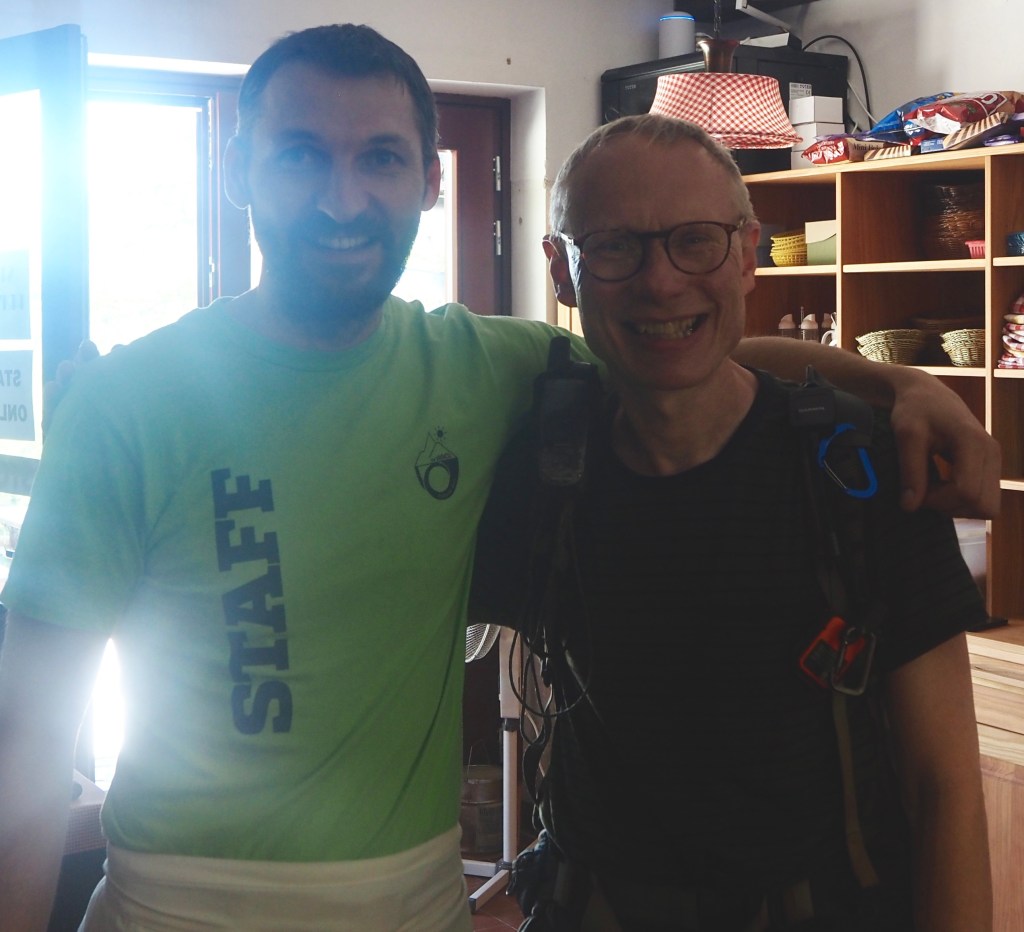
Well amazingly, someone found my phone. And thank you Benjamin, the chef at Postarski Dom na Vrsicu, for reuniting me with it. It’s always a horrible feeling when you lose something important and really reassuring when kind people make that extra effort. Thanks too, to my wife Jeni for finding this out. And to whoever it was that found it and handed the phone in to Benjamin.
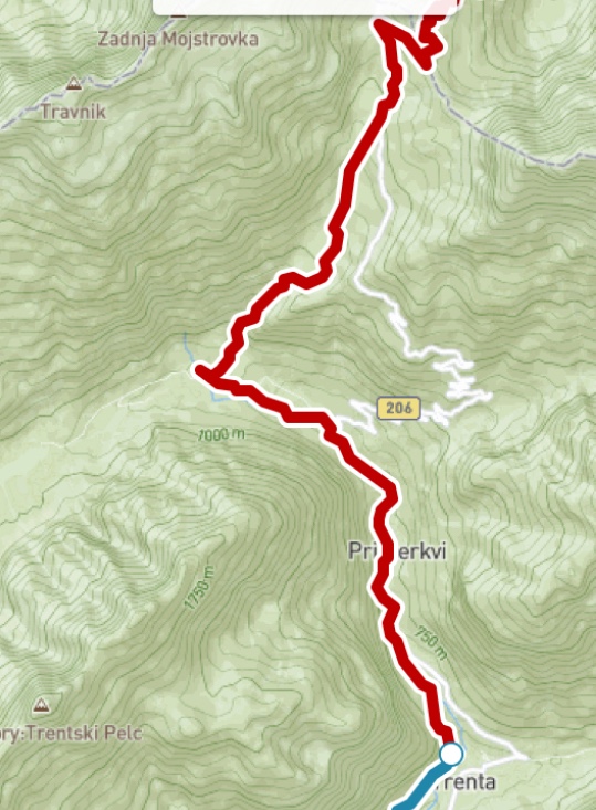
So after that happy start to the day, I continued on my way. Down the southern side of the Vrsic pass, where the traffic was quieter than the way I had arrived by bus (this morning having the added hazard of two cows on the road half way up).
I knew I had to turn off right, but I must have missed the correct turn off because the little path I took wasn’t really a path at all. I could see the actual path below but the way I took was, in reality, just clambering down grassy rock. By the time I realised I’d made a mistake it was too late to turn back. Then two women passed on the actual path below and asked if I could manage. I did, just about, but felt a bit of a fool. The correct way they had taken was probably obvious.
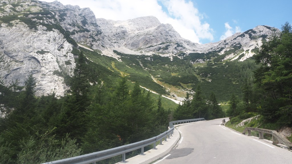
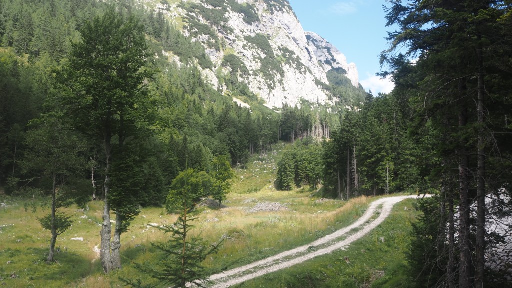
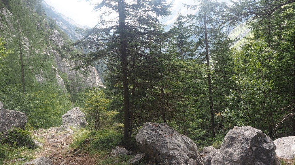
Once on the right track, I started descending, and as on the other side of the pass, the views were to die for, although, as with any mountain pass, very different in character to the other side. Bit by bit I descended below the tree line and into thicker woodland.
I realised at this point how much more sparing they seem to be with Alpe Adria trail signage in Slovenia than in Carinthia. So far it hasn’t been a problem, partly because I have guidebook instructions and gps. But there is nothing like the assurance you get from a sign to know you are going the right way. I just hope they will be there when they need to be.
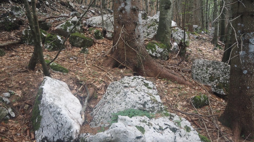
The path started getting steeper downward and I passed through a boulder strewn forest. I always find it a little alarming to see these huge rocks on the hillside just in case their presence signifies that a boulder fall may happen again. Indeed the road down this side of Vrsic had a sign indicating danger of rock falls for the next eight km so I guess it must be a problem in this area from time to time.
There was then a very long series of switchbacks as the path went down and down and down. As I approached the bottom there were a couple of convenient benches, and I decided to break for lunch. Shortly after I’d done this, I was joined by another solo walker, Thomas, from Hamburg, who’d been walking the trail since Saturday and who sat on the other bench. He was camping along the way and aiming to reach Tolmin in time for a punk rock music festival. Having since checked I see that (unfortunately ) I’ll be missing this as it doesn’t start until three days after I leave. Now if it had been jazz…
The downward track continued – after all I had climbed a long way up yesterday. At one point I had to pause as about a dozen mountain bikers passed. Bone rattling it looked and I’m not sure I could really see the point. On the other hand maybe it’s safer than sticking to the road down the Vrsic pass judging by my experiences. The cyclists we passed on the bus just looked so vulnerable on that narrow winding road.
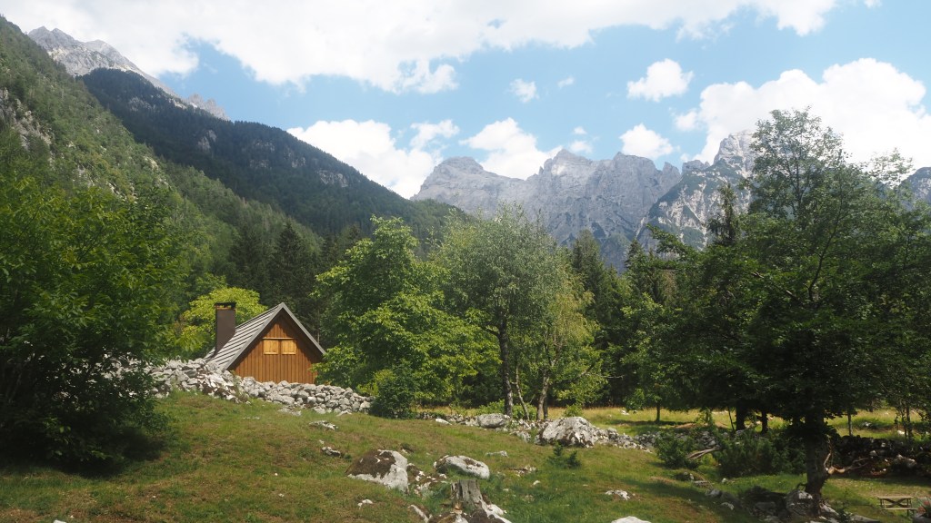
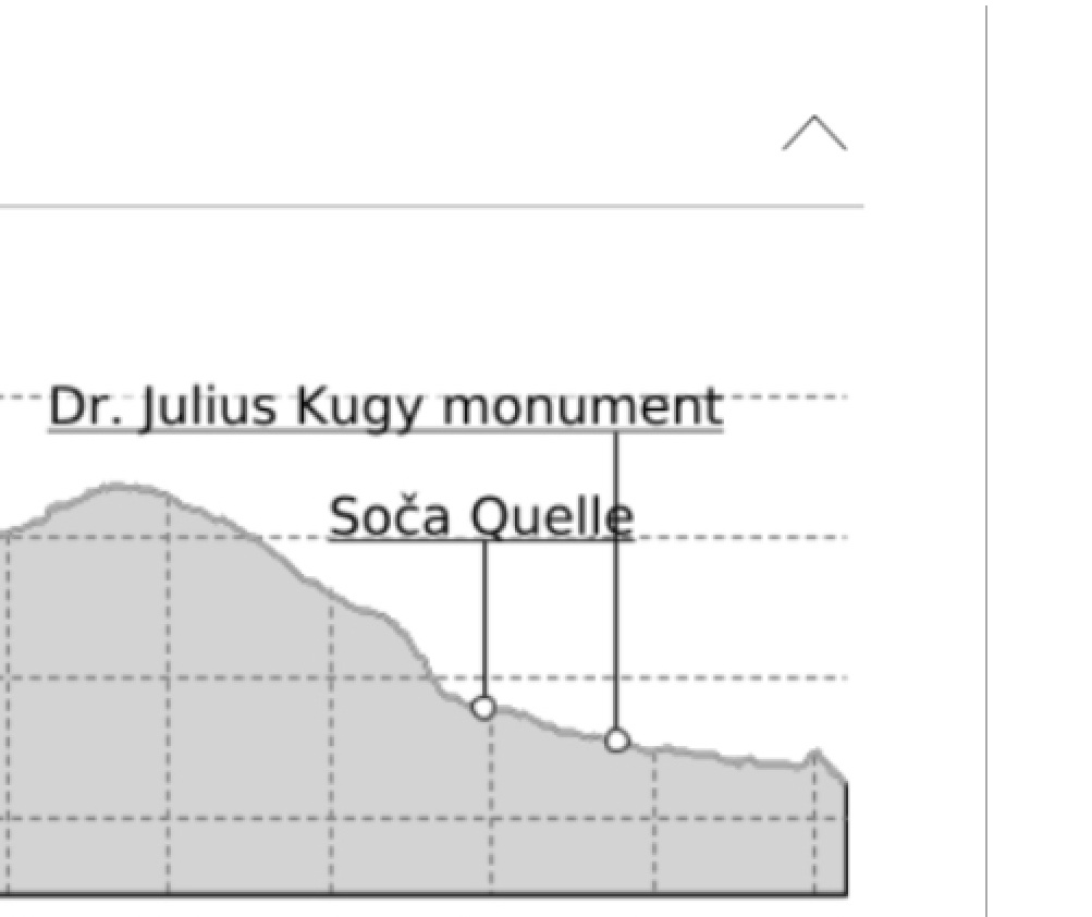
As I neared the bottom the views opened out and at this point I could have taken a side trip to see the source of the river Soca, which I’m to be following for the next few days. It all sounded a bit of an extra effort, though, for not much reward. Having previously seen the source of the Thames (a dry field and stone slab in Oxfordshire) I thought this one might not necessarily be worth it either. I was to be seeing a lot of this river anyway over the next three days. And by this time I realised that I was falling behind with my aim of meeting the 5 pm taxi pickup at Trenta, the end of today’s walk, so I wanted to keep my pace on.
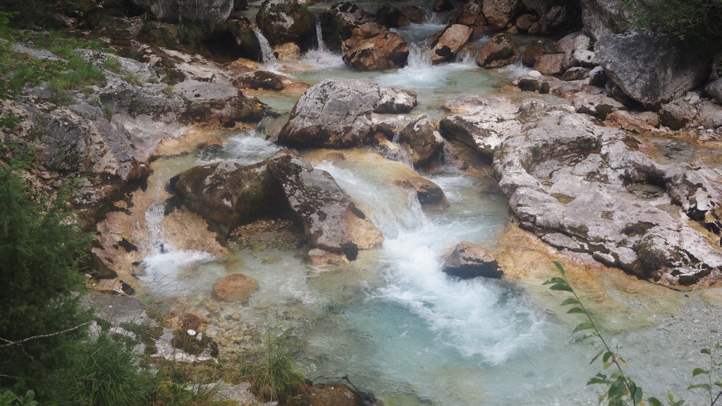
The route followed a road briefly, before turning off by a car park. I now also followed the Soska Pot, the route alongside the Soca river, which coincided with the AAT for a while. Initially at least glimpses of the river were few and far between, and despite hearing the constant sound of the water cascading down the river nearby, the Soca was largely out of sight.
When I did get my first sight of the river, it was instantly distinctive: blue green water, rocks and brown river bed, with water moving fast across it. Later, my taxi driver told me the river was at its lowest level in living memory, and that it wouldn’t be long before water sports like rafting would have to be suspended in this area as the river wasn’t deep enough at the moment.
The path alongside varied between a flat path and little ups and downs, until, with less than a kilometre to go to my end destination, there was a series of steps up, and then what seemed a much longer descent down. It went on a lot longer than I’d expected. Tomorrow, and I think the day after, will be a continuation of the river trail and it will be interesting to see how it alters as I follow it for a while. I know many say these days following the Soca are amongst the highlights of the whole Alpe Adria trail.
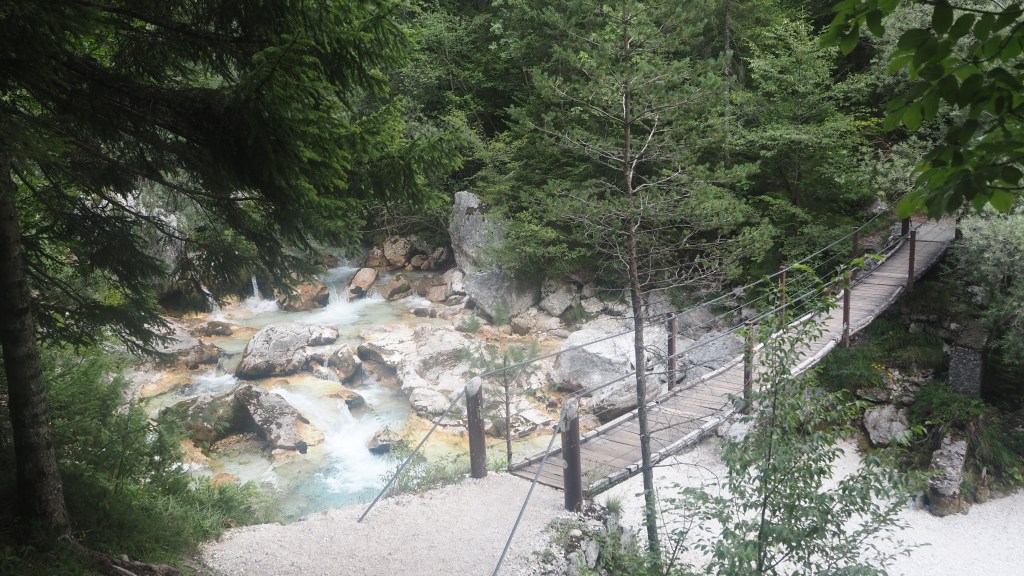
The last part of the walk today was not signed and I had to go by my guidebook instructions- thankfully they proved accurate. I crossed a small swing bridge (which unlike the big one a couple of weeks ago, did actually wobble quite a lot and looked like it had a slat or two missing), managing to get to my rendezvous with the taxi driver 15 minutes early. He was already waiting , and drove me on to Bovec, where I will be walking back to tomorrow having been returned to Trenta in the morning.

FYI Regarding the stage from Bovec to Dreznica:
In our book it was 22 km, in the Alpe Adria app it is 24.3 km. After about 9 km my gpx said to go left on a bridge where repairs were going on, the signs said straight ahead. We had a discussion and met a German couple having the exact same discussion. The men lost the argument and we and them continued using the gpx obtained from the site (stage 25): https://touren.kaernten.at/en/tour/long-distance-hiking/st25-aat-bovec-dreznica-kobarid-/2807529/
LikeLike
Hi Edwin,
You may have taken the better , and more up to date route. I followed signs, my English language guidebook and gpx tracks from 2020. As a result I stayed on the north side of the river. It was very hot, unshaded and you couldn’t see much of the river. So you probably did the right thing. Sorry didn’t see this comment til after I’d walked it. Larry
LikeLike