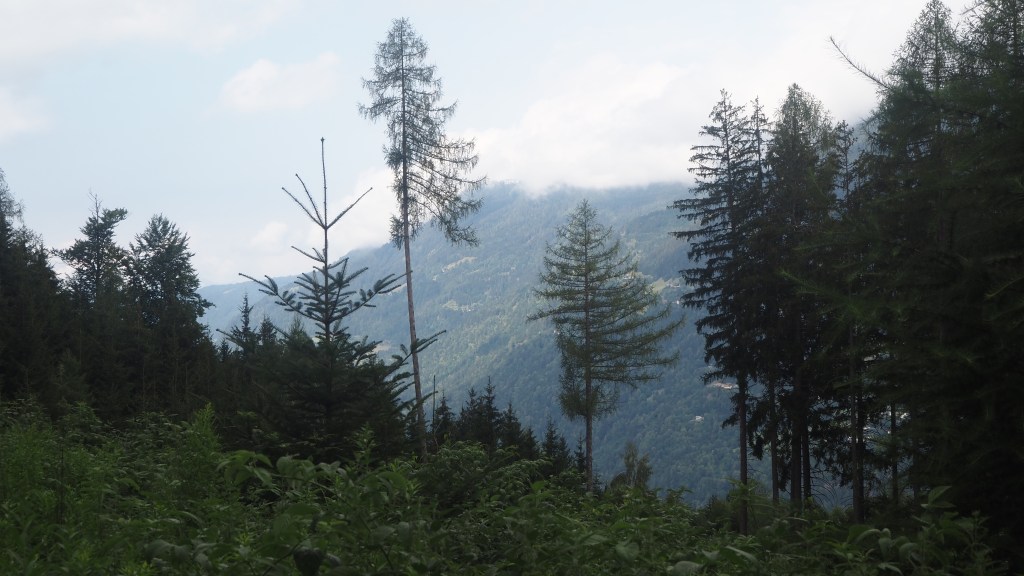
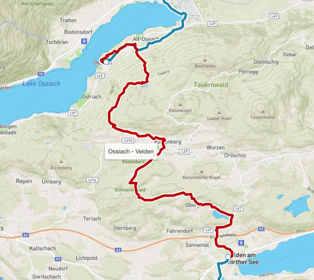
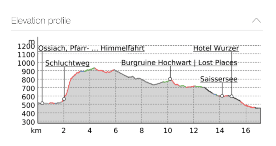
Today was just right. A peaceful straightforward walk with all the difficult work in the first two hours, while it was still cool. No massive ascents or descents, some pretty lakes, more forest walks, a couple of villages and a hazy view of the mountains marking the border with Slovenia.
After the pain I had yesterday with a blister on my right little toe, I had removed the blister plaster, cleaned it up, aired it, and tried something new- wearing thinner breathable sock liners, rather than ordinary socks today. It seemed to make all the difference. Let’s hope it stays that way. I’m keeping my eye on the other foot too and using an anti- chafing stick. I’ve realised that on a long hike like this, looking after your feet makes all the difference between enjoyment and pain, so in future I need to pay more attention and try and prevent or mitigate foot problems before they get too serious.
Unusually, today started with a reprise in reverse of the last couple of kilometres of yesterday’s walk, before it took a turn into the forest. To my right I saw a couple of people who looked like they were climbing a waterfall, and thought: that’s a silly thing to do. Only to realise a minute or two later that my route was taking me that way and I would, in fact, be doing the same.
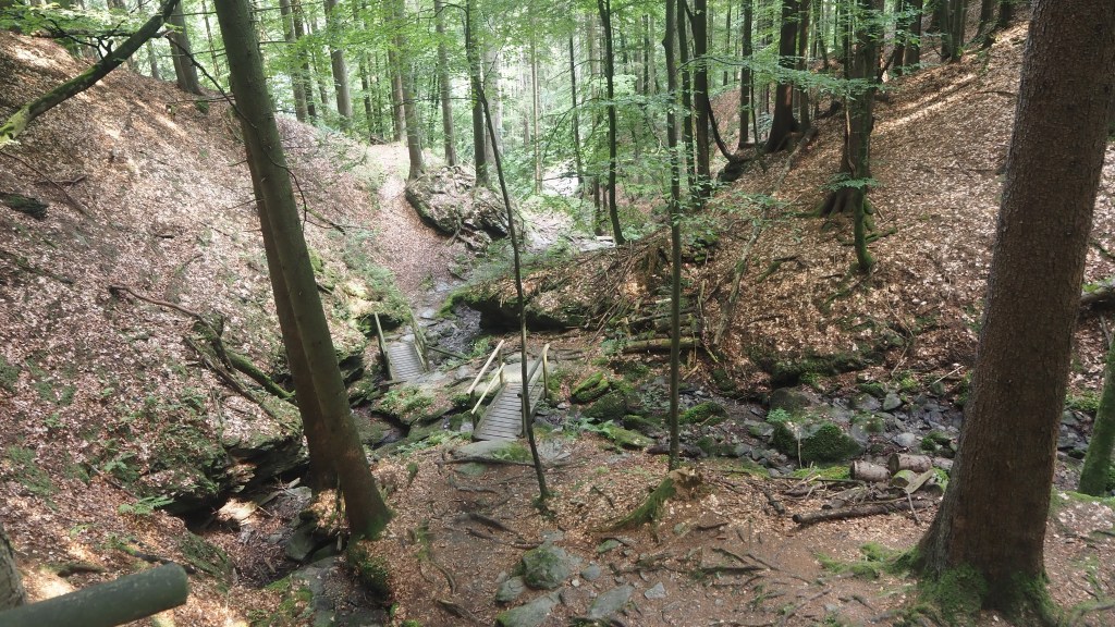
Only it wasn’t exactly climbing a waterfall, much as it looked that way from a distance, but a path called the schlutweg. The stream wasn’t powerful, like some of the schluts I’d seen already, but it was steep, and the rocks and tree roots on either side of it were able to provide a steep path, supplemented by steps, bridges and handrails in places. In fact it felt safer than some of the steep forested sections of the previous days, where there had been trees down or landslips, in that where there wasn’t a natural foothold, someone had thoughtfully provided one. There was only one small part where I felt unsafe, only to realise that I was on the wrong side of a hand rail, where there were actually steps!
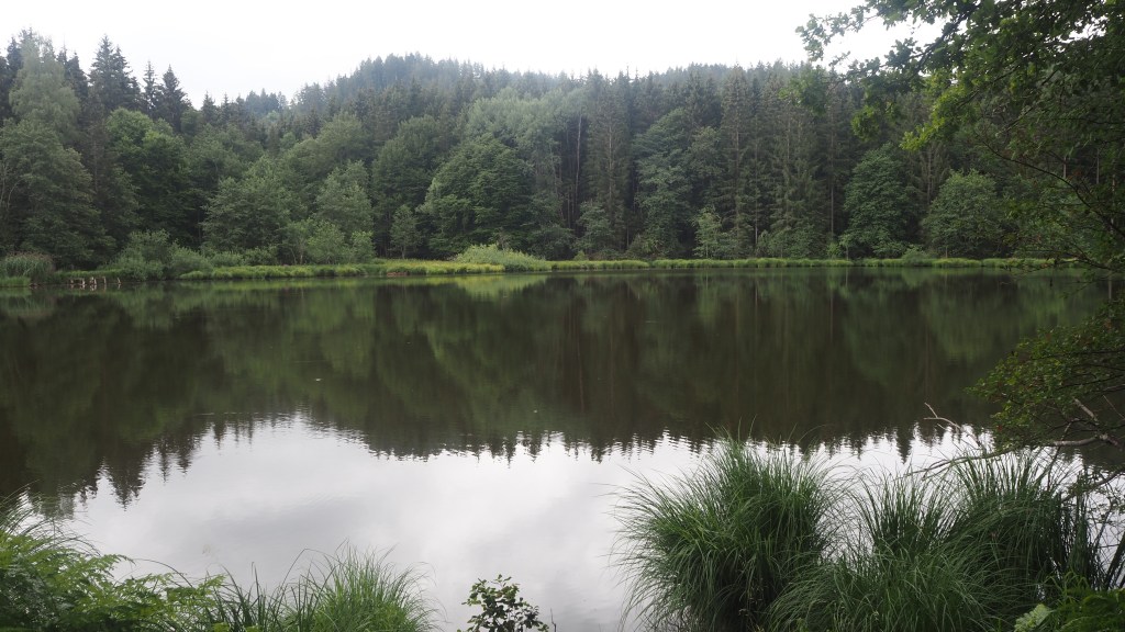
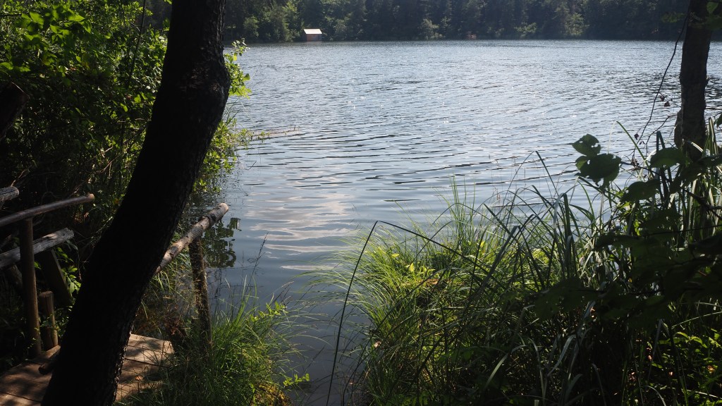
This first couple of hours constituted by far the biggest climb of the day, around 500 metres, and eventually levelled out onto a wide track, by a nice little woodland lake, Tauernteich, where I could see people fishing. It was tempting to sit and enjoy the peacefulness, but I resisted staying too long, and made my way on through the forest. It was easy walking, wide tracks, good footings, and gentle slopes.
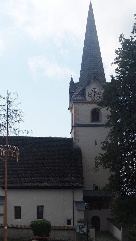
Finally there was a little climb and the route led me out to the village of Oberdorf. Like a lot of the villages I had passed through, this was quite long and straggling, with big houses and gardens lining a winding road. By this time, the sun had come out and I stopped for my lunch on a shady bench by the village church. As I was eating I saw a couple I recognised from my stay at the Gerlitzen Alpe guesthouse, looking a little confused about which direction to take. I asked if I could help and they said they had figured it out, but the app, book and signs for the Alpe Adria Trail were telling them different things (sounds very familiar to me).
So we had a little chat and it turned out that they too were hiking the Alpe Adria Trail to Trieste, all in one go, having started at Grossglockner, like me. They were from the Netherlands, spoke perfect English, and were carrying their own bags (while I couldn’t have managed carrying a bigger rucksack like theirs, I do admire people who are able to pack more selectively than me with my massive suitcase!), They were booking their stays only a few days ahead, which gave them more flexibility I guess, for instance with the weather.
They had been behind me, so had not even reached Erlacherhaus, the hut where I was staying when the storm hit last week, and had had instead to take a taxi between Dobriach and Bad Kleinkirchheim, missing stages 14 to 16. What was interesting though was that they had reached a similar conclusion to me about the forthcoming stage 22 of the trail, the crossing over the pass between Austria and Slovenia. I’ll say more about that when I get there, but it’s clearly a difficult stage and the weather forecast in a couple of days time does not look good.
Anyway they went on ahead as I finished my lunch. I may see them again on the trail, or even in Trieste, if they don’t forge ahead of me too fast.
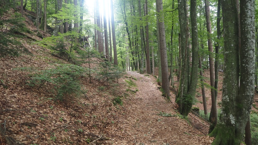
After lunch there was more shady forest walking, mainly on the level, and I didn’t see a single other person for quite some time.
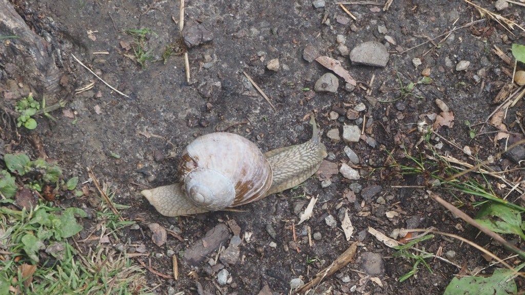
I nearly trod on a large snail on the path, but it escaped for another day.
The forest became more varied, with not just conifer but deciduous trees too, and unless they had been falling early with the heat, the path was, for a while, carpeted in brown leaves from the previous autumn.
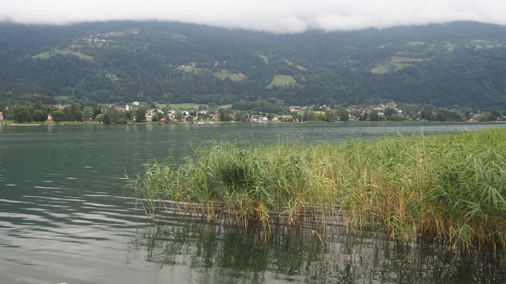
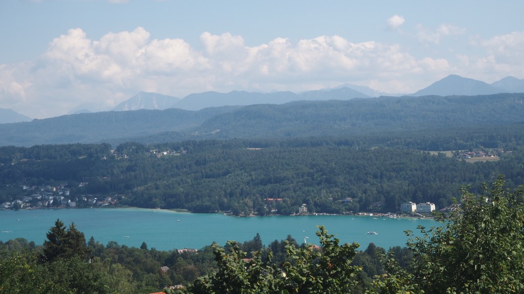
Eventually emerging from the forest the path led round the banks of another small lake, Saissersee, and then it was onto the main road with a seating area by a magnificent view across to Wothersee and the border mountains of Karavanke. The walk into the town of Velden, my end destination, took me under a motorway, across a railway line and back to another final little forested stream, before I came out at the official end of the stage and had to walk an extra kilometre uphill to my hotel for the night.
I didn’t actually get to see the lake, Worther See, close up – only from a distance, before I descended into the town. Maybe I will tomorrow.
Ominously, when I finally found my hotel, I discovered an email from the Italian tourism office saying a fire had caused the closure of stage 33, which I had been due to be walking in a couple of weeks’ time. Let’s hope this is an isolated case. But it certainly shows how hot and dry it’s been there, which doesn’t really come as any surprise with all of the temperatures Europe has been experiencing in recent weeks.

Glad the snail survived!
Was it as big as Speedy?
LikeLike
Nearly
LikeLike