With rain and then severe thunderstorms threatened for today, I was anxious to make an early start again, especially as I was heading for Gerlitzen Alpe, at the top of a chair lift, nearly 2000 metres up, and likely to be just a little exposed. As it turned out, the thunderstorms didn’t materialise where I was, but then again mountain weather is always very localised – it can be totally different on two sides of the same mountain range, as I have often found.
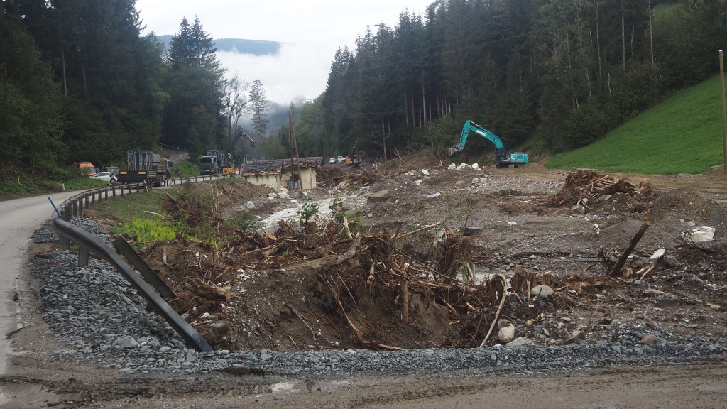
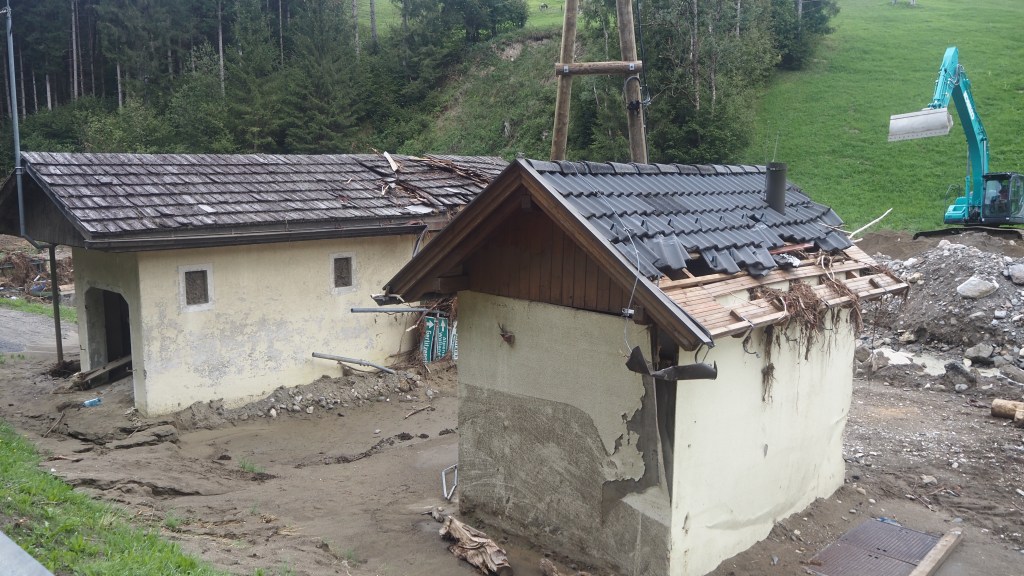
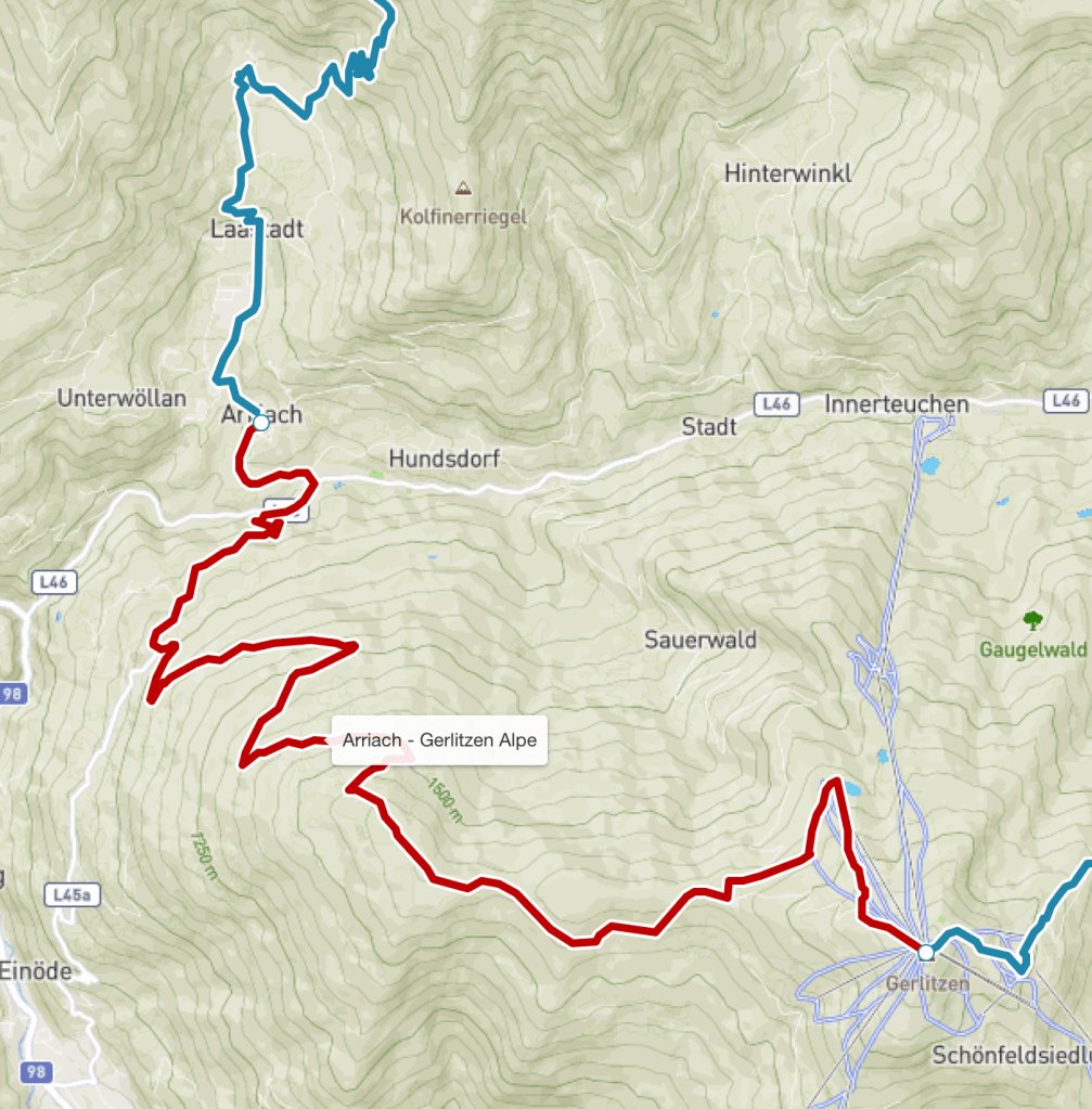
As I left Arriach behind, I could see why they hadn’t been able to take my luggage there overnight. The main road was still closed and the damage wrought by last Thursday’s storm was still being cleared up.
I turned off up a minor road hill and started what I knew would be another 1300 metre climb (another ‘Ben Nevis’ if you like). It had already rained overnight bringing a freshness to the air, the sky was grey and it was a good ten degrees cooler than yesterday making a fast uphill both possible and, with storms expected by midday, advisable. So I went for it, and started ascending at quite a pace. I am definitely finding these sorts of ascents easier as time goes on, particularly if it is not too hot, so I must be getting a bit fitter I guess.
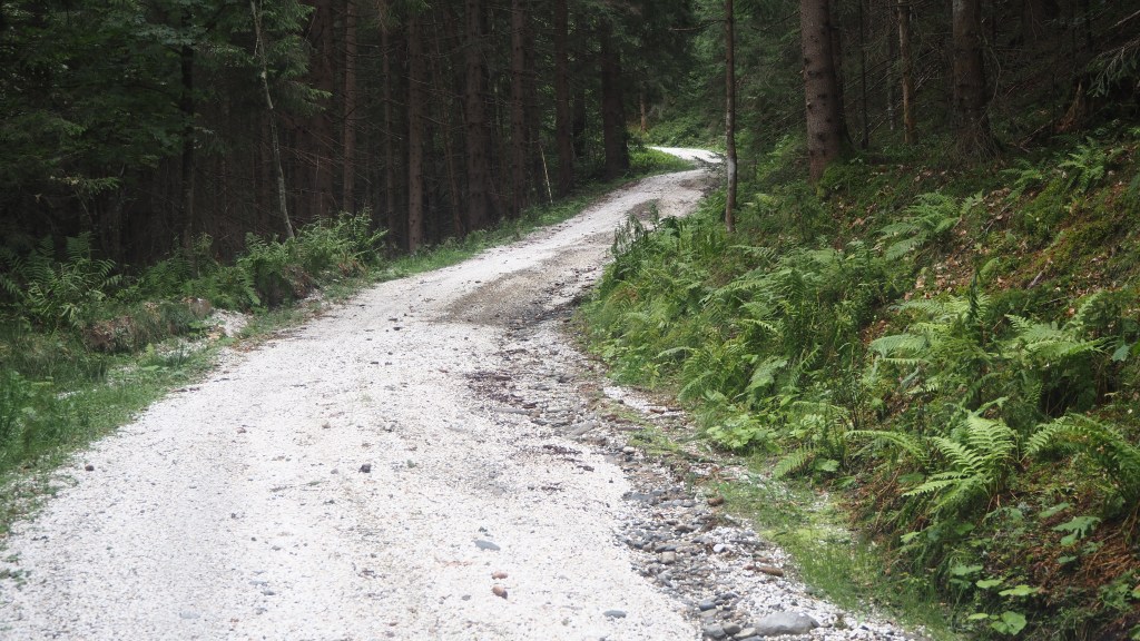
As the road became a wide track you could see where storm water had forced its way across and along the path, so I hoped today’s weather wouldn’t see a repeat of last week and I wouldn’t find myself walking in a fast moving mud stream. I reached a group of houses at a place called Hinterbuchholzer by about 11 am – getting there was meant to take about half the suggested five hours of walking time, so this was a sign of good progress.
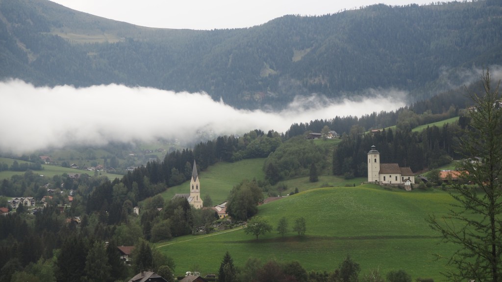
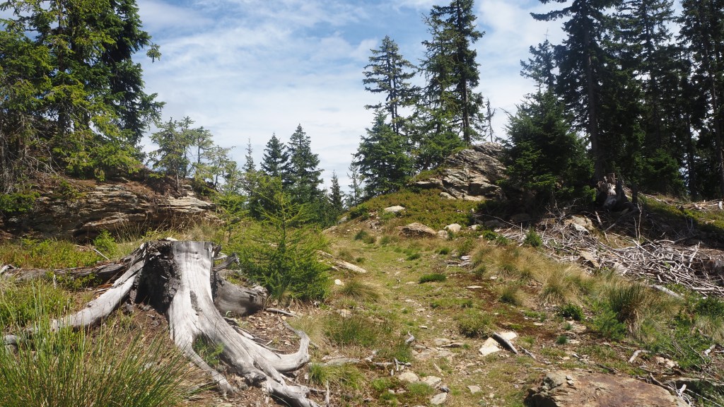
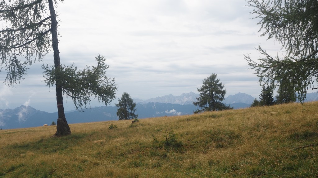
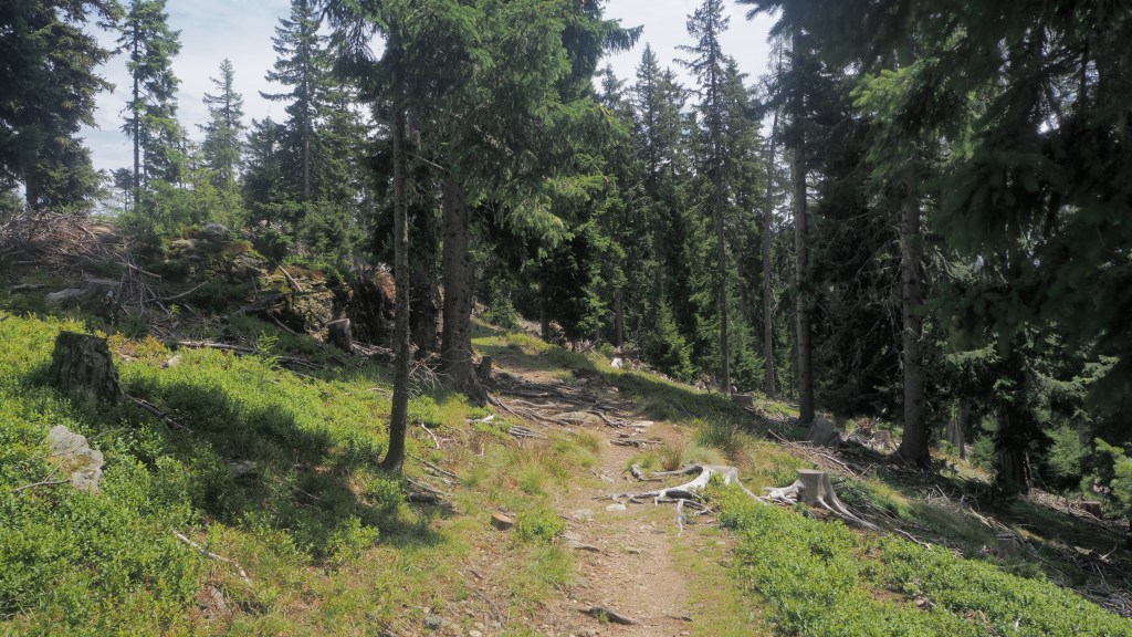
After this point the path became more interesting and for the next couple of hours I enjoyed a lovely walk, through the top of forest, then across a level plain with views for the first time of the Karavanke range, the part of the Alps that separates Austria from Slovenia. These mountains looked much more rugged and craggy than the smoother more rounded neighbours to the north where I had been walking for the last week or so and it won’t be long before I am headed that way.
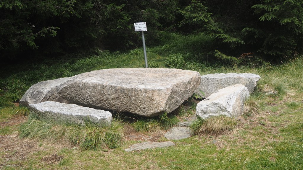
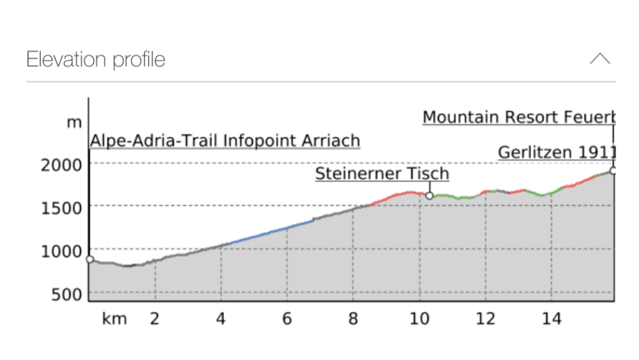
My lunch stop was at a convenient stone table and near here I saw signs suggesting Gerlitzen Alpe was only an hour and half away. By this time though the need for rushing had passed, as the sky was largely blue, it was warming up a little and I even had to put sun screen and a sun hat on again. Plus, after my exertions of the morning, having climbed about 900 metres already, I couldn’t move especially fast if I tried.
I hope not.
As I passed a group of holiday homes I made the mistake of following the Alpe Adria signs literally. Instead of a short 40 minute walk up the road, which I could have taken, as it was signed to Gerlitzen Alpe, but was not as part of the AAT, I opted to follow the official route back into the forest, and then to a ski run, and down. There seemed no point to this other than to lead me to a restaurant and bar, and a rather unappealing small lake, which looked rather sorry for itself- like a gravel pit reservoir without enough water in it. The real killer was then the climb back up, crossing back to the ski run, which seemed never ending. All in all this added about 2 km and 300 metres of ascent for no real benefit, as well as a little descent I could have done without. Finally, I reached my destination at the summit, 1911 metres above sea level.
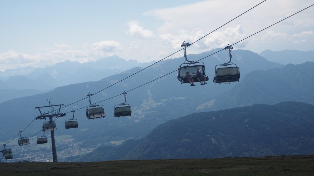
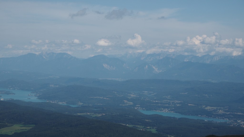
Gerlitzen Alpe is one of those places with all round views, but it is rather marred by the ski lift paraphernalia everywhere- chair lifts going in both directions. It’s quite evidently geared towards winter sports above all else. Nevertheless the room I have in the little guest house above the restaurant here, overlooking the chair lift, has an incredible view with two lakes down below and the mountains of the Karavanke and Slovenia behind.
Tomorrow I should finally reach about the half way point of the hike, so how am I coping so far? Well, I think the successive ascents and descents have certainly taken some getting used to and are much more tiring than the distances alone would suggest. I have developed small blisters on both little toes which are currently annoying, at times sore, and which I hope I can keep under control. My back plays up from time to time, but mainly when I’m tired and have been carrying a heavier rucksack (when the baggage had not been delivered). And I seem to have had a bit of minor hip pain after long descents, but so far this has always cleared up by the next day. So not bad really, physically.
Mentally, I have found being on my own fine, helped by friends and family keeping in touch, whether by email, phone or what’s app. Please do stay in contact – it’s lovely to hear from you. And the donations to the pangolin fund have been overwhelming , over £700. You can still donate at https://justgiving.com/fundraising/larry-honeysett
Writing the blog itself keeps me occupied and I have books and tv to keep me entertained. Meeting some lovely people along the trail has really added to the experience too, and I hope that has come across on the blog.
What can get a bit laborious is the process of packing and unpacking, washing clothes, adjusting to different hotels, and finding places to buy lunch. But I really can’t complain. Some of the hotels have been pretty luxurious, some basic, many in-between, but I think all have been fine, and mostly the staff very friendly. The staff at Trail Angels, who have organised the Austrian part of the trip, have been really helpful too. So I think I’m set fair for the next half of the trek, but you never know what’s coming next, as I found out last week, so best to take each day as it comes.

Dear Larry, I’m glad to hear that you’re fine and safe after the horrible thunderstorm! Have a wonderful trip, I keep following your adventure ! 😉 Gabi, Your Millstätter Hut roommate
LikeLike
Yes that was an adventure, but glad to be back to the hiking. Thanks for continuing to follow my blog. I hope you and Natalie are both well and enjoyed your hike too.
LikeLike
Hi Larry, I’m catching up on your adventures finally. Hope your blisters are healing… Mabel and I will do an extra lap of the park this morning inspired by you. Have a good days walking 🚶🏻♂️🚶🏻♂️🚶🏻♂️Gill
LikeLike
Hi Gill,
Having a rest today, now in Slovenia. Feels odd not doing any walking today but should do my feet some good.Enjoy the park. Larry
LikeLike