Today’s walk was truly magnificent. One of the very best half day hikes I know, and I’ve done most of it twice now. And it’s not in any way a hard walk either, despite about 1000 metres of ascent.
Yesterday, as I explained before, I decided not to walk stage 22 of the trail, crossing the border between Austria and Slovenia, but opted instead to travel in the taxi with my baggage, ably driven by a guy named Luciano. On the drive I had a chance first to see just how long the mountain road I’d taken on Friday afternoon up to Baumgartnerhof was, and then to the cross the border via the mountain road, the Wurzenpass. All in all the journey took little more than 45 minutes but was a fascinating drive.
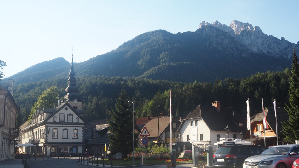
Installed in my (very nice) hotel in Kranjska Gora, in Slovenia, I wandered around the streets and became a little emotional. We’d been here for a week long family holiday in 2009 and it hadn’t really changed much, but somehow wandering around a town doesn’t have the same sort of appeal when you’re on your own. I realised how much I’m missing the family and had a nice videochat shortly afterwards with my daughter, Rachel, back at home in Edinburgh where she was walking her dog.
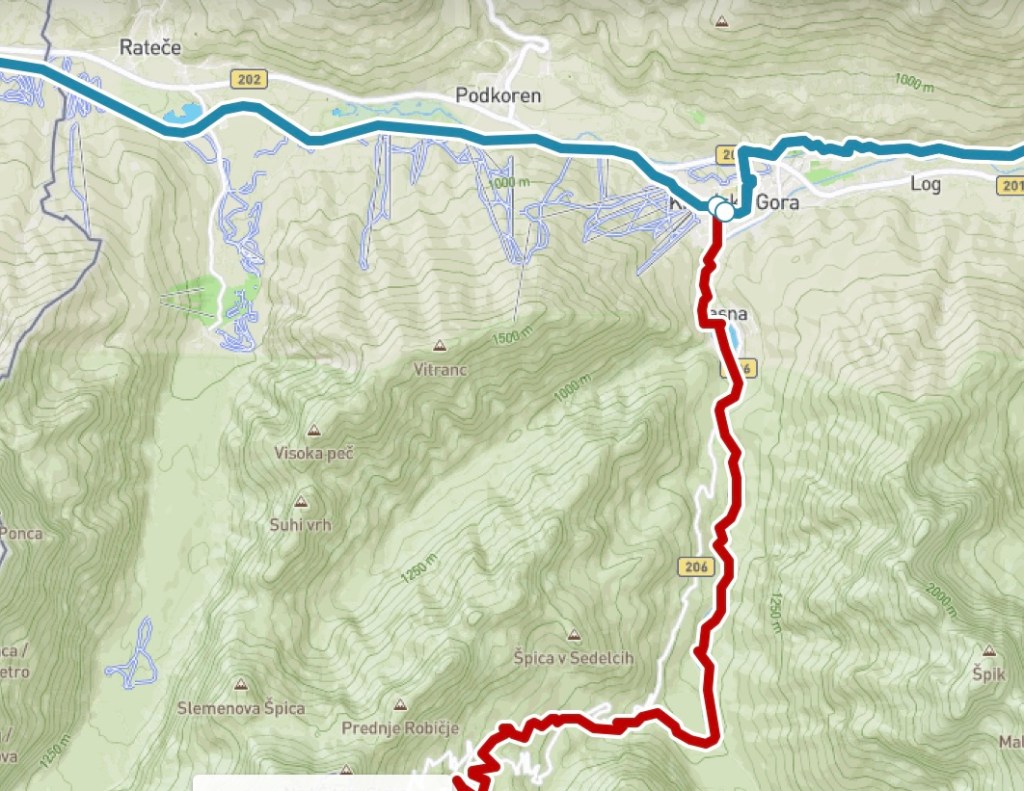
Fully refreshed and recuperated the next day, I started as early as I could this morning, at around 7:45- both to beat the afternoon heat, and also to catch the 12:40 bus back into town (there was a four hour gap for the next one). I was walking half of stage 23, from Kranjska Gora to Vrsic, the mountain pass south of the town. On Monday I’ll get the bus back to Vrsic and complete the rest of stage 23, making two easier days walking- one up, and one down.
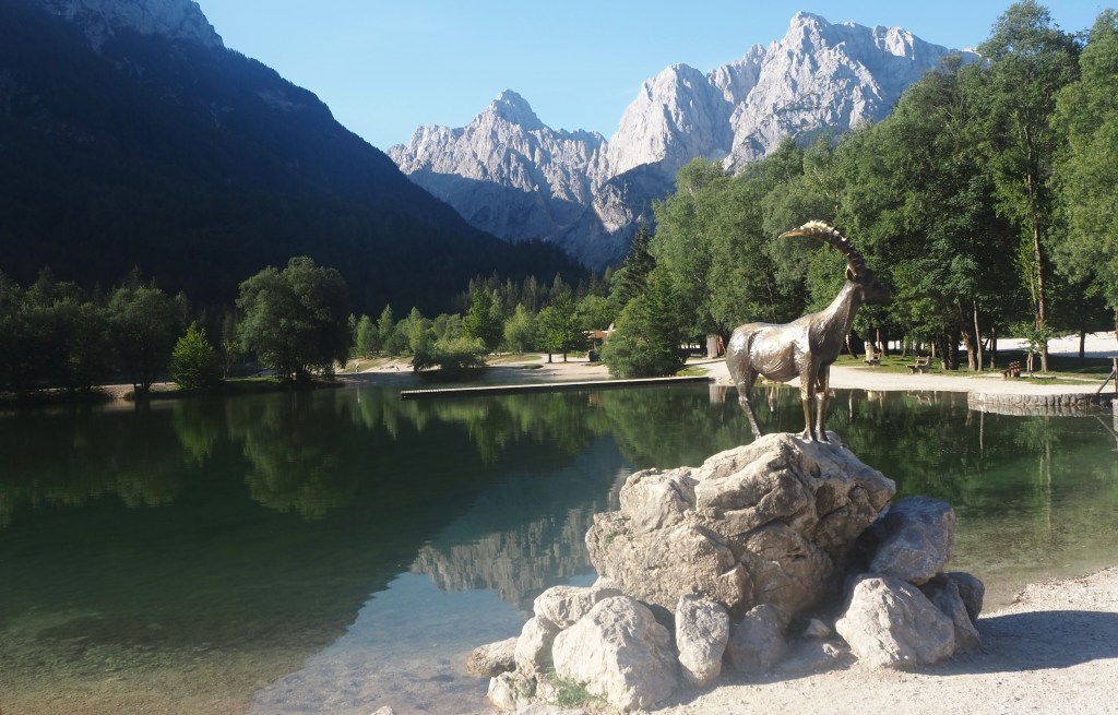
The first part of the walk and the last part of the walk I’d done before, in 2009. It was only the middle that was completely new, not that it really mattered, because the whole is such a marvellous walk. First, I followed the Pisnica river out of town, soon arriving at the beautiful Lake Jasna. A statue of an ibex, the legendary Zlatorog, a figure from Slovene mythology, is prominent here and makes a good photo, against the backdrop of the jagged Karavanke mountains, now close up, which dominate every view.
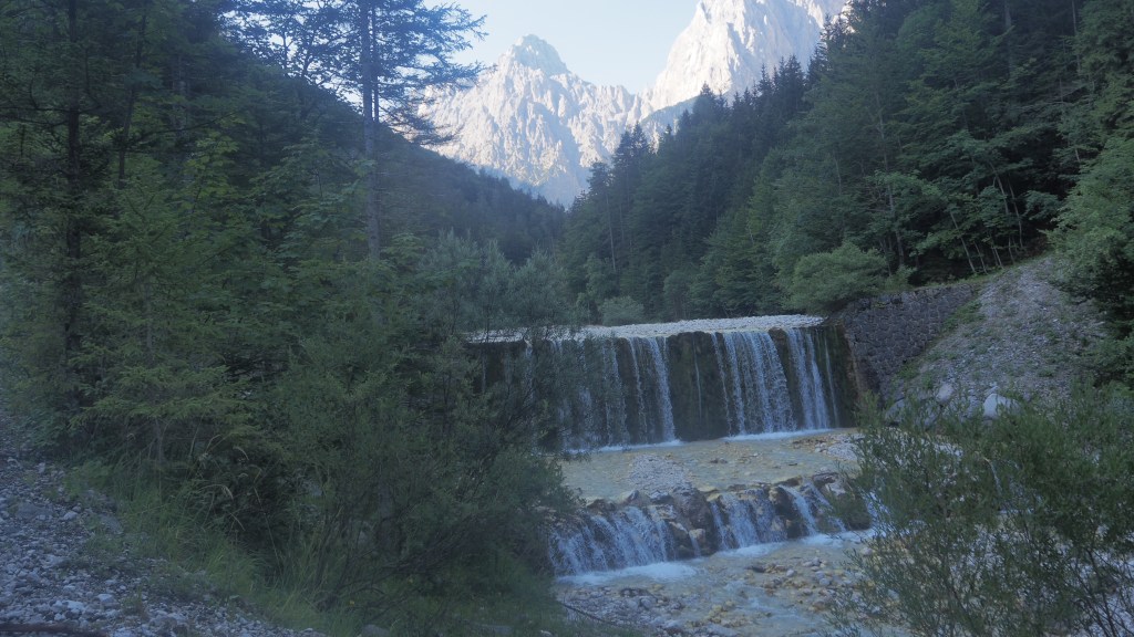
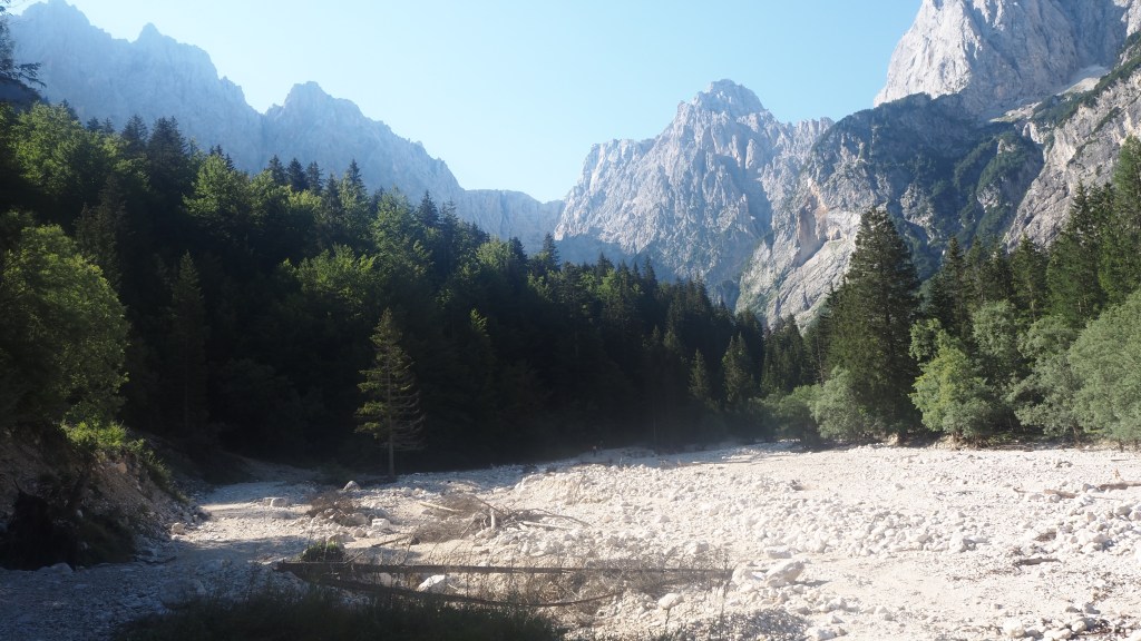
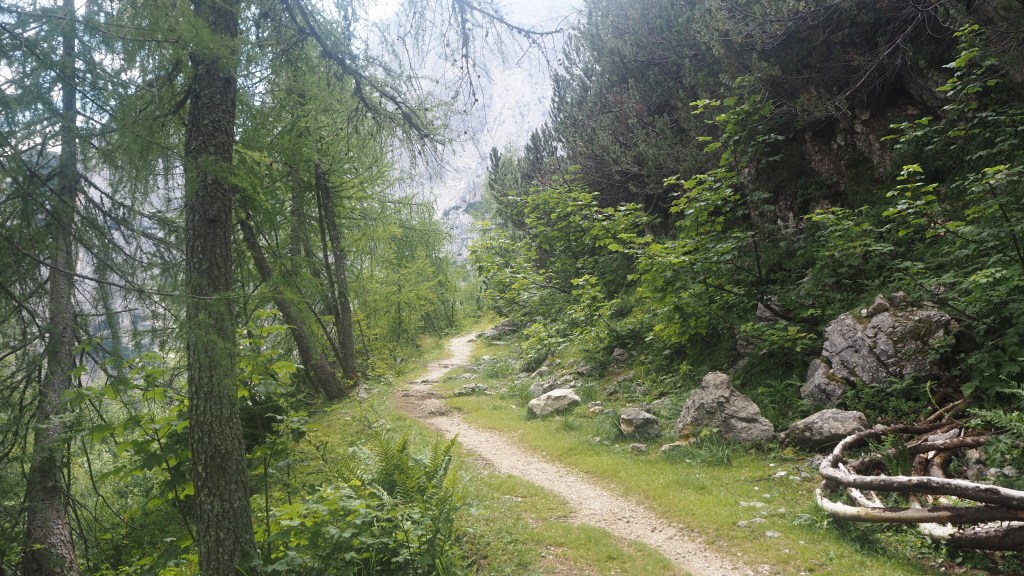
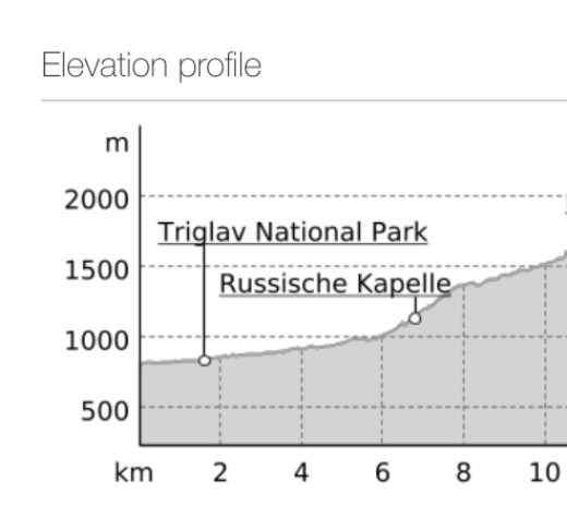
Shortly after I entered the Triglav national park and followed the river bed southward. It was actually very cool here in the morning shadow of the mountain and this, together with, later on, the altitude, meant that it never felt excessively hot all morning.
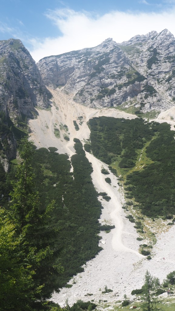
At this point, the river bed here is incredibly wide and made up of white stony rock, with the river itself sometimes barely noticeable as one or more little rivulets, and at other times cascading down waterfalls, depending on how wide the channel is. You actually cross the river bed on a path at one point and while inevitably you get your feet wet, it wasn’t any more than about 10 cm deep when I did.
As I was following the river bed a couple noticed my new Alpe Adria Trail badge on my rucksack and we had a short chat. They were from Graz in Austria and on their second year’s walking of the AAT, having just resumed at Faak am see. They had managed the (in my mind, now notorious) stage 22 yesterday, which I had skipped. They said it had been a long day, but not too bad, and dry despite the rain on the Austrian side on Friday night and Saturday morning. They were aiming to finish in Muggia like me in a few weeks’ time, so it’s possible we may meet again, although as I was splitting this day into two, they may be ahead of me. We got a little confused about wayfinding at this point but managed to find the path together in the end. I walked on ahead keen to get a pace on.
Last time when I walked up from Kranjska Gora I had got as far as the Russian chapel, built to commemorate Russian POWs who were forced to build the road up through the Vrsic pass, which runs alongside the trail, during the First World War, and many of whom died in the process. It being Sunday morning there was a service going on there and I wasn’t allowed anywhere near it, as the whole area was sealed off by Slovenian police (until midday apparently) .Whether someone notable was visiting, or this was just a regular service and simply a reflection of tensions in the light of the current conflict I don’t know. Anyway, a little bit of a shame as a recall it being an interesting looking building, but I simply walked along the road for a little bit instead.
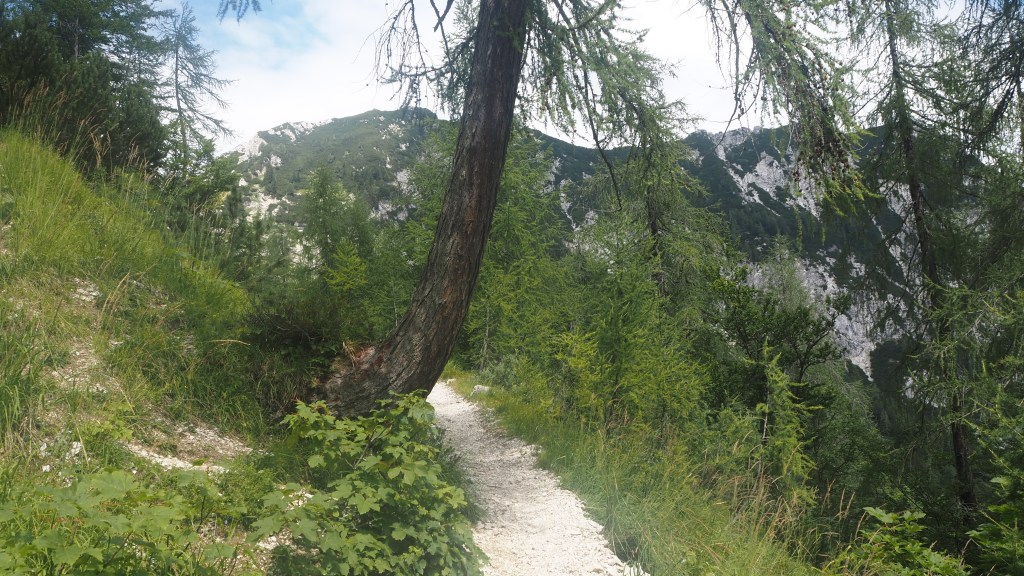
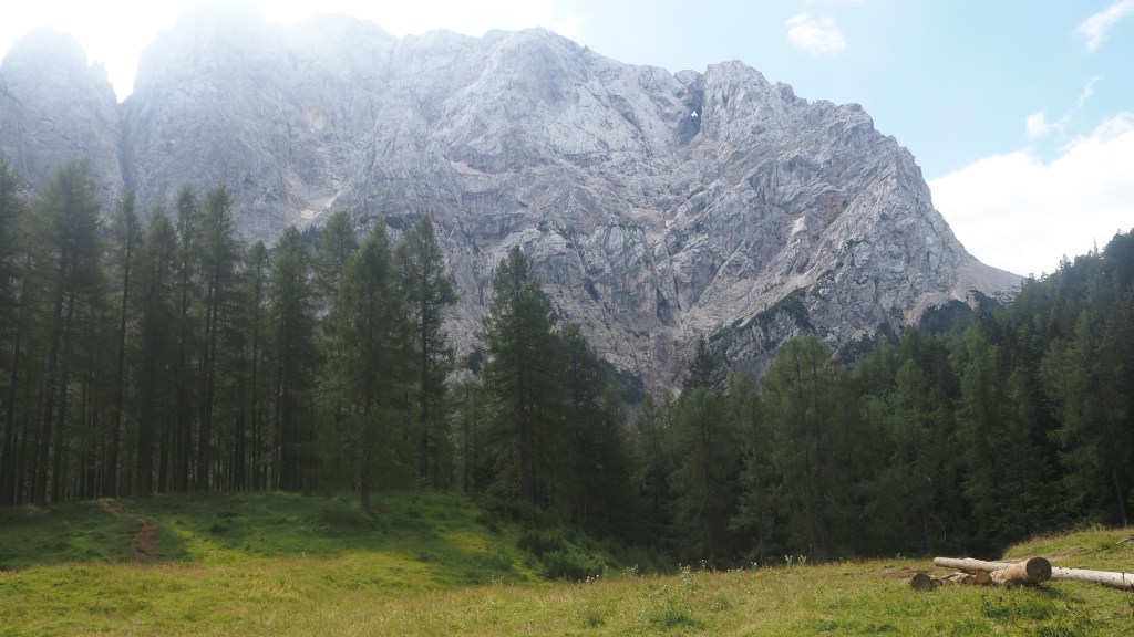
Rejoining the path I began the one part of the walk that was totally new to me, mainly uphill through woods. Then I emerged back at the road, by a mountain hostelry called Tonkina Koca, where the full splendour of the mountain backdrop became apparent for the first time.
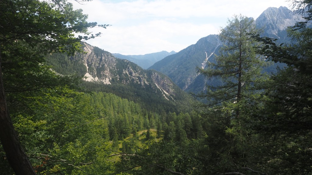
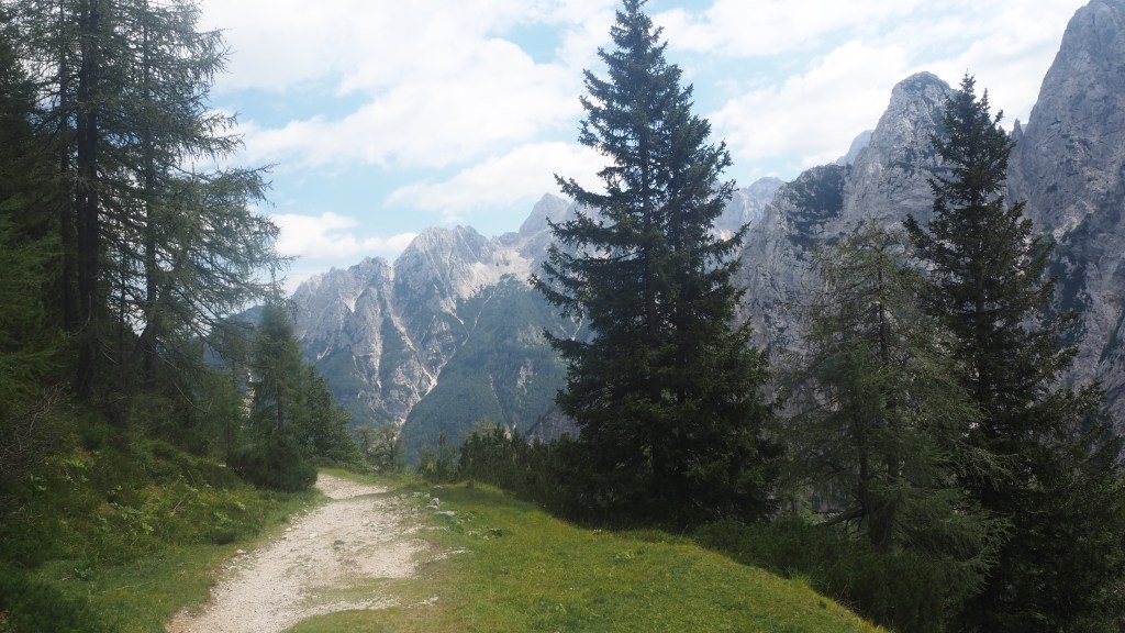
There were various different options here, judging by my guidebook, the signs and the gps track, with the route I took being simply to follow trail signs, and taking me on a beautiful grassy path winding backwards and forward and climbing relatively gently. The trees were thinning here as we approached the top of the treeline, revealing glorious vistas, and allowing you to see different perspectives as you twisted and turned up the mountainside.
I knew I wasn’t that far off the top now, but I had only about an hour to get my bus so after making use of a cafe toilet I took a bit of a short cut from a nearby little peak back down to the path. This was not a good idea. It was steep and gravelly and although it only took a few minutes, it’s probably where I managed to lose my mobile phone out of my pocket (something which I only found out later when getting the bus).
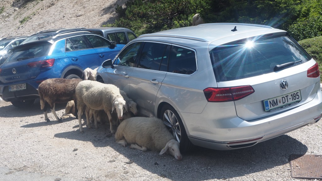
I made it back to the road, and walked up and down trying to find where the bus actually stopped. It being a summer Sunday lunchtime, and a known beauty spot with several mountain cafes thereabouts, the scene at the road was chaotic. There was just about enough room for cars to pass each other, but with cyclists, motor-cyclists, tour buses, pedestrians, parked cars and some long-eared sheep who had decided parked cars offered them useful shade, it was a miracle that anyone got anywhere and no one was hurt.
When I established from someone that a bus stop sign on the other side of the road applied both ways, and boarded the bus, it didn’t get any better. The hairpins were numbered, starting at 27 (there are over fifty altogether counting the Trenta side too) and at each one the narrow road was cobbled to give a little more grip, but cars kept coming, delicate reverses took place, while sometimes cyclists and motor cyclists diced with death by weaving in between vehicles. Hopefully my journey up tomorrow by the 9:30 bus will be a little less nerve-wracking if the traffic is less busy at that time of day.
This really was a wonderful morning’s walk. Not only, in my view, one of the very best on the trail so far, but also, despite the climbing, it didn’t feel really tiring as the ascent was gradual and the path well maintained. I’m really looking forward to the next couple of days as I descend down the other side and follow the scenic Soca valley towards Italy. My main concern as I head south is the temperature, which isforecast to shoot up into the 30s as I head south and the week progresses. More early starts and plenty of water I guess but we’ll have to see whether I have to adapt my plans further.

Looks and sounds amazing.
Sorry that you are missing us.
Love you.
LikeLike