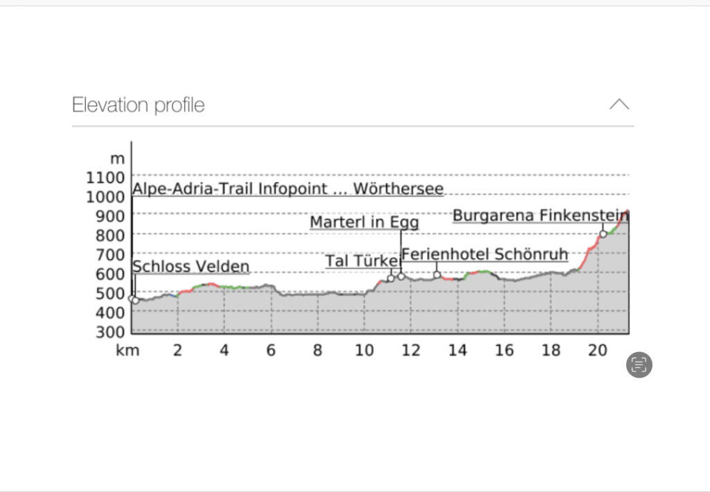
Today’s walk was graded as easy to moderate, and the only reason it had much ascent at all was because I’d decided to extend it from Faak am See to an isolated hotel called the Baumgartnerhof, so as to save time and effort the following day.
The irony of this is that since booking the trip I’d pretty much decided not to walk tomorrow’s stage. That route, crossing the high mountains from Austria to Slovenia has developed quite a fearsome reputation, being sandy and quite slippery after wet weather. With thunderstorms tonight and forecast all day tomorrow that alone makes it likely to be dangerous. Besides this, some of the reviews I have read have said things like: ‘absolute head for heights and sure-footedness required’, ‘if you are afraid of heights you may have some problems at the summit, the path is quite narrow’, there are ‘downhill sandy sections where I could hardly find a footing’ and ‘a long and tough downhill’ . It didn’t sound the sort of walk I would be happy with, particularly after rain. The Dutch couple I’d met yesterday had reached the same conclusion and were skipping it too, which also affirmed me in my decision. Even the guidebook author has warned to be careful on that stage if weather has been bad.
So I would have been better staying in Faak am see itself, particularly as it has a train station. It was too late to change that now.
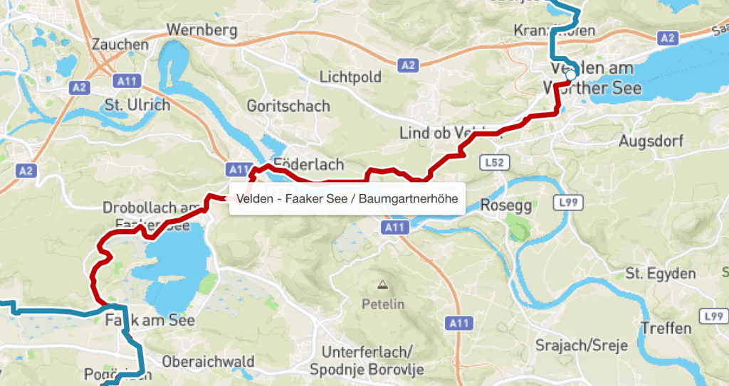
Back to today’s walk, though, leaving Velden it took a while to get out of town (I still didn’t see the lake, Worther See close up) before once more entering woods and pleasant easy, level, walking. It was in this area that I once again met the Dutch couple I’d chatted to yesterday and we walked together for a while- they kindly gave me some of the lambs’ wool which they’d been using to cushion toe blisters, and I have to say when I tried it later it seemed to help.
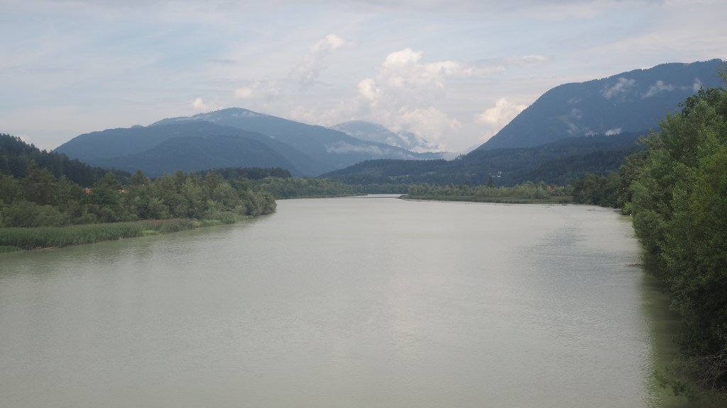
Coming out of the wood there was a long straight, flat section popular with cyclists running alongside the Drau river, which I eventually crossed on a road bridge. I was a little confused shortly after about where to go but eventually figured out that you had to cross two busy roads to resume the path across farmland to the village of Bogenfeld.
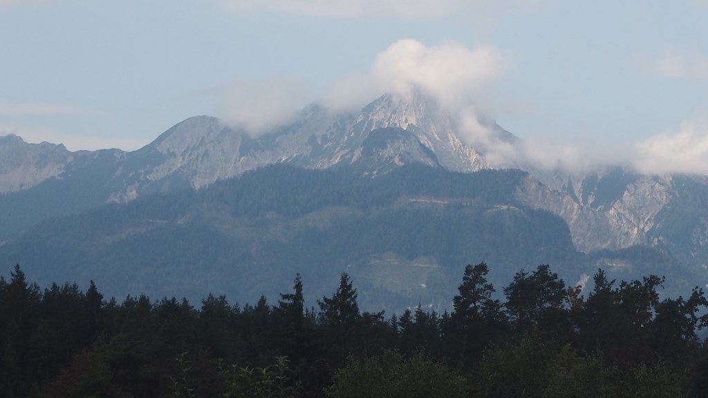
After Bogenfeld, there were some spectacular views across to the Karavanke mountains, before descending to Martel and Drobbalach by Faaker See (another large lake). Briefly.
Here I’m going to make an observation, based only on a few days walking in the area of the lakes of Millstatter See, Ossiacher See, Saissersee, Woerther See and Faaker See. What has struck me in each case is how little public access around each lake there appears to be to the lakeside itself. It seems very much that the majority of the lake bank is parcelled off into private gardens and beaches for holiday homes, hotels and guest houses, with only a small crowded public area available for all, and little or no opportunity to walk directly on paths on the waterside.
To my mind that is a shame. It means even if you rent one of these holiday homes, all you see is the same little bit of the lake every day. I’m a great believer in everyone having access to wider public open space, rather than a few to their own restricted private space. As a walker you’d expect me to say that, because I like moving along at the pace my legs take me, but I realise that some people prefer a more leisurely holiday. Obviously there is a place for both, but what I’ve seen of these lakesides seems to lean towards private space predominating.
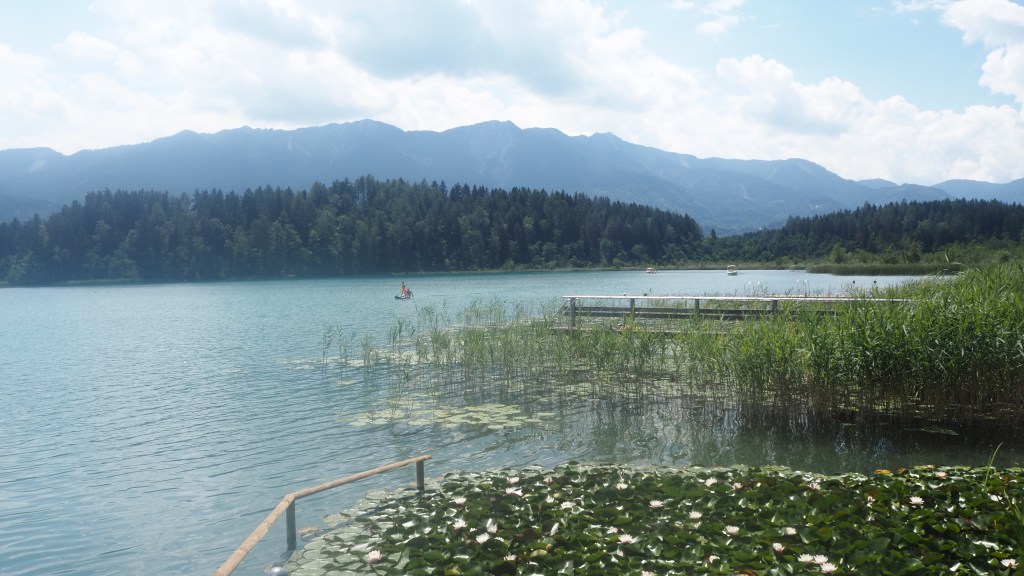
There was a path around the lake of sorts, but it was a long way back from the shore, and you couldn’t actually see the lake at all from it. The route then and then led me back into woodlands once more, before arriving in the outskirts of the town of Faak am See itself.
Faak am See is the setting each September for the world’s biggest annual gathering, known as European Bike week, of Harley Davidson riders. Not quite sure why here, but then why not I guess? I imagine it’s one of those events that started small scale and had just grown, and I should think there’s a fair bit of tearing up and down mountain roads while it’s on. But Faak am See is not just for bikers though- apparently the town also hosts a rock ‘n’ roll festival and a US car and jeep festival too, although thankfully I’m sure for residents, not all at the same time.
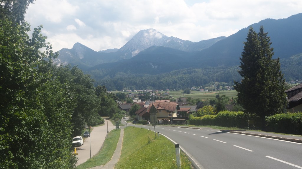
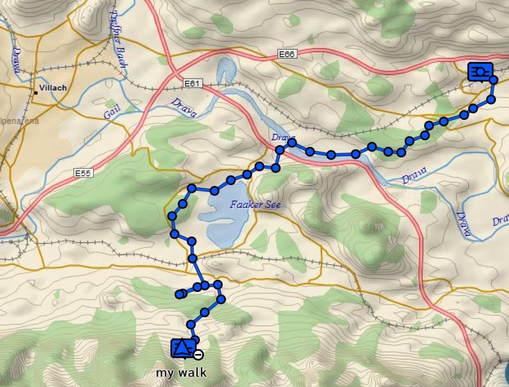
After Faak am See I came to the ‘extra bit’ I talked about earlier, the climb to the Baumgartnerhof hotel. It started well enough, passing the sleepy village of Pogiariach, with its prominent church on a mound, visible all around. Shortly after I took the path up through the woods signed for Baumgartnerhof.
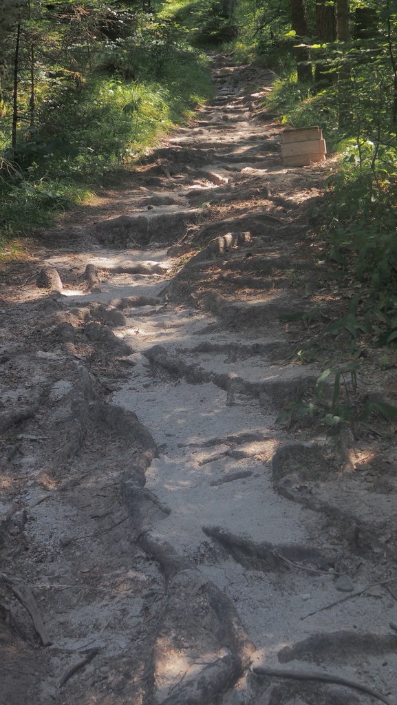
The first thing I noticed was how the ground was sandy, for the first time anywhere on this trail. It was also steep, covered in tree roots and had some gaping holes which looked like they had been worn away by flows of rain water. This didn’t appear to deter the people coming down – there seems to be quite a few. But after a couple of big steps up from gullies, within about ten minutes I came to a bigger problem. The whole path had been washed away, leaving a sandy, sloping remnant of path that had no level footing, looked like it would crumble, and had a big drop to the right.
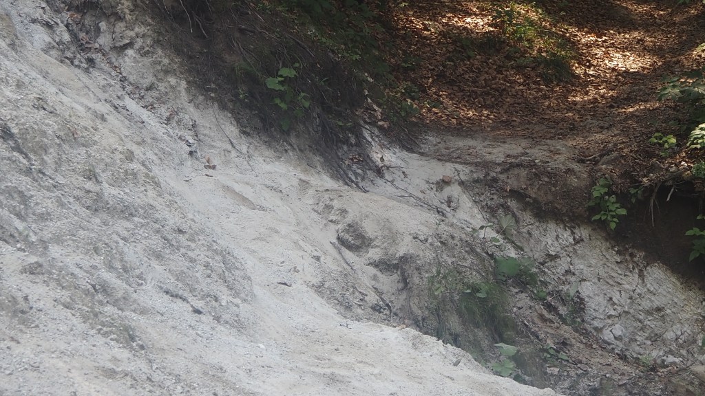
I knew straight away that I wasn’t going to attempt to pass this- I was surprised that others had been OK with it (assuming they hadn’t done the same as me- starting at the bottom and turning around when they reached this point). It wasn’t worth risking serious injury for this.
I knew that there was an alternative – a road up to the hotel – as my luggage was being delivered there by taxi. I would have to take that route today I thought, and take the taxi the following morning with my luggage, to Kranjska Gora.
Having found the road route fairly easily on the gps, I retraced my steps of the last half hour. An hour long walk up a number of steep roads to get there followed. Tired, I finally arrived at the hotel about 5:15 pm having taken two and half hours for the 5km or so from Faak am See. Within half an hour the threatened thunderstorm had arrived. I had timed it just right.
Tomorrow I plan to have a rest day, travelling by car to Kranjska Gora, over the border in Slovenia. It will be goodbye to Austria, specifically Carinthia, where I’ve been for the last three and half weeks and have enjoyed some fabulous walking. Then on Sunday, what had been planned as my rest day, I will probably do the first half of stage 23 of the hike- the uphill part, leaving the downhill for Monday as originally planned. Part of this I have done before, and I recollect there is some beautiful and spectacular scenery to look forward to. I’m sure my memory is not lying.