Following all of the drama of Thursday night’s storms and its aftermath, I spent Friday evening at Radenthein, before being driven to Bad Kleinkirchheim yesterday. There, I said goodbye to Brunhilde and Christian, who have been so good to me the last few days, and had a quiet day at the hotel, washing clothes, relaxing and reading.
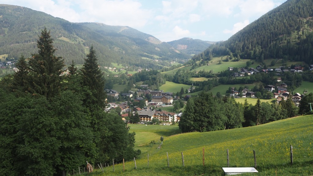
On the drive there, further evidence of the havoc wreaked by the storm on Thursday was obvious. At the western end of Bad Kleinkirchheim, mud, trees and other debris had been washed down the hill in front of a hotel by the power of the water and, now nearly two days later, the road had only just been properly cleared- workers and excavators were still trying to clear up the mess.
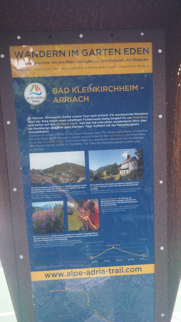
Nice as it is to have a little rest, with me having to abandon any hope of hiking two stages of the trail this summer (stage 15 from Erlacherhaus to Larchenhutte; and stage 16 Larchenhutte to Bad Kleinkirchheim), and extra time on my hands, I was keen to be doing something. My first thought was to take the cable car, the Bergbahnen, which was very close to my hotel, up to the summit of Kaiserberg, which I could actually see from my hotel balcony. But then I realised the climb to Kaiserberg formed the first part of Stage 17 of the Alpe Adria trail, so that would be duplicating my walk the next day.
So instead I thought why not divide stage 17 into two, and walk up to Kaiserberg today, my planned rest day, as a half day walk, catching the gondola (cable car ) back down; and take the gondola back up tomorrow to recommence the walk? That way I would have two easier walking days. Particularly as I had been told that luggage transport would not now be available for the next two days, it made sense to do the big ascent with a lighter rucksack while still based at Bad Kleinkirchheim.
So setting out early, I found the start of this stage of the trail easily enough, but annoyingly, even with my gps, it took me about 20 minutes to establish where the walk went from there. This sort of thing is not actually as unusual to me as it sounds- I’ve often found with walks locating the start and setting off in the right direction from a town can be more difficult than it appears. It’s a bit like when coming up out of an unfamiliar tube station and not being able to work out which direction you’re facing and where to go.
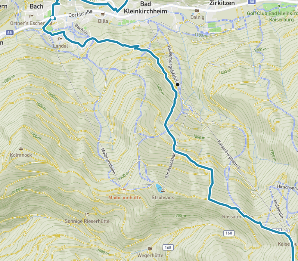
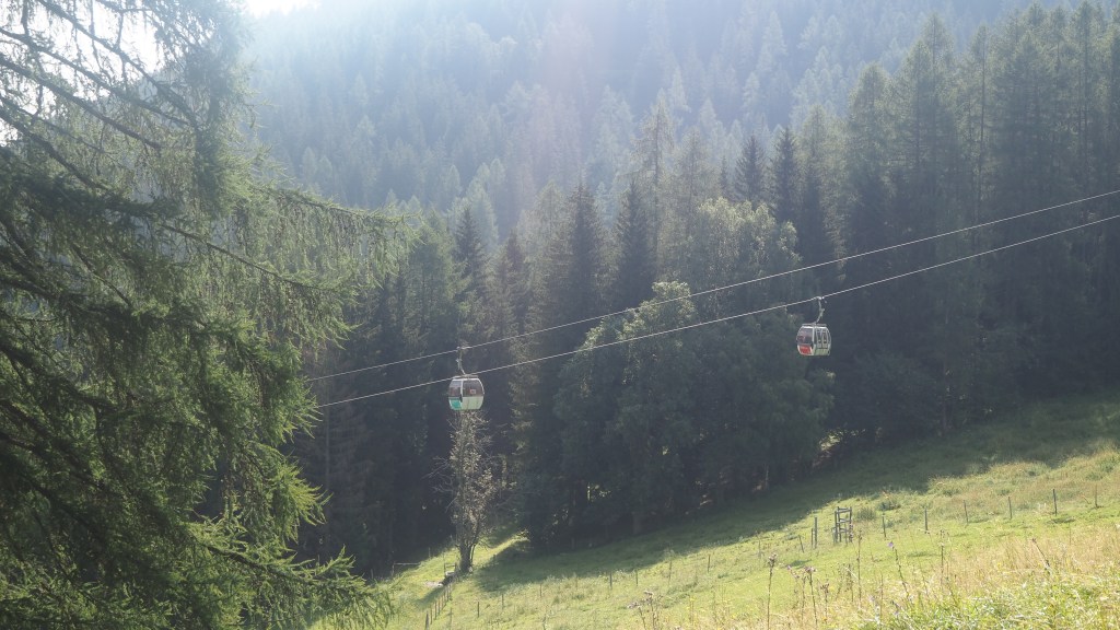
Eventually I found the way though, and then followed a road south east up out of town (the storm devastation had largely been to the north), soon becoming a cinder track, with hardy cyclists pedalling their way vigorously uphill. A bobsleigh run crossed over the track at one point and before long, I could see a line of gondola cabins ascending the hillside ahead of me.
When I walk past a line of gondolas what often strikes me is how quiet they are. It’s not until you are very close or underneath them that you can hear much at all, and then it’s only a hum and a rumble as a each gondola passes a pylon. They’re actually quite peaceful to watch.
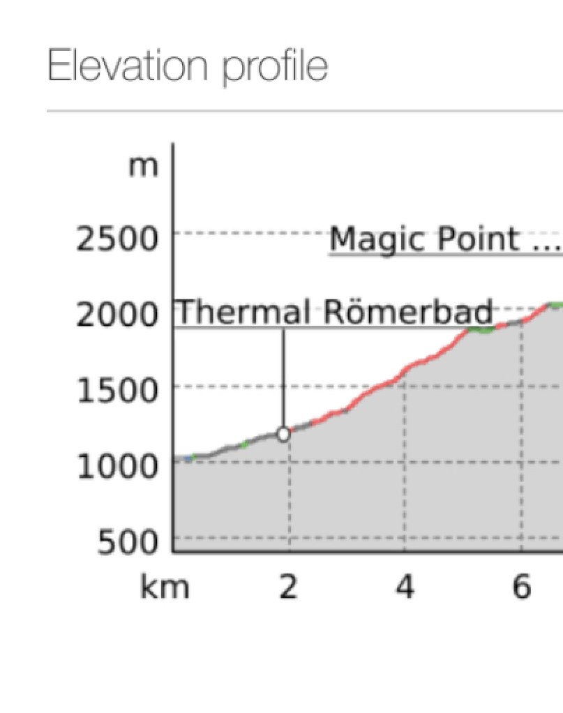
After one or two switchbacks in the wide track, the Alpe Adria route started taking steep short cuts before it abandoned the track altogether, to take a steep root-covered path uphill. And it got pretty steep from then on. On average, the morning’s walk was about a 10% incline- 1000 metres or so over 10 km, but with the roads being less steep and a few flatter sections the steeper paths were probably double that. With the rain we had had here again last night, parts of the path were quite slippery so I was actually glad I was going up and not down.
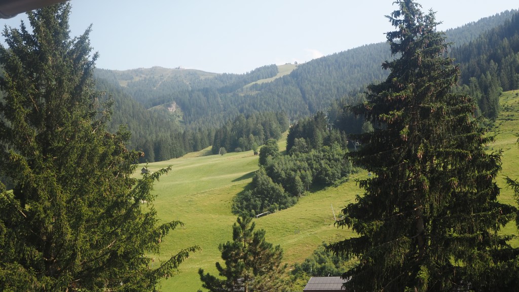
I passed a ski run, and then started meeting people who had obviously caught the gondola up and decided to walk down.
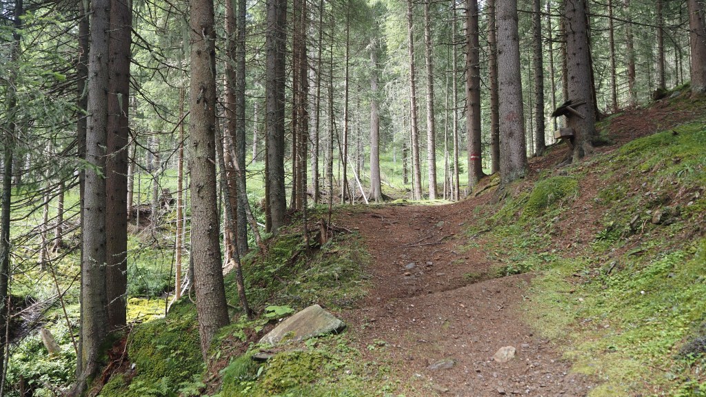
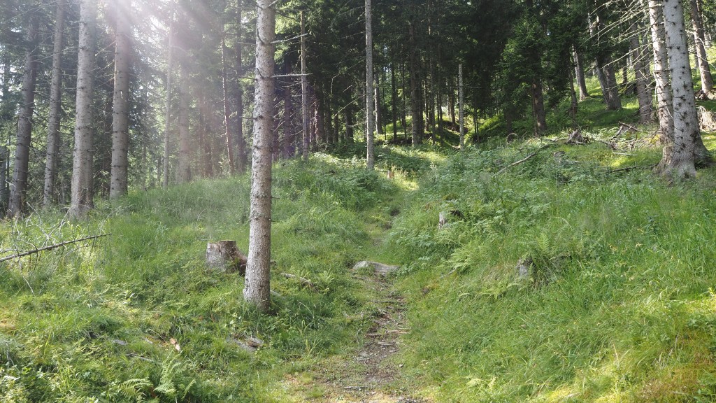
For most of the time the walk today was in forest, and when you’re carefully watching your feet as I was you can’t help noticing the number of ants you see here. They’re much bigger than those you normally see in the UK, and they march in lines across the trail to and fro from their enormous mounded nests, often carrying bits of leaves and the like that are bigger than they are. It also means you have to think and look every time you stop and put anything down- to adjust a sock or get something out of your bag, especially to eat. I have once had an experience, back at home with smaller ants, when I forgot to do this and spent the next half an hour desperately trying to get rid of the swarms of ants that had colonised my rucksack. I don’t want to risk it with these bigger, more menacing-looking, species.
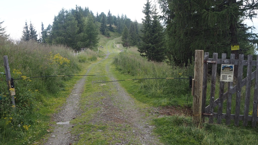
Eventually I came to a level, clearer grassy area. Here there was an electrified gate barrier to keep out the cattle, which helpfully had a side gate for hikers. Over the last few weeks, I’ve come across quite a few of these, and where there has not been a side gate, I have become used to having to limbo underneath them to avoid getting a shock. You never really know whether the current is on or not, but I reckon if a shock is enough to deter a big animal like a cow, it’s going to be painful if you are unlucky enough to touch it and the power is on. Better to be safe than sorry.
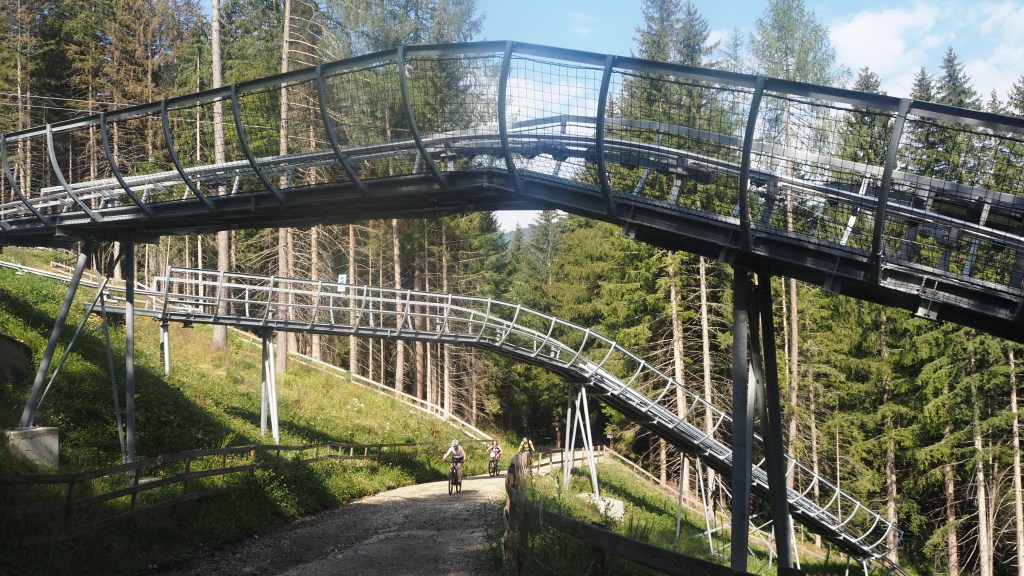
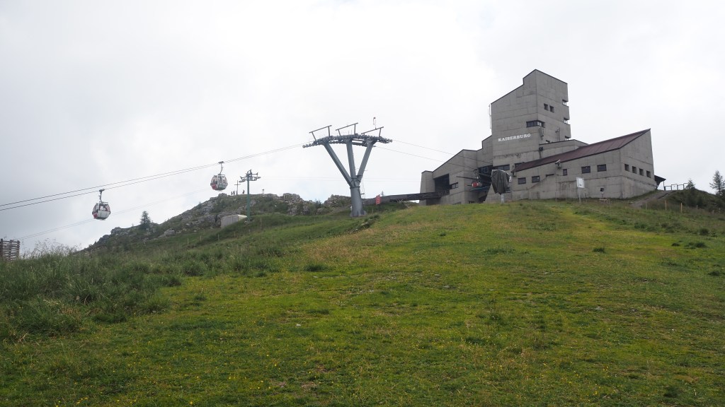
The last part of the walk ran alongside a mountain bikers’ route, thankfully segregated as they were rattling along at quite a pace as they passed. Ahead I could see the concrete block of the Bergbahnen top station, Kaiserberg, but the last stretch was a stiff climb before you actually got there.
Nearby there were two obvious summits- one very close by, marked by a big cross, and another which I think is probably Wollaner Nock. There was a long line of people making their way there by means of a ridge, their silhouettes visible on the horizon. Tomorrow I may be one of them as I think this is the route I’m going to be taking.
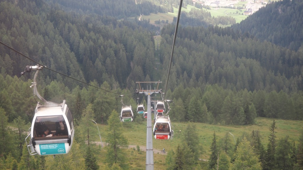
And so I took the gondola down. Actually, as is often the case with these, it was a two part ride with a middle station where you had to get out before getting another one. Unfortunately, I had made the mistake of not buying a ticket at the bottom before I left, not realising there is often nowhere to buy a ticket at the top, so I had to persuade two guys of my honesty and that I would buy a ticket when I got down. Once there, of course no one asked me, but I bought a ticket anyway. It’s a shame you can’t get a return ticket coming back on a different days, but never mind.
So, nice to get back to the hiking, and I think I’ve made the right decision to split this stage across two days as I have. Tomorrow there is more up, another 200 metres or so, but the majority will be downhill. I think I’m much more likely to enjoy the day tomorrow doing it this way, and with only 12 km or so to walk it shouldn’t take me all day either.