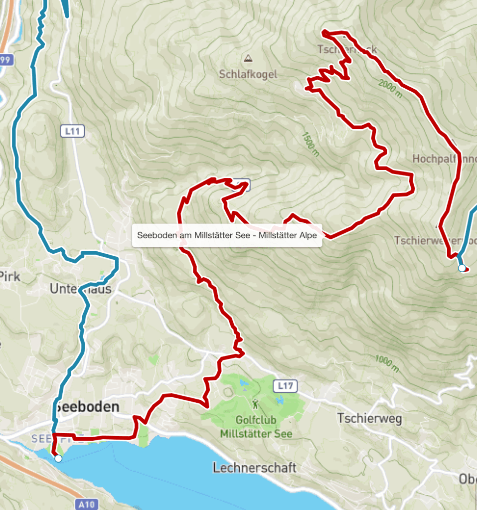
I knew today would see a big change from the easy lower level walks of the last week or so, as I was heading high up into the Nockberge, a range of high, grassy mountains. Tonight I would also be staying in a proper mountain hut for the first time (apart from one experience 25 years earlier in New Zealand). My rucksack was heavier too as I needed to carry toiletries, towel and bedding, not having access to my suitcase until the night after. And again I was anxious to start early in view of the heat- it had been stifling in the hotel room overnight and Seeboden was hot and the air still, even as I left at about 8 am.
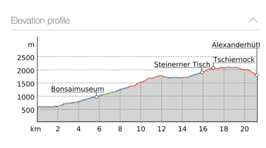
I needed plenty of water- I picked up five half litre bottles from the supermarket, as I knew there was going to be a lot of ascent today. Seeboden, surprisingly , was already at 592 metres above sea level, but Millstatter hut, where I was heading, was a whopping 1880 metres above sea level. In between the route promised to take me up to 2088 metres, before descending down a little – so around 1500 metres of climbing was expected.
In fact it didn’t quite turn out that way. Almost, but not quite.The first couple of hours was a long plod up a mainly shaded road, with little traffic apart from quite a few e-bikes. These seem popular here and it’s understandable because the uphill would be a real struggle even for the fittest cyclist.
I knew that I should arrive at my first landmark, the Pichlhutte, by about 11:30 because thoughtful signs with pictures of frothy beer by the side of the road said ‘30 minutes’ and ‘15 minutes’ – they turned out to be pretty accurate too.
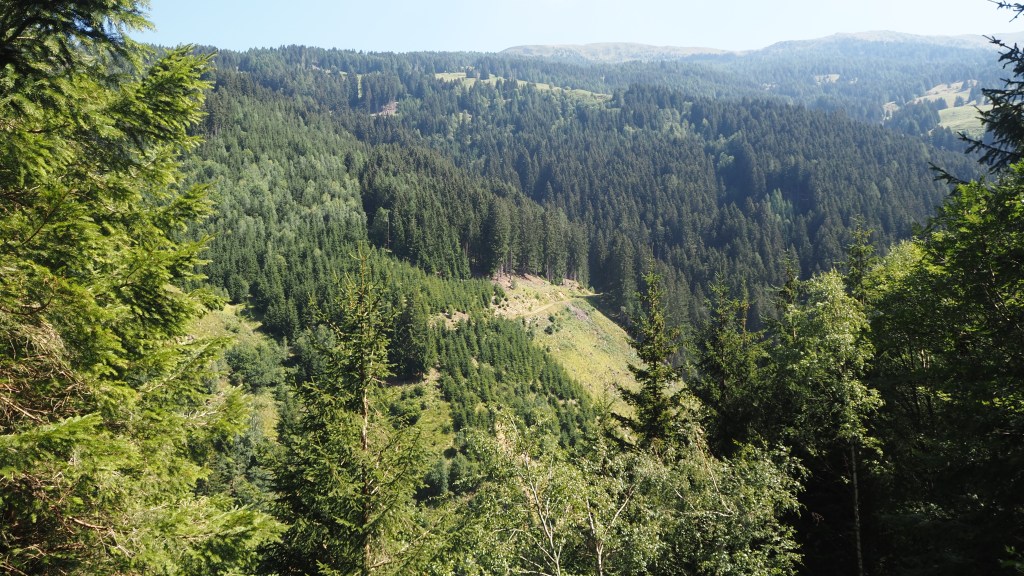
Unfortunately when I arrived at Pichlhutte the path onwards had a ‘Danger walking path closed’ . After phoning my tour company, I was assured that this was an old sign from when there had been some rain damage, that it was now safe, and I should carry on. And so I did, only to find ten minutes later there was another sign, this time saying ‘ Forestry operations, danger, do not enter’ or something similar. I thought I’d heard forestry vehicles, and could certainly see piles of logs ahead and wondered how feasible it would be to continue.
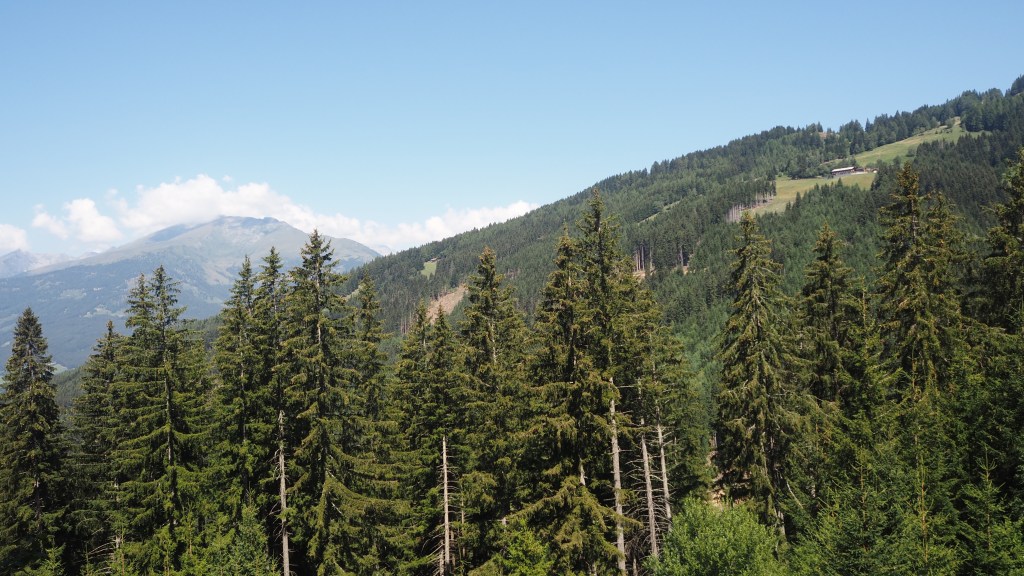
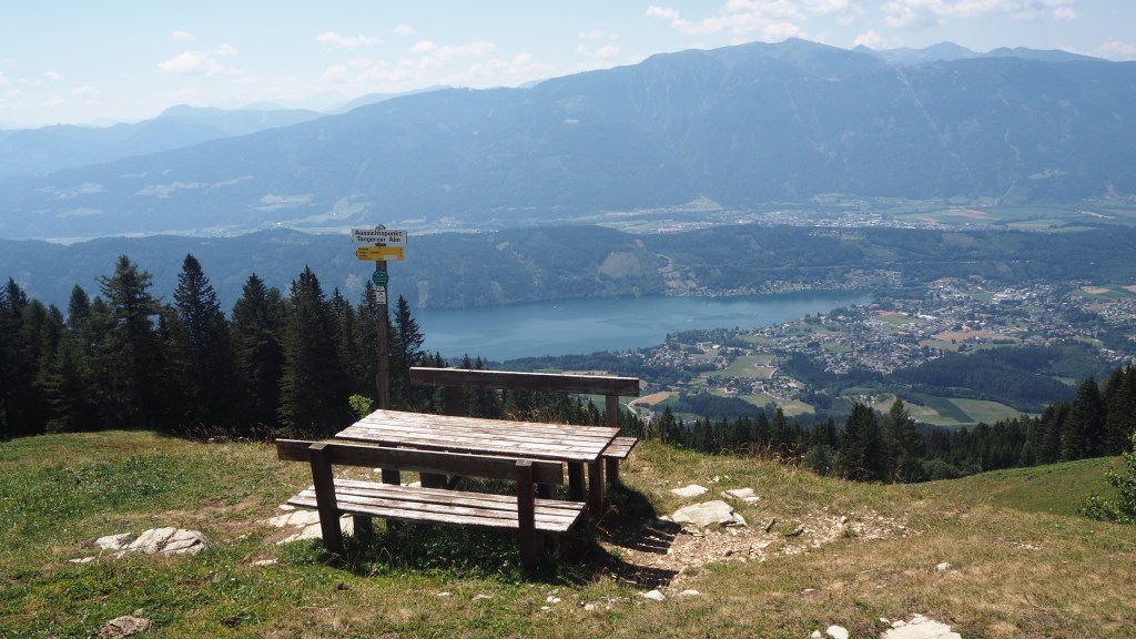
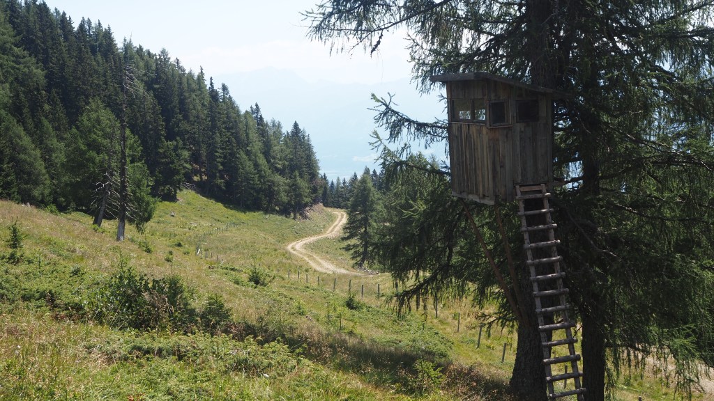
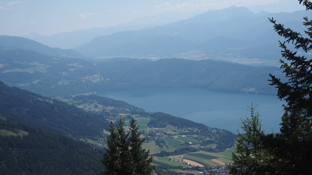
Maybe the forestry workers had gone for lunch, but all I could see now was an abandoned tractor/excavator, so edging ahead, and walking round some cut down trees, I managed to get past to where the vehicle was and onto a wide logging trail. Here there were wonderful views down to Seeboden, which distracted me a little, but then I found a path heading up which seemed to match up with my gps. I was back in safety and headed for a convenient picnic table that I could see on top of the hill of Tangerner Alm. This made a perfect spot for lunch, with amazing views over the hills and forest over Millstatter See.
Resuming the walk, I found the Alpe Adria app saying one thing, and my gps, book and (sometimes) signs another. It all got a bit confusing, so I just cut my losses and followed a (non Alpe Adria Trail) sign for Millstatter hut, my final destination.
Before long I could see on my gps that this route would cut out a big loop north ( and up) of the Trail and to be honest by this time I was quite glad of that. Yes I would miss out a little of the route, and views north from the Nockberge, but when I’d last seen a sign it had said four hours and this one said only 1.5 hours. Tired from a long walk up, an hour and a half sounded appealing.
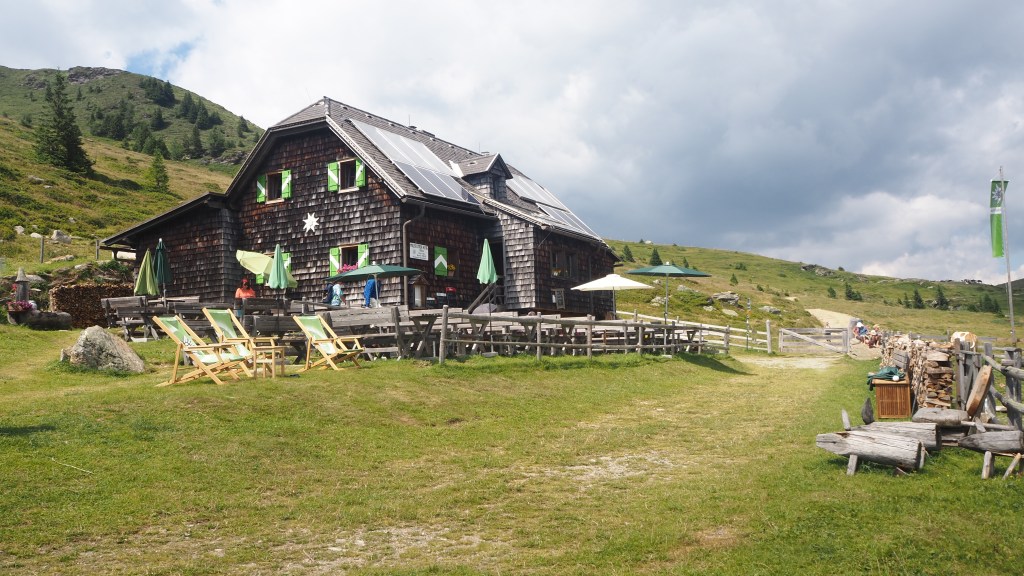
My alternative route in actual fact turned out to be lovely, and easy to walk on, with only minimal further incline. I had already walked up some 1300 metres (a Ben Nevis after all) so I wasn’t distraught about missing out on another 200! But by the time I arrived at the mountain hut at about 3pm I was still worn out.
The mountain hut, Millstatter Hutte, was in a perfect spot and I was immediately made to feel welcome by the staff. I was put in a room of four and asked whether if others arrived I would mind sharing. As I had been expecting some sort of dormitory, and the hut was so small I could hardly object.
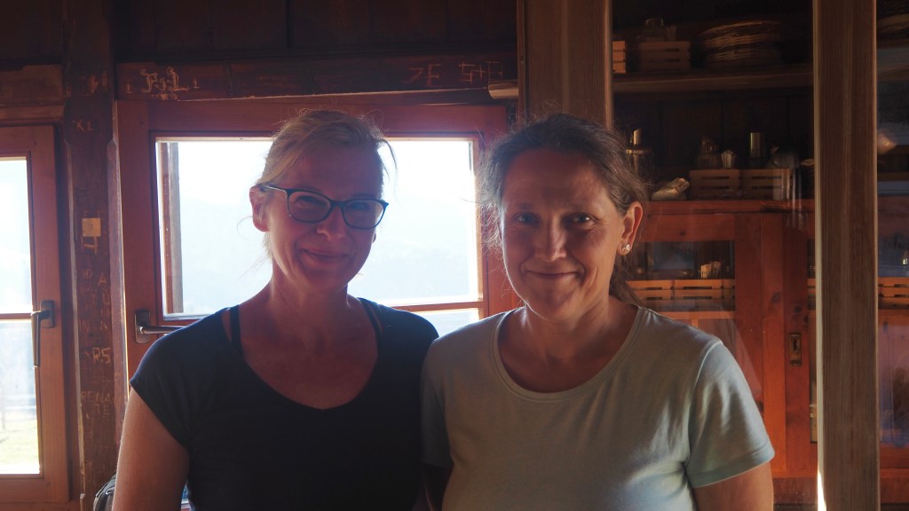
As it turned out I did share, with two keen walkers, Gabby and Natalie, whose families also didn’t quite share their love of hiking, at least not to the same degree. They were from Graz in Austria and were old hands at mountain huts. For the last few days they had been walking the Nockberge trail and tomorrow were going to be walking to Seeboden – my journey of today in reverse. I hope I didn’t disturb them too much by getting up for the toilet in the night and waking early to have a shower. Or snoring.

I was more concerned about you disturbing them with wind!
Well done love ❤
LikeLike