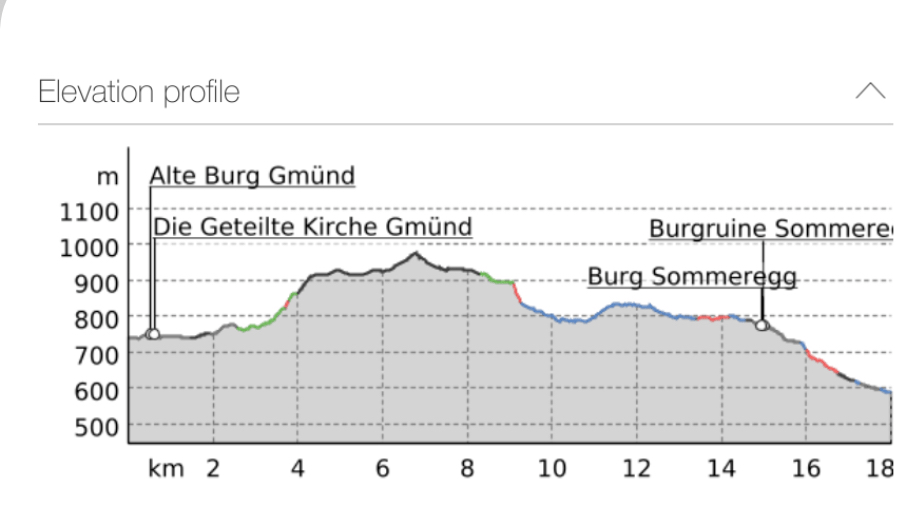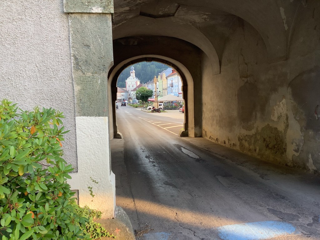
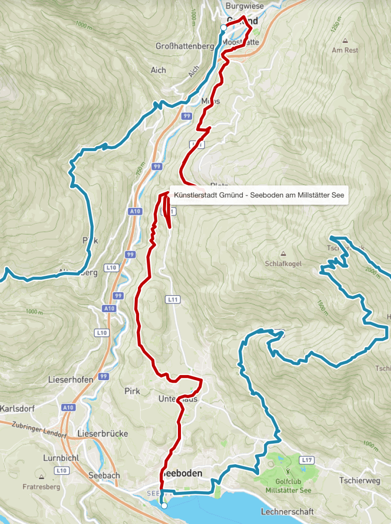
After a day of rest at Gmund, I set out early on my walk to Seeboden so as to avoid the mid afternoon heat, conscious that I was lucky that temperatures in Austria were forecast in the high 20s rather than a possible record breaking 40C back in the UK.
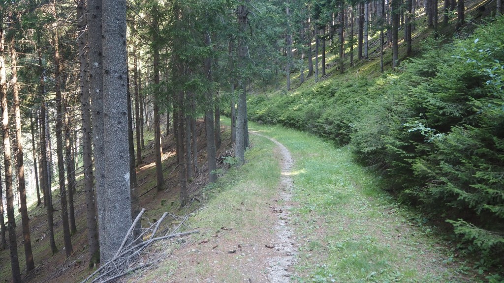
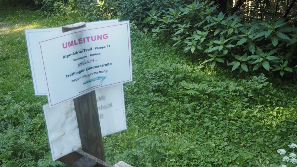
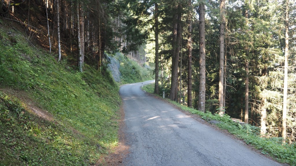
The first few hours of the walk turned out to be very pleasant and easy forest walking, shady with the pervading smell of pine all around. Due to a landslip, I was diverted up higher than the normal route, via a couple of switchbacks, to follow a quiet road, before descending back to the path – all of which probably added a couple of km to today’s distance. But nonetheless it was easy walk, and after previous exertions felt almost effortless.
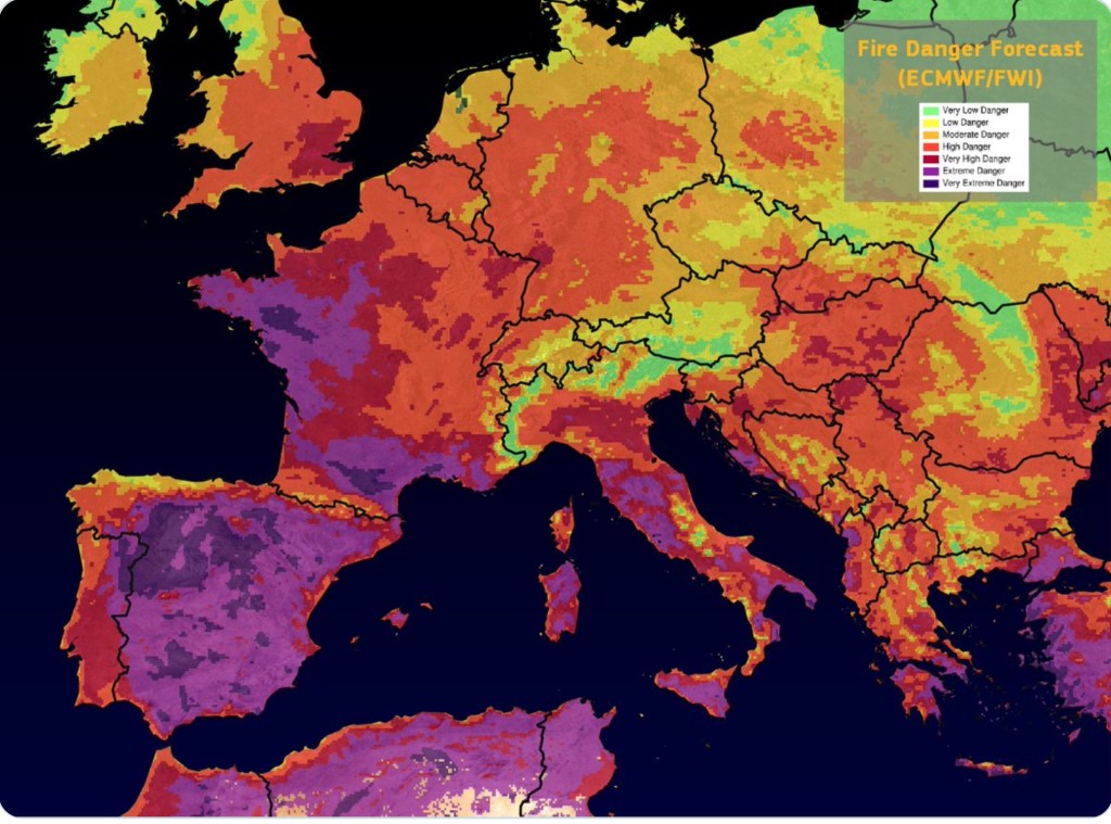
With all the news at the moment of forest fires across Europe though I thought I’d check out his things stand here in Austria. I found the map below, which shows, fortunately, that Austria is one of the safer places to be walking in forest in Europe at present, along with Ireland and Scotland. The bigger worry is for Slovenia and Italy, when I arrive there (but at least none of the areas I’m going to are coloured purple yet). Essentially once I’m there it’s about the same risk as back home in southern England. I’ll just have to pay attention to weather and news reports.
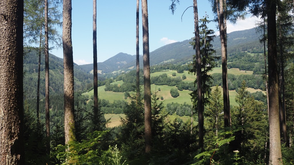
Anyway, back to today’s walk, and after a while, gaps in the trees started to appear, and I was taken on a roundabout route close to the village of Kolm, and then round the edge of another village, Treffling.
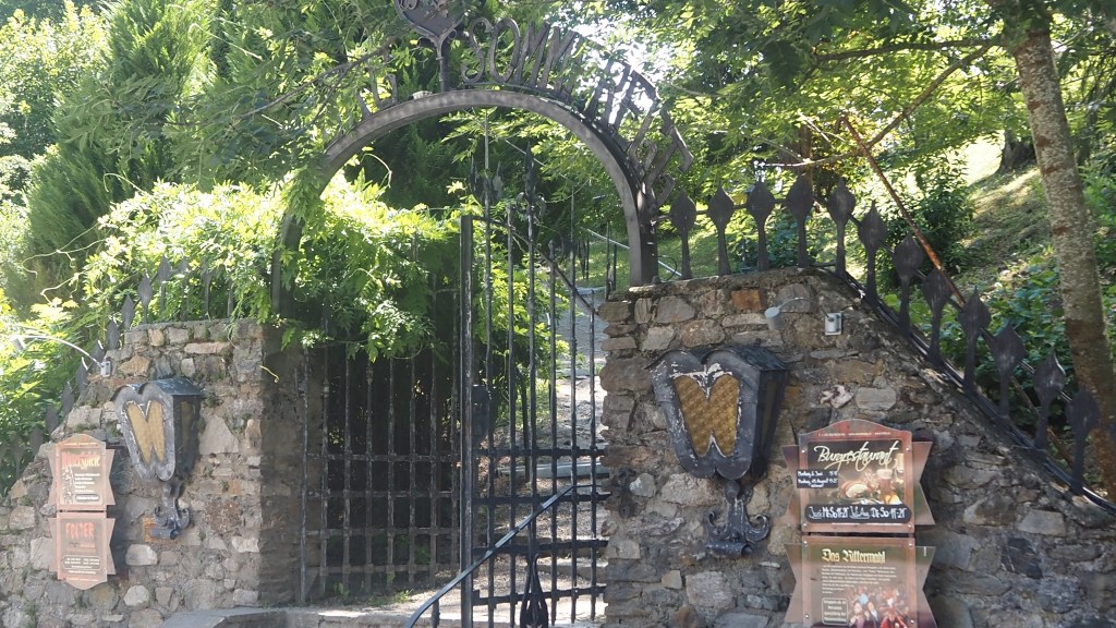
Here I resisted any temptation to visit what is apparently the world’s biggest torture museum, in Sommeregg castle. Why it should be here I’m not entirely sure. But having been to a museum of torture years ago (in Ghent in Belgium) I could do without visiting another.
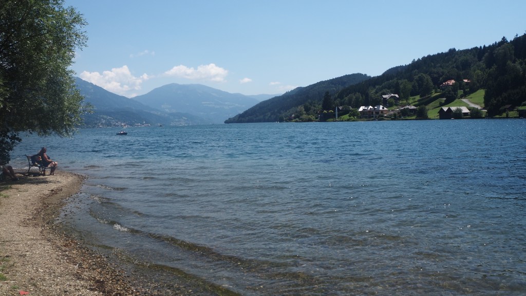
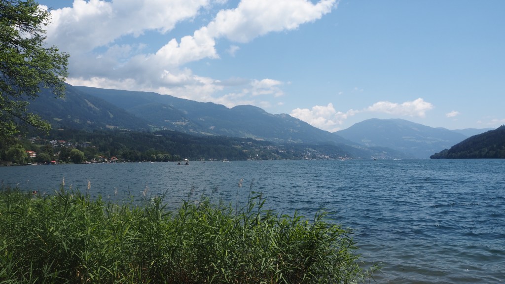
Shortly after I descended through the town and resort of Seeboden, set on Millstatter See. It’s clearly a popular place, with families sunbathing and taking to the water.
Even with the added distance I was finished by around 1 pm, having started just after 8, taking about five hours, compared to the guideline four hours. But rather than 14.6 km I had walked 18.77 km. Some of this was due to the diversion, and some more to my decision to walk to the water’s edge and back, beyond the official stage end. But there’s more to it than just that, I think.
All of my distance and elevation readings are taken from my own gps, which should make them considerably more accurate than anything else in measuring what I actually walked. So what’s the explanation for the sometimes big differences form routes and book measurements? I think it is what my wife, Jeni, and I labelled the ‘Fletcher principle’ years ago after a Scottish B and B proprietor who explained why our all day walk along Loch Lomond seemed like a lot more than the official distance. He said: that’s because it was.
Essentially, any route traced on a map is an approximation. It consists of a series of straight lines. In reality we move both is a sidewards plane, curving and from side to side as the walk is often not straight; and varying in height- whether in a ‘hypotenuse’, a ‘roller coaster’ up and down effect, or a series of zigzags, for instance when there’s a steep descent. All of these add distance, and over the course of a day’s walk the amount can be quite considerable.
It’s like the question ‘how long is the coastline of Britain?’ If you measured it on small scale map you would get a very different answer to the distance measured on a large scale map – where you would measure all the little inlets. And in real life those ins and outs are even greater. There was a notable paper written over fifty years ago on this very issue, sometimes called the ‘coastline paradox’ , by a mathematician by the name of Benoit Mandelbrot. If you’re interested, check it out.