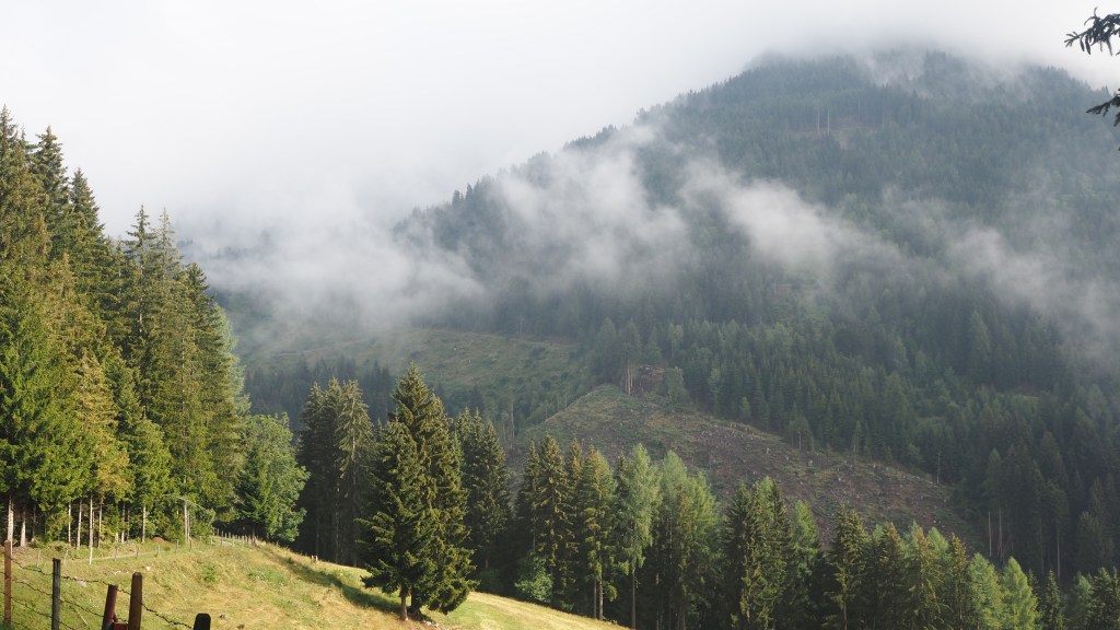
The rain of yesterday continued all evening and all night, and was heavy and noisy- I was woken by thunder and lightening during the night. By morning the rain had stopped, but the view from the balcony was still completely enveloped in cloud.
It seemed after all I hadn’t been staying at my hotel alone- there was a group of six who were rising for breakfast as I left. But with the cloud enveloping the hillside there was still an eerieness when I started walking as you couldn’t see far ahead. It was pleasantly cool, and the cloud lingered before turning into a haze which made taking photographs difficult.
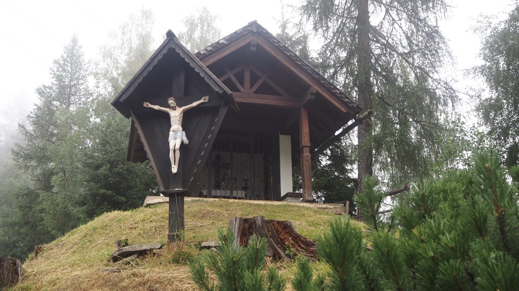
Near the start of the walk I passed one of the many Catholic shrines that can be found throughout this area. I guess on a typical day I have passed at least half a dozen. Some are small roadside affairs, others quite grand, like this one in the woods which included a shelter. I’ve seen this sort of thing before in other catholic regions in Europe, but can’t remember seeing as many as this before, with the possible exception of the Black Forest in Germany. I guess, regardless of your convictions, you can appreciate a shelter being provided in the forest.
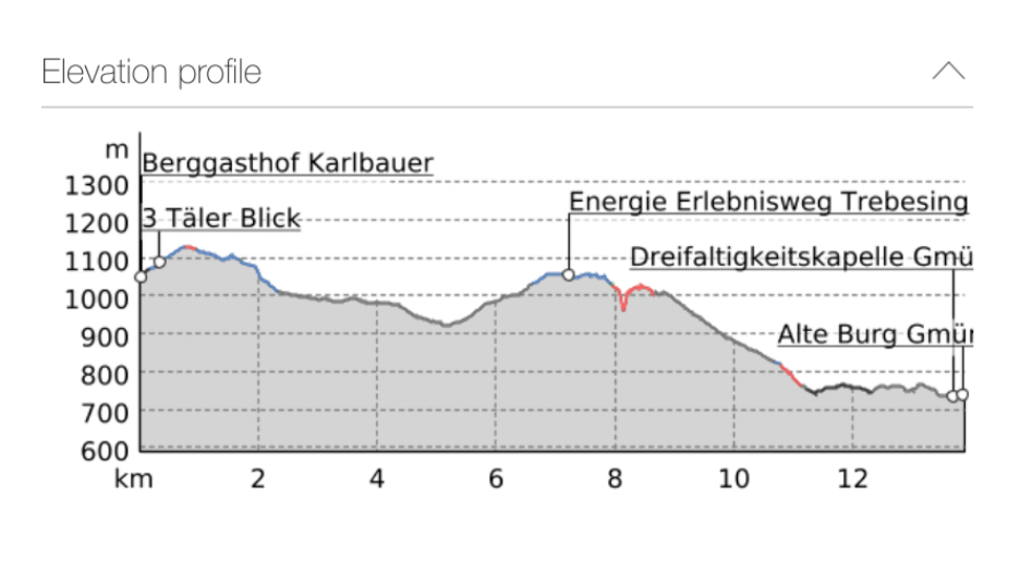
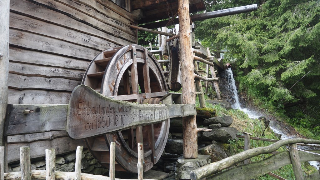
At first, there was another pleasant forest walk, before I followed lanes through farmland and villages. I passed another waterwheel, part of a preserved old mill.
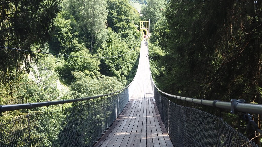
Today I had a choice of two routes once I reached the village of Altersberg. I could walk uphill, via the intriguing sounding ‘Fairytale hiking mile’ to a suspension bridge over the Drachenschlut gorge. Or I could play safe and take a route downhill crossing a stone bridge. The suspension bridge, which is the longest in the Alps, at 175 metres sounded more interesting, but I was a bit concerned that I might walk all the way uphill only to find it closed, as apparently others had complained about. This would mean walking back down and then taking the alternative route, a long detour. Anyway I took the risk, and it paid off.
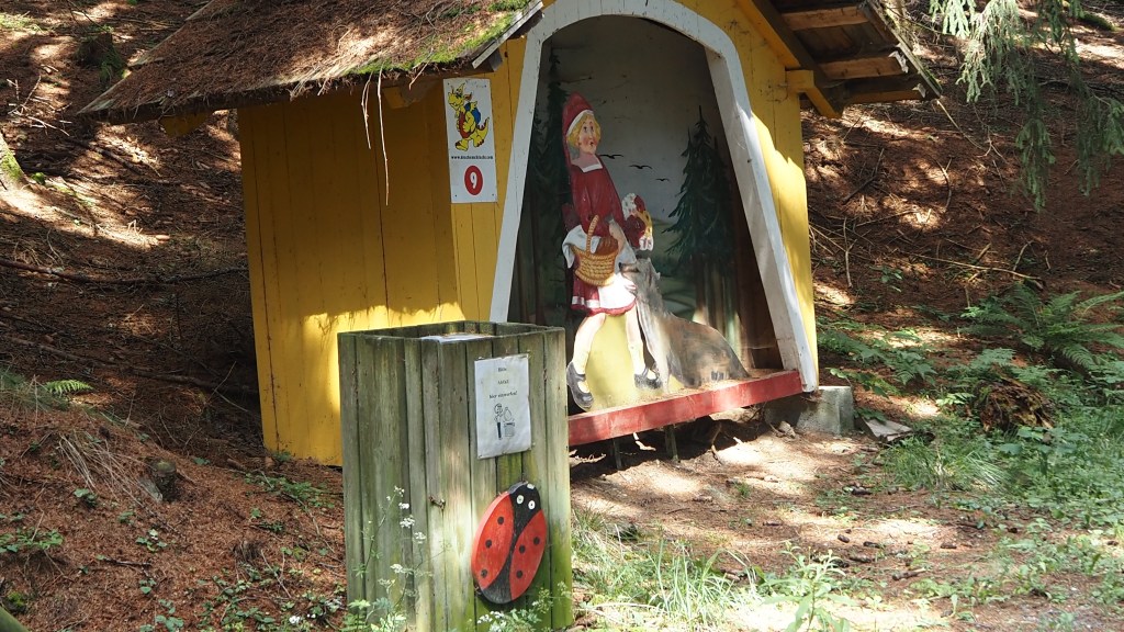
My holiday company had sent me some notes which pointedly referred to the ‘former’ Fairytale hiking mile, and as I started walking up I was distinctly underwhelmed. At first there were simply what looked like a few garden gnomes at intervals along the road; then some little huts started to appear with wooden figures depicting scenes and characters from fairy tales; and finally there were some large figures like this one of the dragon below.
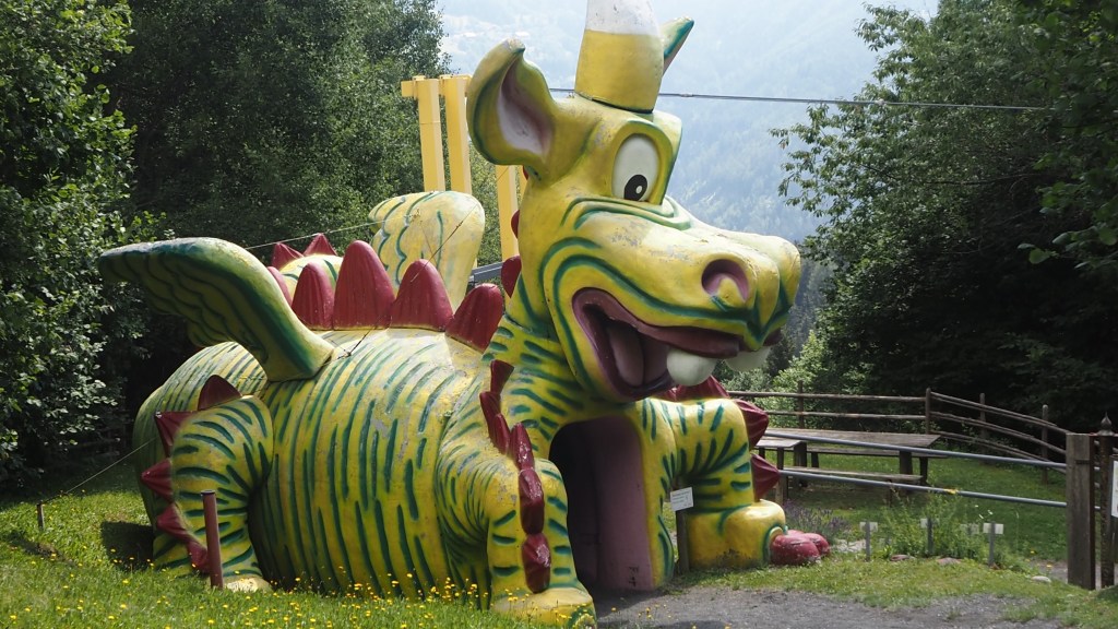
It seemed like what had been some sort of paid attraction had probably folded, and what I was seeing were the slightly tatty remnants of what had been left behind. The bridge formerly was part of this attraction, but was now free to use (when it was open). Luckily it was.
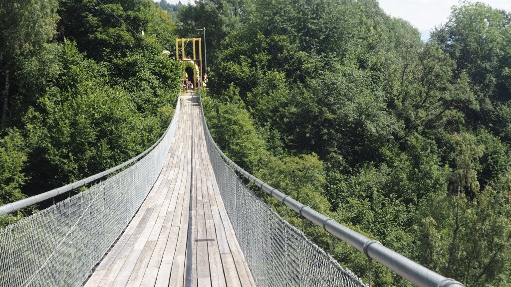
What actually surprised me was how stable the bridge was. In Britain no doubt there would be people trying to make it wobble, but here there were just a couple of families taking selfies and walking with their children across the gorge. Yes, there was a slight wobble in the middle, and no doubt in bad weather it wouldn’t be much fun, but it didn’t seem much more wobbly than Penge West station bridge to me! A little disappointedly, because the bridge was hidden in forest there was nowhere you could take a picture to show how long the bridge was.
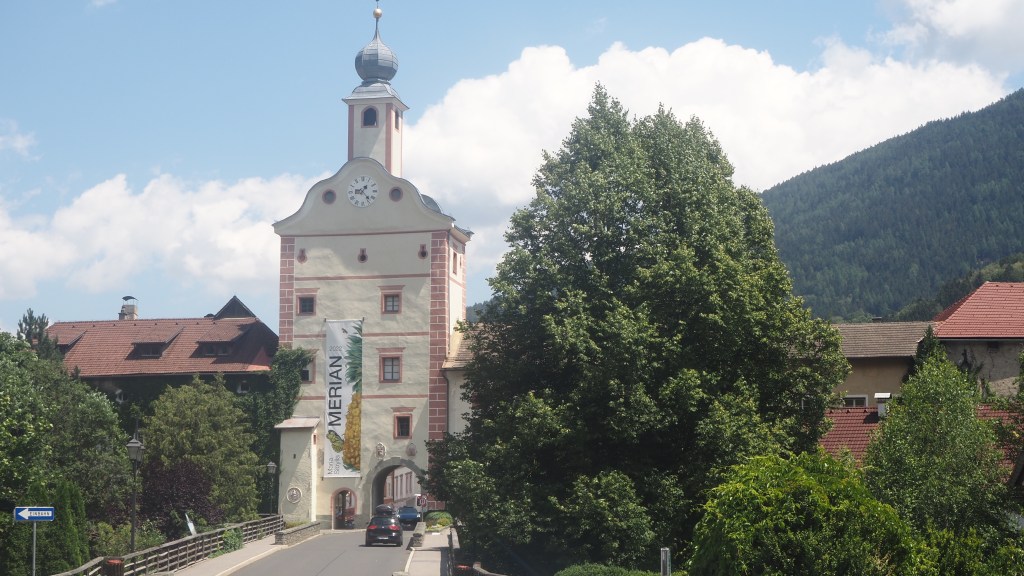
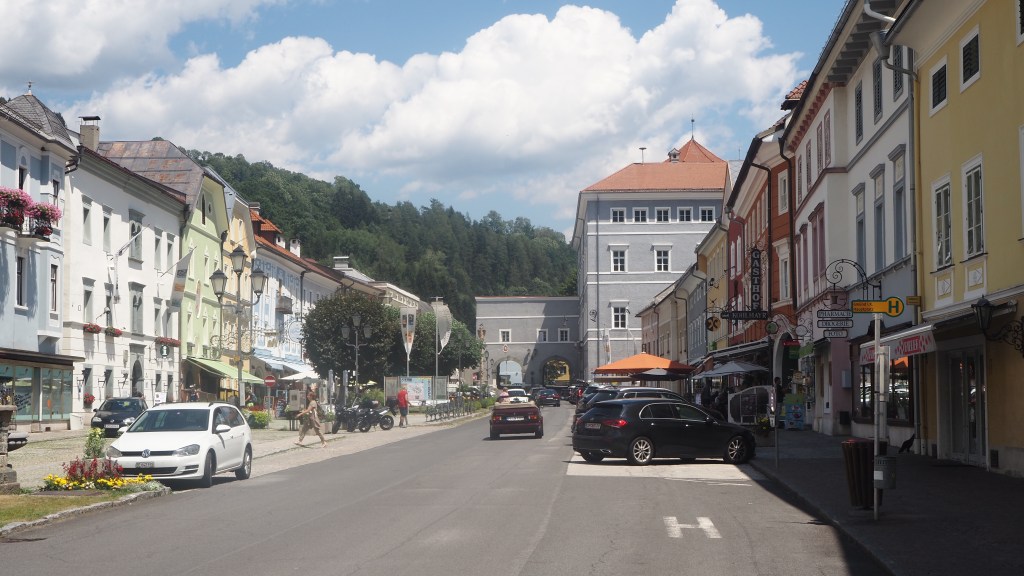
I then found myself on a long descent along a little lane down towards the valley. By this time the temperature was creeping up. The path led under a motorway and then into the town of Gmund, entering via the west gate. The town isn’t very big, but is instantly appealing with its well preserved town walls and gates, buildings and town square. As I write this I have already spent a pleasant hour reading, over a pint, sat in bar in the square (but if only so many Austrians didn’t smoke!)
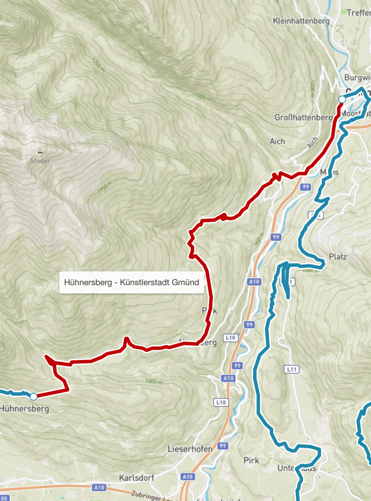
This week has been a short and easy week’s walking. From now on I shall be walking six days and resting on Sunday, right up until towards the end when I have ambitiously planned nine walking days in a row.
On a hike such as this of course, rest days are not just that, but also a chance to wash your clothes, which hopefully I shall get better at. At least with the weather warming up they should be easier to dry.
Nest week promises temperatures possibly as high as 31C. Hopefully up high it will be cooler than that, and if I start early I shall spend at least a few hours in much cooler temperatures, better for long climbs. And the walk should be more adventurous again, with some big climbs, more forest and off road walking again, as well as stays in some mountain huts. I will also be saying farewell to the Moll valley, which I’ve been following for most of the last ten days. So some interesting walking in prospect, and I will do my best to capture some of the experience in my posts.