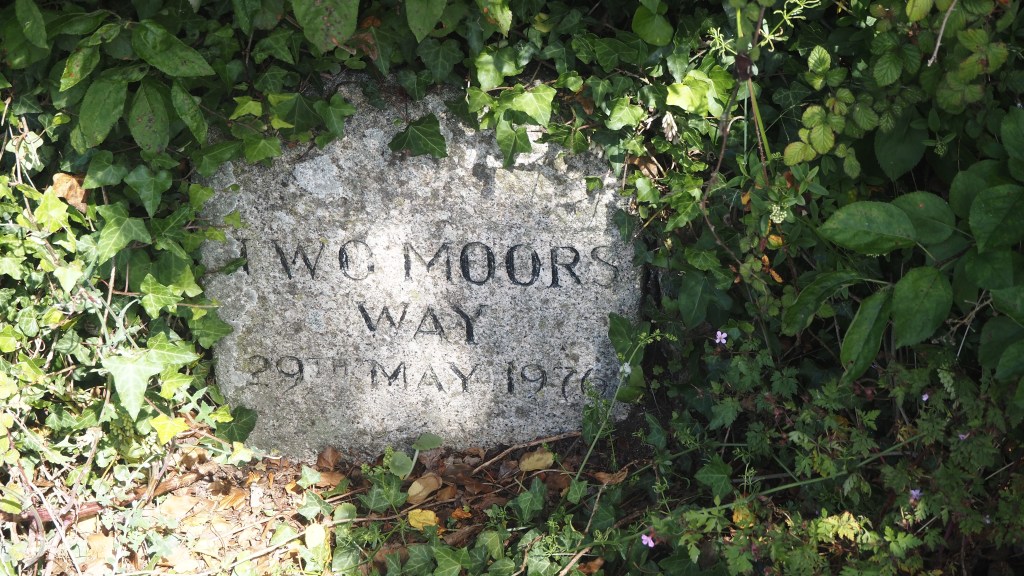
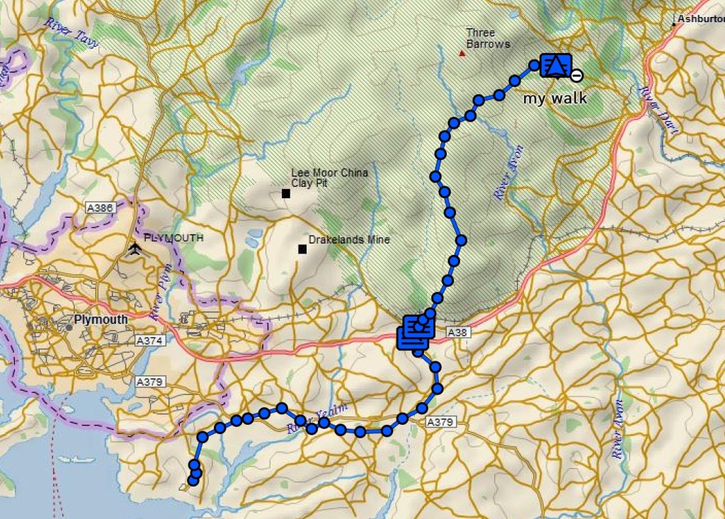
Today we started on the Two Moors Way proper, after yesterday’s introductory day on the Erme-Plym trail. Within ten minutes of leaving Ivybridge, we passed an inauspicious stone marking in the bushes indicating the start of the Two Moors route, and shortly after entered Dartmoor national park.
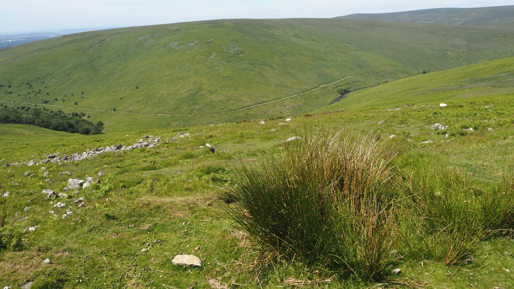
We climbed up onto the moor, and immediately encountered a very different landscape to the managed farmland of the previous day. And, as we have experienced before in Britain, bizarrely, the minute you enter a moor, the signage becomes non existent. There is, I’ve been told, a school of thought in this country that moorland should be free of any form of signage, in order to preserve the wilderness character of moorland. I’m not sure myself that this ‘purist’ approach really makes sense. Once again, armed with a Garmin gps, a detailed guide to the route and more than twenty years’ experience of long distance walking, we today still managed to stray from the route on at least three occasions. And this was in perfect weather with dry ground, and a long June day. I would think that a few marker posts, arrows on rocks or even paint markings like those in mountain Europe wouldn’t go amiss, and would help prevent unnecessary emergency call-outs.
Our route today took us into the heart of Dartmoor along clear tracks, not-so-clear tracks, and non-existent tracks.
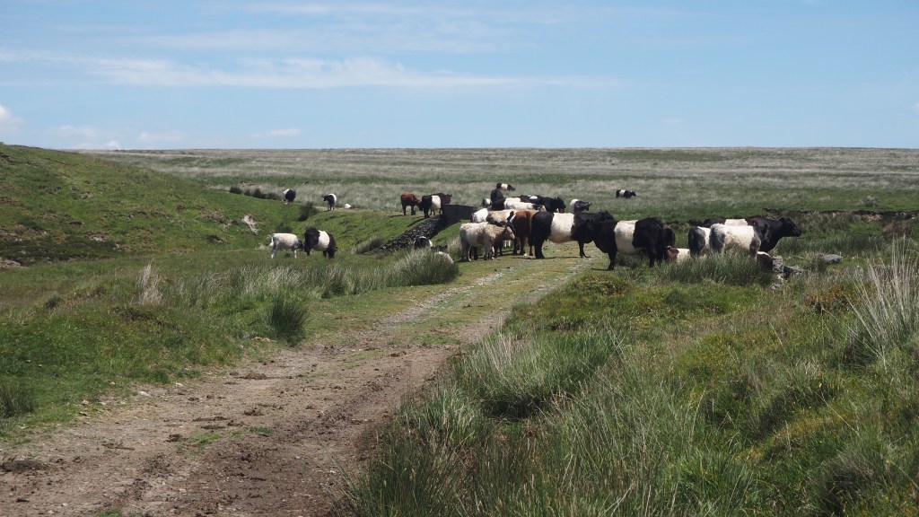
A couple of times the path was completely blocked by cattle, and detours around were a little tricky. We had to wait for the cattle to provide gaps for us to pass, and to avoid unnerving mother cows with their calves, as well as passing some bullocks. But in the end none of the animals were really threatening. It just meant we had be careful, patient and alert.
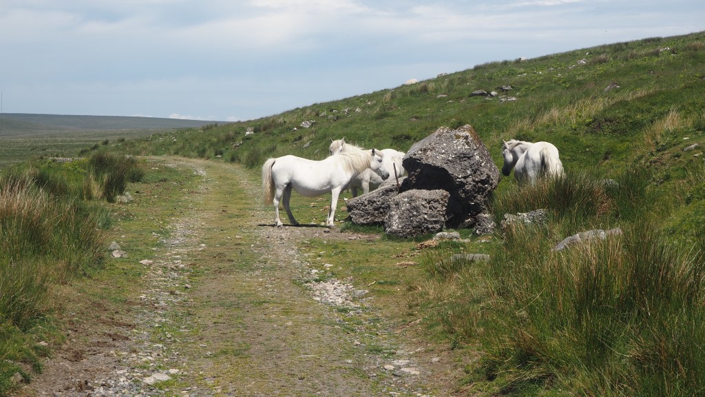
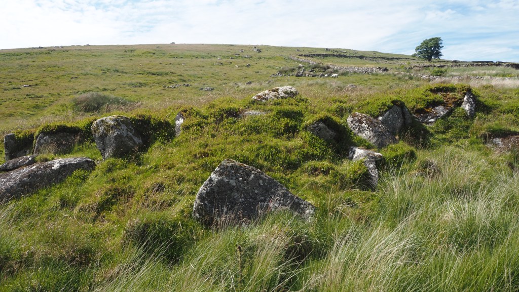
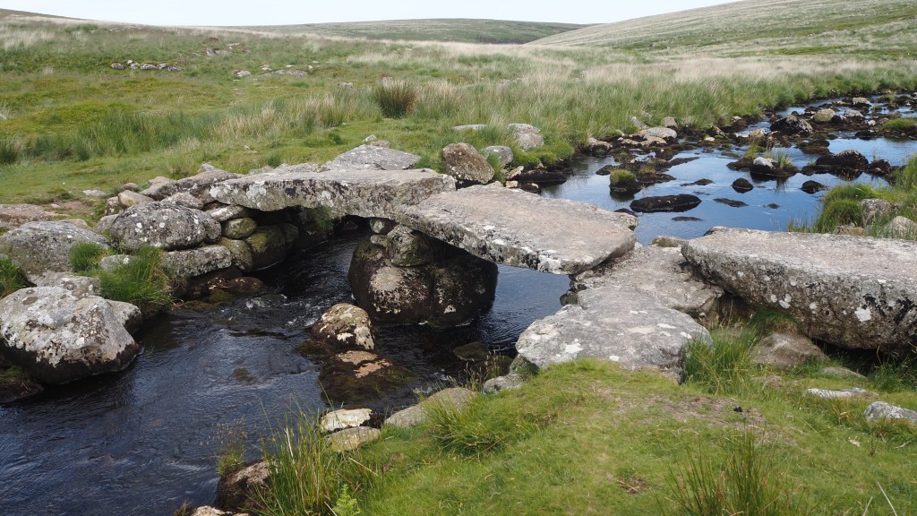
We also encountered sleek, Dartmoor ponies for the first time. Apparently they are not wild, all belonging to someone, but they have been a feature of the moor for time immemorial, giving a special character to the moor . In fact they are so associated with Dartmoor they were chosen as the symbol of the national park. Along the way we also crossed a couple of ‘clapper’ bridges- stone slabs placed carefully across ditches and streams, but which seem perfectly to complement the landscape. They were also some old cairns, puzzling ruins, and stone tors (rocky outcrops familiar to readers of the Hound of the Baskervilles)
What I noticed also is that the landscape of Dartmoor is lusher and greener than the Pennine moors. No doubt this helps explain the ponies and cattle not seen in the northern grouse moorlands. But nonetheless, both types of moor share some common features: sphagnum moss, bog (luckily much drier than usual due to the recent weather) and tussocks of reedy grass, as well as the inevitable hardy sheep. As well as ease of getting lost!
Out route across Dartmoor today took us north east toward the village of Scoriton on a route of 14 miles , rising gradually and descending more steeply. It didn’t take us long to go a bit wrong.
If our first misrouting didn’t take us long to recover from (regaining the ‘correct’ route in ten minutes or so, on open moorland), the second mistake took a little longer, and involved jumping a couple of small ditches before rejoining the path. But the third was a different story.
Only a couple of miles from the end, we unintentionally veered a little too far right, and trying to follow an alternative route back left to the official route, a promising path turned into a little sheep track before disappearing altogether. Convinced (rightly) that we weren’t far from the route but (wrongly) than an alternative marked on the map would lead us there, we ended up in steep corner of woods having to climb over a broken gate. We carried on through brambles, holly and tree roots on an increasingly precarious ‘non’ route before we realised that we would have to cross a small river to get to where we needed to be. Without a long detour back up the hill, and so close to a bridge I could see marked on the map, we persevered, slowly, getting scratched and watching every step. Eventually we could see the wooden bridge we needed to reach and managed to get near to it, but annoyingly without being able to reach it to cross, our path blocked by a steep river bank and trees. So we still had, in the end, to cross the river by means of nearby mossy stones, before finally breathing a sigh of relief as we to managed to regain the trail .
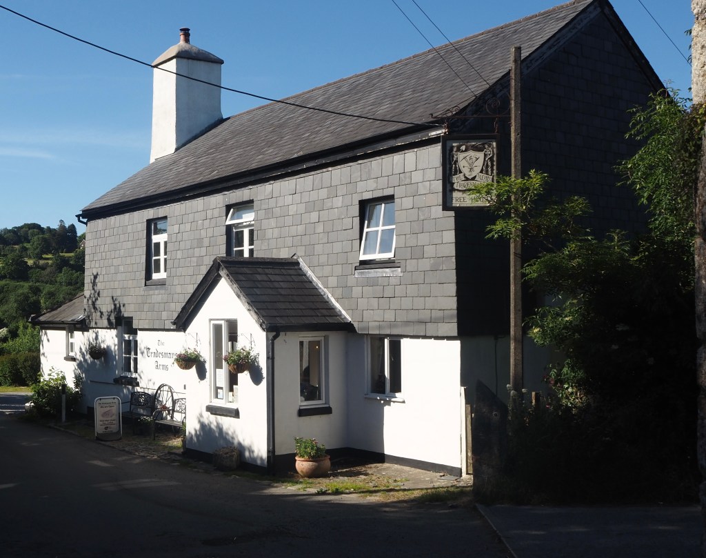
From there it was only a couple of easier miles walking down hill to the village of Scoriton, and the pub, the Tradesman’s Arms, where we are to be staying the next two nights.
So all in all, today was a very different day to yesterday, crossing a much wilder landscape, managing to get lost a few times, and not seeing a road virtually all day. I think it has reminded us how careful, even in beautiful dry sunny weather like today, you need to be, and how you have to respect the moor. Certainly I would not recommend relying solely on Google maps to navigate, as someone we met today, a little lost, appeared to be doing. And you need to be prepared to have to recover your way if do get lost, or even to retrace your steps.
Tomorrow is more moorland, but a much shorter eight miles, and hopefully we have learned a lesson and will keep our eyes more keenly on the ground and our gps to make sure we don’t go wrong. We shall see!
