It’s taken around twenty years from when I first heard of the Canary island of La Gomera to actually getting there. One of the relatively few places you can enjoy snow free mountain walking in the northern hemisphere during our winter, the best time to walk there coincided, until now, with my busiest time at work. But recently retired, at long last we managed to visit earlier this month. I even persuaded my wife, Jeni, to join me for a walking holiday there, although I’m well aware by now that walking isn’t really her thing!
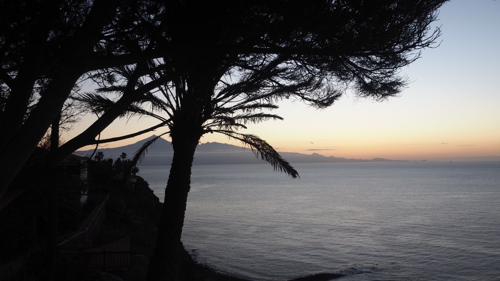
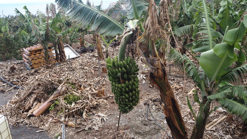
La Gomera is almost entirely covered by mountains and crisscrossed by barrancos (essentially a local name for ravines). Its generally moderately warm climate means that the central part of the island is lush and green, with mossy laurisilva forests (the Garajonay National Park). The north east, where we spent much of our time, is a home of massive palms, papaya, banana and cacti; while the south is dryer and more arid.
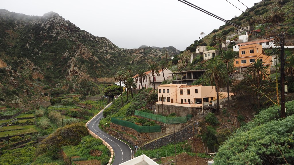
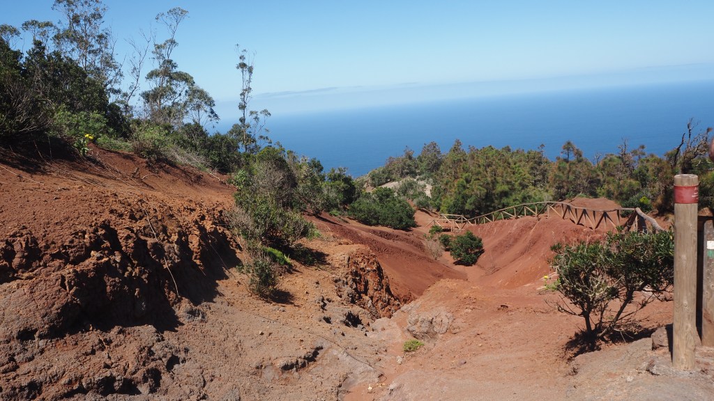
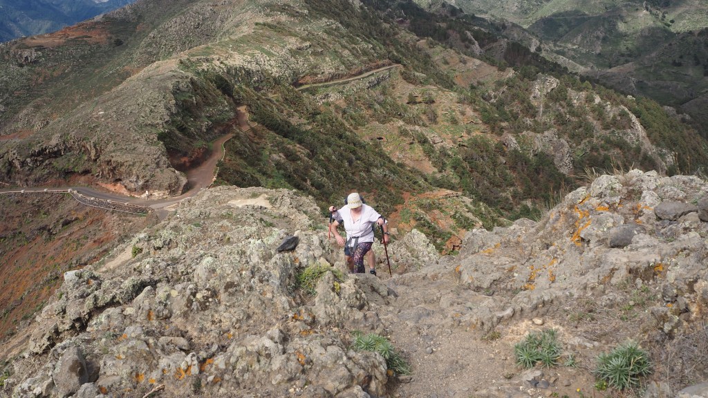
between Las Casetas and San Sebastián.
Christopher Columbus restocked at La Gomera on his voyage to the New World, subsequently earning the island the nickname of ‘Isla Columbina’. The island was already inhabited at this time by the Guanche people, who are thought to have originated in North Africa, but was eventually conquered by the Spanish, who have governed it ever since.
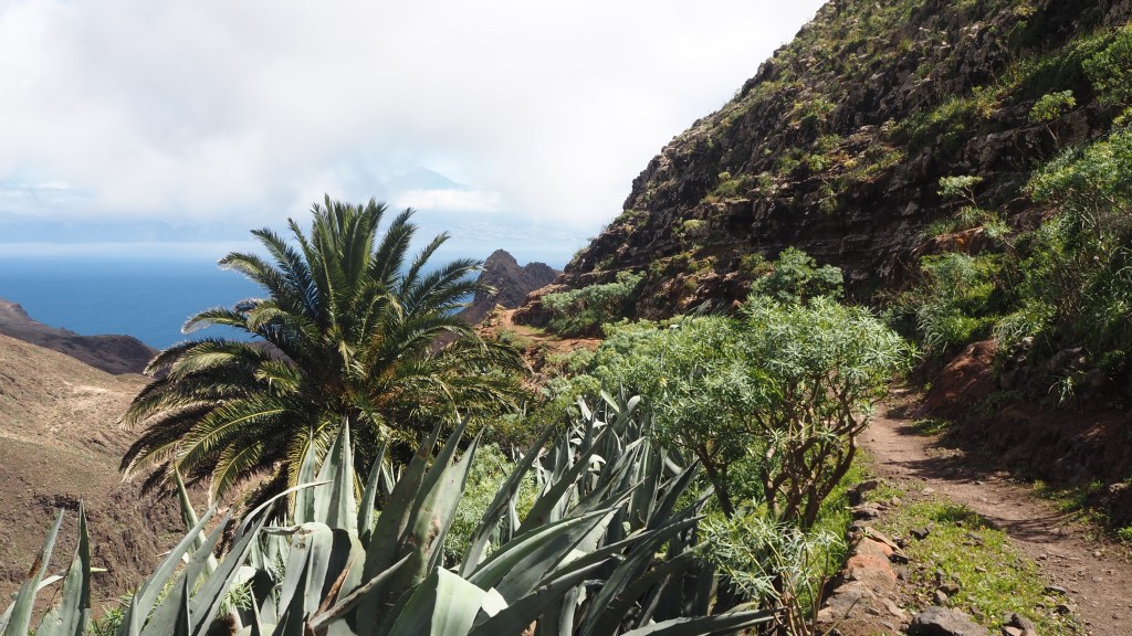
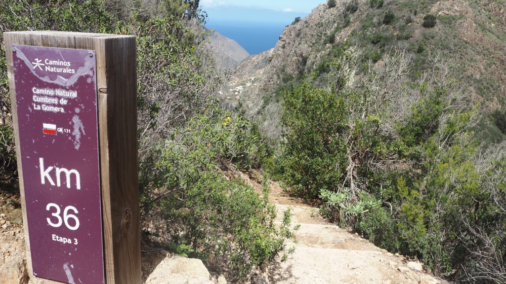
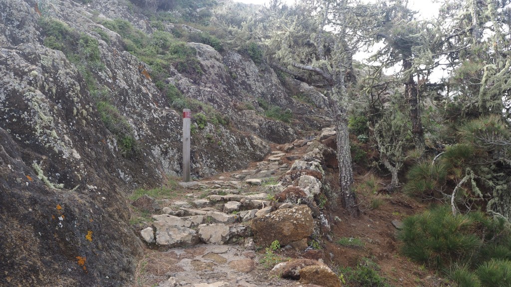
Walking wise, the island has two well marked multi-day routes: the GR131, from Playa de Vallehermoso in the north to San Sebastián in the south (a Gran Recorrido, or Grand Randonnee, part of a route spanning all seven Canary Islands); and the GR 132, a seven day walk around La Gomera. Both are well signed, with regular km wayposts. In addition, there are plenty of day walks, known as PR (pequino recorrido), which are also well marked,
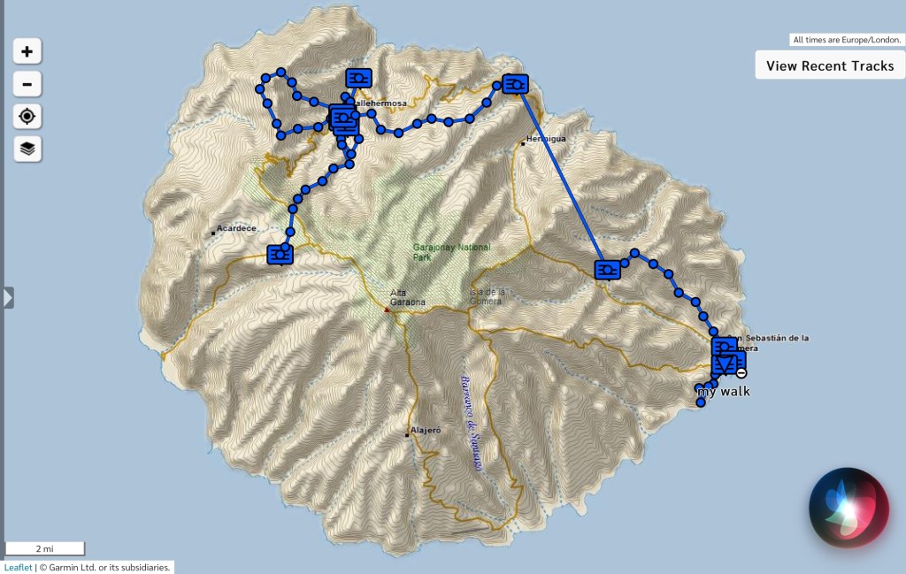
As first time travellers, we visited using a package offered by the travel company, Inntravel, which gave us a good taster of many of these walks, from bases in Vallehermoso, Agulo and San Sebastián.
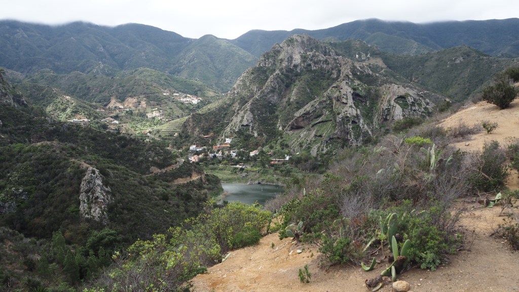
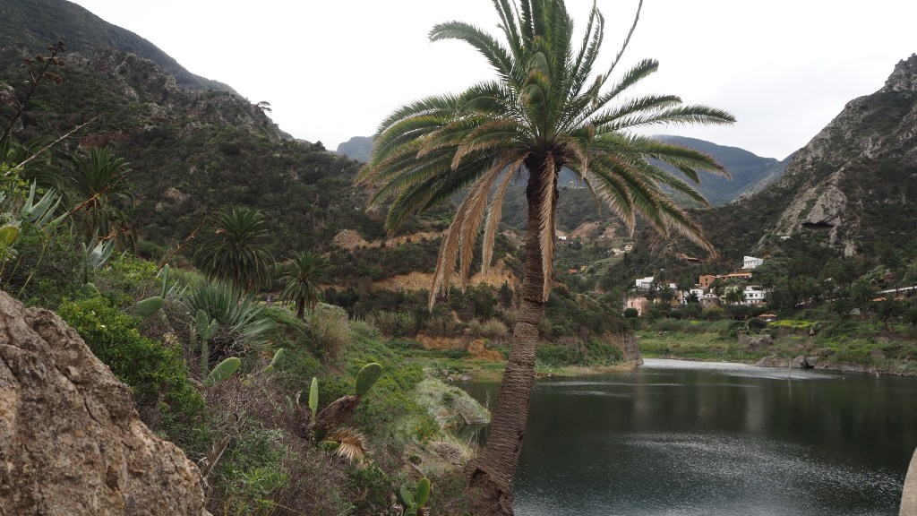
First off, there was a short, sharp climb and then descent to the reservoir of La Encantadora. This gave us a flavour of what was to come, with the rocky terrain and palms typical of the island, but in a short four mile circuit.
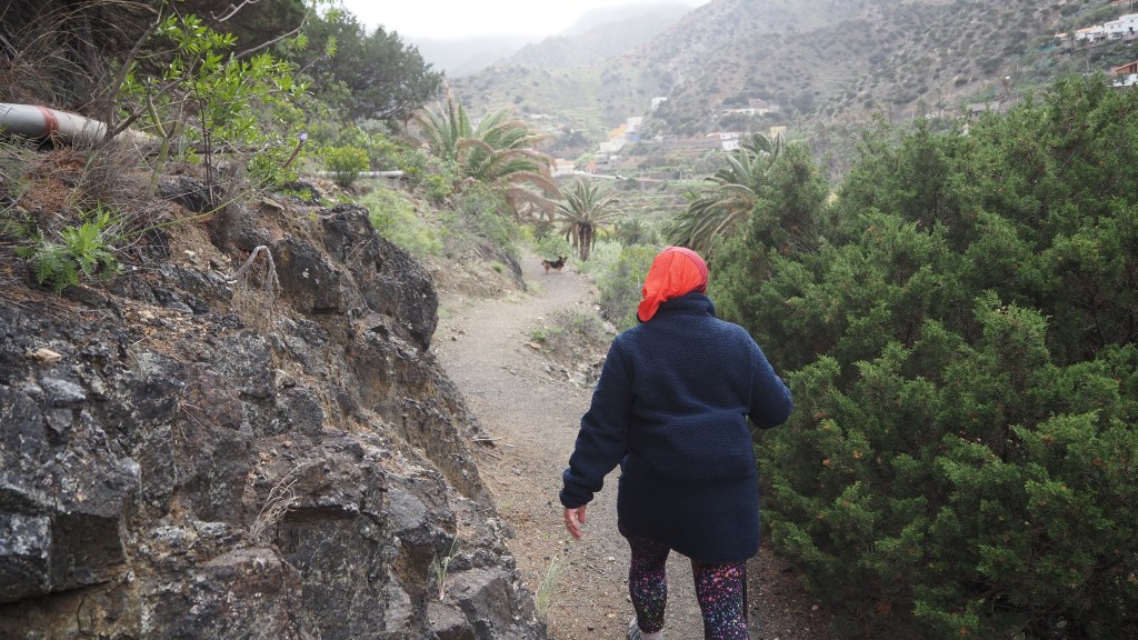
While it was a little blowy this day we weren’t really prepared for the next couple of days, when the Spanish meteorological office gave weather warnings of up to 90 km/h winds. I abandoned a planned walk above the cliffs heading north of Vallehermoso. Instead we did an interesting walk and back to the (small) local beach, initially up a flat farm track through the valley, and back up a more interesting narrow little path, led by a local dog all the way (!) above the valley floor.
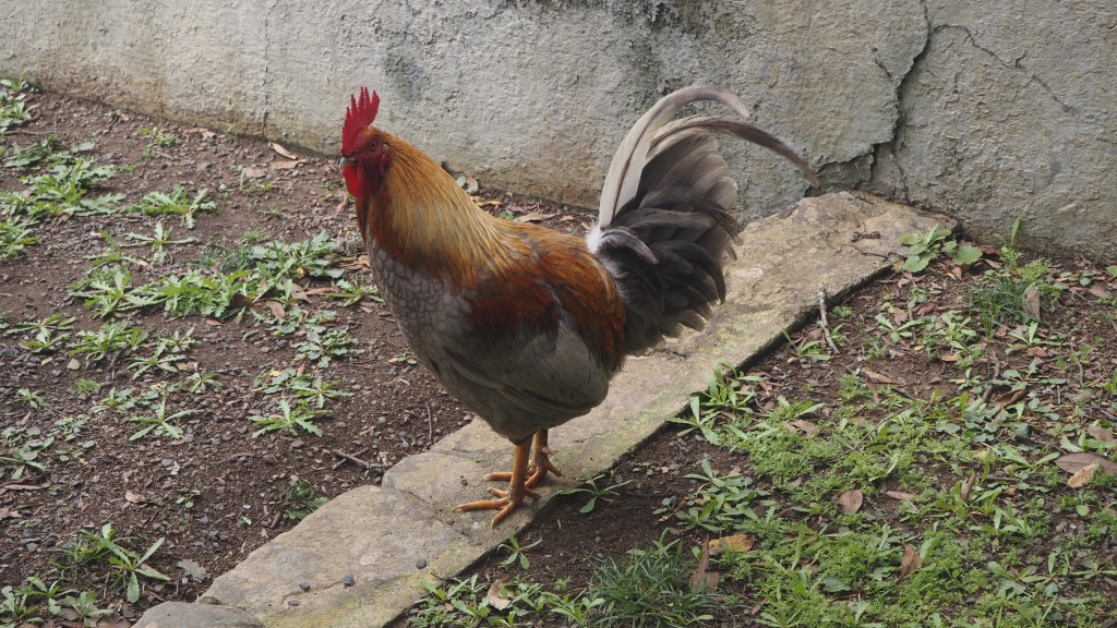
While the forecast was still not great, the next day we managed a suggested circuit north west of Vallehermoso, initially up a long and quite windy path to the hermitage of Santa Clara. Here we had lunch, overlooking the sea, and were joined by some lively cockerels, a chicken and chicks, as well as three cats, who I thought were interested in our tuna.
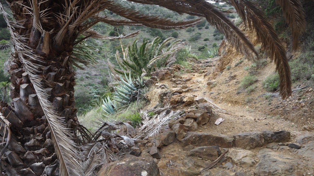
A long gradually climbing track followed, as it became hotter, before we joined the GR132 route back into the village, where we had to watch our steps as the track was rocky and steep. But a beautiful and varied route, surrounded by exotic ( for us) vegetation.
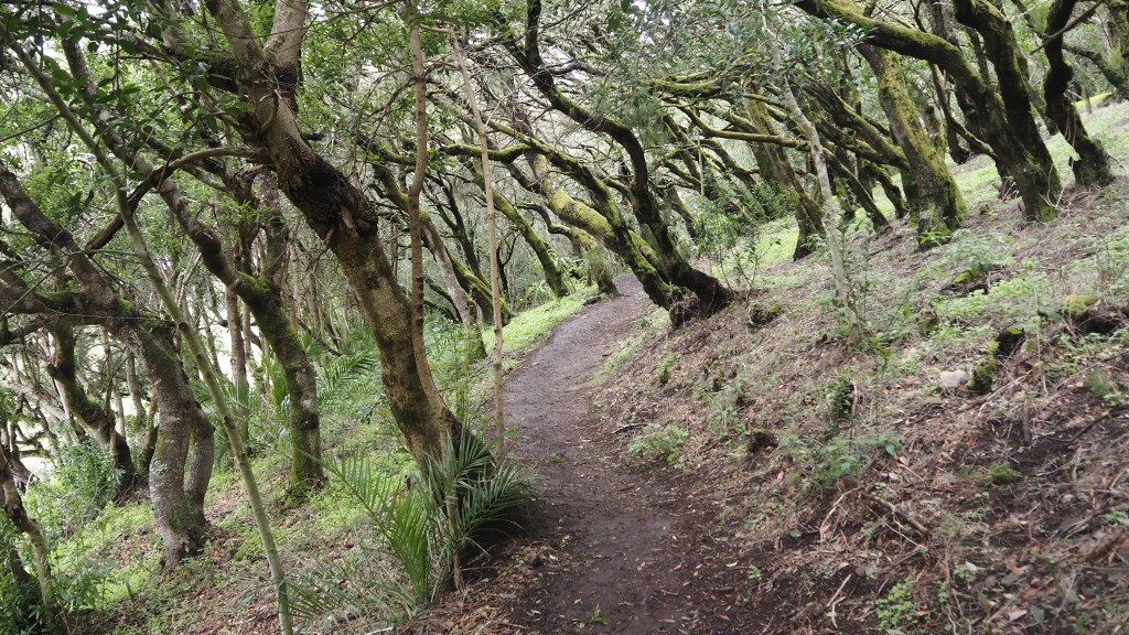
For our final day in Vallehermoso, I took the GR131 north from Las Hayas back to the hotel. This was a walk of two halves. The first part windy, cold , lush and green, but an easy level walk through what reminded me of walks in the woodland of the Surrey hills, albeit a bit greener and mossier. This was the Garajonay National Park, around 20% of which was burnt in the big fire of 2012, but is making a strong recovery. The trees were fascinating to see, lurching firmly to one side, presumably as a result of strong winds.
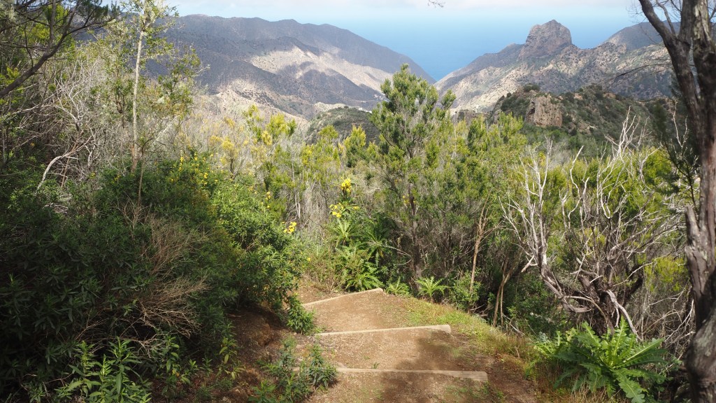
Then suddenly I emerged into the sunlight, and back to the palms, cacti and rocks with a beautiful descent eventually taking me back to the encantadora reservoir. The descent was easier than the day before though, with ready made log steps most of the way. On this day, I encountered more people than on any other walk, perhaps because it was Sunday, but it still wasn’t busy. I spoke to one couple from the south coast of England enjoying their third visit, redoing some walks they had done before.
The next day Jeni was going to join me again for the walk to Agulo, but warnings in the walk notes we had about vertiginous sections of the route led her to take the bus, and instead I was joined by Billy from Prestwick, who was doing the same itinerary as us, and whose planned walking companions hadn’t been able to join him due to illness and injury.
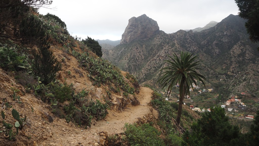
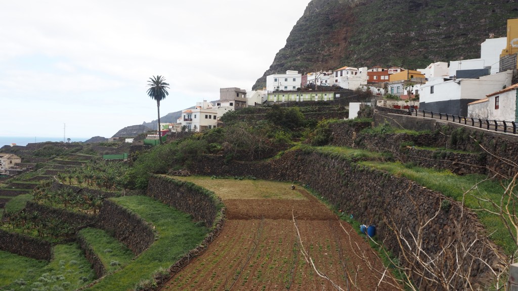
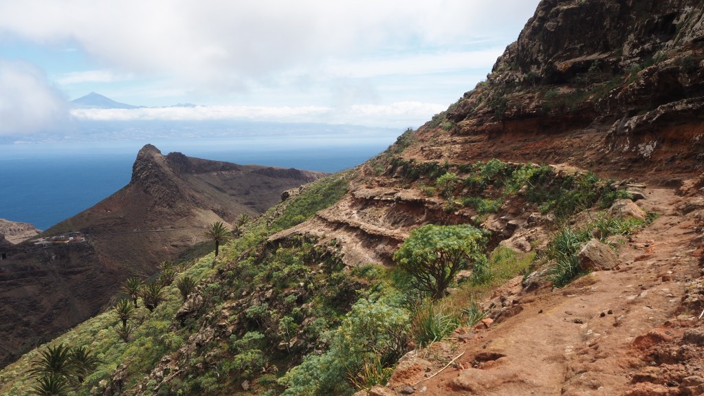
For this day we were back on the GR132 circuit, heading east, initially up beside the impressive and dominant Roque Canó, then descending to another reservoir, before another ascent, with marvellous views of Mount Tiede on Tenerife across the water. Then we passed the Juego de Bolas visitor centre, where I narrowly avoided two coachloads of day trippers in the shop. We then followed the vividly orange soil steeply down to Agulo, in most places alongside wooden fences, the surface latterly becoming a sort of cobbled causeway or mule track. It was quite a lot of up and down, as usual, but we didn’t think anything especially vertigo inducing, any more than the other walks.
Agulo was a highlight, a real gem of a village, spread out idyllically close to the sea, with a smattering of small shops and cafes. Incredibly quiet and picturesque , we spent a calm day there while Jo, Alan and Billy, who we’d met on the trip, did part of the suggested circuit to nearby towns and coastline, some of it, we later gathered, quite tricky terrain. The hotel, Casa de Helechos, was a delight, and the proprietor who was jolly and helpful, did a wonderful breakfast.
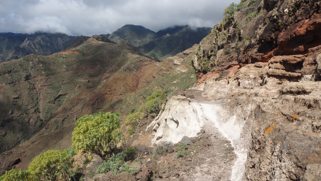
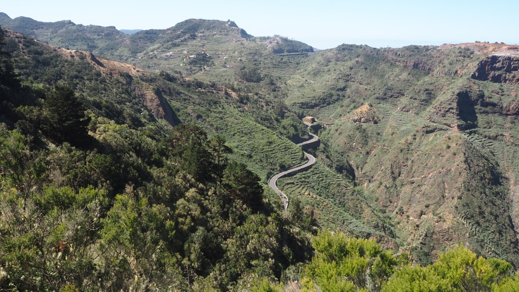
For the next day we were driven eastwards and upwards, through a series of impressive mountain road tunnels, to a spot known as Las Casetas, on the main GM1 road, where we resumed the GR132 circuit. Or should have done, in fact talking amongst ourselves we took the wrong initial turn, but in fact saved ourselves a rocky climb by instead following a quiet roadway. Billy had joined us once again to the top, but he left us around lunch for a quicker descent- we are always very slow going down.
This was a long walk, gradually becoming more barren, arid and desert like, until we eventually reached the outskirts of San Sebastián and the long walk down to the beautiful Parador where we stayed for the remaining few nights.
Here we said goodbye first to Jo and Alan from Harrogate, who’d often been a day ahead of us, and with who we’d shared experiences of the walks and convivial evenings ;and then Billy, off to meet friends for a few days in Tenerife.
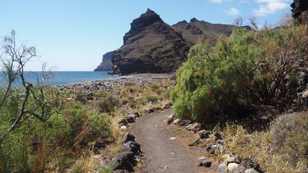
There was a chance for one final walk, a further stretch of the GR132, westward to the Playa de La Guancha. This was a hot day with two climbs and two descents in each direction, and once more the more barren landscape of the south of the island. But the views of Mount Tiede once again were outstanding, and the beach, peaceful and relaxing, making a fitting end to over a weeks’ perfect walking.
So after waiting twenty years to visit what was my conclusion? In my view, La Gomera was well worth waiting for, a perfect destination for mountain walkers yearning for some hiking without snow and rain, and some pleasant weather while Britain is still in the midst of its dank and cold winters. Having said that, be prepared for some high winds in February and March, and take our advice, bring some warm clothes, not just for the evening but for the walks as well. You may be lucky, but we were at times a bit cold, although at other times very warm.
If you get the chance, and you are prepared for a lot of ascent and descent, some rocky terrain, without scrambling or the hazards of ice and snow, a winter trip here is well worth it. The island remains unspoilt while well connected by ferry from Tenerife with its flights to all points of the UK and the rest of Europe. As I hope the pictures show, it really is a remarkable place, with some beautiful walking.