I really enjoyed the Pennine Way. And I’m not sure I fully expected to. Certainly, I knew it passed through the splendour of the Yorkshire Dales, but fundamentally it was more a walk that I felt I should do, rather than one I actively longed to.
I think this goes back a long way. My first recollection of hearing of the Pennine Way, or indeed the Pennines, was back in the early 1970s when a BBC Nationwide reporter, Bob Langley (later of Pebble Mill fame) did a series of reports as he walked the length of Britain’s first official long distance trail, opened only a few years earlier, in 1965. It seemed tough.
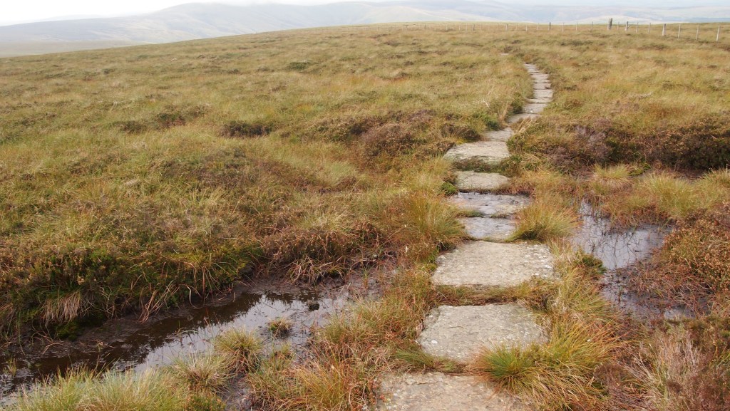
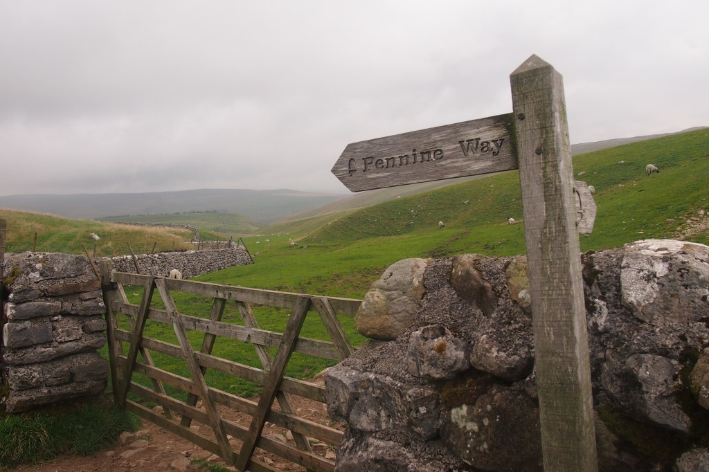
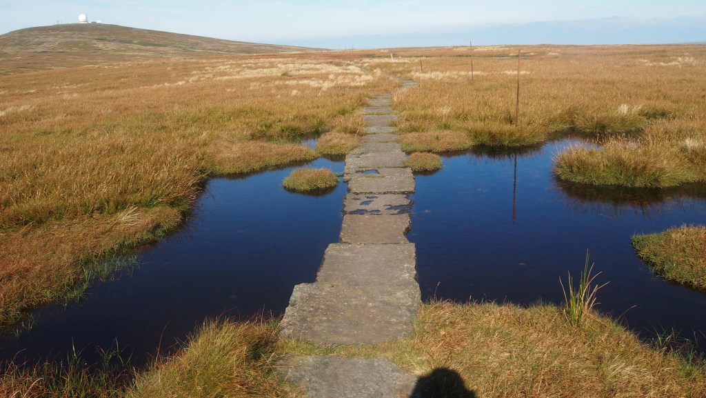
At this time, the trail became a victim of its own success. Seen as a rite of passage by ‘serious’ walkers, the already treacherous route across boggy peat moor became something of an ordeal as popularity led to the route deteriorating in quality- the peat bog just couldn’t take the volume of use. This in turn led to people turning against the trail and trying a more enjoyable alternative, as more long distance trails were established in Britain. Luckily by the 1990s measures were being taken to address this – largely huge numbers of old industrial flagstones helicoptered in and laid across the worst parts -and by the time we walked the route between 2014 and 2016 it was, while still a challenge, no longer the boggy morass famously described by Alfred Wainwright.
Walking South to North, the route starts in the heart of the Derbyshire Peak District, at Edale close to Kinder Scout, symbolic for its association with the mass ‘trespass’ of the 30s. After that, the first parts of the walk skirt the conurbations of Yorkshire and Lancashire, avoiding the cities through the narrow gap in between, but taking in some of the reservoirs which serve them. After passing close to Haworth, home to the Bronte sisters and the setting for many of their books, you enter the bucolic beauty of the Yorkshire Dales National Park and the grandeur of Malham Cove.
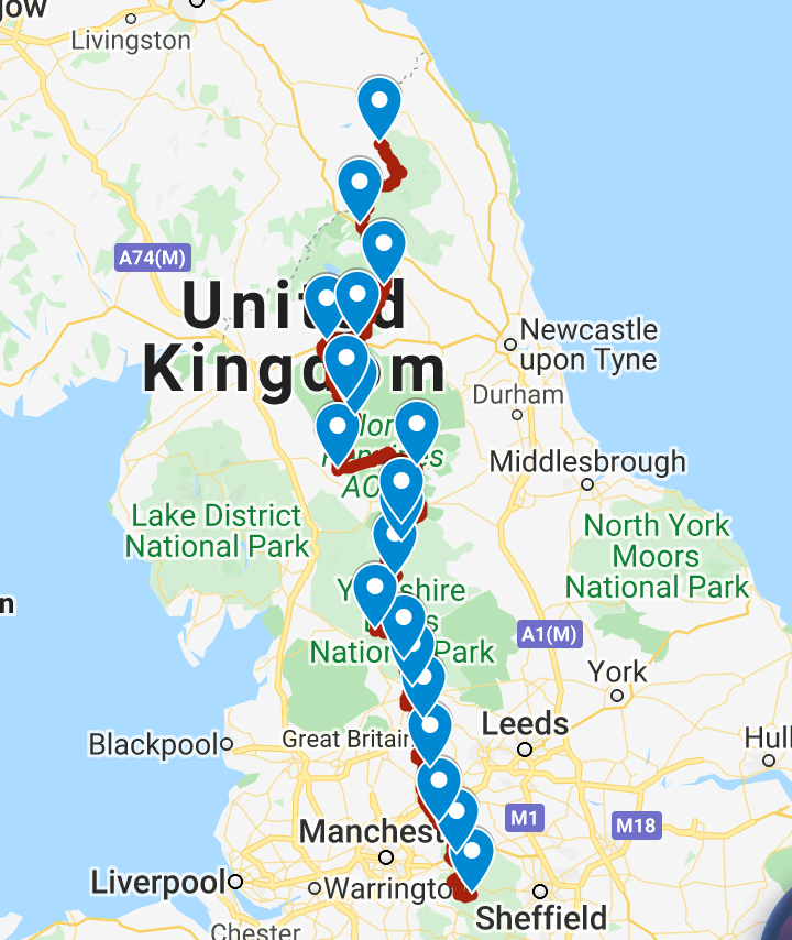
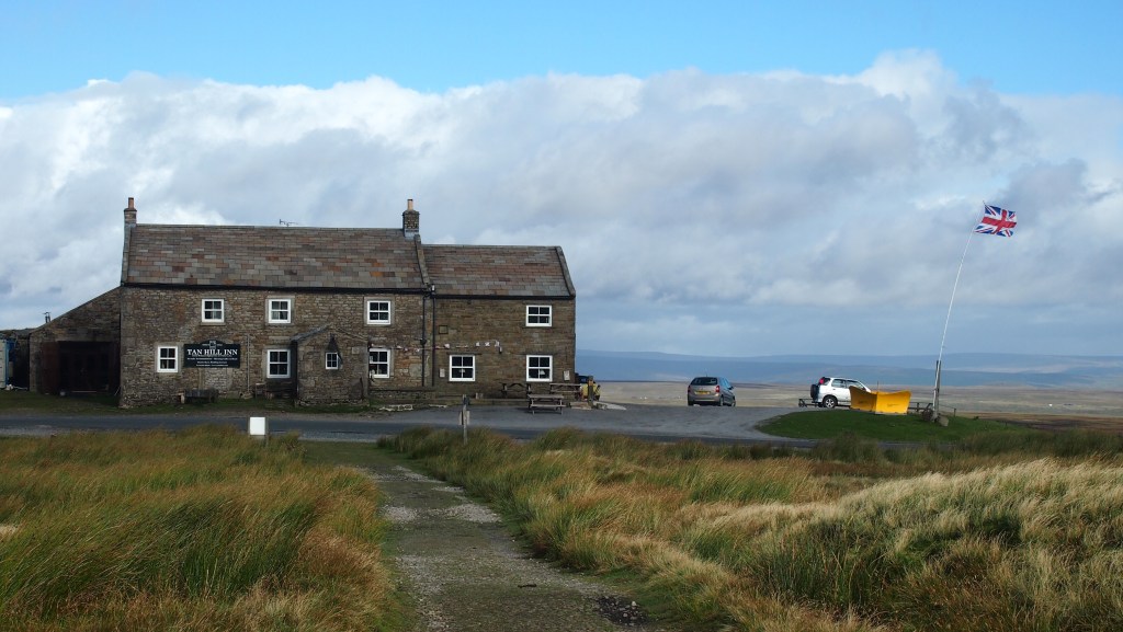
Pen-y-Ghent then follows (an admission- this was the one part of the way we didn’t do due to appalling weather, instead bypassing into nearby Horton). At Keld and its waterfalls the route crosses the now more popular Coast to Coast Walk before reaching the highest pub in England, almost annually snowed in it seems, the Tan Hill Inn.
While there is lots more moorland, this is also sheep country too, and you pass through little farmsteads familiar from tv’s All Creatures Great and Small. Grouse shooting was also in evidence during our journeys over successive Septembers (when we were blessed with near perfect weather, most of the time).
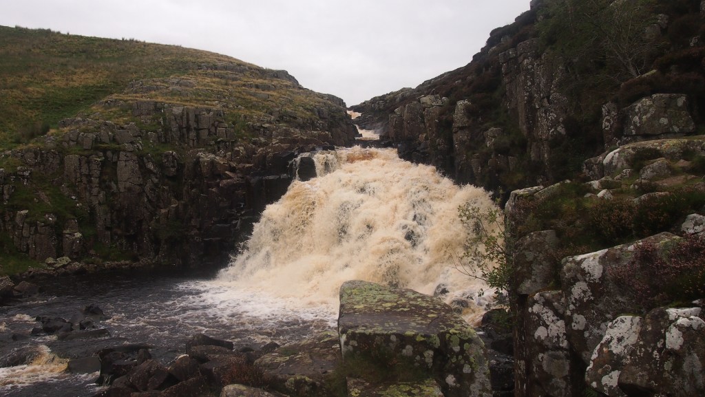
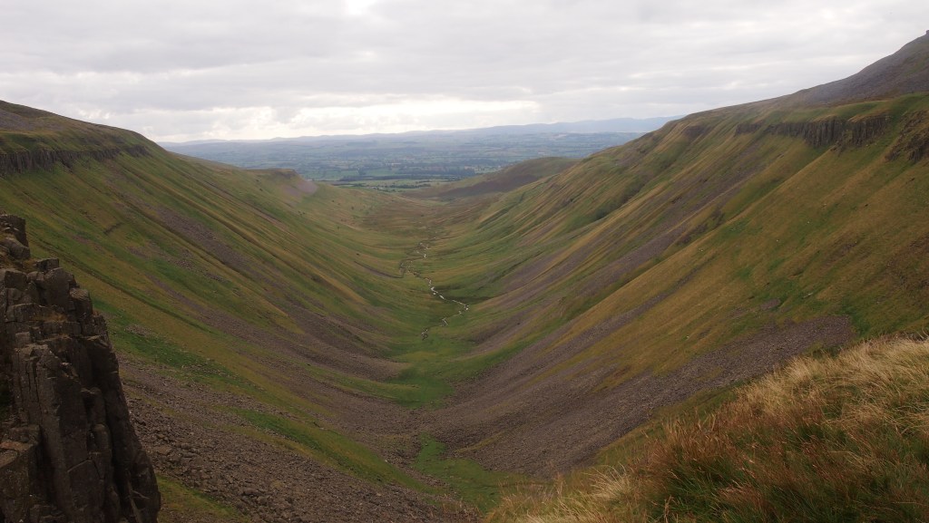
The beautiful Teesdale (a rare touristed section of the trail) with its magnificent waterfalls, leads on past Cautley Spout and then the amazing, and unexpected, High Cup Nick.
There is then a day of big peaks in eastern Cumbria, beyond the better known Lake District, followed by some lovely little Cumbrian and Durham towns and villages before a further change of scene as you reach Hadrian’s wall.
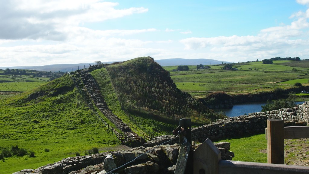
I had never actually been to Hadrian’s wall before, and I was surprised how much the wall seemed to fit the land on which it was built, a fold in the landscape, no doubt chosen for its defensive properties.
After a day following the wall you’re off through the UK’s least visited (but marvellous) National Park, Northumberland, pass through a rare bit of forest, culminating in a final couple of days walking a magnificent high ridge of the Cheviot Hills, on the present English/Scottish border.

Then there’s a final descent into Kirk Yetholm just over the border in Scotland. Just make sure that, unlike us, you get to the pub in time to have a proper evening meal! After 256 miles or more, you’ll need it.
Having walked the Pennine Way, there’s no doubt I felt a sense of achievement, even though we didn’t walk it one go, nor carry our own luggage or camp. It’s also fascinating to see a less visited part of Britain, yet often so close to civilisation- and as it has sometimes been described , the backbone of England. Now that it’s been carefully looked after it’s well worth a go, and certainly one of the top trails in the UK. But don’t treat it lightly- in bad weather and low mist I can imagine it being a lot tougher than we encountered. And with few if any directional signs on the moorland parts, where paving stones don’t make the route obvious, good map and compass skills, and ideally a GPS (with long battery life) are a must.